Related Research Articles
The Columbia and Kootenay Railway (C&KR) was a historic railway operated by the Canadian Pacific Railway (CPR) in the West Kootenay region of British Columbia. This 25-mile (40 km) route, beside the unnavigable Kootenay River, linked Nelson on the west arm of Kootenay Lake with Robson at the confluence of the Kootenay River and the Columbia River near Castlegar.
The Nakusp and Slocan Railway (N&S) is a historic Canadian railway that operated in the West Kootenay region of southeastern British Columbia. The N&S initially connected Nakusp and Three Forks but soon extended to Sandon.
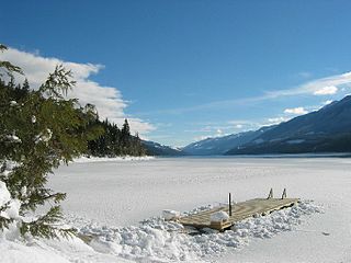
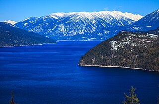
Trout Lake is a ribbon lake in the West Kootenay region of southeastern British Columbia. Between the Selkirk Mountains to the west and the Purcell Mountains to the east, the lake is about 23 kilometres (14 mi) long and 1.6 kilometres (1 mi) wide. Lardeau Creek flows into the northern end and Lardeau River flows from the southern end. BC Highway 31 skirts the northeast shore. The northern end is about 90 kilometres (56 mi) by road and ferry southeast of Revelstoke.

The Village of Slocan is in the West Kootenay region of southeastern British Columbia. The former steamboat landing and ferry terminal is at the mouth of Springer Creek, at the foot of Slocan Lake. The locality, on BC Highway 6 is about 69 kilometres (43 mi) by road north of Castlegar and 183 kilometres (114 mi) by road and ferry south of Revelstoke.
The Slocan Valley is a valley in the West Kootenay region of southeastern British Columbia.
Robson/Raspberry is a designated place located north of Castlegar across the Columbia River combining two historical communities, Robson, formerly a steamboat landing and railway terminal, and Raspberry, formerly encompassing Sproat's Landing and later a Doukhobor colony. It has one school, Robson Community School.
The Duncan River is in the West Kootenay region of southeastern British Columbia. Entering the North Arm of Kootenay Lake, the river is a major tributary of the Kootenay River, which in turn flows into the Columbia River. The Selkirk Mountains lie to the west and the Purcell Mountains to the east.

Lytton was a sternwheel steamboat that ran on the Arrow Lakes and the Columbia River in southeastern British Columbia and northeastern Washington from 1890 to 1904.
Raspberry is an unincorporated community in the West Kootenay region of southeastern British Columbia. On the northeast side of the Columbia River adjacent to the mouth of Norns Creek, the residential area is part of Greater Castlegar.
The Whatshan River is a tributary of the Columbia River in the West Kootenay region of southeastern British Columbia. The river's drainage basin is approximately 390 square kilometres (150 sq mi) in area.

Marion was a small sternwheel steamboat that operated in several waterways in inland British Columbia from 1888 to 1901.
The Columbia and Western Railway (C&W) was a historic, and initially narrow gauge, railway in southern British Columbia.
Rosebery is an unincorporated community about 6 kilometres (4 mi) north of New Denver in the West Kootenay region of southeastern British Columbia. The former steamboat landing and ferry terminal is at the mouth of Wilson Creek on the eastern shore of Slocan Lake. The locality, on BC Highway 6, is about 106 kilometres (66 mi) by road north of Castlegar and 144 kilometres (89 mi) by road and ferry south of Revelstoke.
Fauquier is an unincorporated place on the east shore of Lower Arrow Lake in the West Kootenay region of southeastern British Columbia. The eastern terminal for the Needles Ferry, the landing on Highway 6 is 57 kilometres (35 mi) south of Nakusp.
Tarrys is an unincorporated community spanning both shores of the Kootenay River in the West Kootenay region of southeastern British Columbia. The location, on BC Highway 3A, is by road about 14 kilometres (9 mi) northeast of Castlegar, and 30 kilometres (19 mi) southwest of Nelson.
South Slocan is an unincorporated community in rural British Columbia with a population of approximately 100 people, many of whom are followers of the Doukhobors religion. It is located on the northwest shore of the Kootenay River in the West Kootenay region of southeastern British Columbia. The village comprises 51 households. A former railway junction on BC Highway 6, it is approximately 24 kilometres (15 mi) northeast of Castlegar, and 20 kilometres (12 mi) southwest of Nelson. Its postal category is Rural Route One.
The Upper Arrow Lake Ferry is a ferry across Upper Arrow Lake in the West Kootenay region of southeastern British Columbia. Linking Shelter Bay and Galena Bay, the ferry, part of BC Highway 23, is by road about 52 kilometres (32 mi) south of Revelstoke and 47 kilometres (29 mi) north of Nakusp.
Shoreacres is an unincorporated community in the West Kootenay region of southeastern British Columbia. This former ferry landing lies on the northwest shore of the Kootenay River and northeast shore of the Slocan River. The location, on BC Highway 3A, is by road about 20 kilometres (12 mi) northeast of Castlegar, and 24 kilometres (15 mi) southwest of Nelson.
The Harrop Ferry is a cable ferry at Harrop Narrows on the west arm of Kootenay Lake in the West Kootenay region of southeastern British Columbia. The crossing, off BC Highway 3A, is by road about 27 kilometres (17 mi) northeast of Nelson and 7 kilometres (4 mi) west of Balfour.
Sidmouth or Twenty-Four Mile was a railway point in the West Kootenay region of southeastern British Columbia. The scattered community straddled the shores of the Columbia River immediately south of the mouth of Cranberry Creek. The locality, off BC Highway 23, is by road about 43 kilometres (27 mi) southeast of Revelstoke.
References
- ↑ "Robson (community)". BC Geographical Names .
- 1 2 3 4 5 "Sproat's Landing and Robson". www.crowsnest-highway.ca.
- 1 2 3 "Nelson Star, 21 Jan 2017". www.nelsonstar.com.
- ↑ Meyer, Ronald Howard (1967). "The Evolution of Railways in the Kootenays". www.open.library.ubc.ca. p. 20.
- 1 2 Turner, Robert D.; Wilkie, J.S. David (2007). Steam Along the Boundary. Sono Nis Press. p. 35. ISBN 978 1-55039-158-9.
- ↑ "Castlegar News, 12 Mar 2015". www.castlegarnews.com.
- ↑ "Project highlights". www.h2oinnovation.com.
- ↑ "Castlegar News, 8 Mar 2014". www.castlegarnews.com.
- ↑ "Castlegar News, 5 Jul 2016". www.castlegarnews.com.