Cedonia, Washington

Last updated

Cedonia (pronounced sĕh-dōn-ya) is a very small unincorporated community in Stevens County, Washington, United States. [1] Formerly a town, [2] it lies in the valley of the Columbia River, on the western slope of hills known as Summit Mines, [3] at a river section known as Lake Roosevelt, a reservoir created by Grand Coulee Dam.

Unincorporated area Region of land not governed by own local government

In law, an unincorporated area is a region of land that is not governed by a local municipal corporation; similarly an unincorporated community is a settlement that is not governed by its own local municipal corporation, but rather is administered as part of larger administrative divisions, such as a township, parish, borough, county, city, canton, state, province or country. Occasionally, municipalities dissolve or disincorporate, which may happen if they become fiscally insolvent, and services become the responsibility of a higher administration. Widespread unincorporated communities and areas are a distinguishing feature of the United States and Canada. In most other countries of the world, there are either no unincorporated areas at all, or these are very rare; typically remote, outlying, sparsely populated or uninhabited areas.

Stevens County, Washington County in the United States

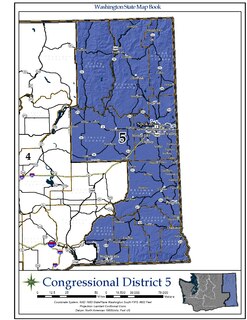
Stevens County is a county located in the U.S. state of Washington along the Canada–US border. As of the 2014 United States Census, its population was 43,650. As of July 2016, the population was estimated to be 44,439. The county seat and largest city is Colville. The county was created in 1863 and named after Isaac Stevens, the first governor of Washington Territory.

United States federal republic in North America

The United States of America (USA), commonly known as the United States or America, is a country composed of 50 states, a federal district, five major self-governing territories, and various possessions. At 3.8 million square miles, the United States is the world's third or fourth largest country by total area and is slightly smaller than the entire continent of Europe's 3.9 million square miles. With a population of over 327 million people, the U.S. is the third most populous country. The capital is Washington, D.C., and the largest city by population is New York City. Forty-eight states and the capital's federal district are contiguous in North America between Canada and Mexico. The State of Alaska is in the northwest corner of North America, bordered by Canada to the east and across the Bering Strait from Russia to the west. The State of Hawaii is an archipelago in the mid-Pacific Ocean. The U.S. territories are scattered about the Pacific Ocean and the Caribbean Sea, stretching across nine official time zones. The extremely diverse geography, climate, and wildlife of the United States make it one of the world's 17 megadiverse countries.

The area surrounding it is primarily a farming and ranching community with some logging activity. Cedonia comprises the Ye Olde Country Store, a veterinary clinic, and seven homes. There are a few farms surrounding it, and The Cedonia Community Church lies just outside the city limits. The church tends to be seen as the focal point of the community, hosting many community events as well as events from neighboring communities. The church is also the source of the name Cedonia. When it was built in 1897, the settlers searched for a name for their community. They settled on the name Cedonia, a shortened version of Macedonia [2] from the plea to the apostle Paul in Acts Ch. 16 vs. 9 that says, "Come over here to Macedonia and help us."

Education services are provided by Columbia High School in Hunters, Washington, about 3 miles due south of Cedonia.

Related Research Articles

Walla Walla County, Washington County in the United States

Walla Walla County is a county located in the U.S. state of Washington. As of the 2010 census, its population was 58,781. The county seat and largest city is Walla Walla. The county was formed on April 25, 1854 and is named after the Walla Walla tribe of Native Americans.

Ferry County, Washington County in the United States

Ferry County is a county located on the northern border of the U.S. state of Washington. As of the 2010 census, the population was 7,551, making it the fourth-least populous county in Washington. The county seat and largest city is Republic. The county was created out of Stevens County in February 1899 and is named for Elisha P. Ferry, the state's first governor.

Umatilla County, Oregon County in the United States

Umatilla County is a county located in the U.S. state of Oregon. As of the 2010 census, the population was 75,889. The county seat is Pendleton, but the largest city is Hermiston. The county is named for the Umatilla River.

Fairview, Illinois Village in Illinois, United States

Fairview is a village in Fulton County, Illinois, United States. The population was 522 at the 2010 census.

Dixie, Washington CDP in Washington, United States

Dixie is a census-designated place (CDP) in Walla Walla County, Washington, United States. The population was 197 at the 2010 census.

Woodland, Washington City in Washington, United States

Woodland is a city in Clark and Cowlitz counties in the State of Washington. Most residents live within Cowlitz County, in which the majority of the city lies. It is part of the 'Longview, Washington Metropolitan Statistical Area'. The population was 5,509 at the 2010 census.

The Territory of Washington was an organized incorporated territory of the United States that existed from March 2, 1853, until November 11, 1889, when the territory was admitted to the Union as the State of Washington. It was created from the portion of the Oregon Territory north of the lower Columbia River and north of the 46th parallel east of the Columbia. At its largest extent, it also included the entirety of modern Idaho and parts of Montana and Wyoming, before attaining its final boundaries in 1863.

Franklin D. Roosevelt Lake

Franklin D. Roosevelt Lake is the reservoir created in 1941 by the impoundment of the Columbia River by the Grand Coulee Dam in Washington state. It is named for Franklin D. Roosevelt, who was President during the construction of the dam. Covering 125 square miles, it stretches about 150 miles (240 km) from the Canada–US border to Grand Coulee Dam, with over 600 miles (970 km) of shoreline; by surface area it is the largest lake and reservoir in Washington. It is the home of the Lake Roosevelt National Recreation Area.

Washington State Route 25 highway in Washington

State Route 25 (SR 25), named the Coulee Reservoir Highway, is a 121.17-mile-long (195.00 km) state highway serving communities in Lincoln and Stevens counties in the U.S. state of Washington. The highway begins at an intersection with U.S. Route 2 (US 2) east of Davenport and continues northwest to cross the Spokane River on the Spokane River Bridge. From the bridge, SR 25 parallels the Columbia River and Franklin D. Roosevelt Lake upstream through several small communities, passing the Gifford–Inchelium Ferry, to Kettle Falls. In Kettle Falls, the roadway intersects US 395, co-signed with SR 20 and continues north to Northport, where former SR 251 is intersected and SR 25 crosses the Columbia River on the Northport Bridge. The highway travels northwest to the Canadian border, where it becomes British Columbia Highway 22 (BC 22).

Washingtons 5th congressional district

Washington's 5th congressional district encompasses the Eastern Washington counties of Ferry, Stevens, Pend Oreille, Lincoln, Spokane, Whitman, Walla Walla, Columbia, Garfield, and Asotin. It is centered on Spokane, the state's second largest city.

Hunters is an unincorporated community in Stevens County, Washington, United States. The population for its zip code (99137) was 306 at the 2000 census.

Sardinia, Indiana Unincorporated community in Indiana, United States

Sardinia is an unincorporated community in Jackson Township, Decatur County, Indiana.

Kettle River Range

The Kettle River Range, often called the Kettle Range, is the southernmost range of the Monashee Mountains, located in far southeastern British Columbia, Canada and Ferry County, Washington, in the United States. Most of the northern half of the range is protected by the Colville National Forest and the southern half of the range is located on the Colville Indian Reservation. The highest peak is Copper Butte, which reaches 2,177 metres (7,142 ft). The range is crossed by Washington State Route 20 at Sherman Pass.

Oval is a census-designated place (CDP) in Limestone Township in Lycoming County, in the U.S. state of Pennsylvania. Oval is not a separately incorporated community, but is a part of Limestone Township. Oval is on Pennsylvania Route 44 and is completely surrounded by Limestone Township is southwest Lycoming County. As of the 2010 census the population of the community of Oval was 361 residents.

Colley is an unincorporated community in Dickenson County, Virginia, in the United States.

New Hope, Indiana Unincorporated Community in Indiana, United States

New Hope is an unincorporated community in the southeast corner of Franklin Township, Owen County, in the U.S. state of Indiana. It lies near the intersection of County Road 740 South and County Road 285 West, which is a community about nine miles southwest of the city of Spencer, the county seat. Its elevation is 522 feet, and it is located at 39°10′59″N86°49′40″W.

Clark, Washington Place in Washington, United States

Clark is an unincorporated community located along the Columbia River in the U.S. state of Washington. Most buildings in the community are grouped around the Keller Ferry Campground at the south side of the Keller Ferry crossing. There are several businesses, including a car repair shop and a convenience store. The community is located on Lake Roosevelt, just south of the Lake Roosevelt National Recreation Area. The town is named after Todd Clark. At one time, the town also had a post office.

Chief Tonasket Log Cabin is a log cabin in Okanogan County, Washington, once the home of Chief Tonasket, born 1822. It is along Washington State Route 21 near Curlew, Washington. Tonasket moved to the Colville Indian Reservation, now the Old North Half in the Curlew area, after signing the 1883 treaty with the United States. Tonasket died in 1891, and the structure was operated as the "Curlew Store" for a period of time by G.S. Helphry and J. Walters, beginning in 1896, supplying prospectors coming to the Okanogan gold rush.

References

  1. "Cedonia". Geographic Names Information System . United States Geological Survey . Retrieved 11 March 2015.
  2. 1 2 Kay L. Counts, Stevens County, Arcadia Publishing, 2014, ISBN   143964554X, p.49
  3. "Monthly Weather Review".

Coordinates: 48°09′14″N118°10′09″W / 48.15389°N 118.16917°W / 48.15389; -118.16917

Geographic coordinate system Coordinate system

A geographic coordinate system is a coordinate system that enables every location on Earth to be specified by a set of numbers, letters or symbols. The coordinates are often chosen such that one of the numbers represents a vertical position and two or three of the numbers represent a horizontal position; alternatively, a geographic position may be expressed in a combined three-dimensional Cartesian vector. A common choice of coordinates is latitude, longitude and elevation. To specify a location on a plane requires a map projection.