This article needs additional citations for verification .(July 2025) |
| Discovery Passage | |
|---|---|
| French: Passage Discovery | |
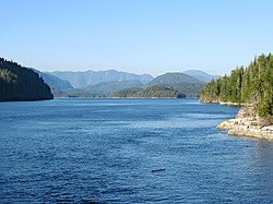 Looking south from between Vancouver Island and Sonora Island | |
 Discovery Passage | |
 | |
| Location | British Columbia, Canada |
| Coordinates | 50°13′N125°23′W / 50.217°N 125.383°W |
| Type | Strait |
| Part of | Inside Passage, Discovery Islands |
| Ocean/sea sources | Salish Sea |
| Max. length | 25 km (16 mi) |
| Max. width | 2 km (1.2 mi) |
| Max. depth | 100 m (330 ft) [1] |
| Sections/sub-basins | Seymour Narrows |
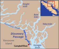
The Discovery Passage (French : Passage Discovery) is a strait that forms part of the Inside Passage between Vancouver Island and the Discovery Islands of British Columbia. The strait is considered the most important natural passage for vessels entering or leaving the Salish Sea from the north.