
Knight Inlet is one of the principal inlets of the British Columbia Coast, and the largest of the major inlets in the southern part of the Coast. It is fifth in sequence of the great saltwater inlets north from the 49th parallel near Vancouver, but it is the first whose outflow points away from the Strait of Georgia, opening into Queen Charlotte Strait at the Kwakwakaʼwakw community of Memkumlis on Village Island.
Seymour Inlet is one of the lesser travelled of the principal inlets of the British Columbia Coast. Unlike larger inlets such as Knight or Bute, it is not flanked by mountains but by relatively low, but still rugged, coastal hill-country and forms a maze of complex, narrow waterways and tidal pools and lagoons. It is located within a corresponding maze of peninsulas on the mainland on the northwest side of the Queen Charlotte Strait region.
The Klinaklini River is one of the major rivers of the Pacific Ranges section of the Coast Mountains in the Canadian province of British Columbia. It originates in the Pantheon Range and empties into the head of Knight Inlet.
Broughton Archipelago is a group of islands located at the eastern end of Queen Charlotte Strait in Mount Waddington Regional District, British Columbia. The archipelago is the traditional territory of the Musgamagw Dzawada'enuxw, Namgis, Ma'amtagila and Tlowitsis nations of the Kwakwaka'wakw peoples.

Porcher Island is an island in Hecate Strait, British Columbia, Canada, near the mouth of the Skeena River and southwest of the port city of Prince Rupert. The locality of Porcher Island is located near the island's northern tip at Humpback Bay, 54°05′11″N130°23′23″W. Stephens and Prescott Islands are located off its northwestern tip.
The Tlowitsis Nation, formerly the Klowitsis Tribe, the Turnour Island Band and the Tlowitsis-Mumtagila First Nation, is the Indian Act band government of the Ławit'sis (Tlowitsis) tribe of the Kwakwaka'wakw peoples, located in the Queen Charlotte Strait-Johnstone Strait area in the Discovery Islands between Vancouver Island and the British Columbia mainland in Canada. Ławit'sis territory covers parts of northern Vancouver Island, Johnstone Strait, and adjoining inlets of the mainland. Kalugwis, on Turnour Island, was their principal community in times past, but the band's offices are in the city of Campbell River to the southeast. Hanatsa IR No. 6 on Port Neville is the most populated of the band's Indian reserves.
Havannah Channel is a marine passageway in the South Coast region of British Columbia, Canada, leading off of the north side of Johnstone Strait leading to Chatham Channel and Call Inlet, south of East Cracroft Island. Havannah Channel is entered from Johnstone Strait at the Broken Islands. Hull Island is located in the channel, to the southeast of East Cracroft and south of the opening of Call Inlet.

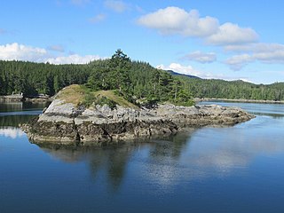
Minstrel Island, is an island in the Johnstone Strait region of the Central Coast region of British Columbia, Canada. It is near the entrance to Knight Inlet just east of Turnour Island at the junction of Clio and Chatham Channels. The island is separated on its south from East Cracroft Island by a marine passageway called The Blow Hole.
Tribune Channel is a channel or strait on the Central Coast of British Columbia, Canada, separating Gilford Island on the west and north from the mainland. The channel bends around Gilford Island, with the mouth of Thompson Sound at the elbow of the bend, opening eastwards to the mouth of the Kakweiken River.
Hanson Island is an island in the Queen Charlotte Strait region of the Central Coast of British Columbia, located west of Harbledown Island and south of the Plumper Islands. The westernmost part of Johnstone Strait is to the south of the island, Blackfish Sound to the north, beyond which is Swanson Island. The island is named for James Hanson who served aboard HMS Chatham in 1792 and was later transferred that year to command Vancouver's supply ship HMS Daedalus.

Port Neville is a bay, port and locality on the north side of Johnstone Strait, south of Call Inlet, in the Central Coast region of British Columbia, Canada.

Turnour Island is an island in the Johnstone Strait region of the Central Coast of British Columbia, located between Gilford Island and West Cracroft Island. On the other side Canoe Passage on its northwest is Village Island, while to its south and southwest is Beware Passage, across from which is Harbledown Island. Gilford Island is to the north across Tribune Channel. Separating Turnour from West Cracroft is Clio Channel.

East Cracroft Island is an island in the Johnstone Strait region of the Central Coast region of British Columbia, Canada. It is the smaller of the two Cracroft Islands, and at low tide is really one island with its larger neighbour, West Cracroft Island. On the south side of the shallows that form an isthmus between them at low tide is Port Harvey, a short, wide inlet or bay. On its east shore is Keecekiltum Indian Reserve No. 2, which is under the governance of the Tlowitsis Nation of the Kwakwaka'wakw peoples. at 50°33′00″N126°16′00″W.
Port Harvey is a port on the south side of the Cracroft Islands in the Johnstone Strait region of the Central Coast region of British Columbia, Canada, forming a small bay or inlet south of the shallows that link West Cracroft and East Cracroft Islands. On its east shore is Keecekiltum Indian Reserve No. 2, 11.7 ha., which is under the governance of the Tlowitsis Nation of the Kwakwaka'wakw peoples. at 50°33′00″N126°16′00″W. It was named by Captain Richards for Captain Harvey of HMS Havannah.
The Blow Hole is a short marine passage or strait separating Minstrel Island on the north from East Cracroft Island to the south, in the lower Knight Inlet region of the Central Coast region of British Columbia, Canada. At its east end is the northern end of Chatham Channel, which separates East Cracroft from the mainland to the east, and leads southeast to the opening of Call Inlet and beyond to Johnstone Strait via Havannah Passage.
Chatham Channel is a strait and marine passageway on the coast of British Columbia. It leads from the lower reaches of Knight Inlet to the opening of Call Inlet, separating Minstrel and East Cracroft Islands from the mainland to the east. From the opening of Call Inlet, running south then east around East Cracroft, is Havannah Channel.
Hull Island is an island in the Central Coast region of British Columbia, Canada, located in Havannah Channel to the east of the southern end of East Cracroft Island.
Drury inlet is an inlet in the Queen Charlotte Strait region of the Central Coast of British Columbia, Canada, extending west from Wells Passage to the northwest of North Broughton Island, northwest of the town of Port Hardy. Branching off to the northeast from the north side of the head of the inlet is Actaeon Sound.
Stuart Channel is a strait in the Gulf Islands region of the Gulf of Georgia, separating Vancouver Island on the west from Thetis, DeCourcy and Penelakut (Kuper) Islands on the east. Ladysmith Harbour and the town of Chemainus face onto it from Vancouver Island. It is crossed by a BC Ferries route serving Thetis and Penelakut Islands.
Waddington Harbour is a harbour at the head of Bute Inlet in the Central Coast region of British Columbia, Canada. Also issuing into the head of Bute Inlet and Waddington Harbour, just east of the mouth of the Homathko, is the Teaquahan River. Issuing directly into the inlet a few miles south on the harbour's southeast is the Southgate River, one of the major rivers of the central Pacific Ranges, which begins on the west side of the Lillooet Icecap. Its lower valley adjacent to the inlet's shores is called Pigeon Valley.
