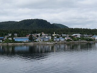
Shearwater is a community in coastal British Columbia. It is located three miles from Old Bella Bella on Denny Island. [1] It is in the territory of the Heiltsuk Nation.

Shearwater is a community in coastal British Columbia. It is located three miles from Old Bella Bella on Denny Island. [1] It is in the territory of the Heiltsuk Nation.
Shearwater was originally built as an antisubmarine bomber reconnaissance post in 1941 and then abandoned in 1944. It was then purchased and developed into a fishing resort with a full service marina, fishing resort, restaurant and hotel. The hangar and the bomb shelter are all that survive from the original base.
The resort was recently sold to (2022), and is now owned and operated by, The Heiltsuk Nation.
Today, Shearwater Resort LLP is British Columbia’s ultimate wilderness and eco-tour destination, offering a selection of wildlife tours as well as accommodations and mooring services. Shearwater is located on BC’s Central Coast in the Great Bear Rainforest. The resort offers many amenities including moorage, a year round hotel, a fully stocked grocery and liquor store, a post office, a bar and grill, a laundromat, a full service boatyard and a marine store. During the summer months, kayaking, paddle boarding, eco tours and other tourist activities are planned.
There are local community members that offer sport fishing tours as well.
It was named after HMS Shearwater, a Royal Navy vessel on the British Columbia coast from 1902 to 1915 when she was transferred to the Royal Canadian Navy. [2] : 241
There is a Canada Post branch for the community of Denny Island (V0T-1B0) located inside the grocery and liquor store. There is also a laundromat, gift shops, clothing store and gardening store just up the road. There is a small community school with students from grades K–7. There are approximately 100 full-time (and growing) residents. There is also a small RV park (with full hook ups) and tenting grounds available for a small fee.
Accommodations in the town include the Shearwater Resort, [3] La La Land, [4] the Denny Island B&B, [5] and the Whiskey Cove B&B. [6]
The Shearwater Resort operates an hourly or bi-hourly ferry service to Bella Bella. If taking the BC Ferries "Discovery Coast Passage" route, you can take the Ferries South to Port Hardy or North/East to a number of communities including: Bella Bella, Bella Coola, Klemtu, and Ocean Falls. There are a limited number of roads on Denny Island, though there is a barge service provided by BC Ferries that can bring your vehicle over to the island.
Pacific Coastal Airlines operates flights twice daily in the summer and daily in the winter to Bella Bella from Vancouver International Airport South, also Air North has Seasonal Charters from Vancouver International Airport South to Bella Bella. From there, boat service is available to Shearwater itself.
British Columbia Ferry Services Inc., operating as BC Ferries (BCF), is a former provincial Crown corporation, now operating as an independently managed, publicly owned Canadian company. BC Ferries provides all major passenger and vehicle ferry services for coastal and island communities in the Canadian province of British Columbia. Set up in 1960 to provide a similar service to that provided by the Black Ball Line and the Canadian Pacific Railway, which were affected by job action at the time, BC Ferries has become the largest passenger ferry line in North America, operating a fleet of 41 vessels with a total passenger and crew capacity of over 27,000, serving 47 locations on the B.C. coast.

Quadra Island is a large island off the eastern coast of Vancouver Island, in British Columbia, Canada. It is part of the Discovery Islands, in the Strathcona Regional District.

Bella Bella, also known as Waglisla, is the home of the Heiltsuk and is an unincorporated community and Indian reserve community located within Bella Bella Indian Reserve No. 1 on the east coast of Campbell Island in the Central Coast region of British Columbia, Canada. Bella Bella is located 98 nautical miles (181 km) north of Port Hardy, on Vancouver Island, and 78 nautical miles (144 km) west of Bella Coola. The community is on Lama Passage, part of the Inside Passage – a transportation route linking the area, and northern British Columbia as well as Alaska for marine vessels carrying cargo, passengers and recreational boaters from the south coast. The settlement "forms a national capital of sorts" to the Heiltsuk.
Bella Bella may refer to:

The Heiltsuk or Haíɫzaqv, sometimes historically referred to as Bella Bella, are an Indigenous people of the Central Coast region in British Columbia, centred on the island community of Bella Bella. The government of the Heiltsuk people is the Heiltsuk Nation, though the term is also used to describe the community. Its largest community is Bella Bella.

Bella Coola is a community in the Bella Coola Valley, in British Columbia, Canada. Bella Coola usually refers to the entire valley, encompassing the settlements of Bella Coola proper, Lower Bella Coola, Hagensborg, Salloompt, Nusatsum, Firvale, and Stuie. It is also the location of the head offices of the Central Coast Regional District.

The Heiltsuk Nation is a First Nations government in the Central Coast region of the Canadian province of British Columbia, centred on Campbell Island in the community of Bella Bella, British Columbia. The Heiltsuk people speak the Heiltsuk language, and were, like their language, and along with the neighbouring Haisla and Wuikinuxv (Owekeeno) peoples, incorrectly known in the past as the "Northern Kwakiutl". The Heiltsuk were also known as the Bella Bella, after their core community.

Ganges, British Columbia is an unincorporated community on Salt Spring Island in the province of British Columbia, Canada.

Bella Bella Airport is located 1 nautical mile northwest of Bella Bella on Campbell Island. British Columbia, Canada. The airport is connected by paved road to the village of Bella Bella, and forms a hub of sorts for the Central Coast, with flights linking to Klemtu, Port Hardy, and Vancouver with additional flights during the summer servicing tourist and commercial operations in the area.

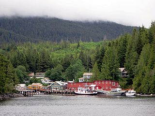
Telegraph Cove is a community of about 20 inhabitants, on Vancouver Island in British Columbia, Canada, located approximately 210 kilometres (130 mi) northwest of Campbell River. It is a former fishing and cannery village that has become a launch point for eco-tourism. It shares the inlet with Beaver Cove which is 3 km (2 mi) up the inlet.

Cortes Island is an island in the Discovery Islands archipelago on the coast of British Columbia, Canada. The island is 25 km (16 mi) long, 13 km (8 mi) wide, and 130 km2 (50 sq mi) in area. It has a population of 1,035 permanent residents. Cortes Island lies within Electoral Area B of the Strathcona Regional District, which provides water and sewerage systems, fire protection, land use planning, parks, recreation, and emergency response.

Lund is a small craft harbour and unincorporated village on Tla'amin land in qathet Regional District, British Columbia, Canada. It is along the northern part of the Salish Sea on the mainland BC coast. The main landmark in the village is the Lund Hotel, established in 1905. By boat from Lund, the Copeland Islands and Desolation Sound, are nearby. Lund is home to many shops and services including a general store, a restaurant overlooking the water, kayak and adventure tourism stores, and Nancy's Bakery, a favourite of locals and tourists.

Namu is a small fishing port, former cannery town and First Nations community on the coast of British Columbia, Canada. It is located about 95 km (59.0 mi) southwest of Bella Coola or 35 km (21.7 mi) SSE of Bella Bella, on the mainland shore of the Inside Passage ferry route directly opposite Hunter Island, and just south of the opening of Burke Channel and King Island. The community's harbour is named Namu Harbour, and a large lake just inland is Namu Lake, which lies in the short drainage basin of the 15 km Namu River, immediately east of which is the small but rugged Namu Range.
The WuikinuxvIPA: [ʔuwik'inuxʷ],, also rendered Oweekano (Pre-1976); Oowekeeno (1976-2003) are an Indigenous First Nations people of the Central Coast region of the Canadian province of British Columbia, located around Rivers Inlet and Owikeno Lake, to the north of Queen Charlotte Strait. The Wuikinuxv people and their neighbours the Heiltsuk and Haisla peoples were in the past sometimes known incorrectly as the "Northern Kwakiutl".

Milbanke Sound is a sound on the coast of the Canadian province of British Columbia.
Fort McLoughlin was a fur trading post established in 1833 by the Hudson's Bay Company (HBC) on Campbell Island in present-day British Columbia, Canada. At the time the Hudson's Bay Company performed quasi-governmental duties on behalf of the British Empire as well as undertaking trade for profit. The site is believed to have been at McLoughlin Bay on the northeast side of Campbell Island and is associated with the relocation of the Heiltsuk community of Bella Bella from its former location on islets near Denny Island. The McLoughlin name, which is that of John McLoughlin, regional head of company operations at that time, is also found in a lake and a creek entering that bay, and was conferred on these locations after the fort had closed.

Campbell Island is an island in the Canadian province of British Columbia, located west of Denny Island and north of Hunter Island, near Milbanke Sound. The Inside Passage waterways of Lama Passage and Seaforth Channel meet at its northern end.
Denny Island is an island on the Central Coast of British Columbia, Canada, just east of the community of Bella Bella, aka Waglisla, on Campbell Island. It is the location of Old Bella Bella, now mainly abandoned, but home to Canadian Coast Guard and Fisheries & Oceans bases, and Shearwater, home to Shearwater Marine. The island has a population of 138. Its main attraction is the McEmery Aquatic Centre on Reservoir Lane.

Old Bella Bella, also known as Old Towns or Qlts, was the name for the Heiltsuk village that grew up around the Hudson's Bay Company's historic Fort McLoughlin, at McLoughlin Bay on Campbell Island. The village relocated to the present site of Bella Bella, British Columbia by 1903. Today the Heiltsuk control the site, which houses a BC Ferries terminal, fish plant, and two houses, as well as archaeological remains of the old village.

Seaforth Channel is a channel in the Central Coast region of the Canadian province of British Columbia which is part of the Inside Passage - the 950 miles (1,530 km) passage between Seattle, Washington and Juneau, Alaska. The marine highway goes through Seaforth Channel on the way to Milbanke Sound, one of the open sea portions of the Inland Passage. Seaforth Channel which is part of the Prince Rupert/Port Hardy BC ferry route, extends in a westerly direction from Denny Island to Milbanke Sound between Denny Island, Campbell Island and the Wright group of islands on the south. In October 2016, a Texas-owned tug/barge transiting the Canadian waters of the Inside Passage without a local pilot was hard grounded on a reef at the entrance to Seaforth Channel in October 2016. More than 100,000 L of fuel contaminated the coast, coves and shores 20 km (12 mi) west of Bella Bella, the core community of the Heiltsuk Nation as well as the environmentally sensitive Great Bear Rainforest - Canada's contribution to the Queen's Commonwealth Canopy (QCC), a network of forest conservation programs. Clean up response and salvage was criticized by the Heiltsuk, B.C. Premier Christy Clark and Prime Minister Justin Trudeau. In November in Vancouver the Prime Minister announced a $1.5B ocean protection plan to "create a marine safety system, restore marine ecosystems and undertake research into oil spill cleanup methods."