Related Research Articles

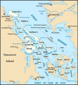
Thetis Island is an island and unincorporated community off the coast of British Columbia, Canada, lying between Vancouver Island, which is to the west across Stuart Channel, and the west from the north tip of Galiano Island, from which it is separated by Trincomali Channel. With its immediate southern neighbour Penelakut Island, it is one of the Gulf Islands. Thetis island is 2,560 acres (1,036 ha) in size. It is approximately two miles wide and three miles long north to south. Two north to south land ridges define the east and west sides of the island. Burchell Hill is 503 feet above sea level, and forms the high point on the west side of Thetis island, and Moore Hill is 511 feet above sea level, and forms the high point ridge on the east side of the island

15th Field Artillery Regiment, RCA, is a Primary Reserve Royal Canadian Artillery (RCA) regiment based in Vancouver, British Columbia, at the Bessborough Armoury. 15th Field Regiment is part of the 39 Canadian Brigade Group of 3rd Canadian Division.
The Artificial Reef Society of British Columbia (ARSBC) is a registered non-profit society based in Vancouver, British Columbia (BC), and is a registered tax-deductible charity in Canada.

Fort Rodd Hill National Historic Site is a 19th-century coastal artillery fort on the Colwood side of Esquimalt Harbour,. The site is adjacent to Fisgard Lighthouse National Historic Site, the first lighthouse on the west coast of Canada. Both the fort and lighthouse are managed and presented to the public by Parks Canada.

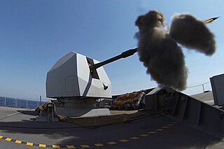
The 4.5 inch Mark 8 is a British naval gun system which currently equips the Royal Navy's destroyers and frigates, and some British destroyers and frigates sold to other countries.
Heinrich "Hein" Severloh was a soldier in the German 352nd Infantry Division stationed in Normandy in 1944. He became famous for a memoir WN 62 – Erinnerungen an Omaha Beach Normandie, 6. Juni 1944, published in 2000. In the book, the author claims that as a machine gunner, he inflicted over 1,000 and possibly over 2,000 casualties to the American soldiers landing on Omaha Beach on D-Day. However, Severloh's claim is not viewed as credible by either US or German historians. Total US casualties from all sources along the five-mile length of Omaha Beach on D-Day are estimated at 2,400.

Victoria Harbour is a harbour, seaport, and seaplane airport in the Canadian city of Victoria, British Columbia. It serves as a cruise ship and ferry destination for tourists and visitors to the city and Vancouver Island. It is both a port of entry and an airport of entry for general aviation. Historically it was a shipbuilding and commercial fishing centre. While the Inner Harbour is fully within the City of Victoria, separating the city's downtown on its east side from the Victoria West neighbourhood, the Upper Harbour serves as the boundary between the City of Victoria and the district municipality of Esquimalt. The inner reaches are also bordered by the district of Saanich and the town of View Royal. Victoria is a federal "public harbour" as defined by Transport Canada. Several port facilities in the harbour are overseen and developed by the Greater Victoria Harbour Authority, however the harbour master's position is with Transport Canada.

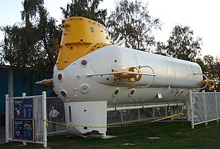
The Ben Franklin mesoscaphe, also known as the Grumman/Piccard PX-15, is a crewed underwater submersible, built in 1968. It was the brainchild of explorer and inventor Jacques Piccard. The research vessel was designed to house a six-man crew for up to 30 days of oceanographic study in the depths of the Gulf Stream. NASA became involved, seeing this as an opportunity to study the effects of long-term, continuous close confinement, a useful simulation of long space flights.

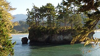
Salt Creek Recreation Area is a 196-acre park located about 15 miles west of Port Angeles, Washington on U.S. Route 101 near the city of Joyce, Washington. The park was previously Camp Hayden, a World War II military camp built 1942–1945. The site was established as the Striped Peak Military Reservation in 1941, renamed as Camp Hayden on 22 October 1942, and renamed again as Fort Hayden on 17 April 1944. It was named for Brigadier General John Louis Hayden, a former commander of the Harbor Defenses of Puget Sound. It was purchased by the Federal General Services Administration after the war. There are still several structures left from the fort, including two large casemates which sheltered 16" guns and several other structures. The 16-inch battery was Battery 131, with two ex-Navy 16-inch Mark 2 guns capable of firing a one-ton projectile around 28 miles connected by a large magazine bunker. The camp also had Battery 249, which had two 6-inch guns with a bunker housing magazines and fire control equipment.

The Bombardment of Fort Stevens occurred in June 1942, in the American Theater and the Pacific Theater of World War II. The Imperial Japanese submarine I-25 fired on Fort Stevens, which defended the Oregon side of the Columbia River's Pacific entrance.
Barrett Point is located at the foot of Mount Hayes at the entrance to Prince Rupert Harbour at 54°14′28″N130°20′02″W. It was a coastal fortification during World War II.

The 130 mm/50 B13 Pattern 1936 was a 130 mm (5.1 in) 50 caliber Soviet naval gun. The gun was used as a standard destroyer weapon during World War II, and it was also used as a coastal gun and railway gun. The gun was produced in three different versions which all had incompatible ammunition and range tables. Mountings for the weapon included single open mounts and twin turrets. Besides the Soviet Union, the gun was used on ships sold or donated to Poland, People's Republic of China, Egypt and Indonesia. Finland captured five guns during the Continuation War and used them until the 1990s.
The Attack on Saint Martin was a failed attempt by the Dutch Republic to recapture the island and former base of the Dutch West India Company (WIC) from the Spanish. In 1633 the Spanish had invaded Saint-Martin and Anguilla, driving off the French and Dutch inhabitants. The French and Dutch banded together to repel the Spanish and it was during a 1644 sea battle that the Dutch commander Peter Stuyvesant, later the governor of New Amsterdam, unsuccessfully besieged Fort Amsterdam and was forced to retreat with the loss of hundreds of men. A stray Spanish cannonball shattered his leg, which had to be amputated. But luck was on the Dutch side, and when the Eighty Years' War between Spain and the Netherlands ended, the Spanish no longer needed a Caribbean base and just sailed away in 1648.
There are many lakes named Long Lake in British Columbia, Canada.
Fairview Point is a point or headland on the west side of Kaien Island on the North Coast of British Columbia, Canada.
References
- ↑ Sailing Directions for British Columbia. United States Navy, Hydrographic Office. 1941. p. 144.
- ↑ Watson Island
- ↑ Command post
- ↑ Majewski, Teresita; Gaimster, David (7 June 2009). International Handbook of Historical Archaeology. Springer. p. 518. ISBN 978-0-387-72071-5.
- ↑ Macaree, Mary; Macaree, David (4 April 2014). 109 Walks in British Columbia's Lower Mainland: Revised & Updated Seventh Edition. Greystone Books Ltd. p. 85. ISBN 978-1-77100-000-0.