Spatsizi Plateau Wilderness Provincial Park

Last updated
Spatsizi Plateau Wilderness Provincial Park
Canada British Columbia location map 2.svg
Red pog.svg
Location in British Columbia
Location Kitimat-Stikine and Stikine Region, British Columbia, Canada
Nearest town Iskut
Coordinates 57°25′00″N128°30′00″W / 57.41667°N 128.50000°W / 57.41667; -128.50000
Area698,659 ha (2,697.54 sq mi)
EstablishedDecember 3, 1975
Governing body BC Parks
Website BC Parks Spatsizi

Spatsizi Plateau Wilderness Provincial Park is located in the northern portion of British Columbia, Canada, approximately 698, 659 hectares and encompasses the Spatsizi River and Gladys Lake Ecological Reserve. [2] The park is a designated protected area that is intended for the conservation and research on caribou, grizzly bears, fish, and other wildlife species populations. [3] Before the provincial park's establishment in 1975, the area was a historical hunting ground for local Indigenous communities like the Tahltan First Nations. [4] It is the second largest provincial park in British Columbia. [5]

Contents

History

Spatsizi is derived from the Sekani phrase (Tahltan First Nation/Dene Language), [2] meaning the "red goat" since the mountain goats that reside in the area roll in iron-oxide dust, colouring them in an earthy red tone. [2] [6] During the early 18th to late 19th century, there were two known early explorations of Spatsizi conducted by Samuel Black and P. M. Monkton. [5] Samuel Black, the chief trader for the Hudson Bay Company, crossed the Finlay-Stikine divide in 1824, and in 1935, the B.C. Government surveyor P. M. Monkton explored and analyzed the upper Stikine. [7] After the late 19th century, individuals like prospectors, hunters, and trappers explored the area for resources, [5] and the Hyland Brothers established a post by the Spatsizi River. [2] The trading post is known as the Hyland Post, and it was used to trade with native Indigenous trappers, but it was later abandoned in a few years. [5]

In 1948, Tommy Walker built a camp at the northwest end of Coldfish Lake, purchasing property at the lake and the Hyland Post. [5] Furthermore, Walker recruited the services of the Caribou Hide to act as hunting guides starting in 1949 all the way to 1968 due to Walker's departure. [5]

With Walker's departure, the outfitter guide operation was sold to a group that included L. Perry, but in 1975, the license was transferred to H. Paish. [5] On November 27, 1975, the Spatsizi Wilderness Provincial Park was established [5] by Order-in-Council No. 3756/75 [8] [9] with the express purpose of the reserve is to protect wildlife habitat and preserve the alpine landscape. What was unique about the creation of this park at the time is the lack of mention of harvesting or exploiting in it's policy statement. [9] The park sits at a combined size of 6,783 km2 including the Gladys Lake Ecological Reserve, [5] but a later revision of the area is estimated to be 698,659 hectares (excluding the reserve), [2] making it the second largest provincial park in British Columbia. [5] In 2001, the provincial park added more parkland following the Cassiar Iskut Stikine Land and Resource Management Plan (CIS LRMP), altering the Gladys Lake Ecological Reserve Boundary. [10]

Ecology

The Spatsizi Plateau Wilderness Provincial Park is under the Stikine Country Protected Area. [10] The protected area is composed of different provincial parks like Mount Edziza Provincial Park, Stikine River Provincial Park, Gladys Lake Ecological Reserve, Pitman River Protected Area, Chukachida Protected Area, and Tatlatui Provincial Park. [3]

The Stikine Country Protected Area System is composed of two major ecosections: the Southern Boreal Plateau and Stikine Plateau. [3] Other ecosections include the Cassiar Ranges, Tahltan Highlands, Northern Skeena Mountains, and Eastern Skeena Mountains, but these areas have minor influence so they are underrepresented. [3]

Other notable regions include the Spatsizi River stream, located an estimated 300km north of Terrace. The sub-region features a high elevation range of up to 2800m to extreme lows of less than 750m. [11] The river flows downstream from the south of and into Spatsizi Headwaters Provincial Park. [12]

Biogeoclimatic zones and subzones of the protected area include five different types and they include: Alpine Tundra (AT), Spruce-Willow-Birch (SWB), Boreal White and Black Spruce (BWBSdk1), Engelmann Spruce-Subalpine Fir (ESSFwv), and Sub-Boreal Spruce (SBS). [3] For Spatsizi Plateau Wilderness Park, it falls within the alpine zone and upper limit ranges of the subalpine zone from 1500 to 1700 metres. [5]

Weather is commonly cloudy, with low temperatures and high humidity despite low precipitation. Temperatures generally remain freezing between October to April followed by cool summers. Recorded temperatures at the center of the park hold a mean maximum of 16.4C and a mean minimum of -24.7C. [13]

Conservation

The Stikine Country Protected Area has an important conservation role in maintaining two natural ecosystem functions: the environment's absoprtive capacity to natural disturbances and predator-prey systems. [3] In the protected area, there are many large mammal predatory-prey relations that include wildlife such as grizzly/black bears (Ursus arctos & Ursus americanus), caribou (Rangifer tarandus caribou), moose (Alces alces), wolves (Canis lupus), mountain goats (Oreamnos americanus), and Stone's sheep (Ovis dallis stonei). [3]

Moreover, the Stikine Country Protected Area is also primarily protecting the biodiversity that it contains by preserving 27 plant species, 11 plant communities, and 15 animals species that are at risk. [3] Animal species include caribou, grizzly bear, bull trout (Salvalinus confluentus), wolverine (Gulo gulo), and 11 bird species. [3] Spatsizi Plateau is home to approximately 2000-2500 woodland caribou. [13] Caribou in the area tend to winter along the Stikine River, and in general were found in higher concentrations in the northern portion of the park all year. [13]

Gladys Lake Ecological Reserve

Gladys Lake Ecological Reserve, a 40,541 hectare area [14] within Spatsizi Plateau Wilderness Provincial Park, contains twenty known subalpine ecological communities and thirteen known alpine ecological communities. [15] White spruce ( Picea glauca ), subalpine fir ( Abies lasiocarpa ), and the American dwarf shrub ( Betula glandulosa ) are the primary woody vegetation found in lower subalpine areas. [15] Many of the alpine areas in the Gladys Lake Ecological Reserve are Tundra. [15]

Gladys Lake Ecological Reserve was created simultaneously and lies within the park, with the express purpose of studying Stone sheep and mountain goats, [16] though in the modern day the scope of research in the area has expanded, most notably to include caribou and moose.

First Nations cultural heritage

The Stikine Country Protected Area contains four cultural heritage roles for Mount Edziza Provincial Park, Spatsizi Plateau Wilderness Provincial Park, Stikine River Provincial Park, and Tatlatui Provincial Park. [3] The cultural heritage role is to protect sites and key Aboriginal landmarks like Cold Fish Lake, obsidian quarry sites, and parts of the Dominion Telegraph Trail and Tahltan Eagle. [3]

For the Spatsizi Plateau Wilderness Provincial Park, the cultural heritage role assigned to the area has protected village sites of the Caribou Hide and Metsantan First Nations. [3] Also, historical and traditional trails, and various legend, archaeological, non-Aboriginal fur trade sites have been conserved. [3]

In Spatsizi Plateau Wilderness Provincial Park, the Tahltan First Nation has used the area in the past for many generations, holding cultural significance to them as the land contains a rich history because of how the traditional ceremonies and practices conducted are essential for identity. [2] The Tahltan First Nation has extensively used the land, emphasizing inter-community trade with nearby Indigenous communities like the Tlingit, Kaska, and Sekani people and Aboriginal subsistence through hunting and fishing. [6] Hunting has been conducted in groups, where a wide range of wildlife such as rodents (squirrels, marmots, and beavers), to larger game like mountain goats/sheeps, caribou, moose, and bears are hunted during the summer and continuing all the way through winter. [6]

Recreation

Recreation in the Spatsizi Plateau is a topic of significance in the remote wilderness of northern British Columbia, Canada. The Spatsizi Plateau, encompassing a vast expanse of pristine wilderness, is renowned for its outstanding recreational opportunities and natural beauty. [17]

The Spatsizi Plateau in northern British Columbia offers diverse recreational opportunities within its remote wilderness. Visitors can enjoy activities like hiking, wildlife viewing, canoeing, fishing, camping, photography, stargazing, and guided nature interpretation. The park's pristine environment and stunning landscapes provide a unique outdoor experience, and responsible tourism practices are encouraged to protect its natural beauty.[ citation needed ]

See also

Related Research Articles

<span class="mw-page-title-main">Stikine River</span> River in British Columbia and Alaska

The Stikine River is a major river in northern British Columbia (BC), Canada and southeastern Alaska in the United States. It drains a large, remote upland area known as the Stikine Country east of the Coast Mountains. Flowing west and south for 610 kilometres (379 mi), it empties into various straits of the Inside Passage near Wrangell, Alaska. About 90 percent of the river's length and 95 percent of its drainage basin are in Canada. Considered one of the last truly wild large rivers in BC, the Stikine flows through a variety of landscapes including boreal forest, steep canyons and wide glacial valleys.

<span class="mw-page-title-main">Skeena River</span> River in British Columbia, Canada

The Skeena River is the second-longest river entirely within British Columbia, Canada. Since ancient times, the Skeena has been an important transportation artery, particularly for the Tsimshian and the Gitxsan—whose names mean "inside the Skeena River" ,and "people of the Skeena River," respectively. The river and its basin sustain a wide variety of fish, wildlife, and vegetation, and communities native to the area depend on the health of the river. The Tsimshian migrated to the Lower Skeena River, and the Gitxsan occupy territory of the Upper Skeena.

<span class="mw-page-title-main">Geography of British Columbia</span> Overview of the geography of British Columbia

British Columbia is the westernmost province of Canada, bordered by the Pacific Ocean. With an area of 944,735 km2 (364,764 sq mi) it is Canada's third-largest province. The province is almost four times the size of the United Kingdom and larger than every United States state except Alaska. It is bounded on the northwest by the U.S. state of Alaska, directly north by Yukon and the Northwest Territories, on the east by Alberta, and on the south by the U.S. states of Washington, Idaho, and Montana. Formerly part of the British Empire, the southern border of British Columbia was established by the 1846 Oregon Treaty. The province is dominated by mountain ranges, among them the Canadian Rockies but dominantly the Coast Mountains, Cassiar Mountains, and the Columbia Mountains. Most of the population is concentrated on the Pacific coast, notably in the area of Vancouver, located on the southwestern tip of the mainland, which is known as the Lower Mainland. It is the most mountainous province of Canada.

<span class="mw-page-title-main">Kechika River</span> River in British Columbia, Canada

The Kechika River is a tributary of the Liard River, about 300 kilometres (190 mi) long, in northern British Columbia, Canada. The Kechika flows generally northwest through the northernmost section of the Rocky Mountain Trench before turning east to join the Liard, a major branch of the Mackenzie River system. The river's 22,700 km2 (8,800 sq mi) drainage basin is characterized by high glaciated peaks, boreal forest, and open tundra. With no settlements, roads or dams along its course, the Kechika is considered "one of British Columbia's finest examples of wilderness and undisturbed wildlife habitat."

Atlin/Áa Tlein Téix'i Provincial Park is a provincial park in British Columbia, Canada. Situated in the remote northwestern corner of the province, the park protects large tracts of boreal forest, alpine tundra and glaciated terrain. The southern third of Atlin Lake, the largest natural body of freshwater in the province, is within the park boundary. The park is very undeveloped; no roads traverse it and no facilities, supplies, developed campsites or maintained hiking trails are available inside the park. The area has become a focal point in controversies involving proposed hydroelectric projects affecting Atlin Lake and environmental groups who view these proposals as potentially damaging to the lake's environment and its surroundings.

Iskut is a small, mostly Indigenous community in the Stikine Country of northwestern British Columbia. It is located on Highway 37, at the north end of Eddontenajon Lake just south of Dease Lake and the crossing of the Stikine River.

Spatsizi Headwaters Provincial Park is a provincial park in the Stikine Region of British Columbia, Canada. It was established on January 25, 2001 to protect the headwaters of the Spatsizi River while providing recreational facilities for visitors.

<span class="mw-page-title-main">Skeena Mountains</span> Mountains in British Columbia, Canada

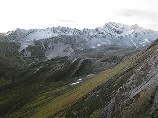
The Skeena Mountains, also known as the Skeenas, are a subrange of the Interior Mountains of northern British Columbia, Canada, essentially flanking the upper basin of the Skeena River. They lie just inland from the southern end of the Boundary Ranges of the Coast Mountains, and also of the northern end of the Kitimat Ranges. Their southern limit is described by the Bulkley River and the upper northwestern reaches of Babine and Takla Lakes, and on their northeast by the upper reaches of the Omineca River.

<span class="mw-page-title-main">Interior Mountains</span> Group of mountain ranges in British Columbia and Yukon

The Interior Mountains or Northern Interior Mountains are the semi-official names for an expansive collection of mountain ranges that comprises much of the northern half of the Canadian province of British Columbia and a large area of southern Yukon.

<span class="mw-page-title-main">Stikine Plateau</span> Plateau in British Columbia, Canada

The Stikine Plateau is a plateau in northern British Columbia, Canada. It lies between the Boundary Ranges of the Coast Mountains on the west and southwest and the Cassiar Mountains along its northeast, and between the Skeena Mountains on its south and southeast and the Jennings and Nakina Rivers on the north.

<span class="mw-page-title-main">Iskut River</span> River in British Columbia, Canada

The Iskut River, located in the northwest part of the province of British Columbia is the largest tributary of the Stikine River, entering it about 11 km (6.8 mi) above its entry into Alaska.

The Spatsizi Plateau is a plateau in the upper basin of the Stikine River in north-central British Columbia, Canada. Most of the plateau, which is a sub-plateau of the Stikine Plateau, is enshrined in either Spatsizi Plateau Wilderness Provincial Park or Spatsizi Headwaters Provincial Park. It is flanked on the south and southwest by the Skeena Mountains, on the southeast by the Omineca Mountains, on the northeast by the Stikine Ranges of the Cassiar Mountains, and on the west by the Klastline Plateau.

<span class="mw-page-title-main">Spatsizi River</span> River in British Columbia, Canada

The Spatsizi River is a tributary of the Stikine River, rising near Mount Gunanoot in the southeastern Spatsizi Plateau, British Columbia.

Spatsizi Mountain is a mountain in the Spatsizi Plateau, a sub-plateau of the Stikine Plateau in north-central British Columbia, Canada. The name "Spatsizi" derives from the Sekani language and means "red goat", as mountain goats in this region are known to roll on a particular red mountain, resulting in a red colour to their coats.

<span class="mw-page-title-main">Yukon Interior dry forests</span> Taiga ecoregion of British Columbia and Yukon, Canada

The Yukon Interior dry forests is a taiga ecoregion of Canada.

<span class="mw-page-title-main">North Central Rockies forests</span> Temperate coniferous forest ecoregion in Canada and the United States

The North Central Rockies forests is a temperate coniferous forest ecoregion of Canada and the United States. This region overlaps in large part with the North American inland temperate rainforest and gets more rain on average than the South Central Rockies forests and is notable for containing the only inland populations of many species from the Pacific coast.

<span class="mw-page-title-main">Central British Columbia Mountain forests</span> Temperate coniferous forest ecoregion in British Columbia, Canada

The Central British Columbia Mountain forests is a temperate coniferous forest ecoregion in north-central British Columbia, as defined by the World Wildlife Fund (WWF) categorization system.

Todagin Wildlife Management Area is a wildlife management area located southeast of Iskut in northwestern British Columbia. It was established by the British Columbia Ministry of Forests, Lands, Natural Resource Operations and Rural Development (FLNRORD) on 19 March 2001 to conserve and manage critical habitat for stone sheep. It is the largest wildlife management area in British Columbia at 122,787 ha.

Gladys Lake Ecological Reserve is an ecological reserve located in the Eaglenest Range of the Spatsizi Plateau in north-central British Columbia, Canada. It was established in 1975 under the Ecological Reserves Act to facilitate scientific research of the region's alpine-subalpine ecosystems while discouraging outdoor recreation use. The reserve protects 44,098 hectares of pristine wilderness and is the largest ecological reserve in British Columbia.

<span class="mw-page-title-main">Northern Cordillera forests</span> Taiga ecoregion of northwestern Canada

Northern Cordillera forests is a taiga ecoregion that extends across the northern interior of British Columbia, southern Yukon, and a small area of the Northwest Territories as defined by the World Wildlife Fund (WWF) categorization system.

References

  1. "Protected Planet | Spatsizi Plateau Wilderness Park". Protected Planet. Retrieved 2020-10-17.
  2. 1 2 3 4 5 6 "Spatsizi Plateau Wilderness Park". BC Parks. Retrieved 2023-10-11.
  3. 1 2 3 4 5 6 7 8 9 10 11 12 13 Ministry of Environment, Stikine Region Environmental Division (January 2003). "Stikine Country Protected Areas Management Plan (Final Report Volume 1)" (PDF). Retrieved October 11, 2023.
  4. Government of Canada, Natural Resources Canada (2015-12-07). "GEOSCAN Search Results: Fastlink". geoscan.nrcan.gc.ca. Retrieved 2023-10-09.
  5. 1 2 3 4 5 6 7 8 9 10 11 Osmond-Jones, E.J.; Sather, M.; Hazelwood, W.G.; Ford, B. (1977). Wildlife and Fisheries Inventory of Spatsizi Wilderness and Tatlatui Provincial Parks, British Columbia. Victoria B.C.: Provincial Parks Branch.
  6. 1 2 3 "Tahltan". www.thecanadianencyclopedia.ca. Retrieved 2023-10-11.
  7. Lau, J. T. (1971) The upper Stikine - a case for preservation. pp.26. G. Hazelwood files, B.C. Parks Branch, Victoria
  8. "BC Geographical Names". apps.gov.bc.ca. Retrieved 2023-10-17.
  9. 1 2 Pearse, A. D. (1983). An examination of wildlife policy in Spatsizi Plateau Wilderness Park (Doctoral dissertation, University of British Columbia).
  10. 1 2 Ministry of Environment, Skeena Region Environmental Division (January 2003). "Stikine Country Protected Areas Management Plan (Final Report Volume 2)" (PDF). Retrieved October 11, 2023.
  11. Matysek, P F; Gravel, J L; Jackaman, W; Feulgen, S (1990). British Columbia regional geochemical survey, stream sediment and water geochemical data, Alberni - NTS 92F (Report). Natural Resources Canada/CMSS/Information Management.
  12. Jackaman, Wayne (2004). "Spatsizi River Stream Sediment and Water Survey, Northwestern British Columbia (NTS 104H/1, 2, 3, 4, 5, 6, 7, 11, 12 & 13)" (PDF). British Columbia Geological Survey: 221–224.
  13. 1 2 3 Boonstra, Ruby; Sinclair, A.R.E. (1984). "Distribution and Habitat Use of Caribou, Rangifer tarandus caribou, and Moose, Alces alces andersoni, in the Spatsizi Plateau Wilderness Area, British Columbia" (PDF). Division of Life Sciences, Scarborough College, University of Toronto: 12–21.
  14. "Gladys Lake Ecological Reserve". BC Parks. Retrieved 2023-10-08.
  15. 1 2 3 Pojar, Jim (1986). Vegetation and Ungulate Habitat in the Gladys Lake Ecological Reserve, Northern British Columbia (Research Report RR85009-PR ed.). British Columbia Ministry of Forests.
  16. Scuddder, G.G.E; Sinclair, A.R.E. (1976). "A Research Plan For Spatsizi Plateau Wilderness Park And Gladys Lake Ecological Reserve" (PDF). Ecological Reserves Collection, Government of British Columbia.
  17. Government of British Columbia, BC Parks. "Spatsizi Headwaters Park".