The Lower Mainland is a geographic and cultural region of the mainland coast of British Columbia that generally comprises the regional districts of Metro Vancouver and Fraser Valley. Home to approximately 3.05 million people as of the 2021 Canadian census, the Lower Mainland contains sixteen of the province's 30 most populous municipalities and approximately 60% of the province's total population.

Greater Wellington, also known as the Wellington Region, is a non-unitary region of New Zealand that occupies the southernmost part of the North Island. The region covers an area of 8,049 square kilometres (3,108 sq mi), and has a population of 547,000.

Territorial authorities are the second tier of local government in New Zealand, below regional councils. There are 67 territorial authorities: 13 city councils, 53 district councils and the Chatham Islands Council. District councils serve a combination of rural and urban communities, while city councils administer the larger urban areas. Five territorial authorities also perform the functions of a regional council and thus are unitary authorities. The Chatham Islands Council is a sui generis territorial authority that is similar to a unitary authority.

The Western Region is located in south Ghana, spreads from the Ivory Coast in the west to the Central region in the east, includes the capital and large twin city of Sekondi-Takoradi on the coast, coastal Axim, and a hilly inland area including Elubo. It includes Ghana's southernmost location, Cape Three Points, where crude oil was discovered in commercial quantities in June 2007. The region covers an area of 13,842 sq. km, and had a population of 2,060,585 at the 2021 Census.
West Vancouver—Sunshine Coast—Sea to Sky Country is a federal electoral district in British Columbia, Canada, that has been represented in the House of Commons of Canada since 1997.

Vancouver Island North is a former federal electoral district in British Columbia, Canada, that was represented in the House of Commons of Canada from 1997 to 2015.

The Limestone Coast is a name used since the early twenty-first century for a South Australian government region located in the south east of South Australia which immediately adjoins the continental coastline and the Victorian border. The name is also used for a tourist region and a wine zone both located in the same part of South Australia.
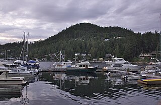
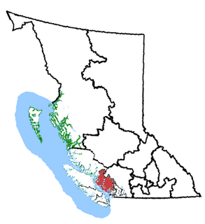
The Sunshine Coast is a geographic subregion of the British Columbia Coast that generally comprises the regional districts of qathet and Sunshine Coast.

Greater Vancouver, also known as Metro Vancouver, is the metropolitan area with its major urban centre being the city of Vancouver, British Columbia, Canada. The term "Greater Vancouver" is roughly coterminous with the geographic area governed by the Metro Vancouver Regional District, though it predates the 1966 creation of the regional district. It is often used to include areas beyond the boundaries of the regional district but does not generally include wilderness and agricultural areas within that regional district.
The country of Norway is historically divided into a number of districts. Many districts have deep historical roots, and only partially coincide with today's administrative units of counties and municipalities. The districts are defined by geographical features, often valleys, mountain ranges, fjords, plains, or coastlines, or combinations of the above. Many such regions were petty kingdoms up to the early Viking Age.

Central California is generally thought of as the middle third of the state, north of Southern California, which includes Los Angeles, and south of Northern California, which includes San Francisco. It includes the northern portion of the San Joaquin Valley, part of the Central Coast, the central hills of the California Coast Ranges and the foothills and mountain areas of the central Sierra Nevada.

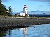
The British Columbia Coast, popularly referred to as the BC Coast or simply the Coast, is a geographic region of the Canadian province of British Columbia. As the entire western continental coastline of Canada along the Pacific Ocean is in B.C., it is synonymous with being the West Coast of Canada.

Vancouver Coastal Health (VCH) is a regional health authority that provides health services including primary, secondary, tertiary and quaternary care, home and community care, mental health services, population and preventive health and addictions services in part of Greater Vancouver and the Coast Garibaldi area.

The Sunshine Coast Region is a local government area located in the Sunshine Coast district of South East Queensland, Australia.
In South Australia, one of the states of Australia, there are many areas which are commonly known by regional names. Regions are areas that share similar characteristics. These characteristics may be natural such as the Murray River, the coastline, desert or mountains. Alternatively, the characteristics may be cultural, such as common land use. South Australia is divided by numerous sets of regional boundaries, based on different characteristics. In many cases boundaries defined by different agencies are coterminous.

The districts of Ivory Coast are the first-level administrative subdivisions of the country. The districts were created in 2011 in an effort to further decentralise the state, but in practice most of them have not yet begun to function as governmental entities.
Southport–Nerang Road is a major arterial road on the Gold Coast, Queensland that connects the outlying suburb of Nerang with Southport, the Gold Coast's Central Business District.

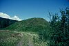
Mount Arrowsmith Biosphere Region (MABR) is a UNESCO Biosphere Reserve located on the east coast of Vancouver Island in British Columbia, Canada. It was designated in 2000 by UNESCO to protect a large second-growth coast Douglas fir ecosystem in the watersheds of the Little Qualicum and Englishman Rivers from being developed.