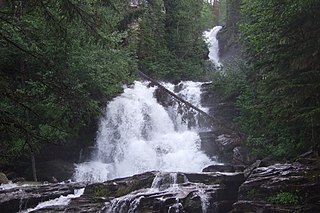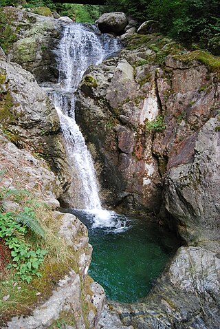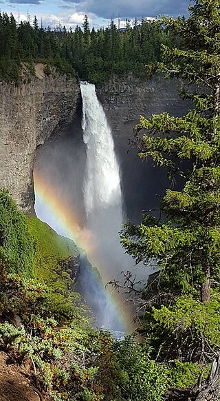
Bridal Veil Falls Provincial Park is a BC Park situated on the Trans-Canada Highway just east of Rosedale, British Columbia, Canada, within of the City of Chilliwack. The community of Bridal Falls is located adjacent to the falls and park, as well as the interchange between the Trans-Canada and BC Highway 9, offering a variety of highway-based tourism services. Access to the falls requires a short hike from the parking lot and well-groomed trails, taking most groups 15-25 minutes.

Brandywine Falls Provincial Park is a provincial park in British Columbia, Canada, located adjacent to BC Highway 99 between Garibaldi and Whistler, British Columbia. It is managed by Sea to Sky Parks for BC Parks.

Bijoux Falls Provincial Park is a provincial park in British Columbia, Canada. The park is located north of the city of Prince George on BC Highway 97 on the southern approach to the summit of the Pine Pass through the Rocky Mountains. The park was established in 1956 primarily to serve as a rest stop and to provide information about the park system in BC to travellers. The park is named for Bijoux Falls, a 40-metre-high (130 ft) cascading waterfall that is the central feature of the park.

Canim Beach Provincial Park is a provincial park in British Columbia, Canada, located at the southwest end of Canim Lake in the Interlakes District of the South Cariboo region, adjacent to the Secwepemc Indian reserve community of Canim Lake, British Columbia just northeast of 100 Mile House. The park was established by Order-in-Council in 1956 and expanded by later legislation in 2000 and 2004 to total a current approximate of 8.2 hectares, 3.6 hectares of upland and 4.6 hectares of foreshore.

Davis Lake Provincial Park is a 185 acres (0.75 km2) park in British Columbia, Canada, established as a protected provincial park in October 1963. It is located east of the southern end of Stave Lake, northeast of Mission, British Columbia, approximately 18 km north on Sylvester Rd from BC Highway 7. There are campgrounds and beaches at the south end of the lake, access is walk-in only via a 1 km unmaintained gravel road.

E.C. Manning Provincial Park is a provincial park in British Columbia, Canada. It is usually referred to as Manning Park, although that nomenclature is also used to refer to the resort and ski area at the park's core. The park covers 83,671 hectares (323 mi2) and was the second most visited provincial park in 2017-18 after Cypress Provincial Park. The park lies along British Columbia Highway 3, and occupies a large amount of land between Hope and Princeton along the Canada-United States border.
Monkman Provincial Park is a provincial park in British Columbia, southwest of Tumbler Ridge and northeast of Hansard. Like Monkman Pass, Monkman Lake, Monkman Creek and Monkman Falls, it was named after Alexander Monkman.
Schoen Lake Provincial Park is a provincial park in northeastern Vancouver Island, British Columbia, Canada, located east of the community of Woss Lake and southwest of Sayward. The park lies inside the Nimpkish Valley watershed. On October 28, 1977, the "Class A" park was officially created to protect, exhibit and interpret an example of the natural features and processes of the Insular Mountains Natural Region. The park covers a total area of 8,775 hectares. Within those hectares of park land is a number of lakes, creeks and mountain ranges.
Todagin South Slope Provincial Park is a provincial park in British Columbia, Canada, located on the west side of Todagin Creek to the east of Kinaskan Lake in the Stikine Country, to the south of the community of Dease Lake. Created in 2001, it contains c. 3557 ha.

Vaseux Lake is a shallow freshwater lake located along the course of the Okanagan River in the Okanagan Valley of British Columbia, Canada.

The Mahood River is a river in the northern Shuswap Highland of the Central Interior of British Columbia in Wells Gray Provincial Park. It is 7 kilometres (4.3 mi) long from its source at Mahood Lake to its confluence with the Clearwater River, a tributary of the North Thompson River. The Mahood River has cut a deep canyon into Cambrian rocks and Pleistocene glacial moraines.

Chilliwack Lake is a lake in the upper basin of the Chilliwack River southeast of the city of the same name in the Lower Mainland of British Columbia, Canada. The lake, while entirely within Canada, is located just north of the border between British Columbia and the state of Washington and is both fed and drained by the Chilliwack River, which has its source in the North Cascades of Washington state and Canada, which surround the lake on all sides.

The Iskut River, located in the northwest part of the province of British Columbia is the largest tributary of the Stikine River, entering it about 11 km (6.8 mi) above its entry into Alaska.
Depot Creek, also known as Brown Creek and Kokanee Creek, is a large creek in south-central British Columbia, Canada and Whatcom County, Washington, United States. It is in the Pacific Ocean drainage basin, and is located in the North Cascades. There is a waterfall along its course, Depot Creek Falls.

The geography of the North Cascades describes a range of rugged mountains in British Columbia, Canada and Washington, United States. In Canada, the range is officially named the Cascade Mountains but is commonly referred to as the Canadian Cascades.
Cascade Falls is a waterfall on the Iskut River in the Stikine Country of northwestern British Columbia, Canada, to the southeast of Mount Edziza and near the Stewart-Cassiar Highway. About 12.2 m (40 ft) tall, it is located at the south end of Kinaskan Lake Provincial Park.
A mountain formerly known as Mount Pétain, but with no current official name, is located on the border of the Canadian provinces of Alberta and British Columbia (BC) on the Continental Divide.

Wells Gray Provincial Park is a large wilderness park located in east-central British Columbia, Canada. The park protects most of the southern, and highest, regions of the Cariboo Mountains and covers 5,415 square kilometres. It is British Columbia's fifth largest provincial park, after Tweedsmuir, Tatshenshini, Spatsizi and Northern Rocky Mountains.

Cascade Falls Regional Park is a regional park under the administration of the Fraser Valley Regional District in the Hatzic Valley of the Lower Mainland region of British Columbia, Canada. The park was originally 9.5 hectares in area but was expanded to a current 22 hectares. It has picnic tables and pit toilets, with various hiking trails and a walkway leading to a viewing platform over a large waterfall, which is 15 minutes walk from the park's parking lot.
The Little Iskut River is a tributary of the Iskut River in the northwest part of the province of British Columbia, Canada, in Cassiar Land District. From its source at Little Ball Lake in Mount Edziza Provincial Park, the Little Iskut River flows about 45 km (28 mi), generally north to the vicinity of Mowdale Lake, then southeast and south to the Iskut River just below Cascade Falls. The Little Iskut River is part of the Stikine River drainage basin, as the Iskut River is a major tributary of the Stikine.


