Esquimalt Lagoon Migratory Bird Sanctuary

Last updated

The Esquimalt Lagoon Migratory Bird Sanctuary is a migratory bird sanctuary near Esquimalt Harbour in Colwood, British Columbia. The Esquimalt Lagoon is found on the traditional territories of the Esquimalt and Songhees Nations. [1] The park was established in 1931 with the objective of creating a safe haven for migratory birds, [2] and has become a popular place for birdwatching. [3] Many other species can be found within the park, such as coho salmon and cutthroat trout. [2] Pacific herring also spawn in nearby waters. [4]

Contents

Esquimalt Lagoon Migratory Bird Sanctuary
Landscape photograph of Esquimalt Lagoon (NE).jpg
Birds resting on the water in Esquimalt Lagoon.
Canada British Columbia location map 2.svg
Red pog.svg
Location in British Columbia
Location Salish Sea, British Columbia, Canada
Nearest city Victoria, British Columbia, Canada
Coordinates 48°25′34″N123°27′58″W / 48.42611°N 123.46611°W / 48.42611; -123.46611
Area134 ha (330 acres)
Designation Migratory Bird Sanctuary
Established1931
Governing body Canadian Wildlife Service
Website Esquimalt Lagoon Migratory Bird Sanctuary

History

Archaeological findings suggest that the native Esquimalt and Songhees peoples have a longstanding connection to the Esquimalt Lagoon and Coburg Peninsula. [5] For thousands of years, these Indigenous communities occupied and utilized the lagoon for subsistence, and spiritual purposes. [5] The area provided abundant resources such as fish, birds, mammals, berries, roots, tubers, and clam beds at the lagoon's entrance for harvest. [1] [5]

European influence in the area began in 1854 with the establishment of a British naval base and firing range. [5] The Gold Rush of 1858 brought a influx of settlers to the region, leading to the establishment of farms and industries. [5]

In 1931 the Esquimalt Lagoon Migratory Bird Sanctuary was established [5] with the purpose of protecting migratory species of birds that travel through the pacific by providing a safe space for them to roost. [1] Currently, the lagoon is used by residents and tourists alike for outdoor activities such as kayaking and scuba diving, as well as watching its unique wildlife. [6]

Indigenous background

The lagoon lies on the territory of the Esquimalt and the Songhees Nation, and nearby resides the Beecher Bay Nation. [1]  These nations gathered plant resources, including essential materials, root tubers, and berries from the shoreline and harbour. [1]  They also used the land the hunt, fish, and collect shellfish. [1] It is reported that the nations split their time between the Esquimalt lagoon and the Gulf and San Juan Islands based on the seasons. [1]

In 1849 Aboriginal Title was recognized and Esquimalt Nation was one of fourteen nations to sign the Douglas treaty over 150 years ago. [7] Though they retain Aboriginal Title under the Douglas treaty and the right to hunt on unoccupied land, Esquimalt Nation has identified one of its current challenges as understanding what these rights mean for them if resources are no longer available due to urban development; including forest and fisheries management. [7]

Objectives

Established on December 12, 1931, The Esquimalt Lagoon Migratory bird Sanctuary was created in Colwood, British Columbia with the objective of providing a safe haven for migratory birds on the Pacific coast. [2] Due to its shallow tidal waters, the abundant shelter and resources found within, and due to having two gravel-bar islands and a rocky outcrop for loafing, the Esquimalt Lagoon sanctuary has become one of the most important Birding spots in the region. [2]

Climate change

Climate change will affect the Esquimalt Lagoon through rising sea-levels [1] and temperatures, which causes a loss of habitat. [8]  The intertidal marsh is considered to be acting resilient against climate change. [1]  The salt marsh acts as a carbon sequestration system and also adds protection against flooding. [1]  However the rising-sea levels will continue to cause a loss of low-lying lands, coastal erosion, saltwater intrusion and soil salination. [8]  Rising temperatures are also altering key ecosystem functions like phenology, reproduction, nutrient cycling, and other vital functions necessary for a resilient ecosystem. [8]

Habitat management

The nearby First Nation communities of the Esquimalt Nation, Songhees Nation, and Beecher Bay Nation are working directly with the City of Colwood to protect the waterfront from climate change and sea level rise at the Esquimalt lagoon. [1]  Their future plan will include the management of shoreline sediment processes, infrastructure and service provisions, and the enhancement and protection of the ecological elements. [1]  To further protect the wildlife, the Esquimalt was established as a sanctuary in 1931 by Environment and Climate Change Canada (ECCC). [9]

Plants and wildlife

The Esquimalt Lagoon is used by various bird species year round, including many gulls, ducks and shorebirds. [9] There are seasonal differences in the number of birds visiting the lagoon, and numbers typically peak in the late summer and fall during migration. [9] Common species of birds that can be found within the park are Canada geese (Branta cabadebsis), mallards (Anas okatyrhynchos), American wigeons (Mareca americana), northern pintails (A. acuta), greater and lesser scaups ( Aythya marila/ affinis ), and hooded mergansers (Lophodytes cucullatus). [9] There have been a total of 229 different bird species reported at the site. The mudflats, eelgrass and estuary marsh habitats surrounding and within the lagoon provide foraging opportunities and nesting areas for both migratory and resident birds. [2]

Many aquatic species, including Coho salmon and Cutthroat trout, enter the lagoon through streams that flow into the lagoon. [2] Other species, including river otters ( Lontra canadensis ) can also be found at the Esquimalt Lagoon. [10] Bivalves, sand dollars, sea lettuce and eelgrass are also commonly found within the lagoon. [2]

Species at risk

The great blue heron, which can be seen on site at the Esquimalt Lagoon, is considered to be a species of concern, and is listed under the Species at Risk Act (SARA). [2] The number of herons found here typically peaks in the spring and summer. [9]

Related Research Articles

<span class="mw-page-title-main">Banks Island</span> Inhabited island in the Northwest Territories, Canada

Banks Island is one of the larger members of the Arctic Archipelago. Situated in the Inuvik Region, and part of the Inuvialuit Settlement Region, of the Northwest Territories, it is separated from Victoria Island to its east by the Prince of Wales Strait and from the mainland by Amundsen Gulf to its south. The Beaufort Sea lies to its west, and to its northeast M'Clure Strait separates the island from Prince Patrick Island and Melville Island.

<span class="mw-page-title-main">Akimiski Island</span> Island in southern Hudson Bay

Akimiski Island is the largest island in James Bay, Canada, which is part of the Qikiqtaaluk Region of the territory of Nunavut. It has an area of 3,001 km2 (1,159 sq mi), making it the 163rd largest island in the world, and Canada's 29th largest island. Akimiski Island is 19 km (12 mi) from the province of Ontario. From the western side of the island, the Ontario coastline is visible.

<span class="mw-page-title-main">Greater Victoria</span> Metropolitan area in British Columbia, Canada

Greater Victoria is located in British Columbia, Canada, on the southern tip of Vancouver Island. It is usually defined as the thirteen municipalities of the Capital Regional District (CRD) on Vancouver Island as well as some adjacent areas and nearby islands.

<span class="mw-page-title-main">Colwood, British Columbia</span> City in British Columbia, Canada

Colwood is a city located on Vancouver Island to the southwest of Victoria, capital of British Columbia, Canada. Colwood was incorporated in 1985 and has a population of approximately 19,000 people. Colwood lies within the boundaries of the Greater Victoria area or Capital Regional District, in a region called the Western Communities, or the West Shore. It is one of the 13 component municipalities of Greater Victoria.

The Canadian Wildlife Service or CWS, is a Branch of the Department of Environment and Climate Change Canada, a department of the Government of Canada. November 1, 2012 marked the 65th anniversary of the founding of Service.

<span class="mw-page-title-main">Protected areas of Canada</span> Areas protected for conservation or historical reasons

Protected areas of Canada consist of approximately 12.1 percent of the nation's landmass and freshwater are considered conservation areas, including 11.4 percent designated as protected areas. Approximately 13.8 percent of Canada's territorial waters are conserved, including 8.9 percent designated as protected areas. Terrestrial areas conserved have increased by 65 percent in the 21st century, while marine areas conserved have increased by more than 3,800 percent.

<span class="mw-page-title-main">Desolation Sound Marine Provincial Park</span> Provincial park in British Columbia, Canada

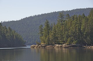
Desolation Sound Marine Provincial Park is a provincial park in British Columbia, Canada. The park is distinguished by its many picturesque sheltered coves and anchorages, frequented by yachts and pleasure craft. The scenery consists of waterfalls, rugged glaciated peaks, and steep forested slopes that fall into the ocean.

<span class="mw-page-title-main">Pacific Flyway</span> Major north-south flyway for migratory birds in the Americas

The Pacific Flyway is a major north-south flyway for migratory birds in the Americas, extending from Alaska to Patagonia. Every year, migratory birds travel some or all of this distance both in spring and in fall, following food sources, heading to breeding grounds, or travelling to overwintering sites.

<span class="mw-page-title-main">Humboldt Bay National Wildlife Refuge</span> National Wildlife Refuge in California

Humboldt Bay National Wildlife Refuge is located on Humboldt Bay, on the California North Coast near the cities of Eureka and Arcata. The refuge exists primarily to protect and enhance wetland habitats for migratory water birds using the bay area, including tens of thousands of shorebirds, ducks, geese, swans, and the black brant. Humboldt Bay National Wildlife Refuge, along with other public and private lands around Humboldt Bay, is one of the key stopovers for the millions of migratory birds that rely on the Pacific Flyway. More than 200 bird species, including 80 kinds of water birds and four endangered species, regularly feed, rest, or nest on the refuge or other areas around the bay.

Vaseux-Bighorn National Wildlife Area is a National Wildlife Area in British Columbia, Canada, primarily set aside to protect winter rangeland for California bighorn sheep. In 1979, the Vaseux-Bighorn Wildlife Area was established in response to substantial reduction in wild animal populations in the area. Identified factors contributing to species decline at the time were high predator population, overharvesting of species, and illegal hunting. Land development, cattle raising, and lumbering also might have altered species populations. Under these conditions, the area was able to be classified as a Category IV area by the IUCN and is now used for wildlife habitat and conservation. Even with minimal anthropogenic use of the area, threats persist through invasive species. Recreational use is limited spatially and is only open to the public during the day.

<span class="mw-page-title-main">Qualicum National Wildlife Area</span> National Wildlife Area on Vancouver Island in British Columbia, Canada

The Qualicum National Wildlife Area (NWA) was officially established in 1977, under the Canada Wildlife Act (1973). The primary objective of the Qualicum NWA was to conserve crucial habitats for migratory birds and various other species.

Located in the southern part of British Columbia, Columbia National Wildlife Area was established to protect its wetlands and as a temporary home for migratory birds travelling to South America. The National Wildlife Area (NWA) is divided into four unit areas: Wilmer, Spillimacheen, Brisco and Harrogate, which are home to many diverse species of animals and plants which are significant in Canada.

Last Mountain Lake Bird Sanctuary is a National Historic Site of Canada, located in the rural municipality of Last Mountain Valley No. 250 in Saskatchewan. The migratory bird sanctuary was the first established in North America. The 47.36 km2 (18.29 sq mi) area is within the Last Mountain Lake National Wildlife Area, an International Biological Program site, and includes adjacent uplands.

Last Mountain Lake National Wildlife Area is a National Wildlife Area (NWA) in the Canadian province of Saskatchewan. The protected area is in the Prairie Pothole Region of North America, which extends throughout three Canadian provinces and five U.S. states. It is also within Palliser's Triangle and the Great Plains ecoregion. The site is an Important Bird Area (IBA) of Canada, designated as Last Mountain Lake NWA .

Lazo Marsh-North East Comox Wildlife Management Area is a wildlife management area on the eastern coast of Vancouver Island, British Columbia, Canada. It was established by the British Columbia Ministry of Forests, Lands, Natural Resource Operations and Rural Development (FLNRORD) on 6 April 2001 to preserve local species. The marshlands is owned jointly by the K'omoxs First Nation, the towns' municipality, and the Comox Valley Regional District, and lays within both the traditional territories of the K'omoks people and the Pacific Temperate Rain Forest.

<span class="mw-page-title-main">Serpentine Wildlife Management Area</span> Wildlife Management Area in British Columbia, Canada

The Serpentine Wildlife Management Area is a small wildlife management area located on the south coast of British Columbia in Surrey. It contains many kilometers of walking trail and viewing towers to enjoy the nature and observe the many species found in the area. Although the boundaries have changed over the years, the Government of British Columbia still manages the land to ensure it meets the currents goals that were set in place to protect the local and endangered species that inhabit the area as well as monitoring the effects of climate change. This is done in partnership with Ducks Unlimited Canada, although the land falls within the territories of the Semiahmoo and Tsawwassen First Nation.

The Christie Islet Migratory Bird Sanctuary is a small migratory bird sanctuary on the south coast of British Columbia. It was established in 1962 by Environment and Climate Change Canada. Located in Howe Sound just south of Anvil Island, it is a small rocky island where seabirds nest, and Harbour seals roam the surrounding waters. To protect the birds' nesting habitat, public access to the islet is not allowed, however is it possible to observe birds by boat.

The Shoal Harbour Migratory Bird Sanctuary is a migratory bird sanctuary on Vancouver Island, British Columbia. More than 40 species of birds are found there.

<span class="mw-page-title-main">Inglewood Bird Sanctuary</span> Park in Calgary, Alberta

The Inglewood Bird Sanctuary is an urban park and nature reserve located along the Bow River in Calgary, Alberta, Canada. The park includes an interpretive nature centre, where educational programs and summer camps are offered. The park is a popular location for birding and wildlife viewing in the city, and is part of the Canadian Migration Monitoring Network. The historic Colonel James Walker house is also located within the park.

References

  1. 1 2 3 4 5 6 7 8 9 10 11 12 "Esquimalt Lagoon". Birds of a Feather B&B. 2007-10-02. Retrieved 2023-10-28.
  2. 1 2 3 4 5 6 7 8 Canada, Environment and Climate Change (2014-11-14). "Esquimalt Lagoon Migratory Bird Sanctuary". www.canada.ca. Retrieved 2023-08-27.
  3. "Birding". www.colwood.ca. Retrieved 2023-08-27.
  4. "Noisy sealife moves off Oak Bay shores, but hope for healthy herring return remains". Oak Bay News. 2023-03-06. Retrieved 2023-08-27.
  5. 1 2 3 4 5 6 "History to Present". www.crd.bc.ca. 2014-04-03. Retrieved 2023-10-28.
  6. "Esquimalt Lagoon MBS Wildlife Watching - Vanisle Wildlife". vanislewildlife.ca. Retrieved 2023-10-28.
  7. 1 2 "Land Use • Esquimalt Nation • Community Engagement". Esquimalt Nation. Retrieved 2023-10-28.
  8. 1 2 3 City of Colwood (2020). "Climate Change Adaptation Strategies for the City of Colwood" (PDF).
  9. 1 2 3 4 5 "Dogs and Migratory Birds within Migratory Bird Sanctuaries in the Greater Victoria Area". www.canada.ca. 2023-08-17. Retrieved 2023-10-28.
  10. Guertin, Daniel A.; Harestad, Alton S.; Ben‐David, Merav; Drouillard, Ken G.; Elliott, John E. (February 2010). "Fecal genotyping and contaminant analyses reveal variation in individual river otter exposure to localized persistent contaminants". Environmental Toxicology and Chemistry. 29 (2): 275–284. doi: 10.1002/etc.53 . ISSN   0730-7268.