Burquitlam was a provincial electoral district for the Legislative Assembly of British Columbia, Canada from 2001 to 2009.
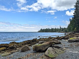
Anderson Bay Provincial Park is a provincial park in British Columbia, Canada, located on the southeast end of Texada Island near the community of Gillies Bay. Created in 2000, it is approximately 35 hectares in area.
Bugaboo Provincial Park is a provincial park in British Columbia, Canada, located in the central Purcell Mountains.

Buccaneer Bay Provincial Park is a provincial park in British Columbia, Canada, located 17 km west of Sechelt on North Thormanby Island, offshore from the community of Halfmoon Bay.
Drewry Point Provincial Park is a provincial park in British Columbia, Canada, on the west side of Kootenay Lake, southeast of the city of Nelson.
Garden Bay Marine Provincial Park is a provincial park in British Columbia, Canada at the northwest end of the Sechelt Peninsula on the lower Sunshine Coast, near the community of Madeira Park. Established in 1969, it is approximately 163 ha.
James Chabot Provincial Park is a provincial park in British Columbia, Canada. Formerly Athalmer Beach Provincial Park, it is located in Invermere at the northeast end of Windermere Lake in the Columbia Valley region of the East Kootenay. Windermere Lake Provincial Park is located at the lake's southwestern end.
Kootenay Lake Provincial Park is a provincial park in British Columbia, Canada. It encompasses five widely dispersed parks around Kootenay Lake: Kootenay Lake Provincial Park, Kootenay Lake Provincial Park, Kootenay Lake Provincial Park, Kootenay Lake Provincial Park, and Kootenay Lake Provincial Park.

Lockhart Beach Provincial Park is a provincial park Located 40 km north of Creston, British Columbia, Canada, on BC Highway 3A. "This park and the adjacent Lockhart Creek Provincial Park extend 3 hectares, from the sunny shores of Kootenay Lake to the headwaters of Lockhart Creek. "This small park provides the only easy access to public camping along the south arm of Kootenay Lake. An 18-site campground and day-use area are located near a sand and fine gravel beach."
Mudzenchoot Provincial Park is a provincial park in British Columbia, Canada, located 90 km (56 mi) northwest of Fort St. James in the Omineca Country of British Columbia's Central Interior. It is at a high elevation and is characterized by dry meadows including unique vegetation such as erigerons, aster type species, and cotton grass. The provincial park has zero facilities or road access points.
Pennask Lake Provincial Park is a provincial park in British Columbia, Canada, located on the easternmost heights of the Thompson Plateau, 50 km (31 mi) to the northwest of the Okanagan town of Peachland.

Porpoise Bay Provincial Park is a provincial park in British Columbia, Canada near the town of Sechelt. Features of the park include a campsite with group and walk-in camping opportunities, as well as opportunities for paddling, swimming and observing nature.
Ryan Provincial Park is a provincial park in British Columbia, Canada.

Saltery Bay Provincial Park is a provincial park in British Columbia, Canada. The park is located southeast of the city of Powell River, and on the north side of the entrance to Jervis Inlet in the central area of the province's Sunshine Coast region.
Sandwell Provincial Park is a provincial park in British Columbia, Canada. It is a small oceanfront site on Lock Bay, on the northeast shore of Gabriola Island. Hiking, swimming and beach-walking are popular activities here, though it is only accessible at low tide and park facilities are limited. There are also petroglyphs carved into the sandstone boulders on Lock Bay's foreshore.
Sargeant Bay Provincial Park, is a provincial park in British Columbia, Canada, located just west of the community of Sechelt on the southern Sunshine Coast. Created in 1990 at 57 ha. in size, the park was expanded to approximately 146 ha. in 1997.

Simson Provincial Park is a provincial park in British Columbia, Canada.
Spipiyus Provincial Park is a 29.79 square kilometres (11.50 sq mi) provincial park in British Columbia, Canada. The park is north of Halfmoon Bay on the Sechelt Peninsula. It protects pockets of old-growth forest that are habitat for the marbled murrelet.

Squitty Bay Provincial Park is a provincial park in British Columbia, Canada, located on Lasqueti Island in the Northern Gulf Islands of the Strait of Georgia region.
St. Mary's Alpine Provincial Park is a provincial park in British Columbia, Canada. According to the Canadian Ministry of the Environment:
St. Mary’s Alpine Park is a wilderness paradise for the experienced backcountry traveller. Numerous lakes and tarns are tucked against rugged granite cliffs and surrounded by tundra and lingering snowfields. Seven creeks drain the lakes, resulting in numerous waterfalls and cataracts, some as much as 150 metres in height. Experienced hikers, willing to expend considerable effort in bushwhacking and route finding should visit this protected area where few, if any, people will be encountered.


