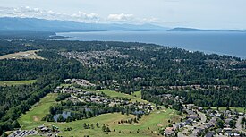
Clayoquot Sound is located on the west coast of Vancouver Island in the Canadian province of British Columbia. It is bordered by the Esowista Peninsula to the south, and the Hesquiaht Peninsula to the North. It is a body of water with many inlets and islands. Major inlets include Sydney Inlet, Shelter Inlet, Herbert Inlet, Bedwell Inlet, Lemmens Inlet, and Tofino Inlet. Major islands include Flores Island, Vargas Island, and Meares Island. The name is also used for the larger region of land around the waterbody.

Qualicum Beach is a town located on Vancouver Island, British Columbia, Canada. In the 2021 census, it had a population of 9,303. It is situated at the foot of Mount Arrowsmith, along the Strait of Georgia on Vancouver Island's northeastern coast.

The Regional District of Nanaimo is a regional district located on the eastern coast of Vancouver Island, British Columbia, Canada. It is bordered to the south by the Cowichan Valley Regional District, to the west by the Alberni-Clayoquot Regional District, and to the northwest by the Comox Valley Regional District. Its administration offices are located in Nanaimo. During the 2016 census, its population was established at 155,698.

Englishman River is a river in the eastern side of Vancouver Island, British Columbia, Canada. It starts on the eastern slopes of the Beaufort Range, originating from tiny Jewel Lake and flowing in an easterly direction for 40 km (25 mi), entering the Strait of Georgia at Parksville, British Columbia. It is an important watershed providing habitat for various species of salmon and community water to the residents of Parksville and surrounding area. The Englishman River watershed includes Arrowsmith Lake, Hidden Lake, Fishtail Lake, Rowbotham Lake, Healy Lake, Shelton Lake, and Rhododendron Lake.

Englishman River Falls Provincial Park is a provincial park in British Columbia, Canada. It is located west of Parksville and borders the small community of Errington on Vancouver Island.

Hesquiat Lake Provincial Park is a provincial park located on the west coast of Vancouver Island in British Columbia, Canada. It was established on April 5, 2001 to mature coastal forests of Western hemlock, western red cedar and lodgepole pine along the eastern shores of Hesquiat Lake.

Little Qualicum Falls Provincial Park is a provincial park in British Columbia, Canada, on central Vancouver Island, that encompasses the entire southern shore of Cameron Lake. The Island Rail Corridor line to Port Alberni passes through the park.

MacMillan Provincial Park is a 301-hectare (740-acre) provincial park in British Columbia, Canada. Located 25 km (16 mi) west of Qualicum Beach and 16 km (9.9 mi) east of Port Alberni, the park straddles Highway 4 and the Island Rail Corridor in central Vancouver Island. It is nestled on the western shore of Cameron Lake, and protects the delta of the Cameron River. The park is home to a famous, 157-hectare (390-acre) stand of ancient Douglas fir, known as Cathedral Grove, which draws visitors from all over the world. The park provides the only highway-accessible protected old-growth Douglas-fir forest in British Columbia. In 2007 Cathedral Grove made the short list on CBC's competition Seven Wonders of Canada.
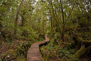
Maquinna Marine Provincial Park and Protected Area is a provincial park in British Columbia, Canada, located northwest of Tofino in the Clayoquot Sound region of the West Coast of Vancouver Island, protecting Ramsay Hot Springs, which is the name-source of the cove, settlement and former post office of Hot Springs Cove.
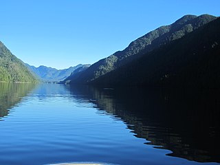
Sydney Inlet Provincial Park is a provincial park in the Clayoquot Sound region of the west coast of Vancouver Island, British Columbia, Canada, located north of the settlement of Hot Springs Cove and northwest of the resort town of Tofino. Sydney Inlet was the name of the post office in the area from its creation in 1947 to 1948, when it was renamed Hot Springs Cove, though that post office was subsequently closed in 1974.

Strathcona Provincial Park is the oldest provincial park in British Columbia, Canada, and the largest on Vancouver Island. Founded in 1911, the park was named for Donald Alexander Smith, 1st Baron Strathcona and Mount Royal, a wealthy philanthropist and railway pioneer. It lies within the Strathcona Regional District. The Clayoquot Sound Biosphere Reserve, established in 2000, includes three watersheds in the western area of the park.
Tranquil Creek Provincial Park is a provincial park in British Columbia, Canada, located at the head of the Kennedy River, east of the head of Bedwell Sound on Vancouver Island.
The Western Canada Wilderness Committee is a non-profit environmental education organization that aims to protect Canada's wild spaces and species. Paul George, along with Richard Krieger, were the founding directors, and formed the Wilderness Committee in the province of British Columbia in 1980. It now has a membership of over 30,000 people with its head office in Vancouver and field offices in Victoria, British Columbia; Winnipeg, Manitoba; and Toronto, Ontario.
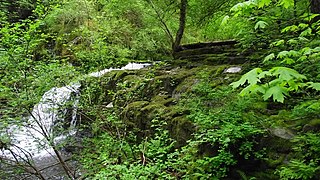
Errington is a small community on Vancouver Island, British Columbia, Canada, located on Errington Road, off Highway 4, just south of Parksville and Qualicum Beach.

Scott Kenneth Fraser is a Canadian politician who represented the Mid Island-Pacific Rim electoral district Legislative Assembly of British Columbia from 2005 to 2020. He is a member of the British Columbia New Democratic Party and was first elected as a Member of the Legislative Assembly in the 2005 election and re-elected in the 2009, 2013 and 2017 elections. During the 41st Parliament (2017-2020) he served in the Executive Council as the Minister of Indigenous Relations and Reconciliation. In that role he led the government through adopting the Declaration on the Rights of Indigenous Peoples Act, with all party support, to implement UNDRIP

Alberni Valley is a broad valley located at the head of Alberni Inlet on Vancouver Island in British Columbia, Canada. It is home to Port Alberni, Sproat Lake and other outlining areas. The term is largely used as a synonym for Greater Port Alberni and adjoining communities but is used in a larger regional sense as well. Various local organizations and companies use the term "Alberni Valley" in their name, e.g. the Alberni Valley Times and Alberni Valley News newspapers the Alberni Valley Chamber of Commerce and the Alberni Valley Bulldogs minor hockey team. The Canadian pioneer, Joe Drinkwater lived in Alberni Valley during the late nineteenth and early twentieth centuries.
Under UNESCO’s Man and the Biosphere Programme, there are 302 biosphere reserves recognized as part of the World Network of Biosphere Reserves in Europe and North America. These are distributed across 36 countries in the region.
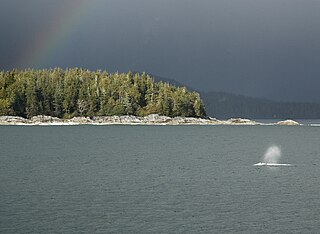
Clayoquot Sound Biosphere Reserve is a UNESCO Biosphere Reserve situated in Clayoquot Sound on the west coast of Vancouver Island in British Columbia, Canada. A diverse range of ecosystems exist within the biosphere reserve boundaries, including temperate coastal rainforest, ocean and rocky coastal shores.
