Related Research Articles

Adams Lake Provincial Park is a provincial park in British Columbia, Canada. It encompasses three distinct parks: Adams Lake Provincial Park, Adams Lake Marine Provincial Park, and Adams Lake Marine Provincial Park.
Liard River Hot Springs Provincial Park is a provincial park in British Columbia, Canada. It is home to the second largest natural hot springs in Canada, after Deer River Hot Springs 15 km to the north east. It is a natural river of hot water rather than a spring fed man made pool. The park is part of the larger Muskwa-Kechika Management Area. The community of Liard River, British Columbia is located nearby.
Arrow Lakes Provincial Park is a provincial park in British Columbia, Canada.
Babine Mountains Provincial Park is a provincial park in British Columbia, Canada, located to the east of the Bulkley River between the town of Smithers and Babine Lake. Established by Order-in-Council as the Babine Mountains Recreation Area in 1984, it was upgraded to park status and its name changed in 1999. It contains approximately 31,465 hectares.
Buckinghorse River Wayside Provincial Park is a provincial park in British Columbia, Canada located on the Alaska Highway, approximately 175 km northwest of the city of Fort St. John. It is located on the north side of the Buckinghorse River, to the northwest of the community of Pink Mountain. The park is 36 ha. in size and is near the community of Buckinghorse River.
Butler Ridge Provincial Park is a provincial park in British Columbia, Canada. Located on the northern shore of the Peach Reach arm of Williston Lake, 20 km northwest of Hudson's Hope, the park covers an area of 6,694 ha. Within the Peace Foothills ecosection, it includes three biogeoclimatic zones: the Engelmann Spruce-Subalpine Fir, the Sub-Boreal Spruce, and the Black and White Boreal Spruce zones. This cold and moist area is used as winter ranges by caribou, Stone's sheep, moose, and elk. It is recognized by the province and the Treaty 8 Tribal Association as an area that has traditionally been used by First Nations people. The park is used for fishing, hunting, trapping, hiking, and wildlife/nature viewing, cross-country skiing. There is a boat launch for Williston Lake, and motorized recreation.

Birkenhead Lake Provincial Park is a provincial park in British Columbia, Canada, located in the Lillooet Country region. The park lies north of the communities of Squamish, Whistler and Pemberton, and immediately northwest of Birkenhead Peak and Gates Lake at the community of Birken.
Ed Bird – Estella Lakes Provincial Park is a provincial park in British Columbia, Canada.
Junction Sheep Range Provincial Park is a provincial park in British Columbia, Canada, located near the confluence of the Chilcotin and Fraser Rivers on the west bank of the latter river.
Jackpine Remnant Provincial Park is a provincial park in British Columbia, Canada, in the area of the community of Fort Nelson. The park, which is 148 hectares in area, protects one of the few remaining jackpine stands in the Fort Nelson area. The park is near the crossing of BC Highway 77 over the Fort Nelson River, northwest of the town.
Kotcho Lake Village Provincial Park is a provincial park in north-eastern British Columbia, Canada.
Tłu Tue - Maxhamish Lake Provincial Park and Protected Area is a 27,516-hectare (67,990-acre) provincial park in British Columbia, Canada.
McDonald Creek Provincial Park is a provincial park in British Columbia, Canada which located 10 km south of Nakusp along Highway 6 in the Arrow Lakes region. The 468-hectare park is bisected by Upper Arrow Lake and provides beaches, a boat launch, and 73 camping spaces on the eastern shore of the reservoir. Formerly a homesteading site, the area was set aside for recreation in 1982. In 2014, the campground underwent an upgrade, including the installation of a new services including showers and additional camping spaces.
Monte Lake Provincial Park is a provincial park in British Columbia, Canada, located on the east side of Monte Lake and to the south of the community of Monte Lake, British Columbia which is at the north end of the lake. About five hectares in size, it protects an area of Ponderosa pine and grasslands.
Norbury Lake Provincial Park is a 97-hectare (240-acre) provincial park in British Columbia, Canada.
Prophet River Wayside Provincial Park is a provincial park in British Columbia, Canada. It is located along the Prophet River, by the Alaska Highway, between the localities of Trutch and Prophet River. Originally created as a Provincial Recreation Area in 1977 with an area of 707 acres (2.86 km2), it was designated a provincial park in 1999 with an area of 111 hectares.

The Spruce Lake Protected Area, formerly known variously as the Southern Chilcotin Mountains Provincial Park, Southern Chilcotins, and also as South Chilcotin Provincial Park, is a 71,347-hectare Protected Area in the British Columbia provincial parks system, approximately 200 km north of Vancouver. The area had been the subject of an ongoing preservationist controversy since the 1930s. In 2007, its status as a provincial park was downgraded to protected area.
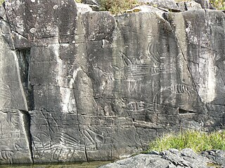
Sproat Lake Provincial Park is a provincial park near Port Alberni in British Columbia, Canada's Vancouver Island. Its name derives from a lake named after 19th century entrepreneur and colonial official Gilbert Malcolm Sproat.

Sugarbowl-Grizzly Den Provincial Park and Protected Area is a provincial park in British Columbia, Canada.

Cascade Falls Regional Park is a regional park under the administration of the Fraser Valley Regional District in the Hatzic Valley of the Lower Mainland region of British Columbia, Canada. The park was originally 9.5 hectares in area but was expanded to a current 22 hectares. It has picnic tables and pit toilets, with various hiking trails and a walkway leading to a viewing platform over a large waterfall, which is 15 minutes walk from the park's parking lot.