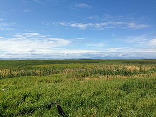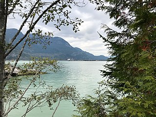
Loch Fleet is a sea loch on the east coast of Scotland, located between Golspie and Dornoch. It forms the estuary of the River Fleet, a small spate river that rises in the hills east of Lairg. The loch was designated a National Nature Reserve (NNR) in 1998, and is managed by a partnership between NatureScot, the Scottish Wildlife Trust (SWT) and Sutherland Estates. The NNR extends to 1058 hectares, including the Loch Fleet tidal basin, sand dunes, shingle ridges and the adjacent pine woods, including Balbair Wood and Ferry Wood. The tidal basin of the loch covers over 630 ha, and forms the largest habitat on the NNR.

The Peace–Athabasca Delta, located in northeast Alberta, is the largest freshwater inland river delta in North America. It is located partially within the southeast corner of Wood Buffalo National Park, Canada's largest national park, and also spreads into the Regional Municipality of Wood Buffalo, west and south of the historical community of Fort Chipewyan. The delta encompasses approximately 321,200 ha, formed where the Peace and Athabasca rivers converge on the Slave River and Lake Athabasca. The delta region is designated a wetland of international importance and a UNESCO World Heritage Site. The region is large enough that it is considered one of twenty distinct natural subregions of Alberta by the provincial government's Natural Regions Committee.

Boundary Bay is a shallow bay situated on the Pacific coast of North America on the Canada–United States border between the Canadian province of British Columbia and the U.S. state of Washington.

Burns Bog is an ombrotrophic peat bog located in Delta, British Columbia, Canada. It is the largest raised peat bog and the largest undeveloped urban land mass on the West Coast of the Americas. Burns Bog was originally 4,000–4,900 hectares before development. Currently, only 3,500 hectares remain of the bog.

Pinecone Burke Provincial Park is a provincial park in British Columbia, Canada. It extends from the southwest corner of Garibaldi Provincial Park, west of Pitt Lake and Pitt River to include Burke Mountain in the City of Coquitlam. Most of the park is unserviced wilderness with very rough trails such as the Fools Gold Trail in the Boise Valley. There is canoe access to Widgeon Slough and from there hiking trails that lead to Widgeon Lake, and a network of old logging roads, hiking and mountain biking trails on Burke Mountain. Visitors can also use the park for camping, backcountry skiing, and snowshoeing.
Spatsizi Plateau Wilderness Provincial Park is located in the northern portion of British Columbia, Canada, approximately 698, 659 hectares and encompasses the Spatsizi River and Gladys Lake Ecological Reserve. The park is a designated protected area that is intended for the conservation and research on caribou, grizzly bears, fish, and other wildlife species populations. Before the provincial park's establishment in 1975, the area was a historical hunting ground for local Indigenous communities like the Tahltan First Nations. It is the second largest provincial park in British Columbia.
Tweedsmuir South Provincial Park is a provincial park covering parts of the eastern Kitimat Ranges, northern Pacific Ranges, and the Rainbow Range in British Columbia, Canada. It was established on May 21, 1938 in the western interior of the province, to protect its important natural features. The park hosts a variety of recreation activities for visitors. This park encompasses a range of diverse species in this park including bears, moose, and various fish. There are also a few at risk species in this park.

The Alaksen National Wildlife Area is located on Westham Island in the city of Delta, British Columbia. It is an important stopover point for many species of birds migrating along the Pacific Flyway.

The Churn Creek Protected Area is a 36,747-hectare (90,800-acre) provincial protected area in British Columbia, Canada. It is a mix of dryland canyon and steppe and adjoining rangeland flanking the canyon of Churn Creek and that stream's confluence with the Fraser River at the northern apex of the Camelsfoot Range. The historic Gang Ranch is just north of the Churn Creek Protected Area. The Empire Valley Ranch ecological preserve was added to the Protected Area in an expansion.
Matsalu National Park is a nature reserve and national park situated in the Lääne and Pärnu counties of Estonia. Matsalu National Park spans an area of 486.1 km2 (187.7 sq mi), comprising Matsalu Bay, the Kasari River delta, the village of Matsalu and surrounding areas.

The Creston Valley Wildlife Management Area is a Canadian river delta wetland and Wildlife Management Area near Creston in south-central British Columbia, on the floodplain of the Kootenay River at the south end of Kootenay Lake. Predominantly marshland, it was classified as a wetland of international importance on February 21, 1994, and is also a globally significant Important Bird Area. It is one of the "few significant agricultural areas of the province", and is in the Montane Cordillera. It stretches north along Kootenay Lake for approximately 20 km, and south to the United States border. It is both the only breeding site of the Forster's tern and the only site with leopard frogs in the province, as well as one of the few Canadian habitats for the Coeur D'Alene salamander. Creston Valley provides staging and nesting areas for migratory birds on the Pacific Flyway.
Vaseux-Bighorn National Wildlife Area is a National Wildlife Area in British Columbia, Canada, primarily set aside to protect winter rangeland for California bighorn sheep. In 1979, the Vaseux-Bighorn Wildlife Area was established in response to substantial reduction in wild animal populations in the area. Identified factors contributing to species decline at the time were high predator population, overharvesting of species, and illegal hunting. Land development, cattle raising, and lumbering also might have altered species populations. Under these conditions, the area was able to be classified as a Category IV area by the IUCN and is now used for wildlife habitat and conservation. Even with minimal anthropogenic use of the area, threats persist through invasive species. Recreational use is limited spatially and is only open to the public during the day.

The Qualicum National Wildlife Area (NWA) was officially established in 1977, under the Canada Wildlife Act (1973). The primary objective of the Qualicum NWA was to conserve crucial habitats for migratory birds and various other species.
Widgeon Valley National Wildlife Area is a National Wildlife Area located near the south end of Pitt Lake in British Columbia, Canada. The property was purchased by the Nature Trust of British Columbia in 1973 and declared a National Wildlife Area by the Canadian Wildlife Service in October of that year. The Widgeon Valley National Wildlife Area is a biologically diverse marsh wetland. It is the traditional territory of various First Nations groups. The Widgeon Valley Wildlife Area is a protected wildlife area that is home to a number of sensitive waterfowl and fish species. The public uses the channels through the Widgeon Valley National Wildlife Area for recreational canoeing, anywhere else within the protected area is strictly off-limits to the public. There are future plans to develop interpretive trails through the park and open it to the public.

Cranberry Marsh/Starratt Wildlife Management Area is a wildlife management area located just south of Valemount, British Columbia. It was established by the British Columbia Ministry of Forests, Lands, Natural Resource Operations and Rural Development (FLNRORD) on 28 March 2013 to protect Cranberry Marsh, a freshwater marsh that serves as an important breeding ground and stopover for a variety of migratory birds.
Todagin Wildlife Management Area is a wildlife management area located southeast of Iskut in northwestern British Columbia. It was established by the British Columbia Ministry of Forests, Lands, Natural Resource Operations and Rural Development (FLNRORD) on 19 March 2001 to conserve and manage critical habitat for stone sheep. It is the largest wildlife management area in British Columbia at 122,787 ha.

White Lake Grasslands Protected Area is a conservation site located in the Regional District of Okanagan-Similkameen of British Columbia, Canada. It was established on April 18, 2001 by an order-in-council under the Environment and Land Use Act to protect the semi-arid grassland and pine forest ecosystem west of Vaseux Lake.

The Skwelwil'em Squamish Estuary Wildlife Management Area is a wildlife management area on the south coast of British Columbia. It was established in 2007 for the management of fish species as well as terrestrial wildlife. The wildlife management area is on the traditional territory of Squamish Nation, which is involved in management of the area. The freshwater of the Squamish River mixes with the saltwater of Howe Sound, resulting in a varied ecosystem containing different habitats that support an abundance of wildlife. It also provides natural flood control for the Squamish town sites.

The Serpentine Wildlife Management Area is a small wildlife management area located on the south coast of British Columbia in Surrey. It contains many kilometers of walking trail and viewing towers to enjoy the nature and observe the many species found in the area. Although the boundaries have changed over the years, the Government of British Columbia still manages the land to ensure it meets the currents goals that were set in place to protect the local and endangered species that inhabit the area as well as monitoring the effects of climate change. This is done in partnership with Ducks Unlimited Canada, although the land falls within the territories of the Semiahmoo and Tsawwassen First Nation.


