
Bridal Veil Falls Provincial Park is a BC Park situated on the Trans-Canada Highway just east of Rosedale, British Columbia, Canada, within of the City of Chilliwack. The community of Bridal Falls is located adjacent to the falls and park, as well as the interchange between the Trans-Canada and BC Highway 9, offering a variety of highway-based tourism services. Access to the falls requires a short hike from the parking lot and well-groomed trails, taking most groups 15-25 minutes.
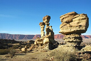
A provincial park is a park administered by one of the provinces of a country, as opposed to a national park. They are similar to state parks in other countries. They are typically open to the public for recreation. Their environment may be more or less strictly protected.

Brandywine Falls Provincial Park is a provincial park in British Columbia, Canada, located adjacent to BC Highway 99 between Garibaldi and Whistler, British Columbia. It is managed by Sea to Sky Parks for BC Parks.
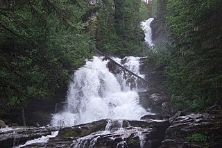
Bijoux Falls Provincial Park is a provincial park in British Columbia, Canada. The park is located north of the city of Prince George on BC Highway 97 on the southern approach to the summit of the Pine Pass through the Rocky Mountains. The park was established in 1956 primarily to serve as a rest stop and to provide information about the park system in BC to travellers. The park is named for Bijoux Falls, a 40-metre-high (130 ft) cascading waterfall that is the central feature of the park.
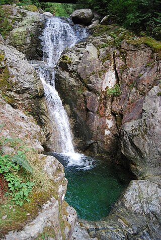
Davis Lake Provincial Park is a 185 acres (0.75 km2) park in British Columbia, Canada, established as a protected provincial park in October 1963. It is located east of the southern end of Stave Lake, northeast of Mission, British Columbia, approximately 18 km north on Sylvester Rd from BC Highway 7. There are campgrounds and beaches at the south end of the lake, access is walk-in only via a 1 km unmaintained gravel road.

Englishman River Falls Provincial Park is a provincial park in British Columbia, Canada. It is located west of Parksville and borders the small community of Errington on Vancouver Island.
Hole-in-the-Wall Provincial Park is a provincial park located in the Hart Ranges of British Columbia, Canada. It was established on June 29, 2000 to protect a resurgent spring which emerges from the base of a limestone rock wall. The spring forms a powerful stream that flows into the Sukunka River at the northern end of the park.
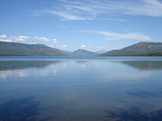
Kinaskan Lake Provincial Park is a provincial park in British Columbia, Canada, located at the south end of Kinaskan Lake along the Stewart-Cassiar Highway near Mowdade Lake and southeast of Mount Edziza. At the south end of the park, the Iskut River, of which the lake is an expansion, spills over 12.2-metre Cascade Falls. The park is approximately 800 ha. in size.

Little Qualicum Falls Provincial Park is a provincial park in British Columbia, Canada, on central Vancouver Island, that encompasses the entire southern shore of Cameron Lake. The Island Rail Corridor line to Port Alberni passes through the park.

Nairn Falls Provincial Park is a provincial park in British Columbia, Canada located on the Green River adjacent to British Columbia Highway 99 and the Canadian National Railway line just south of Pemberton and less than twenty minutes north of the resort town of Whistler. The 170 hectare park was established in 1966, shortly after the highway's opening, to protect and enhance visitor access to Nairn Falls.
Okanagan Falls Provincial Park, now officially named sx̌ʷəx̌ʷnitkʷ Provincial Park, is a provincial park in British Columbia, Canada, located within the traditional territory of the Osoyoos Indian Band. Since time immemorial, the Osoyoos Indian Band's Okanagan ancestors have inhabited and cared for the lands and waters in their traditional territory. The park is also located within the town of Okanagan Falls, protecting the area around the waterfall of the same name, which lies below the outlet of Skaha Lake in the course of the Okanagan River.

Rearguard Falls Provincial Park is a provincial park in British Columbia, Canada, protecting Rearguard Falls on the Fraser River. It is located just above its emergence into the Rocky Mountain Trench near the community of Tete Jaune Cache. The park is easily accessed via BC Highway 16. Rearguard Falls is one of only two waterfalls on the 1,375 km (854 mi)-long Fraser River; the other is a few kilometres upstream at Overlander Falls. Rearguard Falls offers a view of the return of Chinook salmon for spawning.

Rolley Lake Provincial Park is a provincial park in British Columbia, Canada. It is located on Rolley Lake in the Stave Falls area of Mission, British Columbia. The area was inhabited by the Sto:lo people, homesteaded in 1888 by James and Fanny Rolley, and later used for logging operations. The park now provides campsites, use of the lake, and hiking, with an area of 115 hectares.

Shannon Falls Provincial Park is a provincial park in British Columbia, Canada. It is located 58 kilometers (36 mi) from Vancouver and 2 kilometers (1.2 mi) south of Squamish along the Sea to Sky Highway.
Smith River Falls – Fort Halkett Provincial Park is a provincial park in British Columbia, Canada, protecting Smith River Falls and the former Fort Halkett, a Hudson's Bay Company trading post. The park is located at the confluence of the Smith and Liard Rivers.

Strathcona-Westmin Provincial Park is a Class B provincial park located at the southern extremity of Buttle Lake on Vancouver Island in British Columbia, Canada. The park was separated out from Strathcona Provincial Park by BC Parks in 1987 so that mining operations could proceed within park boundaries. Strathcona-Westmin is expected to be reabsorbed into Strathcona Provincial Park once mining operations cease.

BC Parks is an agency of the British Columbia Ministry of Environment and Climate Change Strategy that manages all of the, as of 2020, 1,035 provincial parks and other conservation and historical properties of various title designations within the province's Parks oversaw of the British Columbia Parks and Protected Areas System. The Lieutenant Governor-in-Council created the agency on March 1, 1911, through the Strathcona Park Act. The agency is charged with a dual role of preserving the ecological and historical integrity of the places entrusted to its management, while also making them available and accessible for public use and enjoyment.
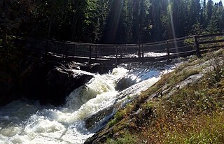
Wekusko Falls Provincial Park is a provincial park straddling the Grass River and Wekusko Lake, located in central Manitoba on Manitoba Provincial Road 392 near Snow Lake, Manitoba.

Uisge Ban Falls Provincial Park is a provincial park near New Glen, in the Canadian province of Nova Scotia on Cape Breton Island. Located on the North Branch Road 14.5 kilometres (9.0 mi) north of Baddeck, the civic address of the park entrance is 715 North Branch Road, Baddeck Forks, Nova Scotia, Canada B0E 1B0.
Misinchinka Ranges, is the largest subdivision range of the Hart Ranges, of the Northern Rockies in British Columbia, Canada. The boundaries of the Misinchinka Ranges generally lie between the Rocky Mountain Trench to the west, Clearwater Creek and the Sukunka River to the east, the Peace Arm of Williston Reservoir to the north and Monkman Provincial Park to the south.


