
Adams Lake Provincial Park is a provincial park in British Columbia, Canada. It encompasses three distinct parks: Adams Lake Provincial Park, Adams Lake Marine Provincial Park, and Adams Lake Marine Provincial Park.
Arrow Lakes Provincial Park is a provincial park in British Columbia, Canada.
Buckinghorse River Wayside Provincial Park is a provincial park in British Columbia, Canada located on the Alaska Highway, approximately 175 km northwest of the city of Fort St. John. It is located on the north side of the Buckinghorse River, to the northwest of the community of Pink Mountain. The park is 36 ha. in size and is near the community of Buckinghorse River.

Cathedral Provincial Park and Protected Area, usually known as Cathedral Provincial Park and also as Cathedral Park, is a provincial park in British Columbia, Canada. It is located east of E.C. Manning Provincial Park, south of BC Highway 3, and southeast of the town of Princeton, and southwest of Keremeos. Its southern boundary is the border with the United States. Much of the park is the basin of the Ashnola River. Cathedral Park is home to teal sub-alpine lakes, vast ridges and jarred peaks, old-growth forests, and rock formations of siltstone, granodiorite, and basalt. Hikers can scramble along various peaks such as the 8000-foot Grimface Mountain and Lakeview Mountain. Tourists flock to Smokey the Bear and Stone City because of their unique formations with incredible views formed by millennia of erosion, volcanic and tectonic activity, and glacial recession.
Chu Chua Cottonwood Provincial Park is a provincial park in British Columbia, Canada, located 80km north of Kamloops and incorporating a group of forested islands in the floodplain of the North Thompson River.
Dala-Kildala Rivers Estuaries Provincial Park is a provincial park of 452 ha. in British Columbia, Canada. It protects the mouth of the Dala River in Kildala Arm.
Junction Sheep Range Provincial Park is a provincial park in British Columbia, Canada, located near the confluence of the Chilcotin and Fraser Rivers on the west bank of the latter river.
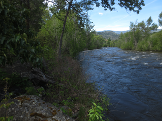
Inkaneep Provincial Park is a provincial park near Oliver, British Columbia, Canada, located just south of the town of Okanagan Falls. The park contributes to the protection of critical riparian values on the Okanagan River. The park is popular with naturalists, particularly bird-watchers. First Nations have identified the river and riparian area of the park as very important contributor to the long-term viability of the Okanagan River salmon run.
Kluskoil Lake Provincial Park is a provincial park in British Columbia, Canada, located on the West Road River downstream from the Euchiniko Lakes.
Morrissey Provincial Park is a provincial park near the southeastern corner of British Columbia, Canada. The park is primitive, with no designated picnic or day-use areas, and no available parking. The park protects a remnant Black Cottonwood ecosystem.

Nairn Falls Provincial Park is a provincial park in British Columbia, Canada located on the Green River adjacent to British Columbia Highway 99 and the Canadian National Railway line just south of Pemberton and less than twenty minutes north of the resort town of Whistler. The 170 hectare park was established in 1966, shortly after the highway's opening, to protect and enhance visitor access to Nairn Falls.

Owyacumish River Provincial Park is a provincial park in British Columbia, Canada.
West Lake Provincial Park is a provincial park in British Columbia, Canada.
Prophet River Wayside Provincial Park is a provincial park in British Columbia, Canada. It is located along the Prophet River, by the Alaska Highway, between the localities of Trutch and Prophet River. Originally created as a Provincial Recreation Area in 1977 with an area of 707 acres (2.86 km2), it was designated a provincial park in 1999 with an area of 111 hectares.
Three Sisters Lake Provincial Park is a provincial park in British Columbia, Canada, located 35 km southeast of Prince George and northeast of the community of Hixon. In addition the three lakes which are the parks namesake the park protects a unique canyon feature on Government Creek.

The Nechacco sternwheeler was built for service on the Soda Creek to Fort George route on the upper Fraser River in British Columbia. She was owned by the Fort George Lumber and Navigation Company. The partners in this company were Nick Clark and Russel Peden of South Fort George, who operated a sawmill there. Nick Clark also owned the lots in that townsite and was offering them up for sale. The new steamer was intended to bring prospective property buyers to Fort George and to furnish them with supplies.
The Cottonwood River is a tributary of the Dease River in the Cassiar Country of the Northern Interior of British Columbia, Canada. Rising in the northern Stikine Ranges just east of Toozaza Peak, and just south of the origins of the Jennings and Little Rancheria River near the border with Yukon, it flows south along the east flank of the Tuya Range to meet the Dease just north of that river's source at Dease Lake, between the north end of that lake and McDame Creek and the former mining centre and community of McDame Post.
Cottonwood River is a tributary of the Fraser River in the Central Interior of British Columbia, Canada. Rising at the confluence of the Swift River and Lightning Creek at Coldspring House in the Cariboo goldfields of the northern Cariboo Plateau, it flows northwest and then turns southwest to join the Fraser just north of the city of Quesnel, which is at the confluence of the Quesnel River with the Fraser.
Cottonwood Canyon is a canyon along the Fraser River in the North Cariboo region of the Central Interior of British Columbia, Canada. It is located west of the Cariboo Mountains on the Fraser River south of its confluence with the east-flowing West Road River and north of its confluence with the northwest-flowing Cottonwood River just northwest of the city of Quesnel, The first European explorer was Simon Fraser (explorer) who ran the rapids on the first of June, 1808. One of his canoes became stranded and had to be pulled out of the canyon with a rope. It was one of the obstacles for gold rush-era steamboats operating on the Fraser from Quesnel to Fort George and up the Nechako and Stuart Rivers to Stuart Lake.
Mary Creek is a creek in the Cariboo region of British Columbia. The creek is located in Cottonwood Country which is between Quesnel and Barkerville. Mary Creek is small tributary of John Boyd Creek which flows into the Cottonwood River. Terry Toop discovered gold on Mary Creek in the fall of 1972. The nuggets found were $150 in value, and $2,200 in gold could be found in a single yard of gravel. Bullion in 15 and 20 pound lots was shipped to a refinery in Richmond. Photographs of the nuggets were published in newspapers along the coast. Other miners moved in and staked claims around the area, but the gold was depleted in 1975.

