List of provincial parks of Vancouver Island

Last updated

The list of provincial parks of Vancouver Island contains the provincial parks located on the island, which is part of the province of British Columbia. It includes parks from the seven regional districts of Alberni-Clayoquot, Capital, Comox Valley, Cowichan Valley, Nanaimo, and the island portions of Mount Waddington and Strathcona. These parks are administered by BC Parks under the jurisdiction of the Ministry of Environment and Climate Change Strategy.

Contents

Parks

Alberni-Clayoquot Regional District

NameEstablishedCommons categoryPictureCoordinates
Clayoquot Arm Provincial Park 49°10′40″N125°34′01″W / 49.1778°N 125.567°W / 49.1778; -125.567
Clayoquot Plateau Provincial Park 49°13′30″N125°25′52″W / 49.225°N 125.431°W / 49.225; -125.431
Dawley Passage Provincial Park 49°08′50″N125°47′10″W / 49.14722222°N 125.78611111°W / 49.14722222; -125.78611111
Epper Passage Provincial Park 49°13′10″N125°57′00″W / 49.21944444°N 125.95°W / 49.21944444; -125.95
Flores Island Marine Provincial Park 1995
Dusk, Flores Island.jpg
49°17′15″N126°11′31″W / 49.2875°N 126.192°W / 49.2875; -126.192
Fossli Provincial Park 49°15′N124°57′W / 49.25°N 124.95°W / 49.25; -124.95
Gibson Marine Provincial Park 49°16′00″N126°04′01″W / 49.2667°N 126.067°W / 49.2667; -126.067
Hesquiat Lake Provincial Park 49°30′07″N126°23′17″W / 49.502°N 126.388°W / 49.502; -126.388
Hesquiat Peninsula Provincial Park 49°26′30″N126°31′01″W / 49.4417°N 126.517°W / 49.4417; -126.517
Kennedy Lake Provincial Park 49°03′00″N125°35′49″W / 49.05°N 125.5969°W / 49.05; -125.5969
Kennedy River Bog Provincial Park 49°05′50″N125°37′01″W / 49.0972°N 125.617°W / 49.0972; -125.617
Maquinna Marine Provincial Park 1955 Maquinna Marine Provincial Park
Maquinna Marine Provincial Park (14890654338).jpg
49°24′00″N126°20′31″W / 49.4°N 126.342°W / 49.4; -126.342
Sproat Lake Provincial Park 1966-06-06 Sproat Lake Provincial Park
Petroglyphs at Sproat Lake Provincial Park.JPG
49°17′46″N124°55′37″W / 49.2961°N 124.927°W / 49.2961; -124.927
Stamp River Provincial Park 1940-12-20 Stamp River Provincial Park
Gorge of Stamp Falls in Stamp River Provincial Park in December.JPG
49°20′30″N124°55′30″W / 49.341666666667°N 124.925°W / 49.341666666667; -124.925
Sulphur Passage Provincial Park 49°25′00″N126°10′59″W / 49.4167°N 126.183°W / 49.4167; -126.183
Sydney Inlet Provincial Park 49°28′50″N126°16′44″W / 49.4806°N 126.279°W / 49.4806; -126.279
Taylor Arm Provincial Park 49°17′00″N125°03′00″W / 49.2833°N 125.05°W / 49.2833; -125.05
Tranquil Creek Provincial Park 49°19′00″N125°37′08″W / 49.3167°N 125.619°W / 49.3167; -125.619
Vargas Island Provincial Park
Clayoquot Sound - Vargas Island.jpg
49°10′45″N126°01′41″W / 49.1792°N 126.028°W / 49.1792; -126.028

Capital Regional District

NameEstablishedCommons categoryPictureCoordinates
Beaver Point Provincial Park 1949 48°46′17″N123°24′13″W / 48.771388888889°N 123.40361111111°W / 48.771388888889; -123.40361111111
Bellhouse Provincial Park 1964-08-21 48°52′20″N123°18′36″W / 48.8722°N 123.31°W / 48.8722; -123.31
Bodega Ridge Provincial Park 2001-04-11 48°57′30″N123°31′30″W / 48.9583°N 123.525°W / 48.9583; -123.525
Burgoyne Bay Provincial Park 2004 48°48′00″N123°31′59″W / 48.8°N 123.533°W / 48.8; -123.533
Collinson Point Provincial Park 2004
Shoreline, Collinson Point.jpg
48°51′42″N123°21′42″W / 48.86166667°N 123.36166667°W / 48.86166667; -123.36166667
Dionisio Point Provincial Park 1991-07-31 Dionisio Point Provincial Park
Dionisio Point Provincial Park, Dionisio Point and sand spit from mainland.JPG
49°00′46″N123°34′22″W / 49.01277778°N 123.57277778°W / 49.01277778; -123.57277778
Discovery Island Marine Provincial Park 1972
Discovery Island Marine Park 2708805631 65cd3ea315 o.jpg
48°25′00″N123°14′00″W / 48.416666666667°N 123.23333333333°W / 48.416666666667; -123.23333333333
French Beach Provincial Park 1974-01-24
French Beach.jpg
48°23′39″N123°56′35″W / 48.3941°N 123.943°W / 48.3941; -123.943
Goldstream Provincial Park 1958
Niagara Creek Falls.jpg
48°28′00″N123°33′00″W / 48.4667°N 123.55°W / 48.4667; -123.55
Gowlland Tod Provincial Park 1993
Saanich Inlet (6930977012).jpg
48°32′46″N123°30′36″W / 48.546°N 123.51°W / 48.546; -123.51
John Dean Provincial Park 1921 48°36′44″N123°26′53″W / 48.61222222°N 123.44805556°W / 48.61222222; -123.44805556
Juan de Fuca Provincial Park 1996
Juan de Fuca Trail Suspension Bridge.jpg
48°29′00″N124°16′59″W / 48.4833°N 124.283°W / 48.4833; -124.283
Montague Harbour Marine Provincial Park Montague Harbour Marine Provincial Park
Montague Harbour Marine Provincial Marine Park, tidal lagoon with view of Mt. Sutil.jpg
48°54′N123°24′W / 48.9°N 123.4°W / 48.9; -123.4
Mount Maxwell Provincial Park 48°48′15″N123°30′57″W / 48.804166666667°N 123.51583333333°W / 48.804166666667; -123.51583333333
Ruckle Provincial Park
Canada Geese and goslings, Ruckles Park.jpg
48°46′00″N123°22′59″W / 48.7667°N 123.383°W / 48.7667; -123.383
Sooke Mountain Provincial Park 48°26′22″N123°39′31″W / 48.439444444444°N 123.65861111111°W / 48.439444444444; -123.65861111111
Sooke Potholes Provincial Park 1972 Sooke Potholes Provincial Park 48°25′41″N123°42′43″W / 48.428°N 123.712°W / 48.428; -123.712
Wallace Island Marine Provincial Park 1990-11-09 48°56′34″N123°33′04″W / 48.9428°N 123.551°W / 48.9428; -123.551

Comox Valley Regional District

NameEstablishedPictureCoordinates
Denman Island Provincial Park 2013-03-14 49°33′55″N124°48′40″W / 49.565277777778°N 124.81111111111°W / 49.565277777778; -124.81111111111
Fillongley Provincial Park 49°32′38″N124°45′43″W / 49.5439°N 124.762°W / 49.5439; -124.762
Helliwell Provincial Park 1966
The Cliffs at Helliwell.JPG
49°31′00″N124°36′20″W / 49.51666667°N 124.60555556°W / 49.51666667; -124.60555556
Kin Beach Provincial Park 49°44′00″N124°54′00″W / 49.7333°N 124.9°W / 49.7333; -124.9
Kitty Coleman Provincial Park 1944-11-14
Kitty Coleman Beach Provincial Park (6942517582).jpg
49°47′20″N124°59′46″W / 49.7889°N 124.996°W / 49.7889; -124.996
Miracle Beach Provincial Park 1950 49°51′N125°06′W / 49.85°N 125.1°W / 49.85; -125.1
Mount Geoffrey Escarpment Provincial Park 2004 49°30′25″N124°41′02″W / 49.5069°N 124.684°W / 49.5069; -124.684
Tribune Bay Provincial Park 1978-11-02
Tribune Bay, Hornby Is.JPG
49°31′46″N124°38′31″W / 49.5294°N 124.642°W / 49.5294; -124.642

Cowichan Valley Regional District

NameEstablishedCommons categoryPictureCoordinates
Bamberton Provincial Park 1960 48°36′30″N123°31′30″W / 48.6083°N 123.525°W / 48.6083; -123.525
Carmanah Walbran Provincial Park 1991-03-13 Carmanah Walbran Provincial Park
Carmanah walbran park.jpg
48°39′N124°39′W / 48.65°N 124.65°W / 48.65; -124.65
Chemainus River Provincial Park 48°50′28″N123°49′34″W / 48.841°N 123.826°W / 48.841; -123.826
Cowichan River Provincial Park 1995-07-13 48°46′20″N123°53′45″W / 48.772222222222°N 123.89583333333°W / 48.772222222222; -123.89583333333
Eves Provincial Park 1962-02-15 48°51′41″N123°41′54″W / 48.861388888889°N 123.69833333333°W / 48.861388888889; -123.69833333333
Gordon Bay Provincial Park 1969-09-18 48°50′10″N124°11′49″W / 48.836°N 124.197°W / 48.836; -124.197
Hitchie Creek Provincial Park 48°47′45″N124°44′17″W / 48.7958°N 124.738°W / 48.7958; -124.738
Koksilah River Provincial Park 1954-09-10 48°39′02″N123°43′25″W / 48.650555555556°N 123.72361111111°W / 48.650555555556; -123.72361111111
Memory Island Provincial Park 1945-08-23 48°36′50″N123°37′59″W / 48.6139°N 123.633°W / 48.6139; -123.633
Nitinat River Provincial Park 1996-04-30 48°53′59″N124°33′45″W / 48.899722222222°N 124.5625°W / 48.899722222222; -124.5625
Spectacle Lake Provincial Park 48°35′00″N123°34′01″W / 48.5833°N 123.567°W / 48.5833; -123.567
Wakes Cove Provincial Park
Wakes Cove Provincial Park.jpg
49°07′25″N123°42′07″W / 49.1236°N 123.702°W / 49.1236; -123.702
West Shawnigan Lake Provincial Park 1979 48°38′27″N123°39′04″W / 48.6408°N 123.651°W / 48.6408; -123.651
Whaleboat Island Marine Provincial Park 49°04′00″N123°42′00″W / 49.0667°N 123.7°W / 49.0667; -123.7

Regional District of Nanaimo

NameEstablishedCommons categoryPictureCoordinates
Arbutus Grove Provincial Park 1966-07-21 49°15′N124°09′W / 49.25°N 124.15°W / 49.25; -124.15
Boyle Point Provincial Park 1989-08-10 49°28′50″N124°42′00″W / 49.480555555556°N 124.7°W / 49.480555555556; -124.7
Drumbeg Provincial Park Drumbeg Provincial Park
Drumbeg provincial park, August 2005.jpg
49°08′02″N123°41′49″W / 49.134°N 123.697°W / 49.134; -123.697
Englishman River Falls Provincial Park 1940 Englishman River
Englishmen-river-falls2.jpg
49°14′51″N124°21′07″W / 49.2475°N 124.352°W / 49.2475; -124.352
Gabriola Sands Provincial Park 49°11′39″N123°51′32″W / 49.1942°N 123.859°W / 49.1942; -123.859
Hemer Provincial Park 1981 49°06′00″N123°49′59″W / 49.1°N 123.833°W / 49.1; -123.833
Horne Lake Caves Provincial Park 1989 Horne Lake Caves Provincial Park 49°20′40″N124°45′29″W / 49.3444°N 124.758°W / 49.3444; -124.758
Little Qualicum Falls Provincial Park 1940
Little Qualicum Falls2.jpg
49°17′07″N124°35′56″W / 49.2853°N 124.599°W / 49.2853; -124.599
MacMillan Provincial Park 1947 MacMillan Provincial Park
Cathedral Grove 2006.jpg
49°17′24″N124°39′40″W / 49.29°N 124.661°W / 49.29; -124.661
Morden Colliery Historic Provincial Park 1972 Morden Colliery Historic Provincial Park 49°06′00″N123°52′01″W / 49.1°N 123.867°W / 49.1; -123.867 Petroglyph Provincial Park 1948-08-24 49°08′28″N123°55′37″W / 49.141111°N 123.926944°W / 49.141111; -123.926944
Pirates Cove Marine Provincial Park
Pirates cove.jpg
49°05′47″N123°43′33″W / 49.096388888889°N 123.72583333333°W / 49.096388888889; -123.72583333333
Rathtrevor Beach Provincial Park Rathtrevor Beach Provincial Park
Rathtrevor Beach Provincial Park (5108813946).jpg
49°19′23″N124°16′12″W / 49.323°N 124.27°W / 49.323; -124.27
Roberts Memorial Provincial Park 1980-05-22 Roberts Memorial Provincial Park 49°04′00″N123°46′00″W / 49.06666667°N 123.76666667°W / 49.06666667; -123.76666667
Rosewall Creek Provincial Park Rosewall Creek Provincial Park 49°27′15″N124°46′30″W / 49.4542°N 124.775°W / 49.4542; -124.775
Sandwell Provincial Park 1988 49°11′06″N123°49′01″W / 49.185°N 123.81694444444°W / 49.185; -123.81694444444
Saysutshun (Newcastle Island Marine) Provincial Park 1961
Nanaimo aerial 2.jpg
49°11′26″N123°56′05″W / 49.1905°N 123.9347°W / 49.1905; -123.9347
Spider Lake Provincial Park 1981 49°20′35″N124°37′55″W / 49.343°N 124.632°W / 49.343; -124.632

Regional District of Mount Waddington

NameEstablishedCommons categoryPictureCoordinates
Broughton Archipelago Marine Provincial Park 1992 50°41′00″N126°40′59″W / 50.6833°N 126.683°W / 50.6833; -126.683
Cape Scott Provincial Park 1973-05-18 Cape Scott Provincial Park
Staircase North Coast Trail.JPG
50°44′00″N128°19′59″W / 50.7333°N 128.333°W / 50.7333; -128.333
Echo Bay Marine Provincial Park 1971
Echo Bay PP.jpg
50°45′03″N126°29′41″W / 50.75083333°N 126.49472222°W / 50.75083333; -126.49472222
Lanz and Cox Islands Provincial Park 50°48′30″N128°40′01″W / 50.8083°N 128.667°W / 50.8083; -128.667
Lower Nimpkish Provincial Park 50°32′15″N127°00′40″W / 50.5375°N 127.01111111111°W / 50.5375; -127.01111111111
Lower Tsitika River Provincial Park 50°27′30″N126°35′20″W / 50.458333333333°N 126.58888888889°W / 50.458333333333; -126.58888888889
Marble River Provincial Park 50°32′30″N127°31′35″W / 50.541666666667°N 127.52638888889°W / 50.541666666667; -127.52638888889
Nimpkish Lake Provincial Park 50°20′20″N127°00′00″W / 50.3389°N 127°W / 50.3389; -127
Quatsino Provincial Park 50°29′30″N127°49′00″W / 50.49166667°N 127.81666667°W / 50.49166667; -127.81666667
Raft Cove Provincial Park 1990 50°35′00″N128°13′59″W / 50.5833°N 128.233°W / 50.5833; -128.233
Schoen Lake Provincial Park 1977 50°11′00″N126°13′59″W / 50.1833°N 126.233°W / 50.1833; -126.233
Woss Lake Provincial Park
Rugged Mountain.png
50°06′05″N126°37′16″W / 50.1014°N 126.621°W / 50.1014; -126.621

Strathcona Regional District

NameEstablishedCommons categoryPictureCoordinates
Artlish Caves Provincial Park 1996-04-30
Artlish River Cave.jpg
50°10′00″N126°55′01″W / 50.1667°N 126.917°W / 50.1667; -126.917
Big Bunsby Marine Provincial Park 1996-04-30 50°07′00″N127°31′01″W / 50.1167°N 127.517°W / 50.1167; -127.517
Bligh Island Marine Provincial Park
Bligh Island (7462037886).jpg
49°38′00″N126°32′30″W / 49.63333333°N 126.54166667°W / 49.63333333; -126.54166667
Brooks Peninsula Provincial Park Brooks Peninsula Provincial Park 50°08′23″N127°46′59″W / 50.1397°N 127.783°W / 50.1397; -127.783
Catala Island Marine Provincial Park 49°50′10″N127°03′15″W / 49.836111111111°N 127.05416666667°W / 49.836111111111; -127.05416666667
Dixie Cove Marine Provincial Park 1996 50°03′N127°12′W / 50.05°N 127.2°W / 50.05; -127.2
Elk Falls Provincial Park 1940
Elk Falls.jpg
50°03′00″N125°19′01″W / 50.05°N 125.317°W / 50.05; -125.317
Gold Muchalat Provincial Park 1996 49°51′58″N126°06′09″W / 49.8661°N 126.1024°W / 49.8661; -126.1024
Háthayim Marine Provincial Park 1993 50°10′30″N124°57′11″W / 50.175°N 124.953°W / 50.175; -124.953
Homathko Estuary Provincial Park 1997 50°56′15″N124°50′31″W / 50.9375°N 124.842°W / 50.9375; -124.842
Loveland Bay Provincial Park 50°03′N125°27′W / 50.05°N 125.45°W / 50.05; -125.45
Main Lake Provincial Park 1996-04-30 50°12′40″N125°13′00″W / 50.211111111111°N 125.21666666667°W / 50.211111111111; -125.21666666667
Mitlenatch Island Nature Provincial Park 49°57′N125°00′W / 49.95°N 125°W / 49.95; -125
Morton Lake Provincial Park 1966-11-28 50°07′32″N125°29′05″W / 50.125555555556°N 125.48472222222°W / 50.125555555556; -125.48472222222
Nuchatlitz Provincial Park 1996 49°50′00″N126°55′01″W / 49.8333°N 126.917°W / 49.8333; -126.917
Octopus Islands Marine Provincial Park
Octopus Island Marine Park sign.jpg
50°16′42″N125°13′47″W / 50.27833056°N 125.22982222°W / 50.27833056; -125.22982222
Read Island Provincial Park 1996 50°08′30″N125°07′59″W / 50.1417°N 125.133°W / 50.1417; -125.133
Rebecca Spit Marine Provincial Park 1959-07-07
Rebecca Spit Marine Provincial Park.jpg
50°06′00″N125°11′00″W / 50.1°N 125.18333333°W / 50.1; -125.18333333
Roscoe Bay Provincial Park 1989 50°09′30″N124°46′26″W / 50.1583°N 124.774°W / 50.1583; -124.774
Small Inlet Marine Provincial Park 1996 50°15′10″N125°16′59″W / 50.2528°N 125.283°W / 50.2528; -125.283
Smelt Bay Provincial Park 1973 50°02′00″N124°58′59″W / 50.0333°N 124.983°W / 50.0333; -124.983
Strathcona Provincial Park 1911 Strathcona Provincial Park
Ghinde2.jpg
49°52′27″N125°44′38″W / 49.8742°N 125.744°W / 49.8742; -125.744
Strathcona-Westmin Provincial Park 1989 49°33′53″N125°33′11″W / 49.5647°N 125.553°W / 49.5647; -125.553
Surge Narrows Provincial Park 1996-04-30 50°14′00″N125°09′00″W / 50.2333°N 125.15°W / 50.2333; -125.15
Tahsish-Kwois Provincial Park 50°11′00″N127°09′00″W / 50.1833°N 127.15°W / 50.1833; -127.15
Teakerne Arm Provincial Park 50°12′05″N124°50′35″W / 50.2014°N 124.843°W / 50.2014; -124.843
Thurston Bay Marine Provincial Park 1970-04-23 50°23′00″N125°19′01″W / 50.3833°N 125.317°W / 50.3833; -125.317
Walsh Cove Provincial Park 1989-08-10 50°16′05″N124°48′00″W / 50.2681°N 124.8°W / 50.2681; -124.8
Weymer Creek Provincial Park 49°54′00″N126°37′01″W / 49.9°N 126.617°W / 49.9; -126.617
White Ridge Provincial Park 49°46′42″N125°58′26″W / 49.7783°N 125.974°W / 49.7783; -125.974
White River Provincial Park 50°08′29″N126°02′02″W / 50.1414°N 126.034°W / 50.1414; -126.034
Map all coordinates using: OpenStreetMap  
Download coordinates as: KML

Commons-logo.svg Media related to Provincial Parks of Vancouver Island at Wikimedia Commons

Related Research Articles

<span class="mw-page-title-main">British Columbia</span> Province of Canada

British Columbia, commonly abbreviated as BC, is the westernmost province of Canada, situated between the Pacific Ocean and the Rocky Mountains. It has a diverse geography, with rugged landscapes that include rocky coastlines, sandy beaches, forests, lakes, mountains, inland deserts and grassy plains, and borders the province of Alberta to the east, the Yukon and Northwest Territories to the north and the US states of Washington, Idaho and Montana to the south. With an estimated population of 5.3 million as of 2022, it is Canada's third-most populous province. The capital of British Columbia is Victoria and its largest city is Vancouver. Vancouver is the third-largest metropolitan area in Canada; the 2021 census recorded 2.6 million people in Metro Vancouver.

<span class="mw-page-title-main">Vancouver Island</span> Southwesternmost Island of Canada

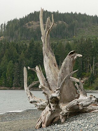
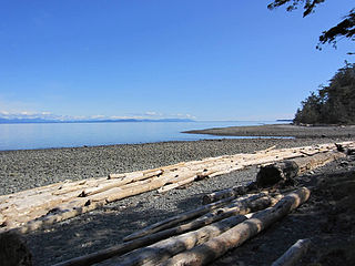
Vancouver Island is an island in the northeastern Pacific Ocean and part of the Canadian province of British Columbia. The island is 456 km (283 mi) in length, 100 km (62 mi) in width at its widest point, and 32,100 km2 (12,400 sq mi) in total area, while 31,285 km2 (12,079 sq mi) are of land. The island is the largest by area and the most populous along the west coasts of the Americas.

<span class="mw-page-title-main">Gulf Islands</span> Group of islands off the eastern coast of Vancouver Island, British Columbia, Canada

The Gulf Islands are a group of islands in the Salish Sea between Vancouver Island and the mainland coast of British Columbia.

<span class="mw-page-title-main">Cowichan River</span>

The Cowichan River is a Canadian Heritage River on Vancouver Island, in British Columbia, Canada. Its headwater is Cowichan Lake. The river flows east over Skutz Falls and through Marie Canyon towards its mouth at Cowichan Bay. The river's drainage basin is 795 square kilometres (307 sq mi) in size.

<span class="mw-page-title-main">British Columbia Rugby Union</span>

The British Columbia Rugby Union (BCRU) is the provincial administrative body for rugby union in British Columbia, Canada. The BCRU consists of nine sub-unions and 65 clubs. It was originally organized in New Westminster in 1889 where Alfred St. George Hamersley, the former England rugby union captain and recent immigrant to Vancouver, and member of Vancouver Football (Rugby) Club, became the first President. The same man is credited with founding the Amateur Athletic Club of British Columbia. and previously had introduced the game of rugby to the youth of South Canterbury, New Zealand. The current headquarters is on the west side of Vancouver.

<span class="mw-page-title-main">Brooks Peninsula Provincial Park</span> Provincial park in British Columbia, Canada

Parts of this article have been adapted from the BC Parks website.

<span class="mw-page-title-main">Carmanah Walbran Provincial Park</span> Provincial park on Vancouver Island in British Columbia, Canada

Carmanah Walbran Provincial Park, originally Carmanah Pacific Provincial Park, is a remote wilderness park located inside traditional Ditidaht First Nation ancestral territory. The park covers a land area of 16,450 ha (63.5 sq mi) immediately adjacent to Pacific Rim National Park Reserve's West Coast Trail on the south-western, coastal terrain of Vancouver Island. The provincial park comprises the entire drainage of Carmanah Creek, and a good portion of the lower Walbran River drainage, both of which independently empty into the Pacific Ocean. The park is named after the Anglicized diitiid?aatx word kwaabaaduw7aa7tx, or Carmanah, meaning "thus far upstream" and John Thomas Walbran, a colonial explorer and ship's captain. Access to the park is by gravel logging road from Port Alberni, Lake Cowichan, or Port Renfrew.

<span class="mw-page-title-main">Fossli Provincial Park</span> Provincial park on Vancouver Island in British Columbia, Canada

Fossli Provincial Park is a provincial park in British Columbia, Canada, located on Stirling Arm of Sproat Lake on Vancouver Island. The 52-hectare park, west of Port Alberni, is accessible by water or private logging road. It has few services, but has a 30-minute hiking trail to an old homestead site. The homestead belonged to Helen and Armour Ford, who donated the land for the park to the province in 1974. Saint Andrew's Creek runs through the park, and is a fall spawning ground for coho salmon.

<span class="mw-page-title-main">French Beach Provincial Park</span> Provincial park in British Columbia, Canada

French Beach Provincial Park is a provincial park in British Columbia, Canada.

Gordon Bay Provincial Park is a provincial park in British Columbia, Canada.

<span class="mw-page-title-main">Kitty Coleman Provincial Park</span> Provincial park in British Columbia, Canada

Kitty Coleman Provincial Park, also known as Kitty Coleman Beach Provincial Park, is a Class C provincial park located in British Columbia, Canada. It is located on Vancouver Island, in the Comox Valley, south of the mouth of the Oyster River just northeast of Courtenay.

<span class="mw-page-title-main">MacMillan Provincial Park</span> Park in British Columbia, Canada

MacMillan Provincial Park is a 301-hectare (740-acre) provincial park in British Columbia, Canada. Located 25 km (16 mi) west of Qualicum Beach and 16 km (9.9 mi) east of Port Alberni, the park straddles Highway 4 and the Island Rail Corridor in central Vancouver Island. It is nestled on the western shore of Cameron Lake, and protects the delta of the Cameron River. The park is home to a famous, 157-hectare (390-acre) stand of ancient Douglas fir, known as Cathedral Grove, which draws visitors from all over the world. The park provides the only highway-accessible protected old-growth Douglas-fir forest in British Columbia. In 2007 Cathedral Grove made the short list on CBC's competition Seven Wonders of Canada.

Memory Island Provincial Park is a provincial park located on Vancouver Island in British Columbia, Canada. It was established by BC Parks on 23 August 1945 to protect a small island located at the southern end of Shawnigan Lake.

Nimpkish Lake Provincial Park is a provincial park on northern Vancouver Island, British Columbia, Canada on Vancouver Island. The park is 3,949 ha. in area and was established on 1995. It is 32 km south of Port McNeill and on the southwest side of Nimpkish Lake. Primary access is by boat launch, though radio-controlled logging roads lead to the edge of the park. Western Forest Products in Woss, British Columbia should be contacted for road advisories. The park is in the traditional territory of the Namgis First Nation.

Schoen Lake Provincial Park is a provincial park in northeastern Vancouver Island, British Columbia, Canada, located east of the community of Woss Lake and southwest of Sayward. The park lies inside the Nimpkish Valley watershed. On October 28, 1977, the "Class A" park was officially created to protect, exhibit and interpret an example of the natural features and processes of the Insular Mountains Natural Region. The park covers a total area of 8,775 hectares. Within those hectares of park land is a number of lakes, creeks and mountain ranges.

<span class="mw-page-title-main">Stamp River Provincial Park</span> Provincial park on Vancouver Island in British Columbia, Canada

Stamp River Provincial Park is a provincial park in British Columbia, Canada. The 327-hectare park is located 14 km north of Port Alberni on Vancouver Island. There are 23 camping spaces and 2 km of trails within the park along the Stamp River, named for Edward Stamp, a sawmill pioneer in the Alberni Valley.

<span class="mw-page-title-main">Strathcona Provincial Park</span> Provincial park in British Columbia, Canada

Strathcona Provincial Park is the oldest provincial park in British Columbia, Canada, and the largest on Vancouver Island. Founded in 1911, the park was named for Donald Alexander Smith, 1st Baron Strathcona and Mount Royal, a wealthy philanthropist and railway pioneer. It lies within the Strathcona Regional District. The Clayoquot Sound Biosphere Reserve, established in 2000, includes three watersheds in the western area of the park.

Nitinat Lake is a large lake and inlet on the southwestern coast of Vancouver Island, British Columbia, Canada. The lake is about 150 km (93 mi) northwest by road from Victoria, BC's capital on the southern tip of Vancouver Island, and about 60 km (37 mi) southwest by road from the town of Lake Cowichan. The city of Port Alberni is about 80 km (50 mi) by road to the north.