The Battle of Loon Lake, also known as the Battle of Steele Narrows, concluded the North-West Rebellion on June 3, 1885, and was the last battle fought on Canadian soil. It was fought in what was then the District of Saskatchewan of the North-West Territories, at what is now known as Steele Narrows at Makwa Lake, in Saskatchewan's Steele Narrows Provincial Park. Steele Narrows is a channel that separates Sanderson Bay from Makwa Lake.

Sechelt Inlet formerly Seechelt Inlet is one of the principal inlets of the British Columbia Coast. The inlet is significant in that it almost makes an island of what is instead the Sechelt Peninsula, whose isthmus is at the town of Sechelt at the head of the inlet. The isthmus is less than 1.2 km (0.75 mi) in length. Sechelt Inlet's mouth is at Jervis Inlet, inland from the Malaspina Strait.
Burgoyne Bay Provincial Park is a provincial park in British Columbia, Canada located on southwestern Saltspring Island near Fulford Harbour. The parks faces northwest to Sansum Narrows, which is the channel between Saltspring Island and Vancouver Island. Mount Maxwell Provincial Park lies adjacent to the north.
Cinnemousun Narrows Provincial Park is a provincial park in British Columbia, Canada, located on Shuswap Lake at the convergence of the lake's four arms.
Dawley Passage Provincial Park is a provincial park in British Columbia, Canada, located at the south end of Fortune Channel, which lies between Meares Island and the mainland of Vancouver Island just south. The park is to the north of the resort town of Tofino and is accessible by boat only. It was created on July 13, 1995 as part of the Clayoquot Land-Use Decision and contains 154 ha, .
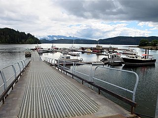
Grohman Narrows Provincial Park is a provincial park in British Columbia, Canada.

Marble River Provincial Park is a provincial park in British Columbia, Canada. The park is located on northern Vancouver Island. It is 14.19 km2 (5.48 sq mi) in area. The park protects an eagle nesting habitat near Quatsino Narrows in Quatsino Sound, a steelhead fishery, and an extensive waterfowl habitat. A 4.2 km (2.6 mi)-long biking or walking trail is available, as well as opportunities for wildlife viewing.

Mount Maxwell Provincial Park is a provincial park in the Gulf Islands of British Columbia, Canada. It is located on Burgoyne Bay and the Sansum Narrows on the western shores of Saltspring Island.

Skookumchuck Narrows Provincial Park is a provincial park in the Sunshine Coast of British Columbia, Canada. It was established on August 25, 1957, to protect the Sechelt Rapids located in the Skookumchuck Narrows between Sechelt Inlet and Jervis Inlet.
The Bras d'Or Lakes Scenic Drive is a scenic roadway on Nova Scotia's Cape Breton Island. It extends around the perimeter of Bras d'Or Lake.
Route 223 is a collector road in the Canadian province of Nova Scotia.

De Courcy Island is one of the Gulf Islands of the coast of southwestern British Columbia, Canada, located between the Pylades and Stuart Channels approximately 16 km (9.9 mi) southeast of Nanaimo and approximately 38 km (24 mi) west of Vancouver.

Batchawana Bay is a small bay in Algoma District in Northeastern Ontario, Canada. It is on the eastern shore of Lake Superior, approximately 50 kilometres (31 mi) north of Sault Ste. Marie.
Highway 155 is a paved, undivided provincial highway in the Canadian province of Saskatchewan. It runs from Highway 55 near Green Lake until La Loche, where it intersects with Highway 955. The highway services several communities and provincial recreation sites and is entirely within the Northern Saskatchewan Administration District. It is about 299 kilometres (186 mi) long.

Halfway Lake Provincial Park is a provincial park astride Ontario Highway 144 in Sudbury District in northeastern Ontario, Canada. It is operated by Ontario Parks and is named for Halfway Lake, which is entirely within the park grounds. The nearest settlement on Highway 144 is Cartier, about 25 kilometres (16 mi) to the south. The park contains more than a dozen lakes, including Antrim Lake, Bailey Lake, Benny Lake, Bittern Lake, Burnt Ridge Lake, Halfway Lake, Lodge Lake, Moosemuck Lake, Otter Lake, Raven Lake, Three Island Lake, Trapper Lake, and Two Narrows Lake. There are a mix of 221 electrical and non-electrical sites in the two campgrounds, 10 interior canoe-access sites located on Antrim Lake, Bailey Lake, and Trapper Lake, plus an additional five interior hike-access sites located along the Hawk Ridge Trail.

Maurelle Island is an island in British Columbia, Canada. It is part of the Discovery Islands between Vancouver Island and the mainland, between the Strait of Georgia and Johnstone Strait.
Quatsino Sound is a complex of coastal inlets, bays and islands on northwestern Vancouver Island in the Canadian province of British Columbia. It is the northernmost of the five sounds that pierce the west coast of Vancouver Island, the others being Kyuquot Sound, Nootka Sound, Clayoquot Sound, and Barkley Sound.

Nitinat Lake is a large lake and inlet on the southwestern coast of Vancouver Island, British Columbia, Canada. The lake is about 150 km (93 mi) northwest by road from Victoria, BC's capital on the southern tip of Vancouver Island, and about 60 km (37 mi) southwest by road from the town of Lake Cowichan. The city of Port Alberni is about 80 km (50 mi) by road to the north.

Bakers Narrows Provincial Park is a provincial park south of Flin Flon in the Northern Region of Manitoba, Canada. It is 145 hectares (0.56 sq mi) in size. It was designated as a provincial park in 1961.
Steele Narrows Provincial Park is an historical provincial park in the west-central region of the Canadian province of Saskatchewan in the transition zone between parkland and boreal forest. It is located on Makwa Lake at Steele Narrows – the channel that separates Sanderson Bay from Makwa Lake – about 10 kilometres (6.2 mi) west of the village of Loon Lake along Highway 699. The park is the site of the Battle of Loon Lake, which was not only the last battle of the North-West Rebellion, but also the last battle fought on Canadian soil. The battle occurred on 3 June 1885.


