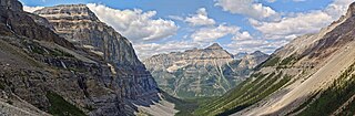
Kootenay National Park is a national park of Canada in southeastern British Columbia. The park consists of 1,406 km2 (543 sq mi) of the Canadian Rockies, including parts of the Kootenay and Park mountain ranges, the Kootenay River and the entirety of the Vermilion River. While the Vermilion River is completely contained within the park, the Kootenay River has its headwaters just outside the park boundary, flowing through the park into the Rocky Mountain Trench and eventually joining the Columbia River. The park ranges in elevation from 918 m (3,012 ft) at the southwestern park entrance to 3,424 m (11,234 ft) at Deltaform Mountain.

The Okanagan, also called the Okanagan Valley and sometimes the Okanagan Country, is a region in the Canadian province of British Columbia defined by the basin of Okanagan Lake and the Canadian portion of the Okanagan River. It is part of the Okanagan Country, extending into the United States as Okanogan County in north-central Washington. According to the 2016 Canadian census, the region's population is 362,258. The largest populated cities are Kelowna, Penticton, Vernon, and West Kelowna.

Chetwynd is a district municipality located in the eastern foothills of the Rocky Mountains, in northeastern British Columbia, Canada. Situated on an ancient floodplain, it is the first town eastbound travellers encounter after emerging from the Rockies along Highway 97, and acts as the gateway to the Peace River Country. The town developed during the construction of infrastructure through the Rocky Mountains in the 1950s; additionally, it was used as a transshipment point during the building of hydroelectric dams, in the 1960s and 1970s, and the new town of Tumbler Ridge, in the early 1980s. Home to approximately 2,600 residents, the town’s population has increased little—if at all—since the 1980s, but is significantly younger than the provincial average.
Bearhole Lake Provincial Park is a provincial park in British Columbia, Canada, 5 km east of the mining community of Tumbler Ridge, on the Alberta Plateau. Established in January 2001, the park includes 12,705 ha of land in the Boreal White and Black Spruce biogeoclimatic zones within the Kiskatinaw Plateau. It is transition zone with mixed wood forests including spruce, pine, and larch. Bearhole Lake, the headwaters of the Kiskatinaw River provides habitat for trumpeter swans, yellow perch, burbot, rainbow trout, and northern pike.

Cathedral Provincial Park and Protected Area, usually known as Cathedral Provincial Park and also as Cathedral Park, is a provincial park in British Columbia, Canada. It is located east of E.C. Manning Provincial Park, south of BC Highway 3, and southeast of the town of Princeton, and southwest of Keremeos. Its southern boundary is the border with the United States. Much of the park is the basin of the Ashnola River. Cathedral Park is home to teal sub-alpine lakes, vast ridges and jarred peaks, old-growth forests, and rock formations of siltstone, granodiorite, and basalt. Hikers can scramble along various peaks such as the 8000-foot Grimface Mountain and Lakeview Mountain. Tourists flock to Smokey the Bear and Stone City because of their unique formations with incredible views formed by millennia of erosion, volcanic and tectonic activity, and glacial recession.

Sx̱ótsaqel/Chilliwack Lake Provincial Park is a provincial park in British Columbia, Canada. Covering 92.58 km2, the park is located 150 km east of Vancouver in the Chilliwack River Valley.
Kikomun Creek Provincial Park is a provincial park in British Columbia, Canada.
Pink Mountain Provincial Park is a provincial park in British Columbia, Canada.

The Purcell Wilderness Conservancy is a provincial park in British Columbia, Canada. It was established in 1974, and encompasses six large drainages in the Purcell Mountains in the southeast of the province. It contains high peaks, alpine meadows and ridges, deep creek and river valleys, and hot springs at Dewar Creek.
Syringa Park is a provincial park on the east shore of Lower Arrow Lake in the West Kootenay region of southeastern British Columbia. At the foot of the Norns Range, Tulip Creek passes through the centre, and Syringa Creek is closer to the southeastern boundary. The park is about 19 kilometres (12 mi) west of Castlegar via Broadwater Rd.

Tantalus Provincial Park is a provincial park located in the Tantalus Range overlooking Squamish Valley in British Columbia, Canada. It was established on December 19, 1998 to protect a large area of pristine alpine wilderness.
Tweedsmuir South Provincial Park is a provincial park covering parts of the eastern Kitimat Ranges, northern Pacific Ranges, and the Rainbow Range in British Columbia, Canada. It was established on May 21, 1938 in the western interior of the province, to protect its important natural features. The park hosts a variety of recreation activities for visitors. This park encompasses a range of diverse species in this park including bears, moose, and various fish. There are also a few at risk species in this park.

The Hart Ranges are a major subrange of the Canadian Rockies located in northeastern British Columbia and western Alberta. The mountains constitute the southernmost portion of the Northern Rocky Mountains.

The Interior Mountains or Northern Interior Mountains are the semi-official names for an expansive collection of mountain ranges that comprises much of the northern half of the Canadian province of British Columbia and a large area of southern Yukon.

Lac du Bois Grasslands Protected Area is a protected area located north of Kamloops in British Columbia, Canada. The protected area was established by BC Parks on 30 April 1996 to protect a unique mixed forest-grassland ecosystem overlooking the North and South forks of the Thompson River.

South Chilcotin Mountains Provincial Park is a provincial park in British Columbia, Canada, located on Highway 40 northwest of Lillooet, British Columbia. The park, which is 56,796 ha. in size, was established on April 18, 2001, and It was created out of a portion of the Spruce Lake Protected Area. The park is located on three Indigenous Nations: The Tsilhqot’in, St’at’imc, and Secwepemc.

Castle Provincial Park is a provincial park in southern Alberta, Canada. It is located within the Municipal District of Pincher Creek No. 9 south of the Municipality of Crowsnest Pass, northwest of Waterton Lakes National Park and west of the Town of Pincher Creek. It shares a boundary with Castle Wildland Provincial Park to the west and south.

The Central British Columbia Mountain forests is a temperate coniferous forest ecoregion in north-central British Columbia, as defined by the World Wildlife Fund (WWF) categorization system.

Kettle River Recreation Area is a 179 hectare provincial recreation area located inside a sharp S-bend of the Kettle River approximately 6 kilometres north of the community of Rock Creek, British Columbia. It is one of only two recreation areas in British Columbia, the other being Coquihalla Summit Recreation Area.

White Lake Grasslands Protected Area is a conservation site located in the Regional District of Okanagan-Similkameen of British Columbia, Canada. It was established on April 18, 2001 by an order-in-council under the Environment and Land Use Act to protect the semi-arid grassland and pine forest ecosystem west of Vaseux Lake.

