
Shuswap Lake is a lake located in the southern interior of British Columbia, Canada that drains via the Little Shuswap River into Little Shuswap Lake. Little Shuswap Lake is the source of the South Thompson River, a branch of the Thompson River, a tributary of the Fraser River. It is at the heart of a region known as the Columbia Shuswap or "the Shuswap", noted for its recreational lakeshore communities including the city of Salmon Arm. The name "Shuswap" is derived from the Shuswap or Secwepemc First Nations people, the most northern of the Interior Salish peoples, whose territory includes the Shuswap. The Shuswap call themselves /ʃǝxwépmǝx/ in their own language, which is called /ʃǝxwepmǝxtʃín/.

The Columbia Mountains are a group of mountain ranges along the Upper Columbia River in British Columbia, Montana, Idaho and Washington. The mountain range covers 135,952 km². The range is bounded by the Rocky Mountain Trench on the east, and the Kootenai River on the south; their western boundary is the edge of the Interior Plateau. Seventy-five percent of the range is located in Canada and the remaining twenty-five percent in the United States; American geographic classifications place the Columbia Mountains as part of the Rocky Mountains complex, but this designation does not apply in Canada. Mount Sir Sandford is the highest mountain in the range, reaching 3,519 metres (11,545 ft).
The Bonaparte Plateau, in British Columbia, Canada, is a sub-plateau of the Thompson Plateau which extends to the Quesnel River and lies between the Cariboo Mountains on the east and the Fraser River on the west. The Thompson Plateau is itself a sub-plateau of the larger Fraser Plateau.
Anstey-Hunakwa Provincial Park is a provincial park in the Shuswap Country of the Southern Interior of British Columbia, Canada. 6,852 hectares in size, the park was established 18 April 2001.
Mabel Lake Provincial Park is a provincial park in the Monashee Mountains of British Columbia, Canada, located on the east side of Mabel Lake, which is part of the Shuswap River system. Created on December 21, 1972, at approximately 182 hectares, the park was expanded in 2000 to approximately 187 hectares.

Monashee Provincial Park is a provincial park located just outside of Cherryville, British Columbia, Canada. It is located in the central Monashee Mountains between the Arrow Lakes and the upper Shuswap River drainage, just east of Sugar Lake. It is a remote grizzly habitat that is a walk-in only. Mount Fosthall is the highest peak in the area and can be hiked in a day. In addition to hiking and alpinism other activities include fishing.
Upper Seymour River Provincial Park is a provincial park in British Columbia, Canada. Located in an isolated area in the interior of the province, 40 kilometres north of the community of Seymour Arm. It protects at the headwaters of the Seymour River, which is the major drainage system into the Seymour Arm of Shuswap Lake.

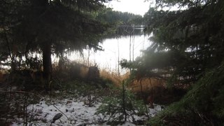
Tsútswecw Provincial Park is a provincial park in British Columbia, Canada, located northeast of Kamloops and northwest of Salmon Arm. It stretches along the banks of the Adams River, between the south end of Adams Lake and the western portion of Shuswap Lake.

Shuswap Lake Provincial Park is a provincial park in British Columbia, Canada. It is located in the community of Scotch Creek, on the north shore of the main arm of Shuswap Lake in the Southern Interior of BC. The park is about 45 minutes north of Salmon Arm, and about 1 hour east of Kamloops. The park contains a large campground with approximately 275 camping sites, as well as a large sand and gravel beach and day use/picnic area. It is a very popular park, with many thousands of people, primarily from BC and Alberta, camping there every year.
Silver Beach Provincial Park is a provincial park in British Columbia, Canada, located at the head of the Seymour Arm of Shuswap Lake in that province's Shuswap Country, adjacent to the settlement of Seymour Arm.
Skookumchuck Rapids Provincial Park is a provincial park in British Columbia, Canada, located on the Shuswap River just below the outlet of Mabel Lake. This park was established as a result of the Okanagan-Shuswap Land and Resource Management Plan.
The Okanagan Highland is an elevated hilly plateau area in British Columbia, Canada, and the U.S. state of Washington. Rounded mountains with elevations up to 8,000 ft (2,400 m) above sea level and deep, narrow valleys are characteristic of the region.
Scotch Creek is a small community in British Columbia based on summer tourism located on the shores of Shuswap Lake at the mouth of the creek of the same name.

Mabel Lake is a lake located in southern Interior British Columbia, Canada, that is fed by and drained by the Shuswap River. It is located southeast of Shuswap Lake, northeast of Okanagan Lake, and west of the Monashee Mountains, and is popular for camping and fishing. The area around the lake is mountainous and sparsely populated.

Adams River is a tributary to the Thompson and Fraser Rivers in British Columbia, Canada. Beginning in the Monashee Mountains to the north, the Upper Adams River flows mainly southward and eventually reaches Adams Lake. The Lower Adams River begins at the southern end of the lake and flows into the extreme western end of Shuswap Lake. The river is one of the most important sockeye salmon breeding areas in North America. The run occurs in mid-October and can bring millions of fish to a concentrated area near the river mouth. Excavations of Secwepemc villages on the river have shown a long tradition of habitation and salmon fishing in the area. The river also served as an important transportation route for early logging operations in the watershed.

Dunn Peak is a group of peaks in the central Interior of British Columbia, Canada. Its most prominent summit, Matterhorn Peak, rises to 2,636 metres (8,648 ft), making it the highest point in the Shuswap Highland. The peak and its surroundings are contained in Dunn Peak Provincial Park.

