
The Great Bear Rainforest is a temperate rain forest on the Pacific coast of British Columbia, comprising 6.4 million hectares. It is part of the larger Pacific temperate rainforest ecoregion, which is the largest coastal temperate rainforest in the world.
Khutzeeymateen Provincial Park, also known as Khutzeymateen/K'tzim-A-Deen Grizzly Sanctuary, is a Class A provincial park located in the North Coast region of British Columbia, Canada. The park, within the purview of BC Parks, was established on August 15, 1994, to protect critical habitat for the region's grizzly bear population and the largest contiguous stand of old-growth Sitka spruce in the world. It was officially opened by Prince Philip, Duke of Edinburgh, on August 17, 1994.

The Purcell Wilderness Conservancy is a provincial park in British Columbia, Canada. It was established in 1974, and encompasses six large drainages in the Purcell Mountains in the southeast of the province. It contains high peaks, alpine meadows and ridges, deep creek and river valleys, and hot springs at Dewar Creek.

Tantalus Provincial Park is a provincial park located in the Tantalus Range overlooking Squamish Valley in British Columbia, Canada. It was established on December 19, 1998 to protect a large area of pristine alpine wilderness.

BC Parks is an agency of the British Columbia Ministry of Environment and Climate Change Strategy that manages all of the, as of 2020, 1,035 provincial parks and other conservation and historical properties of various title designations within the province's Parks oversaw of the British Columbia Parks and Protected Areas System. The Lieutenant Governor-in-Council created the agency on March 1, 1911, through the Strathcona Park Act. The agency is charged with a dual role of preserving the ecological and historical integrity of the places entrusted to its management, while also making them available and accessible for public use and enjoyment.

Pitt Island is an island located on the north coast of British Columbia, Canada.

Banks Island is an island on the coast of the Canadian province of British Columbia. It is located south of Prince Rupert, on Hecate Strait, east of and opposite Haida Gwaii. To its east is Pitt Island and McCauley Island, both across Principe Channel. To its west is Bonilla Island. To its south lies the archipelago of the Estevan Group, beyond which is Caamaño Sound.

Campania Island is an island on the coast of the Canadian province of British Columbia. It is located south of Prince Rupert, east across Hecate Strait from Haida Gwaii. To its west, across Estevan Sound, is the Estevan Group archipelago. Banks Island lies to the northwest, across Nepean Sound; and Pitt Island to the north, across Otter Channel. To the northeast, across Squally Channel, is Gil Island, and to the east is Princess Royal Island, across Campania Sound. To the south of Campania Island is Caamaño Sound, beyond which is Aristazabal Island.

The Fiordland Conservancy, also known as the Fiordland Recreation Area formerly, and since also as the Fiordland Conservation Area, is a conservancy in British Columbia, Canada. It preserves a portion of the province's coast containing glacial fjords; at the time of its inception it was the only protected area in the system protecting this particular environmental zone. Established in 1987, the park covers 76,825 hectares of the Kitimat Ranges, part of the Coast Mountains, and 7,592 hectares of foreshore. It is located approximately 100 kilometers north of the town of Bella Coola. The park encompasses two major inlets — Mussel and Kynoch. As there is no road access to the park, it is mainly enjoyed by sailors and kayakers. Although there are no modern settlements in the area, the Heiltsuk people have maintained villages along the shores in the past. The nearest settlements are Klemtu and Bella Bella.

The Kitlope Heritage Conservancy or Huchsduwachsdu Nuyem Jees in the Haisla language, is a conservancy located on the Pacific coast of the province of British Columbia, Canada. It preserves the largest continuous tract of coastal temperate rainforest in the world. Beginning at the head of Gardner Canal, the park stretches inland along the Kitlope River to the border of Tweedsmuir Provincial Park.
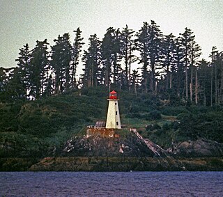
The Lucy Islands are a small archipelago off the North Coast of the province of British Columbia in Canada. The low-lying and heavily forested group, named after its largest island, Lucy Island, constitutes a provincially protected conservancy area that contains some of the North Coast’s oldest archeological sites, a nationally significant seabird population, and a prominent 20th-century lighthouse.
Bonilla Island is a small, remote island in the Hecate Strait west of Banks Island. It has a lighthouse, upland bogs and coastal rainforests. The island is encompassed by the Lax Kul Nii Luutiksm/Bonilla Conservancy which was established in 2006.
Neʼāhʼ Conservancy is a conservancy located in the Stikine Region of British Columbia, Canada. The conservancy was established on 31 March 2013 through a cooperative resource management and land use planning agreement between BC Parks and the Kaska Dena First Nations.
Duu Guusd Heritage Site/Conservancy is a heritage site and conservancy located in the northwest corner of Graham Island in the Haida Gwaii archipelago of British Columbia, Canada. It was established on March 23, 2008 to protect the ecological integrity and cultural importance of the region. The conservancy is part of an archipelago-wide system of protected areas that includes Gwaii Haanas National Park Reserve and Haida Heritage Site, Gwaii Haanas National Marine Conservation Area Reserve and Haida Heritage Site, and 17 other provincially protected areas.
Taku River/T'aḵú Téiú' Conservancy is a conservancy located in the Stikine Region of British Columbia, Canada. It was established on June 22, 2012, as a result of the Wóoshtin Wudidaa Atlin Taku Land Use Plan and Taku River Tlingit First Nation Strategic Engagement Agreement. The conservancy protects a large region of pristine wilderness along the Taku River from its confluence with the Nakina and Inklin Rivers to the Alaska-British Columbia border.
The Ecstall River is a tributary of the Skeena River in the province of British Columbia, Canada. It originates in the Kitimat Ranges, and flows about 110 km (68 mi) to the lower tidal reach of the Skeena River at Port Essington, about 30 km (19 mi) southeast of Prince Rupert, 95 km (59 mi) southwest of Terrace, and 85 km (53 mi) northwest of Kitimat. Its drainage basin covers about 1,485 km2 (573 sq mi) and contains the largest blocks of unlogged land on the north coast of British Columbia, although large-scale industrial logging operations, both active and proposed, have been occurring in the watershed since the 1980s.
The Khtada River is a tributary of the Skeena River in the North Coast Regional District of the province of British Columbia, Canada. It originates in the Kitimat Ranges of the Coast Mountains, and flows south about 26 km (16 mi) to the lower tidal reach of the Skeena River, about 24 km (15 mi) upriver from Port Essington, 48 km (30 mi) southeast of Prince Rupert, and about 74 km (46 mi) southwest of Terrace.
The Banks Nii Łuutiksm Conservancy is located at the northern end of Banks Island along the coast of British Columbia, Canada.

