Campbell River is a city in the Sayward Land District of British Columbia, Canada, on the east coast of Vancouver Island at the south end of Discovery Passage, which lies along the 50th parallel north along the important Inside Passage shipping route. Campbell River has a population of 35,138 and has long been touted as the "salmon capital of the world." Campbell River and Region are near the communities of Quadra and the Discovery Islands, Sayward, Oyster River, Gold River, Tahsis and Zeballos.

Mount Robson Provincial Park is a provincial park in the Canadian Rockies with an area of 2,249 km2. The park is located entirely within British Columbia, bordering Jasper National Park in Alberta. The B.C. legislature created the park in 1913, the same year as the first ascent of Mount Robson by a party led by Conrad Kain. It is the second oldest park in the provincial system. The park is named for Mount Robson, which has the highest point in the Canadian Rockies and is located entirely within the park.

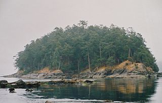
Gulf Islands National Park Reserve is a national park located on and around the Gulf Islands in British Columbia, Canada. In the National Parks System Plan, this park provides representation of the Strait of Georgia Lowlands natural region, the only place in Canada with a Mediterranean climate of dry, sunny summers and mild, wet winters, the result of a rain shadow effect from surrounding mountains between the region and the ocean. It has similar dominant vegetation as the Pacific Northwest, such as coastal Douglas-fir, western red cedar, shore pine, Pacific dogwood, bigleaf maple, and red alder, but also contains the northern extent of some of the more drought tolerant trees such as Garry oak and Arbutus. The park was created in 2003 as the fortieth national park. It covers 36 square kilometres (14 sq mi) of area on 16 islands and more than 30 islets, reefs and surrounding waters, making it the sixth smallest national park in Canada.

Kootenay National Park is a national park of Canada in southeastern British Columbia. The park consists of 1,406 km2 (543 sq mi) of the Canadian Rockies, including parts of the Kootenay and Park mountain ranges, the Kootenay River and the entirety of the Vermilion River. While the Vermilion River is completely contained within the park, the Kootenay River has its headwaters just outside the park boundary, flowing through the park into the Rocky Mountain Trench and eventually joining the Columbia River. The park ranges in elevation from 918 m (3,012 ft) at the southwestern park entrance to 3,424 m (11,234 ft) at Deltaform Mountain.

The Stein Valley Nlaka’pamux Heritage Park is located near Lytton, British Columbia. The park was established in 1995. The park is co-managed, operated, and planned through a partnership between the Lytton First Nation and the government of British Columbia. The park provides recreational opportunities and cultural heritage activities, and features a number of pictographs.

Garibaldi Provincial Park, also called Garibaldi Park, is a wilderness park located on the coastal mainland of British Columbia, Canada, 70 kilometres (43.5 mi) north of Vancouver. It was established in 1920 and named a Class A Provincial Park of British Columbia in 1927. The park is a popular destination for outdoor recreation, with over 30,000 overnight campers and over 106,000 day users in the 2017/2018 season.

Alice Lake Provincial Park is a provincial park in British Columbia, Canada.

Golden Ears Provincial Park is a 555.9 square kilometres (214.6 sq mi) provincial park in British Columbia, Canada. It is named after the prominent twin peaks, which are commonly referred to as Golden Ears. The park was originally part of Garibaldi Provincial Park but was split off as a separate park in 1967. The area was logged extensively in the 1920s by the Lougheed and Abernathy Logging Company. Many recreational attractions are found within the park. Golden Ears Provincial Park is a protected area that contains many endangered species of flora and fauna.

E.C. Manning Provincial Park is a provincial park in British Columbia, Canada. It is usually referred to as Manning Park, although that nomenclature is also used to refer to the resort and ski area at the park's core. The park covers 83,671 hectares (323 mi2) and was the second most visited provincial park in 2017-18 after Cypress Provincial Park. The park lies along British Columbia Highway 3, and occupies a large amount of land between Hope and Princeton along the Canada-United States border.

Hamber Provincial Park is a provincial park in British Columbia, Canada, located 130 kilometres (80.7 mi) north of Golden. Straddling the Great Divide on the provincial boundary with Alberta, the park is surrounded on three sides by Jasper National Park and protects the headwaters of the Wood River at Fortress Lake.
Height of the Rockies Provincial Park is a provincial park in the Canadian Rockies of south eastern British Columbia, Canada. It is located west of the Continental Divide, adjacent to Elk Lakes Provincial Park.

Juan de Fuca Provincial Park is a provincial park located on the west coast of Vancouver Island in British Columbia, Canada. The park was established on April 4, 1996 by combining three former parks — China Beach, Loss Creek, and Botanical Beach — into one provincial park. It is the location of the majority of the Juan de Fuca Marine Trail, which is a southern compliment to the West Coast Trail within Pacific Rim National Park Reserve.
Kikomun Creek Provincial Park is a provincial park in British Columbia, Canada.

Lockhart Beach Provincial Park is a provincial park Located 40 km north of Creston, British Columbia, Canada, on BC Highway 3A. "This park and the adjacent Lockhart Creek Provincial Park extend 3 hectares, from the sunny shores of Kootenay Lake to the headwaters of Lockhart Creek. "This small park provides the only easy access to public camping along the south arm of Kootenay Lake. An 18-site campground and day-use area are located near a sand and fine gravel beach."

Miracle Beach Provincial Park is a provincial park on the eastern shore of Vancouver Island in British Columbia, Canada. Located between Comox and Campbell River, the park includes a foreshore area in the Strait of Georgia, much of the Black Creek estuary, and a forested area. According to its Master Plan, it fulfills primarily a recreational role with a focus on beach play, picnicking, nature appreciation, and camping, and a secondary conservation role with a focus on the natural shoreline and estuary. In support of its recreational focus the park is developed with a day-use parking area with accessible trails leading to the shoreline and a camping area with 200 drive-in sites. The park is also hosts a nature centre building and a sheltered group picnic shelter. Vegetation in the park is typical for the region's second-growth forests with Douglas-fir most prominent. Common associates include Western hemlock, Sitka spruce, red alder and bigleaf maple. Salal and sword fern are the most abundant shrub. Black Creek, which flows through the park, is a spawning area for coho salmon.

Rathtrevor Beach Provincial Park is a provincial park in Parksville, British Columbia, Canada. Located at the east end of the town, the 347-hectare park features a two-kilometre long stretch of sandy beach, a stand of old-growth Douglas fir trees and 250 vehicle-accessible and 25 walk-in camping spaces. Popular year-round, the park is easily accessible from Highway 19. The sandy beach is the main attraction. At low tide, it stretches nearly a kilometre out into the Strait of Georgia.

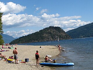
Shuswap Lake Provincial Park is a provincial park in British Columbia, Canada.
Tweedsmuir South Provincial Park is a provincial park covering parts of the eastern Kitimat Ranges, northern Pacific Ranges, and the Rainbow Range in British Columbia, Canada. It was established on May 21, 1938 in the western interior of the province, to protect its important natural features. The park hosts a variety of recreation activities for visitors. This park encompasses a range of diverse species in this park including bears, moose, and various fish. There are also a few at risk species in this park.

Indian Arm is a steep-sided glacial fjord adjacent to the city of Vancouver in southwestern British Columbia. Formed during the last Ice Age, it extends due north from Burrard Inlet, between the communities of Belcarra and the District of North Vancouver, then on into mountainous wilderness. Burrard Inlet and the opening of Indian Arm was mapped by Captain George Vancouver and fully explored days later by Dionisio Alcalá Galiano in June 1792.

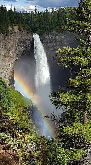
Wells Gray Provincial Park is a large wilderness park located in east-central British Columbia, Canada. The park protects most of the southern, and highest, regions of the Cariboo Mountains and covers 5,415 square kilometres. It is British Columbia's fifth largest provincial park, after Tweedsmuir, Tatshenshini, Spatsizi and Northern Rocky Mountains.


