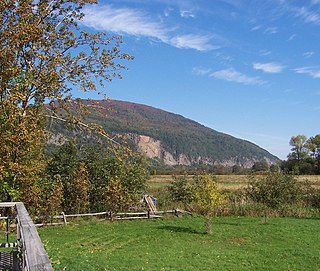
Lazo Marsh-North East Comox Wildlife Management Area

Last updated
Lazo Marsh-North East Comox Wildlife Management Area
IUCN category IV (habitat/species management area)
Canada British Columbia location map 2.svg
Red pog.svg
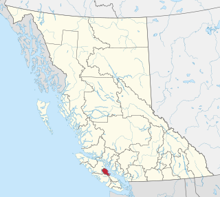
Location in British Columbia
Canada location map 2.svg
Red pog.svg
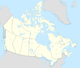
Lazo Marsh-North East Comox Wildlife Management Area (Canada)
Location Comox Valley, British Columbia, Canada
Nearest city Comox
Coordinates 49°41′05″N124°53′28″W / 49.68472°N 124.89111°W / 49.68472; -124.89111
Area159 hectares (1.59 km2)
Elevation2–12 meters (6.6–39.4 ft)
Established6 April 2001;22 years ago (2001-04-06)
Governing body FLNRORD
Website Lazo Marsh-North East Comox Wildlife Management Area

Lazo Marsh-North East Comox Wildlife Management Area is a wildlife management area on the eastern coast of Vancouver Island, British Columbia, Canada. It was established by the British Columbia Ministry of Forests, Lands, Natural Resource Operations and Rural Development (FLNRORD) on 6 April 2001 to preserve local species. [1] The marshlands is owned jointly by the K'omoxs First Nation, the towns' municipality, and the Comox Valley Regional District, [2] and lays within both the traditional territories of the K'omoks people and the Pacific Temperate Rain Forest.

Contents

The Marsh is home to many species of fish, birds, flora and fauna; some endemic, some native to the area (both residential and migratory), and others invasive. The marsh has a long history of mixed uses and protections that have culminated into its present form and use.

Geography

Located within the traditional territory of the K'omoks people, the Lazo Marsh-NE Management Area sits approximately 1.86 miles (3km) East of the town of Comox and sits on a peninsula overlooking the Strait of Georgia. The marsh area varies in elevation from 2-12 meters above sea level. [3] It is 159 hectares in size and is connected to the Comox North East Woods. [4]

The marsh and greater Comox area are described as having a Marine West Coast, Warm Summer Climate (Cfb), [5] having cool summers, mild winters and high humidity, with a relatively narrow temperature range. [6]

The conservation lands on which the marsh sits are also under the District of Campbell River, as per the Natural Resource Regions and Districts of British Columbia.

Environment

Yellow Flagged Iris (An invasive species found in the Lazo Marsh) Yellow Flag Iris (Iris pseudacorus) - geograph.org.uk - 3546035.jpg
Yellow Flagged Iris (An invasive species found in the Lazo Marsh)

Ecosystems

The Lazo Marsh-North East Comox Conservation Area, is a part of a large conversation area which includes the neighboring Lazo Marsh, Comox North East Woods, and a sanctuary. [7] The area(s) are connected through a series of trail networks for people to hike, bike, and enjoy.

The Marsh and surrounding (greater) area lay within the Coastal Western Hemlock Very Dry Maritime zone (CWHxm1) just North of the Coastal Douglas Fir Moist Maritime zone (CDFmm). [8] These zones in turn as both part of the greater Pacific Temperate Rainforest. The surrounding area is made up of several rare ecosystems including wetland and riparian, as well as woodland and coastal bluffs. [9]

The wetland ecosystem of which the conservation area is a part of has seen a roughly 30% reduction since 1992. [9] Today the marsh land undergoes periodic (man-made) scarification by bulldozer(s) in order to aid in creating more open water for birds and other lifeforms. [10]

Wildlife

The marsh has been a well established year-round home for a large variety of birds for some time, as well as home to several fish species, including coho salmon fry and several trout species. [11] Some rare birds have been found at this site, such as the Red-flanked bluetail, which has only ever been spotted in Canada one other time as of 2016. [12] One species of raptor that can be found in the marsh area is the Northern Pygmy Owl or Vancouver Island Pygmy-Owl (Glaucidium Gnoma Swarthi), which is endemic to the area. [13]

Northern Pygmy Owl Perched On a Tree Branch Northern pygmy owl (126363bdfacd4e0b9a1ea0ef3c2c9763).JPG
Northern Pygmy Owl Perched On a Tree Branch

The marsh area is plagued by an invasion of yellow flag iris', which has proven resistant to mitigation efforts. [10] The Iris pseudacorus is able to rapidly spread out and colonize new areas, in part thanks to the buoyancy of its seeds. This coupled, with the vast interconnected root systems that individual plants share, make it particularly difficult to exterminate and put server pressures on native species. [14] Early detection and eradication is a key component to minimizing environmental damages and disturbances.

History

The area surrounding the marsh and greater Comox valley has been inhabited since the last ice age, with European contact occurring in the 1700's. [15] The marsh was briefly known as the Radford's Swamp, [16] and today, the K'omoks First Nation engages in various ecological protect and restoration projects, including the sharing of land and caring for the Lazo Marsh. [17] Much of the area was home to a vast amount of both resident and migratory bird species, however during the 1930's and 1940's the area was drained to make room for potato farming, until beaver damning interfered. [18] The area was also briefly used by the neighbouring municipality as a dumping ground, and then later bought and established as a bird sanctuary. [19]

In 1994 a public hearing was held in response to development proposals, where locals opposed the idea and the area as a whole as designated as Crown Forest. [20] Eventually, in 2001 the Lazo March- North East Comox Wildlife Management Area was established.The view on this now-protected land wasn't always that of appreciation. Old scrap metal and car parts littered among the forest and marsh lands shows the view that this land was once thought of as a dump. [20] Nowadays the trails and natural beauty of the landscape is a source of enjoyment and recreation for residents and visitors to the area. In 2022, the Friends of Comox-Lazo Forest Reserve society dissolved. A group originally formed in 1996 to advise and oversee protection of the marsh. [21]

Related Research Articles

<span class="mw-page-title-main">Comox, British Columbia</span> Town in British Columbia, Canada

Comox is a town on the southern coast of the Comox Peninsula in the Strait of Georgia on the eastern coast of Vancouver Island, British Columbia. Thousands of years ago, the warm dry summers, mild winters, fertile soil, and abundant sea life attracted First Nations, who called the area kw'umuxws.

<span class="mw-page-title-main">Kʼómoks</span>

The Kʼómoks or Kʼomoks, usually known in English as the Comox, are an indigenous group of Coast Salishan-speaking people in Comox, British Columbia and in Toba Inlet and the Malaspina Peninsula areas of the British Columbia mainland across Georgia Strait. They historically spoke the Komox language (Comox-Sliammon), and were divided in two main dialect and tribal groupings, which are known by academics as Island Comox and Mainland Comox.

<span class="mw-page-title-main">Stein Valley Nlaka'pamux Heritage Park</span> British Columbia provincial park

The Stein Valley Nlaka’pamux Heritage Park is located near Lytton, BC northeast of Vancouver. The park was established in 1995. Currently, the park is being co-managed, operated and planned through partnership between the Lytton First Nations and the BC Government. The park provides recreational opportunities and cultural heritage activities.

<span class="mw-page-title-main">Courtenay, British Columbia</span> City in British Columbia, Canada

Courtenay is a city of about 26,000 on the east coast of Vancouver Island, in the Canadian province of British Columbia. It is the largest community and only city in the area commonly known as the Comox Valley, and the seat of the Comox Valley Regional District, which replaced the Comox-Strathcona Regional District. Courtenay is 4 km (2.5 mi) west of the town of Comox, 7 km (4.3 mi) northeast of the village of Cumberland, 5 km (3.1 mi) northwest of the unincorporated settlement of Royston, and 108 km (67 mi) northwest of Nanaimo. Along with Nanaimo and Victoria, it is home to The Canadian Scottish Regiment, a Primary Reserve infantry regiment of the Canadian Armed Forces.

The Yalakom River is a tributary of the Bridge River, which is one of the principal tributaries of the Fraser River, entering it near the town of Lillooet, British Columbia. In frontier times it was also known as the North Fork of the Bridge River, and joins the Bridge River proper at Moha, a rural community with a history in ranching, farming and mining. The river is approximately 50km in length. The valley's climate is semi-arid in character and lodgepole pine predominates below treeline.
<span class="mw-page-title-main">Pinecone Burke Provincial Park</span> Provincial park in British Columbia, Canada


Pinecone Burke Provincial Park is a provincial park in British Columbia, Canada. It extends from the southwest corner of Garibaldi Provincial Park, west of Pitt Lake and Pitt River to include Burke Mountain in the City of Coquitlam. Most of the park is unserviced wilderness with very rough trails such as the Fools Gold Trail in the Boise Valley. There is canoe access to Widgeon Slough and from there hiking trails that lead to Widgeon Lake, and a network of old logging roads, hiking and mountain biking trails on Burke Mountain. Visitors can also use the park for camping, backcountry skiing, and snowshoeing.

<span class="mw-page-title-main">Vaseux Lake</span> Lake in the Okanagan Valley of British Columbia, Canada

Vaseux Lake is a shallow freshwater lake located along the course of the Okanagan River in the Okanagan Valley of British Columbia, Canada.

<span class="mw-page-title-main">Creston Valley Wildlife Management Area</span> Protected area of British Columbia, Canada

The Creston Valley Wildlife Management Area is a Canadian river delta wetland and Wildlife Management Area near Creston in south-central British Columbia, on the floodplain of the Kootenay River at the south end of Kootenay Lake. Predominantly marshland, it was classified as a wetland of international importance on February 21, 1994, and is also a globally significant Important Bird Area. It is one of the "few significant agricultural areas of the province", and is in the Montane Cordillera. It stretches north along Kootenay Lake for approximately 20 km, and south to the United States border. It is both the only breeding site of the Forster's tern and the only site with leopard frogs in the province, as well as one of the few Canadian habitats for the Coeur D'Alene salamander. Creston Valley provides staging and nesting areas for migratory birds on the Pacific Flyway.

<span class="mw-page-title-main">Comox Valley Regional District</span> Regional district in British Columbia, Canada

The Comox Valley Regional District is a regional district in British Columbia, Canada. It was created on February 15, 2008, encompassing the southeastern portions of the former Regional District of Comox-Strathcona, and centred about the Comox Valley. The partition left the new Comox Valley Regional District with only 8.4 percent of the former Comox-Strathcona's land area, but 57.9 percent of its population. The CVRD covers an area of 2,425 square kilometres, of which 1,725 square kilometres is land, and serves a population of 72,445 according to the 2023 Census. The district borders the Strathcona Regional District to the northwest, the Alberni-Clayoquot Regional District to the southwest, and the Regional District of Nanaimo to the southeast, as well as the qathet Regional District along the Strait of Georgia to the east.

Lazo Wildlife Park is a protected area on eastern Vancouver Island in the Comox Valley Regional District (CVRD). It lies at the north end of Lazo Marsh and its entrance is at the end of Sand Pines Drive in Comox. Part of the park lies on the Comox Sandhills in which the forest contains a large proportion of Shore Pine. Douglas-Fir, Western White Pine and Western Red Cedar are prominent among the other tree species present. Bird life is dominated by nesting populations of ducks and geese. Soils in the area were mapped in 1959 as Arrowsmith peat and Kye-Custer complex of rapidly to imperfectly drained sandy podzols.

Comox Sandhills represents an ancient sand dune system in Comox and the Comox Valley Regional District near Cape Lazo, British Columbia. The dunes have been overgrown by a forest of Douglas-Fir and Shore Pine, which are frequently joined by Western Hemlock in moist areas. More rarely, kept uncommon by exceptionally low soil fertility, Western White Pine, Sitka Spruce, Western Red Cedar, Red Alder, Bigleaf Maple, Black Cottonwood and Trembling Aspen are present. Classic podzol soil profile development was the rule, mapped as Kye-Custer complex ("Ky-Cu") in a 1959 survey; however, housing developments have since disturbed the area and disrupted soil profiles so that many of the soils no longer resemble podzols. As a result, a 1985 report mapped the Sandhills in a brunisolic (Kuhushan) soil association. A 1989 report mapped the Beddis series for drier parts and Baynes series for imperfectly drained areas.

<span class="mw-page-title-main">Maplewood Flats Conservation Area</span> Conservation area in Canada

The Maplewood Flats Conservation Area is a 126 hectare conservation area located in North Vancouver, British Columbia, Canada. The area is composed of a 96 hectare intertidal zone of mudflats and salt marsh, and a 30 hectare upland area. It is preserved by Port Metro Vancouver as one of their ecological land initiatives. The land is located approximately 2 km east of the Second Narrows Bridge along Burrard Inlet in North Vancouver.

<span class="mw-page-title-main">Qualicum National Wildlife Area</span> National Wildlife Area on Vancouver Island in British Columbia, Canada

The Qualicum National Wildlife Area (NWA) was officially established in 1977, under the Canada Wildlife Act (1973). The primary objective of the Qualicum NWA was to conserve crucial habitats for migratory birds and various other species.

Widgeon Valley National Wildlife Area is a National Wildlife Area located near the south end of Pitt Lake in British Columbia, Canada. The property was purchased by the Nature Trust of British Columbia in 1973 and declared a National Wildlife Area by the Canadian Wildlife Service in October of that year. The Widgeon Valley National Wildlife Area is a biologically diverse marsh wetland. It is the traditional territory of various First Nations groups. The Widgeon Valley Wildlife Area is a protected wildlife area that is home to a number of sensitive waterfowl and fish species. The public uses the channels through the Widgeon Valley National Wildlife Area for recreational canoeing, anywhere else within the protected area is strictly off-limits to the public. There are future plans to develop interpretive trails through the park and open it to the public.

Located in the southern part of British Columbia, Columbia National Wildlife Area was established to protect its wetlands and as a temporary home for migratory birds travelling to South America. The National Wildlife Area (NWA) is divided into four unit areas: Wilmer, Spillimacheen, Brisco and Harrogate, which are home to many diverse species of animals and plants which are significant in Canada.

<span class="mw-page-title-main">Cranberry Marsh/Starratt Wildlife Management Area</span> Wildlife Management Area in Valemount, British Columbia

Cranberry Marsh/Starratt Wildlife Management Area is a wildlife management area located just south of Valemount, British Columbia. It was established by the British Columbia Ministry of Forests, Lands, Natural Resource Operations and Rural Development (FLNRORD) on 28 March 2013 to protect Cranberry Marsh, a freshwater marsh that serves as an important breeding ground and stopover for a variety of migratory birds.

<span class="mw-page-title-main">Boundary Bay Wildlife Management Area</span> Wildlife Management Area in British Columbia, Canada

Boundary Bay Wildlife Management Area is a wildlife management area encompassing the entire Canadian portion of Boundary Bay in the Lower Mainland of British Columbia. It was established by the British Columbia Ministry of Forests, Lands, Natural Resource Operations and Rural Development (FLNRORD) on 21 June 1995 to conserve critical habitat for migratory bird species and resident fish and marine mammal species. It is part of the larger Fraser River Delta Ramsar Site.

<span class="mw-page-title-main">White Lake Grasslands Protected Area</span> Protected area in British Columbia

White Lake Grasslands Protected Area is a conservation site located in the Regional District of Okanagan-Similkameen of British Columbia, Canada. It was established on April 18, 2001 by order-in-council under the Environment and Land Use Act to protect the semi-arid grassland and pine forest ecosystem west of Vaseux Lake. The region spans from shoreline to mountain top, providing essential living areas for various red and blue-listed species, plants, and plant groups in British Columbia.

<span class="mw-page-title-main">Serpentine Wildlife Management Area</span> Wildlife Management Area in British Columbia, Canada

The Serpentine Wildlife Management Area is a small wildlife management area located on the south coast of British Columbia in Surrey. It contains many kilometers of walking trail and viewing towers to enjoy the nature and observe the many species found in the area. Although the boundaries have changed over the years, the Government of British Columbia still manages the land to ensure it meets the currents goals that were set in place to protect the local and endangered species that inhabit the area as well as monitoring the effects of climate change. This is done in partnership with Ducks Unlimited Canada, although the land falls within the territories of the Semiahmoo and Tsawwassen First Nation.

References

  1. Forests, Ministry of. "Lazo Marsh-North East Comox Wildlife Management Area - Province of British Columbia". www2.gov.bc.ca. Retrieved 2023-10-27.
  2. https://www.comoxvalleyrd.ca/sites/default/files/docs/Parks-Recreation/4lazomarsh_brochure_201703.pdf
  3. "Lazo Marsh-North East Comox Wildlife Management Area topographic map, elevation, terrain". Topographic maps. Retrieved 2023-10-12.
  4. https://www.comoxvalleyrd.ca/sites/default/files/docs/Parks-Recreation/4lazomarsh_brochure_201703.pdf
  5. "Comox, British Columbia, CA Climate Zone, Monthly Averages, Historical Weather Data". weatherandclimate.com. Retrieved 2023-10-28.
  6. "Temperate oceanic climate (Cfb) | SKYbrary Aviation Safety". skybrary.aero. Retrieved 2023-10-28.
  7. https://www.comoxvalleyrd.ca/sites/default/files/docs/Parks-Recreation/4lazomarsh_brochure_201703.pdf
  8. "About the CDFCP". Coastal Douglas-fir Conservation Partnership. Retrieved 2023-10-12.
  9. 1 2 https://a100.gov.bc.ca/pub/acat/documents/r54324/CV_SEIDisturbanceAssessmentReport_Nov13_forprint_1526409414458_6408034929.pdf
  10. 1 2 "Comox Valley resident fighting for the restoration of Lazo Marsh". Comox Valley Record. 2023-07-15. Retrieved 2023-10-12.
  11. Forests, Ministry of. "Lazo Marsh-North East Comox Wildlife Management Area - Province of British Columbia". www2.gov.bc.ca. Retrieved 2023-10-27.
  12. Hafting, Melissa (2016-12-29). "BC Rare Bird Alert: RBA: RED-FLANKED BLUETAIL in Comox - December 22-Jan 14th". BC Rare Bird Alert. Retrieved 2023-10-14.
  13. "Northern Pygmy-owl, swarthi subspecies". South Coast Conservation Program. Retrieved 2023-10-12.
  14. "Yellow flag iris". Invasive Species Council of British Columbia. Retrieved 2023-10-29.
  15. Kelly, Mary (2023-08-23). "Indigenous cultural heritage policies & local planning - A case study in the Land of Plenty". summit.sfu.ca. Retrieved 2023-10-28.
  16. nathan (2021-03-19). "It's All There in Black and White: The Origins of Lazo Marsh -". Courtenay and District Museum & Palaeontology Centre. Retrieved 2023-10-29.
  17. RTC_Admin. "Guardian Watchmen". K'ómoks First Nation. Retrieved 2023-10-28.
  18. "Comox Valley resident fighting for the restoration of Lazo Marsh". Comox Valley Record. 2023-07-15. Retrieved 2023-10-12.
  19. https://walkbc.ca/sites/default/files/trail/newoodslazomarshbrochure.pdf
  20. 1 2 Zoë (2021-12-12). "THE NORTHEAST WOODS". The Collective Magazines. Retrieved 2023-10-12.
  21. "Friends of Comox-Lazo Forest Reserve Society dissolves". Comox Valley Record. 2022-07-27. Retrieved 2023-10-29.