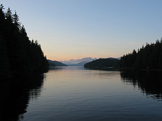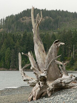
Bligh Island Marine Provincial Park is a provincial park in British Columbia, Canada.
Cormorant Channel Marine Provincial Park is a provincial park in British Columbia, Canada, located in the Pearse Islands, a small archipelago to the east of Cormorant Island and the Village of Alert Bay at the western end of Johnstone Strait.

Codville Lagoon Marine Provincial Park is a provincial park in British Columbia, Canada, located on the southwest end of King Island. The park was created in 1965 because it is a significant site to the Heiltsuk People. This park, which is approximately 755 ha. in area, has an unmaintained trail to Sagar Lake which has a red sand beach. Created in 1992, it was expanded in 1995 by the incorporation of the former Sugar Lake Provincial Park.
Ferry Island Provincial Park is a Class C provincial park in British Columbia that is located on the south side of the Fraser River northeast of Rosedale. This park is northwest of Bridal Falls, British Columbia and adjacent to the Agassiz-Rosedale Bridge. The Ferry Island Park was established in 1963, and it has an area of about 29 hectares.

Flores Island Marine Provincial Park, also known as Flores Island Provincial Park, is a provincial park in British Columbia, Canada, located on the island of the same name in the central Clayoquot Sound region of the West Coast of Vancouver Island, British Columbia, Canada. The park contains 7113 ha. and was created on July 13, 1995, as part of the Clayoqout Land-Use Decision. Gibson Marine Provincial Park, which was created in 1967, adjoins it to the southeast. Sulphur Passage Provincial Park is off the northeast coast of Flores Island, surrounding Obstruction Island.

Fossli Provincial Park is a provincial park in British Columbia, Canada, located on Stirling Arm of Sproat Lake on Vancouver Island. The 52-hectare park, west of Port Alberni, is accessible by water or private logging road. It has few services, but has a 30-minute hiking trail to an old homestead site. The homestead belonged to Helen and Armour Ford, who donated the land for the park to the province in 1974. Saint Andrew's Creek runs through the park, and is a fall spawning ground for coho salmon.

French Beach Provincial Park is a provincial park located on Vancouver Island, between Sooke and Jordan River, British Columbia. The area has a day use parking lot and B.C. provincial campground. It was created in 1980 as the first family-oriented park on the southwest coast of Vancouver Island. Situated on the scenic Strait of Juan de Fuca on the west coast of southern Vancouver Island, French Beach Provincial Park offers views of the Strait and the Olympic Mountains. The beach spreads on 1,600-meters and is a location for whale watching as well as spotting Bald eagles, Ospreys and a variety of seabirds.

Gibson Marine Provincial Park is a provincial park in British Columbia, Canada, located on the southeast end of Flores Island in the central Clayoquot Sound region of Vancouver Island. The park was created on 13 November 1967. It contains approximately 143 hectares and is adjacent to Flores Island Provincial Park.

Helliwell Provincial Park is a provincial park in British Columbia, Canada located on a headland at the northeast end of Hornby Island.

Kitson Island Marine Provincial Park is a provincial park protecting all 45 hectares of Kitson Island and Kitson Islet. The park is located within the asserted traditional territory of the Tsimshian and Metlakatla First Nation, at the mouth of the Skeena River in British Columbia, Canada.

Lakelse Lake Provincial Park is a provincial park in British Columbia, Canada, located just west of Highway 37 between Terrace and Kitimat. The name is derived from the Coast Tsimshian language word "LaxGyels" - "fresh water mussel", for the mollusk that is found on the bottom of both Lakelse Lake and Lakelse River. Before Lakelse Lake became a provincial park, Hatchery Creek, which runs throughout the park, was the site of a sockeye salmon hatchery operated by the Canadian Government between 1919 and 1936. Lakelse Lake Provincial Park was established on March 16, 1956.
Memory Island Provincial Park is a provincial park located on Vancouver Island in British Columbia, Canada. It was established by BC Parks on 23 August 1945 to protect a small island located at the southern end of Shawnigan Lake.
Montague Harbour Marine Provincial Park is a provincial park in British Columbia, Canada, located on Galiano Island, one of the Gulf Islands off BC's South Coast in Canada. It is accessible by BC Ferries from Swartz Bay on Vancouver Island or Tsawwassen on the Mainland. The Island's ferry terminal is at Sturdies Bay, about 6 km (3.7 mi) from Montague.

Mount Maxwell Provincial Park is a provincial park in the Gulf Islands of British Columbia, Canada. It is located on Burgoyne Bay and the Sansum Narrows on the western shores of Saltspring Island.
Nimpkish Lake Provincial Park is a provincial park on northern Vancouver Island, British Columbia, Canada on Vancouver Island. The park is 3,949 ha. in area and was established on 1995. It is 32 km south of Port McNeill and on the southwest side of Nimpkish Lake. Primary access is by boat launch, though radio-controlled logging roads lead to the edge of the park. Western Forest Products in Woss, British Columbia should be contacted for road advisories. The park is in the traditional territory of the Namgis First Nation.
Nitinat River Provincial Park is a provincial park in the Canadian province of British Columbia on Vancouver Island.
Read Island Provincial Park is a provincial park in British Columbia, Canada. It is located on the south end of Read Island. Established in 1996, the park contains approximately 637 ha.
Sabine Channel Provincial Park, also known as Sabine Channel Marine Provincial Park, is a provincial park in British Columbia, Canada, in the waters surrounding Jervis Island in Sabine Channel, which separates Texada Island, to the north, from Lasqueti Island, which lies to the south. Established in 2001, the park is approximately 2,254 hectares in size.
Sulphur Passage Provincial Park is a provincial park in British Columbia, Canada, located in the central part of the Clayoquot Sound region of the West Coast of Vancouver Island, British Columbia, Canada. It is located around Obstruction Island to the northeast of Flores Island. The eponymous Sulphur Passage is located on the east side Obstruction Island.

Naikoon Provincial Park is a provincial park on northeastern Graham Island in the Haida Gwaii archipelago, British Columbia, Canada. It is the ancestral home of the Gwak'rala'chala people, one of the many tribes that form the native group Haida. While it is a popular destination for adventurous campers, it is also very secluded, being over 16 km (9.9 mi) away from Masset.


