
Shuswap Lake is a lake located in the southern interior of British Columbia, Canada that drains via the Little Shuswap River into Little Shuswap Lake. Little Shuswap Lake is the source of the South Thompson River, a branch of the Thompson River, a tributary of the Fraser River. It is at the heart of a region known as the Columbia Shuswap or "the Shuswap", noted for its recreational lakeshore communities including the city of Salmon Arm. The name "Shuswap" is derived from the Shuswap or Secwepemc First Nations people, the most northern of the Interior Salish peoples, whose territory includes the Shuswap. The Shuswap call themselves /ʃǝxwépmǝx/ in their own language, which is called /ʃǝxwepmǝxtʃín/.

The Columbia Mountains are a group of mountain ranges along the Upper Columbia River in British Columbia, Montana, Idaho and Washington. The mountain range covers 135,952 km². The range is bounded by the Rocky Mountain Trench on the east, and the Kootenai River on the south; their western boundary is the edge of the Interior Plateau. Seventy-five percent of the range is located in Canada and the remaining twenty-five percent in the United States; American geographic classifications place the Columbia Mountains as part of the Rocky Mountains complex, but this designation does not apply in Canada. Mount Sir Sandford is the highest mountain in the range, reaching 3,519 metres (11,545 ft).

The North Shore Mountains are a mountain range overlooking Vancouver in British Columbia, Canada. Their southernmost peaks are visible from most areas in Vancouver and form a distinctive backdrop for the city.

Desolation Sound is a deep water sound at the northern end of the Salish Sea and of the Sunshine Coast in British Columbia, Canada.
Clayoquot Arm Provincial Park is a provincial park in British Columbia, Canada.
Clayoquot Plateau Provincial Park is a provincial park in British Columbia, Canada. It is located on the west side of the Kennedy River, to the northeast of the town of Tofino.
Chase Provincial Park is a provincial park in British Columbia, Canada, located around Carina and Tomias Lakes, 70 kilometres (43 mi) north of Germansen Landing in the Omineca Mountains and just west of the Finlay Arm of Williston Lake. Approximately 32,226 hectares (124.43 sq mi), it was established in 2001.

Fossli Provincial Park is a provincial park in British Columbia, Canada, located on Stirling Arm of Sproat Lake on Vancouver Island. The 52-hectare park, west of Port Alberni, is accessible by water or private logging road. It has few services, but has a 30-minute hiking trail to an old homestead site. The homestead belonged to Helen and Armour Ford, who donated the land for the park to the province in 1974. Saint Andrew's Creek runs through the park, and is a fall spawning ground for coho salmon.

Herald Provincial Park is a provincial park in British Columbia, Canada. It is on the north shore of the Salmon Arm of Shuswap Lake, in the Southern Interior of British Columbia, Canada. The park is some 30 minutes northeast of the city of Salmon Arm. Herald Park contains a popular camping area, as well as a day use/picnic area. Large pebble beaches stretch along the southern boundary of the park. Walking and hiking trails exist throughout the park, including an easy 10-minute hike to the spectacular Margaret Falls.

Say Nuth Khaw Yum Provincial Park, also known as Indian Arm Provincial Park, is a provincial park located in the Lower Mainland of British Columbia, Canada. The park was established on July 13, 1995 by BC Parks to protect the forested mountain terrain of Indian Arm.
Okeover Arm Provincial Park is a provincial park in British Columbia, Canada. The park is located on the west side of Okeover Inlet facing Desolation Sound, on the east side of the Malaspina Peninsula.
Shuswap Lake Marine Provincial Park is a provincial park in British Columbia, Canada, comprising 894 ha. The Park has a variety of amenities including boat launch ramps, picnic areas, and 27 campsites around the perimeter of Shuswap Lake. The lake's name and that of the surrounding Shuswap Country is from the Shuswap people (Secwepemc), the most northern of the Salishan speaking people.
Tudyah Lake Provincial Park is a provincial park in British Columbia, Canada. The park is approximately 56 km south of Mackenzie, BC on Highway 97.
Taylor Arm Provincial Park is a provincial park in British Columbia, Canada, located on the north side of Sproat Lake 23 km northwest of Port Alberni on Vancouver Island. Situated along Highway 4, the 71-hectare park has few services but provides group camping sites, undeveloped beaches, and day-use areas. The group camping site has pit toilets and a hand pump water supply, and is connected to the lake shore via a trail that passes under the highway.
Teakerne Arm Provincial Park is a provincial park in British Columbia, Canada, located on the north shore of Teakerne Arm on West Redonda Island in the Discovery Islands archipelago, to the northeast of the city of Campbell River, Canada.

Saanich Inlet is a body of salt water that lies between the Saanich Peninsula and the Malahat highlands of Vancouver Island, British Columbia, Canada. Located just northwest of Victoria, the inlet is 25 km (16 mi) long, has a surface area of 67 km2 (26 sq mi), and its maximum depth is 226 m (741 ft). It extends from Satellite Channel in the north to Squally Reach and Finlayson Arm in the south. The only major tributary feeding the inlet is the Goldstream River.
Route 239 is a collector road in the Canadian province of Nova Scotia.
Indian Arm is a steep-sided glacial fjord adjacent to the city of Vancouver in southwestern British Columbia. Formed during the last Ice Age, it extends due north from Burrard Inlet, between the communities of Belcarra and the District of North Vancouver, then on into mountainous wilderness. Burrard Inlet and the opening of Indian Arm was mapped by Captain George Vancouver and fully explored days later by Dionisio Alcalá Galiano in June 1792.
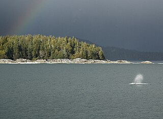
Clayoquot Sound Biosphere Reserve is a UNESCO Biosphere Reserve situated in Clayoquot Sound on the west coast of Vancouver Island in British Columbia, Canada. A diverse range of ecosystems exist within the biosphere reserve boundaries, including temperate coastal rainforest, ocean and rocky coastal shores.
Omineca Provincial Park and Protected Area is a provincial park and protected area located in the north-central interior of British Columbia, Canada. It was established on 11 April 2001 by BC Parks to protect provincially significant riparian and wetland habitats along the Omineca River.

