Related Research Articles
The Upper Similkameen Indian Band or Upper Smelqmix, is a First Nations band government in the Canadian province of British Columbia, whose head offices are located in town of Hedley in the Similkameen Country. They are a member of the Okanagan Nation Alliance.

The Gwa'Sala-Nakwaxda'xw Nations are a union of two Kwakwaka'wakw peoples in a band government based on northern Vancouver Island in British Columbia, Canada, whose main reserve community is near the town of Port Hardy in the Queen Charlotte Strait region of the Central Coast region of British Columbia, Canada. The band government is a member of the Kwakiutl District Council and, for treaty negotiation purposes, the Winalagalis Treaty Group which includes three other members of the Kwakiutl District Council.
Ḵwiḵwa̱sut'inux̱w Ha̱xwa'mis, formerly the Kwicksutaineuk-ah-kwa-mish First Nation is a First Nations band government based on northern Vancouver Island in British Columbia, Canada, in the Queen Charlotte Strait region. It is a member of the Musgamagw Tsawataineuk Tribal Council, along with the ‘Namgis First Nation and the Tsawataineuk First Nation. The Kwikwasut'inuxw and Haxwa'mis are two of the many subgroups of the peoples known as Kwakwaka'wakw, which has two meanings: "smoke of the world" or "beach at the north side of the river."

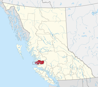
The Stswecem'c Xgat'tem First Nation, formerly known as Canoe Creek Band/Dog Creek Indian Band, created as a result of merger of the Canoe Creek Band and Dog Creek Band is a First Nations government of the Secwepemc (Shuswap) Nation, located in the Fraser Canyon-Cariboo region of the Central Interior of the Canadian province of British Columbia. It was created when the government of the then-Colony of British Columbia established an Indian reserve system in the 1860s. It is a member government of the Northern Shuswap Tribal Council.
The Esk'etemc First Nation, also known as the Alkali Lake Indian Band, is a First Nations government of the Secwepemc (Shuswap) people, located at Alkali Lake in the Cariboo region of the Central Interior of the Canadian province of British Columbia. It was created when the government of the then-Colony of British Columbia established an Indian reserve system in the 1860s. It is one of three Secwepemc bands that is not a member of either the Shuswap Nation Tribal Council or the Northern Shuswap Tribal Council.
The Lytton First Nation, a First Nations band government, has its headquarters at Lytton in the Fraser Canyon region of the Canadian province of British Columbia. While it is the largest of all Nlaka'pamux bands, unlike all other governments of the Nlaka'pamux (Thompson) people, it is not a member of any of the three Nlaka'pamux tribal councils, which are the Nicola Tribal Association, the Fraser Canyon Indian Administration and the Nlaka'pamux Nation Tribal Council.
The Tlʼesqox First Nation is a Tsilhqotʼin community located west of the Fraser Canyon in the Chilcotin region of the Canadian province of British Columbia. It is a member of the Carrier-Chilcotin Tribal Council, which includes both Tsilhqotʼin and Carrier (Dakelh) communities.
The Wuikinuxv Nation, also known as the Oweekeno Nation, is a First Nations band government whose traditional territory is the shores of Rivers Inlet and Owikeno Lake in the Central Coast region of the Canadian province of British Columbia, in the area south of Bella Bella and north of Queen Charlotte Strait. The Wuikinuxv people a.k.a. the Oweekeno people reside in the area of Rivers Inlet and Owikeno Lake, primarily at a village on the Wannock River. Substantial numbers of Wuikinuxv also reside away from the traditional territory in Port Hardy on Vancouver Island and in larger BC communities such as Campbell River, Vancouver and Victoria. Approximately 80 people reside at the village while overall membership was 283 in 2006, 194 of whom lived off-reserve.
The Mamalilikulla Band is a First Nations band government based on northern Vancouver Island in British Columbia, Canada. The home territory of the Mamalilikulla and Qwe-Qwa'Sot'Em groups of Kwakwaka'wakw was in the maze of islands and inlets of the eastern Queen Charlotte Strait region around the opening of Knight Inlet, mainly on Village Island, where their principal village Memkumlis is.
Kingcome, also known as Okwunalis or Ukwana'lis is an unincorporated settlement in the Kingcome Inlet area of the Central Coast of British Columbia, Canada, located a few miles up the Kingcome River from the head of the inlet. Quaee Indian Reserve No. 7 is the Indian reserve containing the village.
The Katzie First Nation or Katzie Nation is the band government of the Katzie people of the Lower Fraser Valley region of British Columbia, Canada.
The Hartley Bay Indian Band is also known as the Gitga'at First Nation or the Hartley Bay First Nation. The members of the Gitga'at First nation are often referred to as Gitka'a'ata. The population of Gitk’a’ata peoples living in Hartley Bay ranges from approximately 130-200 people. There are also about 400-500 Gitk’a’ata peoples living in Prince Rupert, British Columbia, Canada, a neighboring territory. The Gitk’a’ata people have lived in Hartley Bay for hundreds of years, if not always. Some notable things regarding the Gitga'at First Nation are their economy, geography, government, sports involvement, COVID-19 regulations, and relations.
Ruby Creek is a tributary of the Fraser River in the Lower Mainland of British Columbia, Canada, rising in the southern Lillooet Ranges and joining the Fraser east of Sea Bird Island at the locality of Ruby Creek and the associated Ruby Creek Indian Reserve No. 2. It is the largest tributary along the north side of the Fraser between Hope and Agassiz.
Ruby Creek 2, normally referred to as Ruby Creek Indian Reserve No. 2, is an Indian reserve in the Upper Fraser Valley region of British Columbia, Canada, located at the mouth of Ruby Creek at the northeast end of the District of Kent, near the locality of the same name, which is a part of Kent. The reserve is 16.6 hectares in size, and is under the jurisdiction of the Skawahlook First Nation, a member government of the Sto:lo Nation tribal council.
The Sq'éwlets First Nation (Scowlitz) is the band government of Skaulits subgroup of the Stó:lō people located on Harrison Bay in the Upper Fraser Valley region between Chehalis (E) and Lake Errock, British Columbia, Canada (W). They are a member government of the Stó:lō Tribal Council.
Yale First Nation is a First Nations government located at Yale, British Columbia. Yale has 16 distinct reserves stretching from near Sawmill Creek to American Creek, with the most southern reserve situated at Ruby Creek in the District of Kent.
Canoe Creek Indian Reserve No. 1, referred to by Statistics Canada as Canoe Creek 1, is an Indian reserve of the Canoe Creek Band/Dog Creek Indian Band of the Secwepemc people, located five miles northeast of the confluence of Canoe Creek with the Fraser River in British Columbia, Canada, in that province's Cariboo district. The reserve is 37.2 ha. in size.
Gwayasdums is a village of the Kwakwaka'wakw peoples on the west side of Gilford Island in the Johnstone Strait region of the Central Coast of British Columbia, Canada. The village, located on Retreat Pass, is on Gwayasdums Indian Reserve No. 1. Other spellings of the name are Kwaustums and gwa'yasdams and Gwa'yasdams and Gwa’yasdams.
Squeah is a locality in the lower Fraser Canyon of British Columbia, Canada, located between the unincorporated town of Yale (N) and the district municipality of Hope on the Fraser River. Squeah Indian Reserve No. 6 of the Yale First Nation, is located here, at the mouth of Suka Creek. Tiny Squeah Lake is on the south side of the locality at 49°28′51″N121°24′21″W. The mountain above the community on the east side of the canyon, at 49°31′18″N121°23′14″W is called Squeah Mountain by the members of the Yale First Nation.
Choate is a locality in the lower Fraser Canyon of British Columbia, Canada, approximately midway between the unincorporated town of Yale (N) and the district municipality of Hope. A post office operated at Choate from 1923 to 1939. The designation of "flagstop" was changed to "locality" in 1984.
References
49°21′00″N121°36′00″W / 49.35000°N 121.60000°W
| | This article about a location on the Coast of British Columbia, Canada is a stub. You can help Wikipedia by expanding it. |