Related Research Articles

Cowichan Bay is a bay and community located on the east coast of southern Vancouver Island near Duncan, in British Columbia, Canada. The mouth of the Cowichan River is near Cowichan Bay. Mount Tzouhalem with its hiking trails and ecological reserve stands to the north. The bay is known for its fishing and scenic value. The area's main industries are fishing and tourism.

Cowichan River Provincial Park is a provincial park on Vancouver Island in British Columbia, Canada. It includes the Cowichan River in a 1,418 ha area stretching almost 20 kilometres in length from the village of Lake Cowichan to Glenora, just south of Duncan. The Cowichan Valley Trail runs the length of the park, which is part of the greater Trans Canada Trail.

The Chinatown in Victoria, British Columbia is the oldest Chinatown in Canada and the second oldest in North America after San Francisco. Victoria's Chinatown had its beginnings in the mid-nineteenth century in the mass influx of miners from California to what is now British Columbia in 1858. It remains an actively inhabited place and continues to be popular with residents and visitors, many of whom are Chinese-Canadians. Victoria's Chinatown is now surrounded by cultural, entertainment venues as well as being a venue itself. Chinatown is now conveniently just minutes away from other sites of interests such as the Save-On-Foods Memorial Centre, Bay Centre, Empress Hotel, Market Square, and others.
Fairfield is a neighbourhood of Victoria, British Columbia. It is bounded by the James Bay, Downtown, Harris Green, Fernwood, Rockland, and Gonzales neighbourhoods, and meets the Strait of Juan de Fuca to the south.

Clarks Village is an outlet shopping village in Street, Somerset, England. It was established in 1993 on the site of old C&J Clark factory buildings.
X̱wemelch'stn, usually anglicized as Homulchesan, is a large community within the Squamish Nation of the Squamish people, who are a part of the Coast Salish ethnic and linguistic group. The name X̱wemelch'stn, translates to "Fast Moving Water of Fish", relating to the Capilano River. The village is one of the oldest and major villages of the Squamish and continues to be so, being the Squamish Nation's most populated reserve. The community is also known as the Capilano Indian Reserve, formally Capilano Indian Reserve No. 5, and is named like the adjacent Capilano River after the Capilano chieftaincy, the best-known Joe Capilano. The name Kiapila'noq means "people of Kiap", and was the title of the supreme chief of the Sḵwx̱wú7mesh in the area of English Bay. Chief George Capilano was the chief who met Captain Vancouver at X̱wemelch'stn in 1792, and had met Captain Cook in 1782.

Tarrytown is a neighborhood located west of Downtown Austin, Texas. The neighborhood is bordered by Lake Austin Boulevard on the south, Lake Austin on the west, West 35th Street on the north and Mopac Expressway on the east. Major roads in the area include Exposition Boulevard, Enfield Road and Windsor Road. Tarrytown also encompasses the sub-neighborhood of Brown Herman.

Cowichan Tribes is the band government of the Cowichan, a group of Coast Salish peoples who live in the Cowichan Valley region on Vancouver Island. With over 3,800 registered members, it is the single largest First Nations band in British Columbia.

Downtown Victoria is a neighbourhood of Victoria, British Columbia, Canada that serves as the city centre and the central business district for the City of Victoria, and the Greater Victoria regions.

Victoria Harbour is a harbour, seaport, and seaplane airport in the Canadian city of Victoria, British Columbia. It serves as a cruise ship and ferry destination for tourists and visitors to the city and Vancouver Island. It is both a port of entry and an airport of entry for general aviation. Historically it was a shipbuilding and commercial fishing centre. While the Inner Harbour is fully within the City of Victoria, separating the city's downtown on its east side from the Victoria West neighbourhood, the Upper Harbour serves as the boundary between the City of Victoria and the district municipality of Esquimalt. The inner reaches are also bordered by the district of Saanich and the town of View Royal. Victoria is a federal "public harbour" as defined by Transport Canada. Several port facilities in the harbour are overseen and developed by the Greater Victoria Harbour Authority, however the harbour master's position is with Transport Canada.

Fan Tan Alley is an alley in the Chinatown neighbourhood of Victoria, British Columbia, Canada that is known for being the narrowest commercial street in North America, being less than 0.9 m (3.0 ft) wide at its narrowest point. It runs south from Fisgard Avenue to Pandora Avenue at the block between Government Street and Store Street. Named after the Chinese gambling game Fan-Tan, the alley was originally well known for opium factories that produced opium until it was made illegal in 1908. The alley became known for gambling and got its Fan Tan name from the card game of the same name during the 1910s. Police raids on the illegal gambling clubs and declining visitors led to the closure of the gambling clubs in the 1950s and 60s. Fan Tan alley fell into disrepair and buildings were condemned at the time but was later revitalized in the 1970s and 80s with leadership from David Chuenyan Lai. Today the alley is a tourist destination containing many small shops, an art gallery, restaurants, apartments, and offices. It was designated as a heritage property by the local government in 2001.

Tilikum was a 38-foot (12 m) dugout canoe that was used in an effort to circumnavigate the globe starting in 1901. The boat was a "Nootkan" (Nuu-chah-nulth) canoe which was already old when she was obtained by captain John Voss in April 1901. The boat was built in the early 19th century as a dugout canoe made from a large red cedar log. Tilikum was purchased for $80 in silver from a native woman in a transference ceremony allegedly sealed by a bottle of rye whiskey - the name Tilikum means "friend" in Chinook jargon. Apparently, John Voss and his companion in this venture, Norman Luxton, were inspired by the voyage of Joshua Slocum, who sailed the 37-foot (11 m) sloop Spray around the world a few years earlier and wrote a best selling book about his adventures.

Pommes Frites is a New York City restaurant which specializes in Belgian-style fries. The restaurant was located in the East Village at 123 2nd Avenue, but relocated to 128 MacDougal Street after the original building was destroyed in a 2015 natural gas explosion.
The Camas Bookstore and Infoshop is a not-for-profit infoshop located at 2620 Quadra Street in Victoria, British Columbia, Canada.
Touhy Avenue is a major street throughout northern Chicago, Illinois as well as the north and northwestern suburbs of the city. It is named for Patrick L. Touhy, a subdivider who was also the son-in-law of Phillip Rogers, an early settler who helped develop Rogers Park. Points of interest along Touhy Avenue include Loyola Park, the Winston Towers, the Lincolnwood Town Center, Lincolnwood Produce & Grocery, Loeber Motors, Hebrew Theological College, Village Crossing Shopping Center, Pointe Plaza, the Shure Headquarters Building, the Leaning Tower YMCA, the Pickwick Theatre, the northern end of O'Hare International Airport, and the crash site of American Airlines Flight 191.
Blanshard Street is an arterial road in Victoria, British Columbia, Canada. The Save-On-Foods Memorial Centre and Mayfair Shopping Centre are located along Blanshard. It has been the route for the Pat Bay Highway through Victoria since 1978 when the Blanshard Extension was completed from Hillside Street to Douglas Street.

Virginia Village is a neighborhood of Denver, Colorado, roughly five miles southeast of downtown. The neighborhood consists of a mixture of town homes, single-family homes, shopping plazas, and mid to high-rise apartment and office buildings. It is served by the Colorado Station on the E, F, and H RTD light rail lines. The neighborhood is bounded on the west by Colorado Boulevard; on the southwest by Interstate 25; on the south by Evans Avenue; on the east by Quebec Street; on the northeast by Cherry Creek; and on the north by Mississippi Avenue. Holly Street divides the Virginia Village neighborhood into two areas, each represented by a neighborhood association. The area west of Holly Street comprises the Virginia Village Ellis Community Association, while the area to the east of Holly comprises the Cook Park Neighborhood Association.
The Tseycum First Nation is a First Nations government located on Vancouver Island. In the 1850s, they were signatories to the Douglas Treaties.

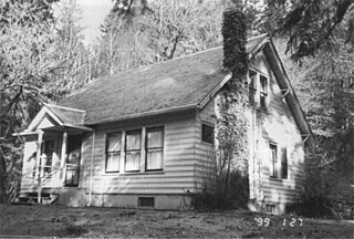
The Elwha Ranger Station is a historic district in Olympic National Park, originally built in the 1930s for the U.S. Forest Service. The complex of fourteen buildings is divided in two by Olympic Hotsprings Road. To the east lie the ranger station and three residences, with nine maintenance buildings on the west side of the road. The complex was turned over to the National Park Service in 1940 when the land was added to Olympic National Park from Olympic National Forest. Construction is typical of USFS practice, and reflects the Forest Service's preference of the time for bungalow and American Craftsman style architecture.

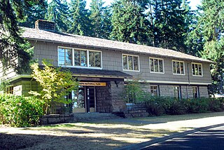
The Olympic National Park Headquarters Historic District overlooks Port Angeles, Washington from Peabody Heights, consisting of 6 contributing buildings built in 1940–44, 8 contributing structures and 17 non-contributing properties that act as the administrative headquarters for Olympic National Park. The contributing structures were built using locally obtained native materials in a late interpretation of the National Park Service Rustic style. Native landscaping enhances the site. Much of the work was carried out by Public Works Administration and Civilian Conservation Corps workers.
References
- ↑ "Discover Cook Street Village: our top 5 picks". Off the beaten track tours. Archived from the original on 11 July 2016. Retrieved 24 June 2016.