Northumberland County, Ontario

Last updated
Northumberland County
County of Northumberland
Trent River at Campbellford.jpg
Colborne, Ontario 2023-09-23 IMG-006.jpg
Northumberland County Farmland, Campbellford, Ontario 1581 (6009504688).jpg
2007.05.30 02 Ganaraska River Port Hope Ontario.jpg
Clockwise from top: Downtown Campbellford from the Trent River, farmland in the Municipality of Trent Hills, downtown Port Hope from the Ganaraska River, downtown Colborne.
Map of Ontario NORTHUMBERLAND.svg
Location of Northumberland County within Ontario
Coordinates: 44°07′N78°02′W / 44.117°N 78.033°W / 44.117; -78.033
Country Flag of Canada (Pantone).svg Canada
Province Flag of Ontario.svg  Ontario
County seat Cobourg
Municipalities
List
Government
  TypeUpper-tier municipal government
  WardenMandy Martin [1]
  Governing bodyNorthumberland County Council
Area
[2]
  Total1,905.15 km2 (735.58 sq mi)
Population
 (2021) [2]
  Total89,365
  Density47.78/km2 (123.7/sq mi)
Time zone UTC−05:00 (EST)
  Summer (DST) UTC−05:00 (EDT)
Website www.northumberlandcounty.ca

Northumberland County is an upper-tier municipality situated on the north shore of Lake Ontario, east of Toronto in Central Ontario. The Northumberland County headquarters are located in Cobourg.

Contents

Municipalities

Northumberland County consists of seven municipalities:

MunicipalityPopulation (2021) [2] Area (km²) [2] Population density (per km²) [2] Major population centres
Town of Cobourg 20,51922.41915.7
Municipality of Port Hope 17,294278.862.0Port Hope
Municipality of Trent Hills 13,861513.8527.0 Campbellford, Warkworth, Hastings
Municipality of Brighton 12,108223.2454.2Brighton
Township of Hamilton 11,059256.0343.2
Township of Alnwick/Haldimand 7,473398.2518.8
Township of Cramahe 6,509202.2232.2Colborne

The Alderville First Nation is geographically located within the County and is a part of the Northumberland census division, but, as an Indian reserve, it is independent of county administration.

History

The County was first established in 1792, and was organized alongside neighbouring Durham County into the Newcastle District of Upper Canada in 1802. [3] The County was initially settled by a mix of Irish, Scottish, and English immigrants, as well as by Americans immigrating north from New England. [3]

In 1850, the Newcastle District was reorganized into the United Counties of Northumberland and Durham, an arrangement which lasted until 1973. Effective January 1, 1974, the majority of Durham County was amalgamated with Ontario County to create the Regional Municipality of Durham. The Township of Hope and the Town of Port Hope were transferred to Northumberland, which reverted to a standalone county.

Recreation

The Ranney Suspension Bridge in Ferris Provincial Park. Ranney Suspension Bridge 2 (163096006).jpg
The Ranney Suspension Bridge in Ferris Provincial Park.

There are two provincial parks in Northumberland County: Presqu'ile Provincial Park in Brighton, and Ferris Provincial Park in Campbellford. [4] There are also several other protected natural areas and forests, including Ganaraska Forest, [5] Northumberland County Forest, Goodrich-Loomis Conservation Area, and Peter's Woods. Waterfront campsites and cottages are located along Lake Ontario and Rice Lake.

Northumberland County has various cycling, hiking and other outdoor trails. The Waterfront Trail along Lake Ontario passes through Northumberland County, [6] as does the Trans-Canada Trail. [7] The Northumberland portion of the Trans-Canada Trail spans from Hastings to Hoard's Station in Campbellford, following an abandoned rail line. Halfway through Campbellford, the trail joins the 6 km long Rotary Trail situated alongside the Trent River. There are five signed bike routes: Glorious Ganaraska, Rice Lake Ramble, Shelter Valley, Presqu’ile Promise and Trent River Truckin'. [8] The Northumberland County Forest offers various trails available for hiking, cycling, horseback riding, ATVing, off-road motorcycling, cross-country skiing, snowmobiling, snowshoeing [9] as well as a 3.2 km, accessible Universal Trail. [10] The Ganaraska Hiking Trail starts in Port Hope and goes north towards the Bruce Trail. [11]

There are three theatres in Northumberland County: Westben in Campbellford, the Capitol Theatre in Port Hope, and the Park Theatre & Performing Arts Centre in Cobourg. [12] Festivals in Northumberland include the Warkworth Maple Syrup and Float Your Fanny Down the Ganny festivals in early spring, the Cobourg Sandcastle Festival and Incredible Edibles Festival in the summer, and the Cultivate Food and Vintage Film Festivals in the fall. [13]

Demographics

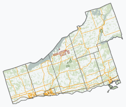
As a census division in the 2021 Census of Population conducted by Statistics Canada, Northumberland County had a population of 89,365 living in 37,328 of its 40,638 total private dwellings, a change of 4.4% from its 2016 population of 85,598. With a land area of 1,907.4 km2 (736.5 sq mi), it had a population density of 46.9/km2 (121.3/sq mi) in 2021. [14]

Canada census – Northumberland community profile
2021 2016 2011
Population89,365 (+4.4% from 2016)85,598 (4.2% from 2011)82,126 (1.4% from 2006)
Land area1,907.40 km2 (736.45 sq mi)1,905.15 km2 (735.58 sq mi)1,905.34 km2 (735.66 sq mi)
Population density46.9/km2 (121/sq mi)44.9/km2 (116/sq mi)43.1/km2 (112/sq mi)
Median age52.4 (M: 50.8, F: 54)51.4 (M: 50.3, F: 52.4)
Private dwellings37,330 (total) 39,032 (total) 37,226 (total) 
Median household income$70,208
References: 2021 [15] 2016 [16] 2011 [17] earlier [18] [19]
Northumberland County population history
YearPop.±%
1996 74,437    
2001 77,497+4.1%
2006 80,963+4.5%
2011 82,126+1.4%
2016 85,598+4.2%
2021 89,365+4.4%
[20] [19] [21] [22]
1996 population adjusted to 2001 boundaries
Panethnic groups in Northumberland County (2001−2021)
Panethnic
group
2021 [23] 2016 [24] 2011 [25] 2006 [26] 2001 [27]
Pop. %Pop.%Pop.%Pop.%Pop.%
European [lower-alpha 1] 80,30578,21575,83575,71073,210
Indigenous 3,0952,2751,8851,6301,420
African 925835355380380
East Asian [lower-alpha 2] 810690460495540
South Asian 715495400310100
Southeast Asian [lower-alpha 3] 54532025019565
Latin American 24520015010585
Middle Eastern [lower-alpha 4] 24080859565
Other [lower-alpha 5] 40025021014565
Total responses87,28083,36579,63579,07075,940
Total population89,36585,59882,12680,96377,497
Note: Totals greater than 100% due to multiple origin responses

See also

Notes

  1. Statistic includes all persons that did not make up part of a visible minority or an indigenous identity.
  2. Statistic includes total responses of "Chinese", "Korean", and "Japanese" under visible minority section on census.
  3. Statistic includes total responses of "Filipino" and "Southeast Asian" under visible minority section on census.
  4. Statistic includes total responses of "West Asian" and "Arab" under visible minority section on census.
  5. Statistic includes total responses of "Visible minority, n.i.e." and "Multiple visible minorities" under visible minority section on census.

Related Research Articles

<span class="mw-page-title-main">Regional Municipality of Durham</span> Regional municipality in Ontario, Canada

The Regional Municipality of Durham, informally referred to as Durham Region, is a regional municipality in Southern Ontario, Canada. Located east of Toronto and the Regional Municipality of York, Durham forms the east-end of the Greater Toronto Area and part of the Golden Horseshoe region. It has an area of approximately 2,500 km2 (970 sq mi). The regional government is headquartered in Whitby.

<span class="mw-page-title-main">Greater Toronto Area</span> Metropolitan area in Ontario, Canada

The Greater Toronto Area, commonly referred to as the GTA, includes the City of Toronto and the regional municipalities of Durham, Halton, Peel, and York. In total, the region contains 25 urban, suburban, and rural municipalities. The Greater Toronto Area begins in Burlington in Halton Region to the west, and extends along Lake Ontario past downtown Toronto eastward to Clarington in Durham Region.

<span class="mw-page-title-main">Golden Horseshoe</span> Secondary region in Ontario, Canada

The Golden Horseshoe is a secondary region of Southern Ontario, Canada, which lies at the western end of Lake Ontario, with outer boundaries stretching south to Lake Erie and north to Lake Scugog, Lake Simcoe and Georgian Bay of Lake Huron. The region is the most densely populated and industrialized in Canada. Based on the 2021 census, with a population of 7,759,635 people in its core and 9,765,188 in its greater area, the Golden Horseshoe accounts for over 20 percent of the population of Canada and more than 54 percent of Ontario's population. It is part of the Quebec City–Windsor Corridor, itself part of the Great Lakes megalopolis.

<span class="mw-page-title-main">Peterborough County</span> County in Ontario, Canada

Peterborough County is located in Southern Ontario, Canada. The county seat is The City of Peterborough, which is independent of the county.

<span class="mw-page-title-main">Kawartha Lakes</span> City in Ontario, Canada

The City of Kawartha Lakes is a unitary municipality in Central Ontario, Canada. It is a municipality legally structured as a single-tier city; however, Kawartha Lakes is the size of a typical Ontario county and is mostly rural. It is the second largest single-tier municipality in Ontario by land area.

<span class="mw-page-title-main">Regional District of Kootenay Boundary</span> Regional district in British Columbia, Canada

The Regional District of Kootenay Boundary (RDKB) is one of 28 regional districts in the province of British Columbia, Canada. As of the 2016 Canadian census, the population was 31,447. The area is 8,095.62 km2. The RDKB was incorporated in 1966 and consists of eight incorporated municipalities and five unincorporated electoral areas. The regional district's offices are in the City of Trail, with secondary offices in the City of Grand Forks. Other major population centres include the cities of Rossland and Greenwood, and the villages of Fruitvale, Warfield, and Montrose. The region also encompasses electoral areas A, B/Lower Columbia-Old Glory, C/Christina Lake, D/Rural Grand Forks and E/West Boundary including Rock Creek, Bridesville, Beaverdell and Big White Ski Resort.

<span class="mw-page-title-main">Dufferin County</span> County in Ontario, Canada

Dufferin County is a county and census division located in Central Ontario, Canada. The county seat is Orangeville, and the current Warden is Darren White. The current chief administrative officer is Sonya Pritchard. Dufferin covers an area of 1,486.31 square kilometres (573.87 sq mi), and its population was 61,735 at the time of the 2016 Census.

<span class="mw-page-title-main">Cambridge (federal electoral district)</span> Federal electoral district in Ontario, Canada

Cambridge is a federal electoral district in Ontario, Canada, that has been represented in the House of Commons of Canada since 1979.

<span class="mw-page-title-main">Squamish, British Columbia</span> Municipality in Canada

Squamish is a community and a district municipality in the Canadian province of British Columbia, located at the north end of Howe Sound on the Sea to Sky Highway. The population of the Squamish census agglomeration, which includes First Nation reserves of the Squamish Nation although they are not governed by the municipality, is 24,232.

<span class="mw-page-title-main">North Cowichan</span> District municipality in British Columbia, Canada

North Cowichan is a district municipality established in 1873 on Vancouver Island, in British Columbia, Canada. The municipality is part of the Cowichan Valley Regional District. North Cowichan is noted for a landscape including forests, beaches, rivers, and lakes. The municipality encompasses the communities of Chemainus; Westholme; Crofton; Maple Bay; and "the South End". The latter is an informal name for a built-up area which is essentially a suburb of the City of Duncan, a separate municipality.

<span class="mw-page-title-main">Durham (federal electoral district)</span> Federal electoral district in Ontario, Canada

Durham is a federal electoral district in Ontario, Canada, that has been represented in the House of Commons of Canada from 1904 to 1968 and since 1988.

<span class="mw-page-title-main">Enderby, British Columbia</span> City in British Columbia, Canada

The City of Enderby is in the North Okanagan region of the Canadian province of British Columbia, between Armstrong and Salmon Arm. It is approximately 80 km north of Kelowna and 130 km east of Kamloops. Highway 97A passes through Enderby and the Shuswap River marks the eastern and northeastern limits of the City. There are two major schools in Enderby: M.V. Beattie Elementary School and A.L. Fortune Secondary School. M.V. Beattie Elementary School was rebuilt in 2012.

The demographics of Toronto, Ontario, Canada make Toronto one of the most multicultural and multiracial cities in the world. In 2021, 57.0 percent of the residents of the metropolitan area belonged to a visible minority group, compared with 51.4 percent in 2016, and 13.6 percent in 1981. Toronto also has established ethnic neighbourhoods such as the multiple Chinatowns, Corso Italia, Little Italy, Little India, Greektown, Koreatown, Little Tokyo, Little Jamaica, Little Portugal, Little Malta, Roncesvalles (Polish), and Bloor West Village (Ukrainian), all of which celebrate the city's multiculturalism. Data from the suburban municipalities are also included for some metrics as most of these municipalities are part of the Toronto CMA.

<span class="mw-page-title-main">Alnwick/Haldimand</span> Township in Ontario, Canada

The Township of Alnwick/Haldimand is a township in central Ontario, Canada, in Northumberland County, situated between Lake Ontario and Rice Lake. It was formed in 2001 by the merger of Alnwick Township in the north and Haldimand Township in the south. Alderville First Nation is an autonomously governed First Nation contained within the township boundaries, in two non-contiguous sections along County Roads 45 and 18.

<span class="mw-page-title-main">Demographics of Ontario</span>

Ontario, one of the 13 provinces and territories of Canada, is located in east-central Canada. It is Canada's most populous province by a large margin, accounting for nearly 40 percent of all Canadians, and is the second-largest province in total area. Ontario is fourth-largest in total area when the territories of the Northwest Territories and Nunavut are included. It is home to the nation's capital city, Ottawa, and the nation's most populous city, Toronto.

<span class="mw-page-title-main">Demographics of Ottawa</span>

In 2021, the population of the city of Ottawa was 1,017,449. The population of the census metropolitan area, Ottawa-Gatineau, was 1,488,307.

<span class="mw-page-title-main">Demographics of Calgary</span>

In the 2021 Census, the City of Calgary had a population of 1,306,784 residents, representing 30.7% of the 4,262,635 residents in all of Alberta, and 3.5% compared to a population of 36,991,981 in all of Canada. The total population of the Calgary census metropolitan area (CMA) was 1,481,806. Calgary is the largest city in Alberta, and the third-largest municipality and fifth-largest metropolitan area in Canada, as of 2021.

The demographics of Winnipeg reveal the city to be a typically Canadian one: multicultural and multilingual. Winnipeg is also prominent in the size and ratio of its First Nations population, which plays an important part in the city's makeup. About 12.4% of Winnipeggers are of Indigenous descent, which vastly exceeds the national average of 5.0%.

<span class="mw-page-title-main">Ajax (federal electoral district)</span> Federal electoral district in Ontario, Canada

Ajax is a federal electoral district in the Durham Region of Ontario.

<span class="mw-page-title-main">Bay of Quinte (federal electoral district)</span> Federal electoral district in Ontario, Canada

Bay of Quinte is a federal electoral district in central Ontario, Canada, centred on the Bay of Quinte.

References

  1. "Meet Your Council". Northumberland County. Retrieved August 11, 2023.
  2. 1 2 3 4 5 "Census Profile, 2021 Census: Northumberland, County". Statistics Canada. Retrieved August 5, 2019.
  3. 1 2 Barry Stratow. "The Stories of the Counties of Ontario: Northumberland". ElectricCanadian.com. Retrieved August 12, 2023.
  4. "Provincial Park Locator". Ontario Parks. Retrieved 22 November 2017.
  5. "Ganaraska Forest". Ganaraska Conservation. Ganaraska Region Conservation Authority. Retrieved 22 November 2017.
  6. "Interactive Map". Waterfront Trail. Retrieved 22 November 2017.
  7. "Explore The Map". The Great Trail. Retrieved 22 November 2017.
  8. "Cycling Routes and Trails". Northumberland Tourism. 2018-05-03. Retrieved 2018-07-11.
  9. "Forest Trails". northumberlandcounty.ca. Retrieved 2018-08-24.
  10. "Universal Trail". northumberlandcounty.ca. Retrieved 2018-08-24.
  11. "Trail Sections". Ganaraska Hiking Trail. Retrieved 22 November 2017.
  12. "Arts and Culture". Northumberland Arts and Culture. Retrieved 2018-07-11.
  13. "Northumberland Festivals | NorthumberlandNews.com". www.northumberlandnews.com. Retrieved 2018-07-11.
  14. "Population and dwelling counts: Canada and census divisions". Statistics Canada. February 9, 2022. Retrieved April 2, 2022.
  15. "2021 Community Profiles". 2021 Canadian Census . Statistics Canada. February 4, 2022. Retrieved 2022-04-27.
  16. "2016 Community Profiles". 2016 Canadian Census . Statistics Canada. August 12, 2021. Retrieved 2019-08-05.
  17. "2011 Community Profiles". 2011 Canadian Census . Statistics Canada. March 21, 2019. Retrieved 2012-03-22.
  18. "2006 Community Profiles". 2006 Canadian Census . Statistics Canada. August 20, 2019.
  19. 1 2 "2001 Community Profiles". 2001 Canadian Census . Statistics Canada. July 18, 2021.
  20. Statistics Canada: 1996, 2001, 2006, 2011
  21. "Northumberland County census profile". 2011 Census of Population . Statistics Canada. Retrieved 2012-03-22.
  22. "Census Profile, 2016 Census: Northumberland, County". Statistics Canada. Retrieved August 5, 2019.
  23. Government of Canada, Statistics Canada (2022-10-26). "Census Profile, 2021 Census of Population". www12.statcan.gc.ca. Retrieved 2023-03-01.
  24. Government of Canada, Statistics Canada (2021-10-27). "Census Profile, 2016 Census". www12.statcan.gc.ca. Retrieved 2023-03-01.
  25. Government of Canada, Statistics Canada (2015-11-27). "NHS Profile". www12.statcan.gc.ca. Retrieved 2023-03-01.
  26. Government of Canada, Statistics Canada (2019-08-20). "2006 Community Profiles". www12.statcan.gc.ca. Retrieved 2023-03-01.
  27. Government of Canada, Statistics Canada (2019-07-02). "2001 Community Profiles". www12.statcan.gc.ca. Retrieved 2023-03-01.