Trent Hills

Last updated

Trent Hills
Municipality of Trent Hills
Hastings ON.jpg
Hastings as seen across the Trent-Severn Waterway
Northumberland locator map 2021.svg
Red pog.svg
Trent Hills
Canada Southern Ontario location map 2.png
Red pog.svg
Trent Hills
Coordinates: 44°18′51″N77°51′05″W / 44.31417°N 77.85139°W / 44.31417; -77.85139 [1]
Country Flag of Canada (Pantone).svg  Canada
Province Flag of Ontario.svg  Ontario
County Northumberland
Established2001 (2001)
Government
  MayorBob Crate
  Governing BodyTrent Hills Municipal Council
  Federal riding Northumberland—Peterborough South
  Prov. riding Northumberland—Peterborough South
Area
[2]
  Land511.95 km2 (197.67 sq mi)
Population
 (2016) [2]
  Total12,900
  Density25.2/km2 (65/sq mi)
Time zone UTC-5 (EST)
  Summer (DST) UTC-4 (EDT)
Postal code
K0L
Area code(s) 705, 249
Website www.trenthills.ca

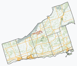
The Municipality of Trent Hills is a township municipality [1] in Northumberland County in Central Ontario, Canada. [1] [3] [4] [5] [6] It is on the Trent River [4] [5] and was created in 2001 through the amalgamation of the municipalities of Campbellford/Seymour, Percy Township and Hastings. [3] Thereafter it was known in brief as Campbellford/Seymour, Percy, Hastings.

Contents

Communities

The municipality was historically four separate administrative subdivisions: the former town of Campbellford; the former village of Hastings; Seymour Township; and Percy Township. The latter two retain the status of geographic townships. [3]

There are three population centres in Trent Hills: Campbellford; Hastings; and the former village of Warkworth, formerly the municipal seat of Percy Township prior to the amalgamation of Trent Hills. Smaller communities within the municipality include Allan Mills, Brickley, Burnbrae, Connellys, Crowe Bridge, Dartford, English Line, Godolphin, Green Acres, Healey Falls, Hoards Station, Kellers, Menie, Meyersburg, Norham, Percy Boom, Pethericks Corners, Stanwood, Sunnybrae, Trent River, West Corners, Westview and Woodland.

Demographics

In the 2021 Census of Population conducted by Statistics Canada, Trent Hills had a population of 13,861 living in 5,903 of its 7,057 total private dwellings, a change of 7.4% from its 2016 population of 12,900. With a land area of 513.85 km2 (198.40 sq mi), it had a population density of 27.0/km2 (69.9/sq mi) in 2021. [7]

Canada census – Trent Hills community profile
2016 2011
Population12,900 (2.3% from 2011)12,604 (2.9% from 2006)
Land area511.95 km2 (197.67 sq mi)511.90 km2 (197.65 sq mi)
Population density25.2/km2 (65/sq mi)24.6/km2 (64/sq mi)
Median age53.5 (M: 52.9, F: 53.9)51.0 (M: 50.6, F: 51.4)
Private dwellings6883 (total) 6613 (total) 
Median household income
References: 2016 [2] 2011 [8] earlier [9] [10]

Mother tongue: [2]

Trent Hills population history
YearPop.±%
1996 12,437    
2001 12,569+1.1%
2006 12,247−2.6%
2011 12,604+2.9%
2016 12,900+2.3%
[11]

Government

The chart below shows the structure of the municipal government of Trent Hills. These politicians were elected as of the 2014 municipal election. Following the death of Hector Macmillan who had served as an elected official from 2003 until 2017, [12] deputy mayor Bob Crate was elected mayor and Rosemary Kelleher-MacLennan deputy mayor by council. [13]

MayorWard 1 – Campbellford/SeymourWard 2 – PercyWard 3 – Hastings
Robert (Bob) CrateCatherine ReddenRick EnglishMike Metcalf
Rosemary Kelleher-MacLennan (deputy mayor)Ken Tully
William (Bill) J. Thompson

The Member of Parliament for the riding of Northumberland—Peterborough South is Philip Lawrence of the Conservative Party of Canada. [14] The Member of Provincial Parliament for Northumberland—Peterborough South (provincial electoral district) is David Piccini of the Progressive Conservative Party of Ontario. [15]

See also

Related Research Articles

<span class="mw-page-title-main">Northumberland County, Ontario</span> County in Ontario, Canada

Northumberland County is an upper-tier municipality situated on the north shore of Lake Ontario, east of Toronto in Central Ontario. The Northumberland County headquarters are located in Cobourg.

<span class="mw-page-title-main">Peterborough County</span> County in Ontario, Canada

Peterborough County is located in Southern Ontario, Canada. The county seat is The City of Peterborough, which is independent of the county.

<span class="mw-page-title-main">Kawartha Lakes</span> City in Ontario, Canada

The City of Kawartha Lakes is a unitary municipality in Central Ontario, Canada. It is a municipality legally structured as a single-tier city; however, Kawartha Lakes is the size of a typical Ontario county and is mostly rural. It is the second largest single-tier municipality in Ontario by land area.

<span class="mw-page-title-main">Hastings County</span> County in Ontario, Canada

Hastings County is located in the province of Ontario, Canada. Geographically, it is located on the border of Eastern Ontario and Central Ontario. Hastings County is the second-largest county in Ontario, after Renfrew County, and its county seat is Belleville, which is independent of Hastings County. Hastings County has trademarked the moniker "Cheese Capital of Canada".

<span class="mw-page-title-main">Essa, Ontario</span> Township in Ontario, Canada

Essa is a township in Ontario, Canada, west and south of the city of Barrie in Simcoe County. It is bounded by County Road 90 to its north, County Road 27 to its east, and Ontario Highway 89 to its south. The township is about 100 kilometres (62 mi) from Toronto. The township is well known for its agriculture industry, particularly potato farming. Nearby CFB Borden brings a strong military presence to the area as well, including a high number of Francophone families.

<span class="mw-page-title-main">Renfrew County</span> County in Ontario, Canada

Renfrew County is a county in the Canadian province of Ontario. It stands on the west bank of the Ottawa River. There are 17 municipalities in the county.

<span class="mw-page-title-main">Tweed, Ontario</span> Municipality in Ontario, Canada

Tweed is a municipality located in central-eastern Ontario, Canada, in Hastings County.

<span class="mw-page-title-main">Marmora and Lake</span> Municipality in Ontario, Canada

Marmora and Lake is a municipality along the banks of Crowe River and Beaver Creek, about midway between Toronto and Ottawa on provincial Highway 7 in Hastings County in Central Ontario, Canada. It is home to over 4,000 full time and seasonal residents, many of whom enjoy outdoor recreation and relaxation on Crowe Lake.

<span class="mw-page-title-main">Asphodel–Norwood</span> Township municipality in Ontario, Canada

Asphodel–Norwood is a lower tier township municipality in Peterborough County in Central Ontario, Canada, with a 2021 population of 4,658. The land on which the township is situated is the traditional territory of the Mississauga, and became open to European colonization following its survey in 1820. The site that would become Norwood was settled in 1823, and it was incorporated as a village in 1878. The township, in its current form, was created in 1998 by the reunification of the village of Norwood with the surrounding township of Asphodel.

<span class="mw-page-title-main">Northumberland—Quinte West (federal electoral district)</span> Federal electoral district in Ontario, Canada

Northumberland—Quinte West was a federal electoral district in Ontario, Canada, that was represented in the House of Commons of Canada from 2004 to 2013. Its population in 2001 was 118,906. Following the Canadian federal electoral redistribution, 2012, the electoral district was dissolved into the ridings of Northumberland—Peterborough South and Bay of Quinte.

<span class="mw-page-title-main">Campbellford</span> Unincorporated community in Ontario, Canada

Campbellford is an unincorporated place and former town in Northumberland County, Ontario, Canada, in the township municipality of Trent Hills. It lies approximately midway between Toronto and Ottawa. It is situated on both the Trent-Severn Waterway and the Trans Canada Trail. It can be reached from Highway 401 by exiting at Brighton and going north on County Road 30. It can also be reached from Highway 7 at the Havelock exit going south. Campbellford is surrounded by prime agricultural land which is home to many farms. In recent years, some of the town's agricultural sector has diversified into non-traditional areas such as bison farming, rare breeds farming and there are many horse farms in the area. The town has a farmers market that is open two days a week in the summer.

<span class="mw-page-title-main">Trent Lakes</span> Municipality in Ontario, Canada

The Municipality of Trent Lakes is a lower-tier township in the rural, mostly wooded northern section of Peterborough County, Ontario, Canada. The municipality has a primarily cottage and tourist industry based economy but has grown year round residency due to its commute distance to the Greater Toronto Area.

<span class="mw-page-title-main">Warkworth, Ontario</span> Place in Ontario, Canada

Warkworth is a community in the municipality of Trent Hills, Northumberland in Central Ontario, Canada. Originally known as Percy Mills, the village of Warkworth was incorporated in 1857, and became part of Trent Hills when the latter was formed in 2001. Warkworth is named after Warkworth, Northumberland.

Northumberland East was a federal electoral district represented in the House of Commons of Canada from 1867 to 1917. It was located in the province of Ontario. It was created by the British North America Act of 1867.

<span class="mw-page-title-main">Alnwick/Haldimand</span> Township in Ontario, Canada

The Township of Alnwick/Haldimand is a township in central Ontario, Canada, in Northumberland County, situated between Lake Ontario and Rice Lake. It was formed in 2001 by the merger of Alnwick Township in the north and Haldimand Township in the south. Alderville First Nation is an autonomously governed First Nation contained within the township boundaries, in two non-contiguous sections along County Roads 45 and 18.

<span class="mw-page-title-main">Hastings, Ontario</span> Village in Ontario, Canada

Hastings is a community within the municipality of Trent Hills, Northumberland County, in the province of Ontario, Canada. It is situated on the Trent-Severn Waterway and the Trans Canada Trail in what is considered to be Ontario's "cottage country". It can be reached from Highway 401 by exiting at exit 474 at Cobourg and going north on County Road 45. It can be reached from Highway 7 at the Norwood exit going south.

Seymour is a former incorporated township and now a geographic township located in Northumberland County, Ontario, Canada. It is currently part of the Municipality of Trent Hills.

Percy, Ontario was a former incorporated township and now a geographic township located in Northumberland County, Ontario, Canada. It is currently part of the Municipality of Trent Hills.

<span class="mw-page-title-main">Wollaston, Ontario</span> Township in Ontario, Canada

Wollaston is an incorporated township in Hastings County, Ontario, Canada. The township had a population of 670 in the Canada 2016 Census.

Percy Creek is a stream in the municipalities of Trent Hills and Alnwick/Haldimand, Northumberland County, in Central Ontario, Canada. It is in the Great Lakes Basin and is a right tributary of the Trent River. Percy Creek is named after Elizabeth Percy, Duchess of Northumberland.

References

  1. 1 2 3 "Trent Hills". Geographical Names Data Base . Natural Resources Canada . Retrieved 2018-08-28.
  2. 1 2 3 4 "2016 Community Profiles". 2016 Canadian Census . Statistics Canada. August 12, 2021. Retrieved 2017-11-25.
  3. 1 2 3 4 Restructured municipalities – Ontario map #5 (Map). Restructuring Maps of Ontario. Ontario Ministry of Municipal Affairs and Housing. 2006. Retrieved March 20, 2018.
  4. 1 2 "Toporama". Atlas of Canada . Natural Resources Canada. 12 September 2016. Retrieved 2018-08-28.
  5. 1 2 "Ontario Geonames GIS (on-line map and search)". Ontario Ministry of Natural Resources and Forestry. 2014. Retrieved 2018-08-28.
  6. Map 6 (PDF) (Map). 1 : 700,000. Official road map of Ontario. Ministry of Transportation of Ontario. 2018-01-01. Retrieved 2018-08-28.
  7. "Population and dwelling counts: Canada, provinces and territories, census divisions and census subdivisions (municipalities), Ontario". Statistics Canada. February 9, 2022. Retrieved March 31, 2022.
  8. "2011 Community Profiles". 2011 Canadian Census . Statistics Canada. March 21, 2019. Retrieved 2012-03-12.
  9. "2006 Community Profiles". 2006 Canadian Census . Statistics Canada. August 20, 2019.
  10. "2001 Community Profiles". 2001 Canadian Census . Statistics Canada. July 18, 2021.
  11. Statistics Canada: 1996, 2001, 2006, 2011, 2016 Census
  12. Pengelly, Jeanne (2017-10-11). "Longtime Trent Hills mayor Hector Macmillan loses battle with cancer". Global News. Retrieved October 11, 2017.
  13. Foot, David (2017-11-09). "Crate to succeed Macmillan as Mayor of Trent HillsCrate to succeed Macmillan as Mayor of Trent Hills". Quinte News. Retrieved 2024-02-12.
  14. "Members of the House of Commons". National Parliament website. Retrieved 2009-01-17.
  15. "Current MPPs". Ontario Parliament website. Retrieved 2017-11-25.