Havelock-Belmont-Methuen

Last updated

Havelock-Belmont-Methuen
Township of Havelock-Belmont-Methuen
Havelock ON.JPG
Municipal office in Havelock
Peterborough locator map 2021.svg
Red pog.svg
Havelock-Belmont-Methuen
Canada Southern Ontario location map 2.png
Red pog.svg
Havelock-Belmont-Methuen
Coordinates: 44°34′N77°54′W / 44.567°N 77.900°W / 44.567; -77.900
CountryFlag of Canada (Pantone).svg  Canada
ProvinceFlag of Ontario.svg  Ontario
County Peterborough
Settled1823
Incorporated1998
Government
  TypeTownship
  MayorJim Martin [1]
  Deputy MayorDavid Gerow [1]
  Prov. riding Peterborough
  Federal riding Peterborough
Area
[2]
  Land542.73 km2 (209.55 sq mi)
Population
 (2011) [2]
  Total4,530
  Density8.3/km2 (21/sq mi)
Time zone UTC-5 (EST)
  Summer (DST) UTC-4 (EDT)
Postal Code
K0L 1Z0
Area code(s) 705, 249
Website www.hbmtwp.ca

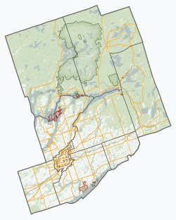
Havelock-Belmont-Methuen is a township in central-eastern Ontario, Canada, in Peterborough County. On January 1, 1998, Belmont and Methuen Township amalgamated with the Village of Havelock to form what is now Havelock-Belmont-Methuen.

Contents

History

The region's colonial history began with an influx of settlers after Belmont and Methuen Township was surveyed in 1823. The community of Havelock was incorporated as an independent village in 1892. [3]

Havelock was named after the British general, Sir Henry Havelock.

Early settlers built their homes in an area of dense forests and numerous lakes and rivers within the rocky Canadian Shield. They survived by means of fishing, logging, and farming.

By 1869, Blairton, in the Township of Belmont County, was a village with a population of 500. The village was near the richest iron mines in the Dominion. Miners and laborers were in great demand. The village was a station of the Cobourg, Peterborough & Marmora Railway. The land in the vicinity was almost all taken up. There were stages to Norwood and Marmora. [4]

Later, in the nineteenth century and continuing to the present, mining became an important economic activity. Early businesses in Havelock included a post office, bakery, and a blacksmith were located south of the current village on high ground at the intersection of County Road 30 and Old Norwood Road. In 1881, the Canadian Pacific Railway surveyed a right-of-way through the area north of Havelock and a year later laid rails and surveyed and filled the swampy land to make room for a larger village. [3] The current village of Havelock was developed on the filled land by the tracks north of the former village site and was incorporated in 1892. In the fall of 1884, the first full passenger train stopped at Havelock, from Toronto on its way to Smith's Falls. In 1961, the Havelock branch of the Toronto-Dominian Bank was robbed, in what was described by the Toronto Star in 2021 as "one of the biggest bank robberies in Canadian history." [5]

Havelock was an important freight depot from the 1880s to the 1960s. The railway is now run by Canadian Pacific as Kawartha Lakes Railway and its activity today consists of transporting nepheline syenite and crushed basalt rock from two mines north of Havelock operated by Unimin. [3] In 1998, the village of Havelock was amalgamated with the township of Belmont-Methuen to form the current township of Havelock-Belmont-Methuen.

Historic School

The old school, a two-story building now known as the Hilltop Apartments, stands at the northwest corner of Oak Street and Mathison Street, Havelock. In 1890 to 1963 Havelock area students attended this school which in 1937 was renamed Havelock High School. In 1952 Havelock High School students were transferred to the new Norwood District High School in the neighbouring town of Norwood, Ontario. In 1963 Havelock Public School students were transferred to the new Havelock Public School, east of the Havelock Community Centre. In 1963 the school building was sold and converted to apartments. [3] In September, 2005 the Havelock High School Reunion Committee placed in front of the apartments a commemorative plaque bolted to a large red granite stone from a local quarry.

Railway Station

The Canadian Pacific Railway (CPR) station on Ottawa Street (Hwy #7) in Havelock was built in 1929. [3] It was designated in 1991 as a Heritage Railway Station by the Historic Sights and Monuments Board, Parks Canada. In 2004 the Station was purchased and renovated to accommodate restaurants. [3]

Local Government

The town's council includes a Mayor, Deputy Mayor, and three Councillors elected on the basis of one per ward. One other representative is elected to join the mayor at meetings of Peterborough County Council. The members of council elected in 2022 are: [6]

Mayor: Jim Martin

Deputy Mayor: Hart Webb

Councillors:

Communities

The township comprises the communities of Ashby Mill, Belmont Lake, Blairton (ghost town), Blairton Station, Blue Mountain, Chase Corners, Cordova Mines, Freeman Corners, Jack Lake, Havelock, Kasshabog Lake, MacDonald Bay, Nephton (ghost town), Oak Lake, Preneveau, Rockdale, Round Lake, Rush Point and Vansickle.

Havelock is the site of an annual country music festival, the Havelock Country Jamboree, in August. Havelock Country Jamboree celebrated its 30th Anniversary in the summer of 2019.

Demographics

In the 2021 Census of Population conducted by Statistics Canada, Havelock-Belmont-Methuen had a population of 5,083 living in 2,234 of its 3,856 total private dwellings, a change of 12.2% from its 2016 population of 4,530. With a land area of 529.35 km2 (204.38 sq mi), it had a population density of 9.6/km2 (24.9/sq mi) in 2021. [7]

Canada census – Havelock-Belmont-Methuen community profile
2021 2016 2011
Population5,083 (+12.2% from 2016)4,530 (+0.2% from 2011)4,523 (-2.5% from 2006)
Land area529.35 km2 (204.38 sq mi)542.73 km2 (209.55 sq mi)543.59 km2 (209.88 sq mi)
Population density9.6/km2 (25/sq mi)8.3/km2 (21/sq mi)8.3/km2 (21/sq mi)
Median age54.4 (M: 54.4, F: 54.8)54.4 (M: 54.1, F: 54.7)
Private dwellings3,856 (total)  2,234 (occupied)3,936 (total) 3,747 (total) 
Median household income$71,000$54,571
References: 2021 [8] 2016 [9] 2011 [10] earlier [11] [12]
Belmont Belmont ON.JPG
Belmont
Railway station in Havelock, 2007 Railway Station, Havelock, Ontario, Canada.jpg
Railway station in Havelock, 2007

Mother tongue: [13]

Havelock-Belmont-Methuen historical populations
YearPop.±%
1996 4,327    
2001 4,479+3.5%
2006 4,637+3.5%
2011 4,523−2.5%
2016 4,530+0.2%
[14] [10] [2]
2006 population would have been 6,812 using 2011 boundaries

See also

Related Research Articles

<span class="mw-page-title-main">Cobourg</span> Town in Ontario, Canada

Cobourg is a town in the Canadian province of Ontario, located in Southern Ontario 95 km (59 mi) east of Toronto and 62 km (39 mi) east of Oshawa. It is the largest town in and seat of Northumberland County. Its nearest neighbour is Port Hope, 7 km (4 mi) to the west. It is located along Highway 401 and the former Highway 2. To the south, Cobourg borders Lake Ontario. To the north, east and west, it is surrounded by Hamilton Township.

<span class="mw-page-title-main">Peterborough County</span> County in Ontario, Canada

Peterborough County is located in Southern Ontario, Canada. The county seat is The City of Peterborough, which is independent of the county.

<span class="mw-page-title-main">Kawartha Lakes</span> City in Ontario, Canada

The City of Kawartha Lakes is a unitary municipality in Central Ontario, Canada. It is a municipality legally structured as a single-tier city; however, Kawartha Lakes is the size of a typical Ontario county and is mostly rural. It is the second largest single-tier municipality in Ontario by land area.

<span class="mw-page-title-main">Hastings County</span> County in Ontario, Canada

Hastings County is located in the province of Ontario, Canada. Geographically, it is located on the border of Eastern Ontario and Central Ontario. Hastings County is the second-largest county in Ontario, after Renfrew County, and its county seat is Belleville, which is independent of Hastings County. Hastings County has trademarked the moniker "Cheese Capital of Canada".

<span class="mw-page-title-main">Selwyn, Ontario</span> Township in Ontario, Canada

Selwyn is a township in central-eastern Ontario, Canada, located in Peterborough County.

<span class="mw-page-title-main">Tweed, Ontario</span> Municipality in Ontario, Canada

Tweed is a municipality located in central-eastern Ontario, Canada, in Hastings County.

<span class="mw-page-title-main">Tay Valley, Ontario</span> Township in Ontario, Canada

Tay Valley is a township in eastern Ontario, Canada, on the Tay River in the southwest corner of Lanark County, adjacent to the United Counties of Leeds and Grenville and Frontenac County. The township administrative offices are located in Glen Tay.

<span class="mw-page-title-main">Marmora and Lake</span> Municipality in Ontario, Canada

Marmora and Lake is a municipality along the banks of Crowe River and Beaver Creek, about midway between Toronto and Ottawa on provincial Highway 7 in Hastings County in Central Ontario, Canada. It is home to over 4,000 full time and seasonal residents, many of whom enjoy outdoor recreation and relaxation on Crowe Lake.

<span class="mw-page-title-main">Asphodel–Norwood</span> Township municipality in Ontario, Canada

Asphodel–Norwood is a lower tier township municipality in Peterborough County in Central Ontario, Canada, with a 2021 population of 4,658. The land on which the township is situated is the traditional territory of the Mississauga, and became open to European colonization following its survey in 1820. The site that would become Norwood was settled in 1823, and it was incorporated as a village in 1878. The township, in its current form, was created in 1998 by the reunification of the village of Norwood with the surrounding township of Asphodel.

<span class="mw-page-title-main">Crowe River</span> River in Ontario, Canada

The Crowe River is a river in the counties of Haliburton, Hastings, Northumberland and Peterborough in southern Ontario, Canada. It is in the Lake Ontario drainage basin and is a tributary of the Trent River.

<span class="mw-page-title-main">Marmora, Ontario</span>

Marmora is the largest community in the Municipality of Marmora and Lake in Hastings County, Ontario, Canada. It is located on the Crowe River and along Highway 7 between Havelock to the west and Madoc to the east, about the halfway point between Ottawa and Toronto.

<span class="mw-page-title-main">Peterborough—Kawartha</span> Federal electoral district in Ontario, Canada

Peterborough—Kawartha is a federal electoral district in Ontario, Canada, that has been represented in the House of Commons of Canada since 1953. Prior to the 2015 election, the riding was known as Peterborough.

Peterborough East was a federal electoral district represented in the House of Commons of Canada from 1867 to 1925. It was located in the province of Ontario. It was created by the British North America Act of 1867 which divided the County of Peterborough into two ridings.

<span class="mw-page-title-main">Dysart et al</span> United township in Ontario, Canada

The United Townships of Dysart, Dudley, Harcourt, Guilford, Harburn, Bruton, Havelock, Eyre and Clyde, commonly known as the Municipality of Dysart et al, is a municipality in Haliburton County in Central Ontario, Canada. The original townships were of the Canadian Land and Emigration Company.

<span class="mw-page-title-main">Stirling-Rawdon</span> Township in Ontario, Canada

Stirling-Rawdon is a township in the Canadian province of Ontario, located in Hastings County. It was formed on January 1, 1998, through the amalgamation of Rawdon Township with the Village of Stirling. Stirling was named the 2012 Kraft Hockeyville winner, after gaining more than 3.9 million votes.

<span class="mw-page-title-main">North Kawartha</span> Township in Ontario, Canada

North Kawartha is a township in northern Peterborough County, Ontario, Canada.

<span class="mw-page-title-main">Wollaston, Ontario</span> Township in Ontario, Canada

Wollaston is an incorporated township in Hastings County, Ontario, Canada. The township had a population of 670 in the Canada 2016 Census.

Deloro is a community in geographic Marmora Township in the Municipality of Marmora and Lake, Hastings County in Central Ontario, Canada. Deloro is about 200 kilometres (120 mi) southwest of Ottawa and 65 kilometres (40 mi) east of Peterborough. The Deloro Mine site sits along the banks of the Moira River, along the east side of the community. During the gold rush days, after striking gold in Eldorado in 1866, prospectors built at least 25 shafts on the area now known as the Deloro Mine Site.

<span class="mw-page-title-main">Cobourg and Peterborough Railway</span> Railway line in Ontario, Canada

The Cobourg and Peterborough Railway (C&PRy) was one of the first railway lines to be built in Central Ontario, Canada. The line was initially considered in 1831 as a way to bring the products from the burgeoning area around Peterborough to markets on Lake Ontario through the port in the town of Cobourg. Before the railway the only means of travel was by stage coach lines between larger populated areas overland or by boat. A series of problems, including the Upper Canada Rebellion and the Panic of 1837, meant that construction did not begin until 1853, reaching Peterborough in 1854.

Elections were held in Peterborough County, Ontario, on October 24, 2022, in conjunction with municipal elections across the province.

References

  1. 1 2 "2018 Official Election Results". Township of Havelock-Belmont-Methuen. Retrieved 2018-11-29.
  2. 1 2 3 "Census Profile, 2016 Census: Havelock-Belmont-Methuen". Statistics Canada. Retrieved June 29, 2019.
  3. 1 2 3 4 5 6 Hunter, Harold R. (1993). Havelock Through the Years to Centennial. Belleville, Ontario: Mika Pub. Co. p. 148. ISBN   0-921341-46-6.
  4. The province of Ontario gazetteer and directory. H. McEvoy Editor and Compiler, Toronto : Robertson & Cook, Publishers, 1869
  5. "BEHIND THE CRIMES: Bank bandits hid in basement in one of Canada's biggest robberies at the time". The Toronto Star. 2021-08-19. ISSN   0319-0781 . Retrieved 2022-06-29.
  6. "2018 Official Election Results". hbmtwp.ca/. October 22, 2018. Retrieved November 29, 2018.
  7. "Population and dwelling counts: Canada, provinces and territories, census divisions and census subdivisions (municipalities), Ontario". Statistics Canada. February 9, 2022. Retrieved April 2, 2022.
  8. "2021 Community Profiles". 2021 Canadian Census . Statistics Canada. February 4, 2022. Retrieved 2023-10-19.
  9. "2016 Community Profiles". 2016 Canadian Census . Statistics Canada. August 12, 2021. Retrieved 2019-06-29.
  10. 1 2 "2011 Community Profiles". 2011 Canadian Census . Statistics Canada. March 21, 2019. Retrieved 2012-03-01.
  11. "2006 Community Profiles". 2006 Canadian Census . Statistics Canada. August 20, 2019.
  12. "2001 Community Profiles". 2001 Canadian Census . Statistics Canada. July 18, 2021.
  13. Statistics Canada 2006 Census - Havelock-Belmont-Methuen community profile
  14. Statistics Canada: 1996, 2001, 2006