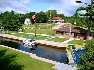
The Trent–Severn Waterway is a 386-kilometre-long (240 mi) canal route connecting Lake Ontario at Trenton to Georgian Bay, Lake Huron, at Port Severn. Its major natural waterways include the Trent River, Otonabee River, Kawartha Lakes, Lake Simcoe, Lake Couchiching and Severn River. Its scenic, meandering route has been called "one of the finest interconnected systems of navigation in the world".
Peterborough is a city on the Otonabee River in Ontario, Canada, about 125 kilometres northeast of Toronto. According to the 2021 Census, the population of the City of Peterborough was 83,651. The population of the Peterborough Census Metropolitan Area (CMA), which includes the surrounding Townships of Selwyn, Cavan Monaghan, Otonabee-South Monaghan, and Douro-Dummer, was 128,624 in 2021. In 2021, Peterborough ranked 32nd among the country's 41 census metropolitan areas according to the CMA in Canada. The current mayor of Peterborough is Jeff Leal.
Trenton is a large community in Central Ontario in the municipality of Quinte West, Ontario, Canada. Located on the Bay of Quinte, it is the starting point for the Trent-Severn Waterway, which continues northwest to Peterborough and eventually Port Severn on Georgian Bay.

Coboconk, often shortened to Coby, is a community in the city of Kawartha Lakes, in the south-central portion of the Canadian province of Ontario. The village lies at the junction of Highway 35 and former Highway 48, on the northern tip of Balsam Lake, the highest point on the Trent–Severn Waterway. Coboconk has a prominent role in the logging, limestone, and tourism industries of the Kawartha Lakes region over the past 150 years.

Northumberland County is an upper-tier municipality situated on the north shore of Lake Ontario, east of Toronto in Central Ontario. The Northumberland County headquarters are located in Cobourg.

Central Ontario is a secondary region of Southern Ontario in the Canadian province of Ontario that lies between Georgian Bay and the eastern end of Lake Ontario.
The Municipality of Trent Lakes is a lower-tier township in the rural, mostly wooded northern section of Peterborough County, Ontario, Canada. The municipality has a primarily cottage and tourist industry based economy but has grown year round residency due to its commute distance to the Greater Toronto Area.

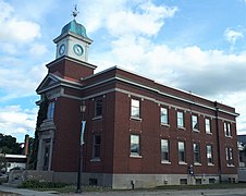
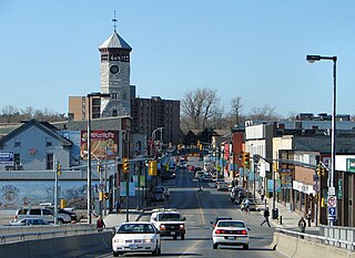
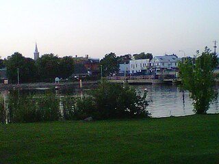
The Municipality of Trent Hills is a township municipality in Northumberland County in Central Ontario, Canada. It is on the Trent River and was created in 2001 through the amalgamation of the municipalities of Campbellford/Seymour, Percy Township and Hastings. Thereafter it was known in brief as Campbellford/Seymour, Percy, Hastings.

The Crowe River is a river in the counties of Haliburton, Hastings, Northumberland and Peterborough in southern Ontario, Canada. It is in the Lake Ontario drainage basin and is a tributary of the Trent River.

Bobcaygeon is a community on the Trent–Severn Waterway in the City of Kawartha Lakes, east-central Ontario, Canada.

Warkworth is a community in the municipality of Trent Hills, Northumberland in Central Ontario, Canada. Originally known as Percy Mills, the village of Warkworth was incorporated in 1857, and became part of Trent Hills when the latter was formed in 2001. Warkworth is named after Warkworth, Northumberland.
Severn Bridge is a small community in the Town of Gravenhurst, of the District of Muskoka in the province of Ontario, Canada. It is located approximately 160 kilometres north of Toronto, on the Severn River, roughly halfway between Orillia and Gravenhurst. Its population was around 300 in 1992. It was founded in the nineteenth century. The village is served by important road, rail, water links and its postal services and rural route are handled in Washago, Ontario.
Hastings is a community within the municipality of Trent Hills, Northumberland County, in the province of Ontario, Canada. It is situated on the Trent-Severn Waterway and the Trans Canada Trail in what is considered to be Ontario's "cottage country". It can be reached from Highway 401 by exiting at exit 474 at Cobourg and going north on County Road 45. It can be reached from Highway 7 at the Norwood exit going south.
Seymour is a former incorporated township and now a geographic township located in Northumberland County, Ontario, Canada. It is currently part of the Municipality of Trent Hills.
Rosedale is a Dispersed Rural Community and unincorporated place located in the city of Kawartha Lakes, Ontario, Canada, 29 kilometres (18 mi) north-west of Lindsay. It is partly in geographic Fenelon Township and partly in Somerville Township, and is on the Rosedale River, part of the Trent–Severn Waterway, where that river drains Balsam Lake on its way to Cameron Lake.
The Gull River is a river in Algonquin Highlands and Dysart et al, Haliburton County and the single-tier municipality of Kawartha Lakes in south-central Ontario, Canada. It is in the Trent River and Lake Ontario drainage basins, and flows from southern Algonquin Provincial Park to Balsam Lake on the Trent–Severn Waterway.
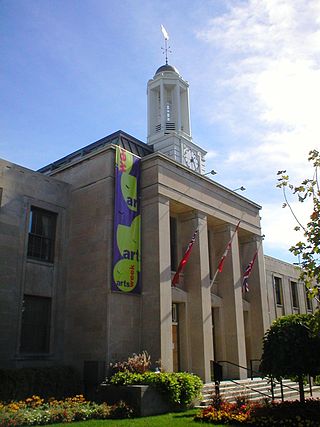
The Campbellford Memorial Hospital is an Ontario class C and class G 34-bed hospital in the community of Campbellford, municipality of Trent Hills, Northumberland County in central Ontario, Canada. It opened in 1953, is part of the Central East LHIN and is the largest employer in the community. The emergency department had 20,448 visits between April 2009 and Mar 2010
King's Highway 30, commonly referred to as Highway 30, was a provincially maintained highway in the Canadian province of Ontario. The 51.1-kilometre (31.8 mi)-long route connected Highway 2 in Brighton with Highway 7 in Havelock via Campbellford. Established in 1930, the highway initially travelled only as far north as Campbellford. Alongside the construction of Highway 7 between Peterborough and Perth, Highway 30 was extended north to Havelock in 1934. The route remained generally consistent until 1998, when it was decommissioned and transferred to Northumberland County and Peterborough County. Both counties redesignated their portion of the former highway as County Road 30.
King's Highway 45, commonly referred to as Highway 45, was a provincially maintained highway in the Canadian province of Ontario. The 54.1-kilometre-long (33.6 mi) route connected Highway 2 in downtown Cobourg with Highway 7 in Norwood. In addition to the towns at either end, it bisected the communities of Baltimore, Fenella, Alderville, Roseneath and Hastings.

Ferris Provincial Park is a provincial park in northeastern Northumberland County in Ontario, Canada. The park occupies an area of 1.98 km2 (0.76 sq mi) next to the Trent River in Campbellford, Ontario. Within the park are 10 kilometres of hiking and mountain biking trails and a suspension bridge over Ranney Gorge. Two campground areas offer 163 sites for car camping. The park has a boat launch facility available for launching into the Trent River.