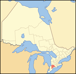
Elgin County

Last updated • 1 min readFrom Wikipedia, The Free Encyclopedia
Elgin County
County of Elgin
Motto: 
"Progressive by Nature!"
Map of Ontario ELGIN.svg
Location of Elgin County in Canada
Coordinates: 42°45′N81°10′W / 42.750°N 81.167°W / 42.750; -81.167
Country Flag of Canada (Pantone).svg Canada
Province Flag of Ontario.svg  Ontario
Organized1851 from Suffolk County
County seat St. Thomas
Municipalities
List
Area
[1]
  Land1,845.41 km2 (712.52 sq mi)
Population
 (2021) [1]
  Total51,912
Time zone UTC-5 (EST)
  Summer (DST) UTC-4 (EDT)
Area code 519 / 226 / 548
Website www.elgincounty.ca

Elgin County ( /ˈɛlɡɪn/ EL-ghin) is a county composed of seven municipalities in Ontario, Canada with a 2021 population of 51,912. Its population centres are Aylmer, Port Stanley, Belmont, Dutton and West Lorne. The county seat is St. Thomas, which is separated from the county but within its geographic boundary.

Contents

Subdivisions

Elgin County is composed of seven incorporated municipalities (in order of population):

The City of St. Thomas is geographically within the boundaries of Elgin County and part of the Elgin census division, but is separated from county administration.

Historical townships

Townships of Elgin County (1877) Townships of Elgin County, Ontario.jpg
Townships of Elgin County (1877)

Originally Elgin County was once part of Middlesex County, [2] which was reorganized as the United Counties of Middlesex and Elgin in 1851. [3] Elgin was named after Lord Elgin, who was Governor-General of Canada at the time.

The County was separated from Middlesex in September 1853. [4]

Historic townships of Elgin County [5]
TownshipAreaDescription
Aldborough 75,197 acres (117 sq mi; 304 km2)In the early days it had a forest of oak, chestnut and black walnut. It was first settled in 1804.
Bayham56,350 acres (88 sq mi; 228 km2)Organized in 1810. It was named for Bayham Abbey in Kent.
Dunwich69,592 acres (109 sq mi; 282 km2)First settled in 1803. During the War of 1812 only twelve families lived in the township. In 1817 a company of Selkirk's Highlander settled in the Township. The Township is named after Dunwich in Suffolk.
Malahide69,181 acres (108 sq mi; 280 km2)Organized in 1810, named for Malahide Castle in Ireland, the former home of Thomas Talbot, patriot of the region. The Township was first settled in 1810.
South Dorchester30,560 acres (48 sq mi; 124 km2)Although surveyed in 1798, it was not settled until 1826.
Southwold72,898 acres (114 sq mi; 295 km2)Opened for settlement in 1797, however the first colonist arrived in 1809. Named for Southwold in Suffolk.
Yarmouth69,181 acres (108 sq mi; 280 km2)Surveyed in 1792 and settled in 1810.
Historical map that includes Elgin County (1875) Atlas of the Dominion. Counties of Middlesex, Elgin, Lambton. Province of Ontario. CTASC.jpg
Historical map that includes Elgin County (1875)

Demographics

Elgin County
YearPop.±%
1996 47,752    
2001 48,250+1.0%
2006 49,241+2.1%
2011 49,556+0.6%
2016 50,069+1.0%
2021 51,912+3.7%
2016 [1] , 2011 [6] , 2006 [7] , earlier [8]

As a census division in the 2021 Census of Population conducted by Statistics Canada, Elgin County had a population of 94,752 living in 37,278 of its 38,889 total private dwellings, a change of

Notable persons from Elgin County

See also

Notes

    Related Research Articles

    <span class="mw-page-title-main">Middlesex County, Ontario</span> County in Ontario, Canada

    Middlesex County is a primarily rural county in Southwestern Ontario, Canada. Landlocked, the county is bordered by Huron and Perth counties on the north, Oxford County on the east, Elgin County on the south, and Chatham-Kent and Lambton County on the west.

    <span class="mw-page-title-main">Aylmer, Ontario</span> Town in Ontario, Canada

    Aylmer is a town in Elgin County in southern Ontario, Canada, just north of Lake Erie, on Catfish Creek. It is 20 kilometres (12 mi) south of Highway 401, and is almost equidistant between the United States cities of Detroit and Buffalo.
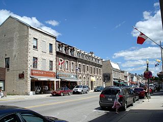
    <span class="mw-page-title-main">Wellington County, Ontario</span> County in Ontario, Canada

    Wellington County is a county located in Southwestern Ontario, Canada and is part of the Greater Golden Horseshoe. The county, made up of two towns and five townships, is predominantly rural in nature. However many of the residents in the southern part of the county commute to urban areas such as Guelph, Kitchener, Waterloo, Brampton, Mississauga, Toronto and Hamilton for employment. The northern part of the county is made up of mainly rural farming communities, except for a few larger towns such as Mount Forest and Arthur. According to the 2021 census, the population of the county was 241,026.

    <span class="mw-page-title-main">Hastings County</span> County in Ontario, Canada

    Hastings County is located in the province of Ontario, Canada. Geographically, it is located on the border of Eastern Ontario and Central Ontario. Hastings County is the second-largest county in Ontario, after Renfrew County, and its county seat is Belleville, which is independent of Hastings County. Hastings County has trademarked the moniker "Cheese Capital of Canada".

    <span class="mw-page-title-main">Renfrew County</span> County in Ontario, Canada

    Renfrew County is a county in the Canadian province of Ontario. It straddles the west bank of the Ottawa River. There are 17 municipalities in the county.

    <span class="mw-page-title-main">Simcoe County</span> County in Ontario, Canada

    Simcoe County is a county located in the central region of Ontario, Canada. The county is located north of the Greater Toronto Area, and forms the north western edge of the Golden Horseshoe. The largest city in the county is Barrie, while the county seat is located in Midhurst.

    <span class="mw-page-title-main">Bruce County</span> County in Ontario, Canada

    Bruce County is a county in Southwestern Ontario, Canada. It has eight lower-tier municipalities with a total 2016 population of 66,491. It is named for James Bruce, 8th Earl of Elgin and 12th Earl of Kincardine, the sixth Governor General of the Province of Canada. The Bruce name is also linked to the Bruce Trail and the Bruce Peninsula.

    <span class="mw-page-title-main">Lanark County</span> County in Ontario, Canada

    Lanark County is a county located in the Canadian province of Ontario. Its county seat is Perth, which was first settled in 1816 and was known as a social and political capital before being over shadowed by what we now know as Ottawa.
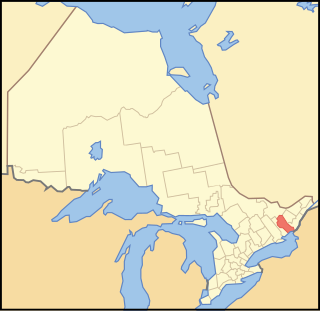
    <span class="mw-page-title-main">Frontenac County</span> County in Ontario, Canada

    Frontenac County is a county and census division of the Canadian province of Ontario. It is located in the eastern portion of Southern Ontario. The city of Kingston is in the Frontenac census division, but is separated from the County of Frontenac.
    <span class="mw-page-title-main">Huron County, Ontario</span> County in Ontario, Canada

    Huron County is a county of the province of Ontario, Canada. It is located on the southeast shore of its namesake, Lake Huron, in the southwest part of the province. The county seat is Goderich, also the county's largest community.

    <span class="mw-page-title-main">Grey County</span> County in Ontario, Canada

    Grey County is a county in the province of Ontario. The county is located in the Southwestern Ontario region, and is a part of the Georgian Triangle. At the time of the Canada 2016 Census the population of the county was 93,830. Owen Sound is the county seat and the largest city in Grey County.

    <span class="mw-page-title-main">Lennox and Addington County</span> County in Ontario, Canada

    Lennox and Addington County is a county and census division of the Canadian province of Ontario. The county seat is Greater Napanee. It is located in the subregion of Southern Ontario named Eastern Ontario.

    <span class="mw-page-title-main">Perth County, Ontario</span> County in Ontario, Canada

    Perth County is a county in the Canadian province of Ontario in Southwestern Ontario, 100 kilometres (62 mi) west of Toronto. Its population centres are Listowel, Mitchell and Milverton. The City of Stratford and the Town of St. Marys are within the Perth census division, but are separate from Perth County. The 2016 population of Perth County was 38,066.

    <span class="mw-page-title-main">Dutton/Dunwich</span> Municipality in Ontario, Canada

    Dutton/Dunwich is a municipality located in western Elgin County in Southwestern Ontario, Canada.

    <span class="mw-page-title-main">Strathroy-Caradoc</span> Municipality in Ontario, Canada

    Strathroy-Caradoc is a municipality located in Southwestern Ontario, Canada. It is 35 kilometres (22 mi) west of London.
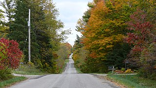
    <span class="mw-page-title-main">Bayham</span> Municipality in Ontario, Canada

    Bayham is a municipality in the southeast corner of Elgin County, Ontario, Canada. It is south of the town of Tillsonburg and Oxford County.

    Malahide is a municipal township in Elgin County in southwestern Ontario, Canada.

    <span class="mw-page-title-main">West Elgin, Ontario</span> Municipality in Ontario, Canada

    West Elgin is a municipality in Elgin County, Ontario, Canada. The township was created on January 1, 1998, through the amalgamation of the former township of Aldborough with the village of West Lorne.
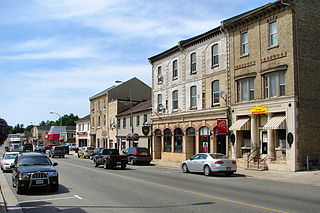
    <span class="mw-page-title-main">Lucan Biddulph</span> Township in Ontario, Canada

    Lucan Biddulph is an incorporated township in southwestern Ontario, Canada. It was formed on January 1, 1999, by amalgamating the Village of Lucan with Biddulph Township. The township had a population of 4,700 people in the Canada 2016 Census, up 8.3% from 4,388 people in 2011, and covers an area of 169.14 km2 of land within Middlesex County.
    References

    1. 1 2 3 "2016 Community Profiles". 2016 Canadian census . Statistics Canada. August 12, 2021.
    2. An Act for abolishing the Territorial Division of Upper-Canada into Districts, and for providing temporary Unions of Counties for Judicial and other purposes, and for the future dissolutions of such Unions, as the increase of wealth and population may require , S.Prov.C. 1849, c. 78, Sch. C
    3. An Act to make certain alterations in the Territorial Divisions of Upper Canada , S.Prov.C. 1851, c. 5, Sch. A, par. 35-36; Sch. B
    4. "Proclamation". Canada Gazette . XII (29): 1452–1453.
    5. Middleton, Jesse Edgar; Landon, Fred (1927). Province of Ontario: A History 1615 to 1927 . Toronto: Dominion Publishing Company.
    6. "2011 Community Profiles". 2011 Canadian census . Statistics Canada. March 21, 2019.
    7. "2006 Community Profiles". 2006 Canadian census . Statistics Canada. August 20, 2019.
    8. "2001 Community Profiles". 2001 Canadian census . Statistics Canada. July 18, 2021.
    9. "Population and dwelling counts: Canada and census divisions". Statistics Canada. February 9, 2022. Retrieved April 2, 2022.