Southwold, Ontario

Last updated

Southwold, Ontario
Township of Southwold
Southwold ON.JPG
Canada Southern Ontario location map 2.png
Red pog.svg
Southwold, Ontario
Coordinates: 42°45′N81°19′W / 42.750°N 81.317°W / 42.750; -81.317
Country Canada
Province Ontario
County Elgin
Incorporated1852
Government
  MayorGrant Jones
  Federal riding Elgin—Middlesex—London
  Prov. riding Elgin—Middlesex—London
Area
[1]
  Land301.74 km2 (116.50 sq mi)
Population
 (2016) [1]
  Total4,421
  Density14.7/km2 (38/sq mi)
Time zone UTC-5 (EST)
  Summer (DST) UTC-4 (EDT)
Postal Code
N0L
Area code(s) 519, 226, 548
Website www.southwold.ca

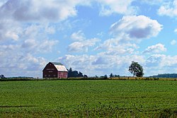
Southwold is a township in Elgin County, in Ontario, Canada, located on the north shore of Lake Erie. It is a rich agricultural zone producing predominantly corn and soybeans. It is part of the London census metropolitan area.

Contents

History

The Southwold Earthworks is located in the township. It is an example of a pre-contact site associated with the indigenous Neutral people. The period of Neutral occupation is dated to approximately 14501550. It was designated as a National Historic Site in 1923. [2]

Southwold was named in 1792 after Southwold in Suffolk, England. The municipality was incorporated in 1852.

Shedden's growth occurred when the Canada Southern Railway was built, bypassing Fingal. Later it was joined by the Pere Marquette railway, boosting Shedden's importance further still. Both railways are now defunct. Talbotville is situated at the intersection of highways 3 & 4, two of the oldest roads in the region.

Southwold was the site of the 2006 Shedden massacre.

Economy

The township is home to the Green Lane Landfill, a large garbage dump site purchased by the City of Toronto in 2007. [3] Toronto began shipping waste to the site in 2010. Southwold was also home of the Ford St. Thomas Assembly plant until its closure in 2011.

Communities

Shedden Shedden ON.JPG
Shedden

Demographics

In the 2021 Census of Population conducted by Statistics Canada, Southwold had a population of 4,851 living in 1,713 of its 1,760 total private dwellings, a change of 9.7% from its 2016 population of 4,421. With a land area of 301.38 km2 (116.36 sq mi), it had a population density of 16.1/km2 (41.7/sq mi) in 2021. [4]

Canada census – Southwold, Ontario community profile
2016 2011
Population4,421 (-1.6% from 2011)4,494 (-4.9% from 2006)
Land area301.74 km2 (116.50 sq mi)301.71 km2 (116.49 sq mi)
Population density14.7/km2 (38/sq mi)14.9/km2 (39/sq mi)
Median age44.7 (M: 44.6, F: 44.8)43.7 (M: 43.2, F: 44.2)
Private dwellings1,655 (total) 1,643 (total) 
Median household income$83,942
References: 2016 [5] 2011 [6] earlier [7] [8]
Historical population
YearPop.±%
19914,351    
1996 4,282−1.6%
2001 4,487+4.8%
2006 4,724+5.3%
2011 4,494−4.9%
2016 4,421−1.6%
[9] [10] [1]
1996 population would have been 4,273 when adjusted to 2001 boundaries

See also

Related Research Articles

<span class="mw-page-title-main">Dawn-Euphemia</span> Township in Ontario, Canada

Dawn-Euphemia is a township in southwestern Ontario, Canada, in Lambton County. Residents primarily are employed by the agricultural industry, or by local industries such as Union Gas distribution centre, along with various smaller agricultural manufacturers or service providers. The township municipal office is located in Rutherford.

<span class="mw-page-title-main">Lake of Bays</span> Township municipality in Ontario, Canada

Lake of Bays is a township municipality within the District Municipality of Muskoka, Ontario, Canada. The township, situated 193 kilometres (120 mi) north of Toronto, is named after the Lake of Bays. During the 2016 census, the township had a population of 3,167 and encompassed 677.91 square kilometres (261.74 sq mi) of land.

<span class="mw-page-title-main">Tay Valley, Ontario</span> Township in Ontario, Canada

Tay Valley is a township in eastern Ontario, Canada, on the Tay River in the southwest corner of Lanark County, adjacent to the United Counties of Leeds and Grenville and Frontenac County. The township administrative offices are located in Glen Tay.

<span class="mw-page-title-main">Havelock-Belmont-Methuen</span> Township in Ontario, Canada

Havelock-Belmont-Methuen is a township in central-eastern Ontario, Canada, in Peterborough County. On January 1, 1998, Belmont and Methuen Township amalgamated with the Village of Havelock to form what is now Havelock-Belmont-Methuen.

<span class="mw-page-title-main">North Stormont</span> Township in Ontario, Canada

North Stormont is a lower tier township in eastern Ontario, Canada in the United Counties of Stormont, Dundas and Glengarry.

<span class="mw-page-title-main">Otonabee–South Monaghan</span> Township in Ontario, Canada

Otonabee–South Monaghan is a township in central-eastern Ontario, Canada, in Peterborough County. The township, located along the Trent–Severn Waterway, was formed on January 1, 1998, through the amalgamation of Otonabee and South Monaghan Townships.

<span class="mw-page-title-main">Elgin County</span> County in Ontario, Canada

Elgin County is a county of the Canadian province of Ontario with a 2016 population of 50,069. Its population centres are St. Thomas, Aylmer, Port Stanley, Belmont, Dutton and West Lorne. The county seat is St. Thomas, which is separated from the county but within its geographic boundary.

<span class="mw-page-title-main">Burk's Falls</span> Village in Ontario, Canada

Burk's Falls is an incorporated village in the Almaguin Highlands region of Parry Sound District, Ontario, Canada, located 265 kilometres (165 mi) north of Toronto and 90 kilometres (56 mi) south of North Bay, Ontario. The village, and the waterfall on the site, were named by David Francis Burk of Oshawa, after he selected the land surrounding the waterfall in the Free Land Grant Act. Burk's Falls is part of the Magnetawan River waterway.

<span class="mw-page-title-main">Tay, Ontario</span> Township in Ontario, Canada

Tay is a township in Central Ontario, Canada, located in Simcoe County in the southern Georgian Bay region. The township was named in 1822 after a pet dog of Lady Sarah Maitland (1792–1873), wife of Sir Peregrine Maitland, Lieutenant Governor of Upper Canada. Two other adjoining townships were also named for her pet dogs, Tiny and Flos.

<span class="mw-page-title-main">Central Elgin</span> Municipality in Ontario, Canada

Central Elgin is a township located in Southwestern Ontario, Canada in Elgin County on Lake Erie. It is part of the London census metropolitan area.

<span class="mw-page-title-main">Dutton/Dunwich</span> Municipality in Ontario, Canada

Dutton/Dunwich is a municipality located in western Elgin County in Southwestern Ontario, Canada.

<span class="mw-page-title-main">Guelph/Eramosa</span> Township in Ontario, Canada

Guelph/Eramosa is a township located in Wellington County, in midwestern Ontario, Canada. It partly encircles the city of Guelph, surrounding it in a continuous arc from approximately northeast to south-southwest of the city. It is part of the Guelph census metropolitan area.

<span class="mw-page-title-main">Bonfield, Ontario</span> Township in Ontario, Canada

Bonfield is a township in northeastern Ontario, Canada, on the Mattawa River in Nipissing District.

<span class="mw-page-title-main">Highlands East, Ontario</span> Township Municipality in Ontario, Canada

Highlands East is a township municipality located in Haliburton County, Ontario, Canada.

<span class="mw-page-title-main">Ignace</span> Township in Ontario, Canada

Ignace is a township in the Kenora District of Northwestern Ontario, Canada, located at Highway 17 and Secondary Highway 599, and on the Canadian Pacific Railway between Thunder Bay and Dryden. It is on the shore of Agimak Lake, and as of 2016, the population of Ignace was 1,202.

<span class="mw-page-title-main">Englehart</span> Town in Ontario, Canada

Englehart is a town in the Canadian province of Ontario, located on the Blanche River in the Timiskaming District.

<span class="mw-page-title-main">Cramahe, Ontario</span> Township in Ontario, Canada

Cramahe is a rural township located in Northumberland County in southern Ontario, Canada. It is situated just off Ontario Highway 401 approximately 140 km East of Toronto. It was named for Hector Theophilus de Cramahé, who was Lieutenant-Governor of the Province of Quebec. The township's seat and largest town is Colborne.

<span class="mw-page-title-main">Southwold Earthworks</span> Archaeological site in Southwold, Ontario, Canada

The Southwold Earthworks is the remains of a pre-contact village site of the Neutral people, occupied about AD 1450 to 1550. The entrance to the site is located on Iona Road, approximately three kilometres south of Iona Ontario, Canada. A double oval ring of raised earthworks surrounds the remains of the village.

<span class="mw-page-title-main">Southwest Middlesex, Ontario</span> Municipality in Ontario, Canada

Southwest Middlesex is a municipality in Middlesex County, Ontario, Canada.

<span class="mw-page-title-main">Spanish, Ontario</span> Town in Ontario, Canada

Spanish is a town in the Canadian province of Ontario, located on Trans-Canada Highway 17 in the Algoma District near the border of the Sudbury District. Formerly known as the Township of Shedden, the municipality adopted its current status and name in 2004, taking the name of its largest community.

References

  1. 1 2 3 "Census Profile, 2016 Census: Southwold, Township". Statistics Canada . Retrieved June 11, 2019.
  2. Southwold Earthworks . Canadian Register of Historic Places .
  3. "Green Lane Landfill". City of Toronto. Archived from the original on March 1, 2017.
  4. "Population and dwelling counts: Canada, provinces and territories, census divisions and census subdivisions (municipalities), Ontario". Statistics Canada. February 9, 2022. Retrieved April 2, 2022.
  5. "2016 Community Profiles". 2016 Canadian Census . Statistics Canada. August 12, 2021. Retrieved 2019-06-11.
  6. "2011 Community Profiles". 2011 Canadian Census . Statistics Canada. March 21, 2019. Retrieved 2012-07-16.
  7. "2006 Community Profiles". 2006 Canadian Census . Statistics Canada. August 20, 2019.
  8. "2001 Community Profiles". 2001 Canadian Census . Statistics Canada. July 18, 2021.
  9. Statistics Canada: 1996, 2001, 2006 census
  10. "Southwold census profile". 2011 Census of Population . Statistics Canada. Retrieved 2012-07-16.