Southwest Middlesex | |
---|---|
Municipality of Southwest Middlesex | |
Wardsville | |
Coordinates: 42°45′N81°42′W / 42.750°N 81.700°W | |
Country | ![]() |
Province | ![]() |
County | Middlesex |
Formed | January 1, 2001 |
Government | |
• Mayor | Allan Mayhew |
• Federal riding | Lambton—Kent—Middlesex |
• Prov. riding | Lambton—Kent—Middlesex |
Area | |
• Land | 427.88 km2 (165.21 sq mi) |
Population (2016) [1] | |
• Total | 5,723 |
• Density | 13.4/km2 (35/sq mi) |
Time zone | UTC-5 (EST) |
• Summer (DST) | UTC-4 (EDT) |
Postal Code | N0L, N0M |
Area code(s) | 519 and 226 |
Website | www.southwestmiddlesex.ca |
Southwest Middlesex is a municipality in Middlesex County, Ontario, Canada.
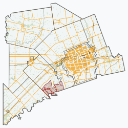
The restructured municipality of Southwest Middlesex was incorporated on January 1, 2001. This amalgamation joined the Village of Glencoe and the Village of Wardsville with the Townships of Ekfrid and Mosa. Southwest Middlesex had a population of 5,723 in the Canada 2016 Census. Southwest Middlesex is located in the southwest corner of Middlesex County, about halfway between London and Chatham.
The township includes the communities of Appin, Ekfrid, Glencoe, Lewis Corners, Macksville, Mayfair, Newbury Station, North Appin Station, North Ekfrid, North Glencoe Station, Riverside, Strathburn, Tait’s Corners, Wardsville and Woodgreen. It surrounds, but does not include, the independent village of Newbury. The township administrative offices are located in Glencoe.
Wardsville was the site of the Battle of Longwoods during the War of 1812.
Canadian National Railway's Longwood Subdivision passes through Southwest Middlesex. A signpost for Appin is at mile 23 of the Longwood Sub.
In the 2021 Census of Population conducted by Statistics Canada, Southwest Middlesex had a population of 5,893 living in 2,407 of its 2,503 total private dwellings, a change of 3% from its 2016 population of 5,723. With a land area of 427.82 km2 (165.18 sq mi), it had a population density of 13.8/km2 (35.7/sq mi) in 2021. [2]
2016 | 2011 | |
---|---|---|
Population | 5,723 (-2.3% from 2011) | 5,860 (-0.5% from 2006) |
Land area | 427.88 km2 (165.21 sq mi) | 427.97 km2 (165.24 sq mi) |
Population density | 13.4/km2 (35/sq mi) | 13.7/km2 (35/sq mi) |
Median age | 46.3 (M: 46.1, F: 46.7) | 45.3 (M: 44.8, F: 45.9) |
Private dwellings | 2,505 (total) | 2,470 (total) |
Median household income | $64,000 |
Year | Pop. | ±% |
---|---|---|
1996 | 6,204 | — |
2001 | 6,144 | −1.0% |
2006 | 5,890 | −4.1% |
2011 | 5,860 | −0.5% |
2016 | 5,723 | −2.3% |
[7] [8] [1] |
Middlesex County is a primarily rural county in Southwestern Ontario, Canada. Landlocked, the county is bordered by Huron and Perth counties on the north, Oxford County on the east, Elgin County on the south, and Chatham-Kent and Lambton County on the west.
North Grenville is a township in eastern Ontario, Canada, in the United Counties of Leeds and Grenville on the Rideau River. It is located just south of Ottawa in Canada's National Capital Region.
Montague is a township in eastern Ontario, Canada, in Lanark County on the Rideau River. The township administrative offices are located on Roger Stevens Drive east of Smiths Falls.
Champlain is a township in eastern Ontario, Canada, in the United Counties of Prescott and Russell on the Ottawa River. It was formed on January 1, 1998, through the amalgamation of West Hawkesbury Township, Longueuil Township, Town of Vankleek Hill, and the Village of L'Orignal.
North Glengarry is a township in eastern Ontario, Canada, in the United Counties of Stormont, Dundas and Glengarry. It is a predominantly rural area located between Ottawa-Gatineau, Montreal and Cornwall.
Tay Valley is a township in eastern Ontario, Canada, on the Tay River in the southwest corner of Lanark County, adjacent to the United Counties of Leeds and Grenville and Frontenac County. The township administrative offices are located in Glen Tay.
North Stormont is a lower tier township in eastern Ontario, Canada in the United Counties of Stormont, Dundas and Glengarry.
Huron County is a county of the province of Ontario, Canada. It is located on the southeast shore of its namesake, Lake Huron, in the southwest part of the province. The county seat is Goderich, also the county's largest community.
Middlesex Centre is a township in Middlesex County, in southwestern Ontario, Canada, north and west of London. The Corporation of the Township of Middlesex Centre formed on January 1, 1998, with the amalgamation of the former Townships of Delaware, Lobo, and London. It is part of the London census metropolitan area.
Thames Centre is a municipality in Middlesex County, Ontario, Canada, directly east of the City of London. It was formed on January 1, 2001, when the townships of West Nissouri and North Dorchester were amalgamated. It is part of the London census metropolitan area.
The Municipality of Trent Hills is a township municipality in Northumberland County in Central Ontario, Canada. It is on the Trent River and was created in 2001 through the amalgamation of the municipalities of Campbellford/Seymour, Percy Township and Hastings. Thereafter it was known in brief as Campbellford/Seymour, Percy, Hastings.
Hamilton Township is a rural township located in Northumberland County in central Ontario. It surrounds the Town of Cobourg.
Middlesex West was a federal electoral district represented in the House of Commons of Canada from 1867 to 1968. It was located in the province of Ontario. It was created by the British North America Act of 1867 which divided the County of Middlesex into three ridings: Middlesex North, Middlesex West and Middlesex East.
Strathroy-Caradoc is a municipality located in Southwestern Ontario, Canada. It is 35 kilometres (22 mi) west of London.
East Ferris is a township in northeastern Ontario, Canada located between Trout Lake and Lake Nosbonsing in the District of Nipissing. West Ferris has long been annexed into the city of North Bay.
Amaranth is a township located in Dufferin County, Ontario, Canada, with a 2021 population of 4,327. It is named after the plant which grows abundantly within its borders. It is bordered by Mono to the east and East Luther to the west.
North Middlesex is a municipality in Middlesex County, Ontario, Canada.
Malahide is a municipal township in Elgin County in southwestern Ontario, Canada.
North Algona Wilberforce is a township municipality in Renfrew County, Ontario, Canada. It has a population of 2,873. The township was formed in 1999 when the North Algona and Wilberforce townships were amalgamated.
Newbury is an incorporated village in the Canadian province of Ontario, located in Middlesex County. As of the 2016 census, its population is 466. It is located in the southwestern corner of the county, entirely surrounded by the municipality of Southwest Middlesex. The Four Counties Health Services Hospital is based in Newbury and is part of the Middlesex Hospital Alliance. The hospital serves approximately 23,000 residents, primarily from the Village of Newbury, Lambton, Kent, Middlesex and Elgin Counties.