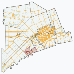
Adelaide Metcalfe

Last updated

Adelaide Metcalfe
Township of Adelaide Metcalfe
Adelaide ON.JPG
Adelaide
Middlesex locator map 2021.svg
Red pog.svg
Adelaide Metcalfe
Canada Southern Ontario location map 2.png
Red pog.svg
Adelaide Metcalfe
Coordinates: 42°57′N81°42′W / 42.950°N 81.700°W / 42.950; -81.700
CountryFlag of Canada (Pantone).svg  Canada
ProvinceFlag of Ontario.svg  Ontario
County Middlesex
FormedJanuary 1, 2001
Government
  MayorSusan Clarke
  Federal riding Lambton—Kent—Middlesex
  Prov. riding Lambton—Kent—Middlesex
Area
[1]
  Land331.46 km2 (127.98 sq mi)
Elevation
227 m (745 ft)
Population
 (2016) [1]
  Total2,990
  Density9.0/km2 (23/sq mi)
Time zone UTC-5 (EST)
  Summer (DST) UTC-4 (EDT)
Postal Code
N0M, N7G
Area codes 519 and 226
Website adelaidemetcalfe.on.ca

Adelaide Metcalfe (2016 population 2,990) is a township in Middlesex County, Ontario, Canada. It was formed on January 1, 2001 through the amalgamation of the former Township of Adelaide and the Township of Metcalfe. It is part of the London census metropolitan area.

Contents

Communities

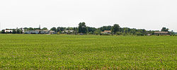
The township contains the communities of Adelaide, Crathie, Dejong, Kerwood, Keyser, Mullifarry, Napier, Napperton, Springfield, Walkers and Wrightmans Corners. The administrative offices of the township are in the locality of Adelaide.

Demographics

Adelaide Metcalfe
YearPop.±%
19912,956 [lower-alpha 1]     
1996 3,128 [lower-alpha 2] +5.8%
2001 3,149+0.7%
2006 3,150+0.0%
2011 3,028−3.9%
2016 2,990−1.3%
2016 [2] , 2011 [3] , 2006 [4] , earlier [5]

In the 2021 Census of Population conducted by Statistics Canada, Adelaide-Metcalfe had a population of 3,011 living in 1,013 of its 1,056 total private dwellings, a change of

According to the 2011 Canadian Census, the median age was 39.7 years old which is approximately the same as the national average at 40.6 years old. [7]

According to the 2011 National Household Survey,

The highest levels of education obtained by residents aged 25 to 64 years old, are as follows:

The median household income before taxes is $28,644, and after taxes is $26,846; lower than the provincial or national figures at $66,358 and $61,072 pre-tax ($58,717 and $54,089 after tax) respectively. The median commute time to work for those 15 years and over was 20.3 minutes with almost all commutes (

Government

Municipal office Adelaide Metcalfe ON.JPG
Municipal office

The Township is led by a Council with a mayor and four councillors. The current council was elected in 2018 along with all other municipal elections in Ontario, and the next election will be in 2022. The members of the current council are:

Notes

  1. Population is the sum of Adelaide (township): 1970 and Metcalfe (township): 986
  2. Population is the sum of Adelaide (township): 1901 and Metcalfe (township): 1057

See also

Related Research Articles

<span class="mw-page-title-main">Caledon, Ontario</span> Town in Ontario, Canada

Caledon is a town in the Regional Municipality of Peel in the Greater Toronto Area of Ontario, Canada. The name comes from a shortened form of Caledonia, the Roman name for what is now Scotland. Caledon is primarily rural with a number of hamlets and small villages, but also contains the larger community of Bolton in its southeastern quadrant, adjacent to York Region. Some spillover urbanization also occurs in the south bordering the City of Brampton.

<span class="mw-page-title-main">Middlesex County, Ontario</span> County in Ontario, Canada

Middlesex County is a primarily rural county in Southwestern Ontario, Canada. Landlocked, the county is bordered by Huron and Perth counties on the north, Oxford County on the east, Elgin County on the south, and Chatham-Kent and Lambton County on the west.

<span class="mw-page-title-main">East Garafraxa</span> Township in Ontario, Canada

East Garafraxa is a rural township located in Dufferin County, Ontario, Canada, to the west of Orangeville and within relative commuting distance of Toronto, Brampton, Guelph, and Kitchener.

<span class="mw-page-title-main">Adjala-Tosorontio</span> Township in Ontario, Canada

Adjala–Tosorontio is a township in south-central Ontario, Canada, in the County of Simcoe.

<span class="mw-page-title-main">Brock, Ontario</span> Township in Ontario, Canada

Brock is a township in the Regional Municipality of Durham, Ontario, Canada. Brock Township is also a former municipality and geographic township prior to the amalgamation that formed the current municipality.

<span class="mw-page-title-main">Essa, Ontario</span> Township in Ontario, Canada

Essa is a township in Ontario, Canada, west and south of the city of Barrie in Simcoe County. It is bounded by County Road 90 to its north, County Road 27 to its east, and Ontario Highway 89 to its south. The township is about 100 kilometres (62 mi) from Toronto. The township is well known for its agriculture industry, particularly potato farming. Nearby CFB Borden brings a strong military presence to the area as well, including a high number of Francophone families.

<span class="mw-page-title-main">Georgian Bay, Ontario</span> Township in Ontario, Canada

The Township of Georgian Bay is an area municipality of the District Municipality of Muskoka, in south-central Ontario, Canada. It is located on the Severn River, where it empties into the eponymous Georgian Bay. The municipal offices are at Port Severn.

<span class="mw-page-title-main">Muskoka Lakes</span> Township in Ontario, Canada

The Township of Muskoka Lakes is a municipality of the District Municipality of Muskoka, Ontario, Canada. It has a year-round population of 7,652.

<span class="mw-page-title-main">Centre Wellington</span> Township in Ontario, Canada

Centre Wellington is a township in south-central Ontario, Canada, located in Wellington County. The primary communities are Elora and Fergus. The area is agricultural but also includes industries such as manufacturing. In the Canada 2016 Census, the population was stated as 28,191.

<span class="mw-page-title-main">Tay Valley, Ontario</span> Township in Ontario, Canada

Tay Valley is a township in eastern Ontario, Canada, on the Tay River in the southwest corner of Lanark County, adjacent to the United Counties of Leeds and Grenville and Frontenac County. The township administrative offices are located in Glen Tay.

<span class="mw-page-title-main">Marmora and Lake</span> Municipality in Ontario, Canada

Marmora and Lake is a municipality along the banks of Crowe River and Beaver Creek, about midway between Toronto and Ottawa on provincial Highway 7 in Hastings County in Central Ontario, Canada. It is home to over 4,000 full time and seasonal residents, many of whom enjoy outdoor recreation and relaxation on Crowe Lake.

<span class="mw-page-title-main">Douro-Dummer</span> Township in Ontario, Canada

Douro-Dummer is a township in central-eastern Ontario, Canada, in Peterborough County along the Trent-Severn Waterway. It was formed on January 1, 1998, through the amalgamation of Douro and Dummer Townships.

<span class="mw-page-title-main">United Counties of Prescott and Russell</span> United counties in Ontario, Canada

The United Counties of Prescott and Russell is a county located in the Canadian province of Ontario. Its county seat is L'Orignal. The county was created as a result of a merger between Russell County and Prescott County in 1820. It is located in Eastern Ontario, in the wedge-shaped area between the Ottawa River and St. Lawrence River, approximately 55 kilometres (34 mi) east of the City of Ottawa. Under Ontario law, the county is an Upper-tier Municipality.

<span class="mw-page-title-main">Oliver Paipoonge</span> Municipality in Ontario, Canada

Oliver Paipoonge is a township in the Canadian province of Ontario, located directly west of the city of Thunder Bay. The municipality was formed on January 1, 1998, with the amalgamation of the former Township of Oliver and Township of Paipoonge. It contains several communities within its boundaries, including Baird, Carters Corners, Harstone, Kakabeka Falls, Lee, McCluskeys Corners, Millar, Murillo, Rosslyn, Slate River Valley, Stanley and Twin City. The remainder of the municipality is agricultural or rural.

<span class="mw-page-title-main">East Ferris</span> Township in Ontario, Canada

East Ferris is a township in northeastern Ontario, Canada located between Trout Lake and Lake Nosbonsing in the District of Nipissing. West Ferris has long been annexed into the city of North Bay.

<span class="mw-page-title-main">South Stormont</span> Township in Ontario, Canada

South Stormont is a township in eastern Ontario, Canada, in the United Counties of Stormont, Dundas and Glengarry. It is located 53 kilometres (33 mi) southeast of Ottawa. South Stormont borders on, but does not include, the city of Cornwall.

<span class="mw-page-title-main">Alnwick/Haldimand</span> Township in Ontario, Canada

The Township of Alnwick/Haldimand is a township in central Ontario, Canada, in Northumberland County, situated between Lake Ontario and Rice Lake. It was formed in 2001 by the merger of Alnwick Township in the north and Haldimand Township in the south. Alderville First Nation is an autonomously governed First Nation contained within the township boundaries, in two non-contiguous sections along County Roads 45 and 18.

<span class="mw-page-title-main">North Perth, Ontario</span> Municipality in Ontario, Canada

North Perth is a lower-tier municipality in Ontario, Canada. Its name is based on its location in the northern portion of Perth County. The main community in North Perth is Listowel. Other communities include Atwood, Monkton, Elma and Wallace township. The municipality was incorporated in 1998 and is heavily agricultural.

<span class="mw-page-title-main">O'Connor, Ontario</span> Township in Ontario, Canada

O'Connor is a township in the Canadian province of Ontario, located 32 kilometres (20 mi) west of the city of Thunder Bay. The municipality was formed on January 1, 1907. The township serves as a bedroom community of Thunder Bay, with some agriculture, and is part of Thunder Bay's Census Metropolitan Area.

References

  1. 1 2 "Adelaide-Metcalfe census profile". 2011 Census of Population . Statistics Canada. 8 February 2012. Retrieved 2012-08-08.
  2. "2016 Community Profiles". 2016 Canadian Census . Statistics Canada. August 12, 2021.
  3. "2011 Community Profiles". 2011 Canadian Census . Statistics Canada. March 21, 2019.
  4. "2006 Community Profiles". 2006 Canadian Census . Statistics Canada. August 20, 2019.
  5. "2001 Community Profiles". 2001 Canadian Census . Statistics Canada. July 18, 2021.
  6. "Population and dwelling counts: Canada, provinces and territories, census divisions and census subdivisions (municipalities), Ontario". Statistics Canada. February 9, 2022. Retrieved April 2, 2022.
  7. 1 2 "Census Profile – 2011 Census". Statistics Canada. 2012-10-24. Retrieved 2016-03-27.
  8. 1 2 3 4 "National Household Survey (NHS) Profile, 2011". Statistics Canada. 2013-09-11. Retrieved 2016-03-27.