North Middlesex, Ontario

Last updated

North Middlesex
Municipality of North Middlesex
North Middlesex Shared Services Building.jpg
Municipal office of North Middlesex in Parkhill
Middlesex locator map 2021.svg
Red pog.svg
North Middlesex
Canada Southern Ontario location map 2.png
Red pog.svg
North Middlesex
Coordinates: 43°09′N81°38′W / 43.150°N 81.633°W / 43.150; -81.633
CountryFlag of Canada (Pantone).svg  Canada
ProvinceFlag of Ontario.svg  Ontario
County Middlesex
FormedJanuary 1, 2001
Government
  MayorBrian Ropp
  Federal riding Lambton—Kent—Middlesex
  Prov. riding Lambton—Kent—Middlesex
Area
[1]
  Land597.88 km2 (230.84 sq mi)
Population
 (2016) [1]
  Total6,352
  Density10.6/km2 (27/sq mi)
Time zone UTC-5 (EST)
  Summer (DST) UTC-4 (EDT)
Postal Code
N0M
Area code(s) 519 and 226
Website www.northmiddlesex.on.ca

North Middlesex is a municipality in Middlesex County, Ontario, Canada.

Contents

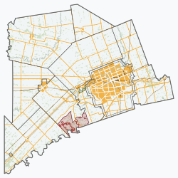
The restructured municipality of North Middlesex was incorporated on January 1, 2001. This amalgamation joined five municipalities — the townships of East Williams, West Williams and McGillivray, the town of Parkhill and the village of Ailsa Craig — to form one municipal corporation. North Middlesex has a population of 6,658 as of the Canada 2011 Census.

North Middlesex is located in the north of Middlesex County, north of London, Ontario.

Communities

Ailsa Craig

Ailsa Craig Ailsa Craig ON.JPG
Ailsa Craig

Ailsa Craig is a community on the Ausable River. Ailsa Craig is best known for its annual Gala Days event. The town was the home of Earl Ross, the first non-American to win a NASCAR Cup Series race, which he did in 1974. Earl was also NASCAR Winston Cup Rookie of the year in 1974.

The winningest harness horse driver in the world also hails from the Ailsa Craig area.[ citation needed ] With over 10,000 wins, John Campbell is one of the youngest members to enter the Harness Horseman's Hall of Fame.

Ailsa Craig was named by the Craig family after a namesake island in the outer Firth of Clyde, Scotland, and the word is derived from the Gaelic, Aillse Creag, or Creag Ealasaid, meaning "Elizabeth's rock". In the early 20th century, Ailsa Craig was a thriving village with several hotels, mills and served as the commercial hub for the farm businesses in the area. Located on the Grand Trunk Railway, Ailsa Craig was once the second largest cattle shipping center in all of Canada surpassed only by Calgary, Alberta. [2] As a child, Norman Bethune often spent his summers in the village.

Parkhill

Parkhill Parkhill ON.JPG
Parkhill

Parkhill owes its beginning to the coming of the railway. In 1859, the Grand Trunk Railway completed a line from St. Mary's to Sarnia. The following year the first Post Office and store were opened at the present site of Parkhill.

Parkhill was originally known as Westwood, named Swainsby in 1861 and finally Parkhill in 1863. Parkhill's growth was slow at first until a grist mill was constructed in the community. Other industries including saw mills, a foundry, a flax mill and a woollen mill became a part of Parkhill. By 1871, the community had a population of 1500. Parkhill was incorporated as a village in 1872 and as a town in 1886. Many fine old Victorian commercial buildings such as the Cheapside Block and Gibbs Block can be found located along Main Street. Parkhill also has many handsome churches and houses throughout the town. The township's administrative offices are located in Parkhill.

Just outside of the modern town of Parkhill, the Parkhill National Historic Site of Canada marks the location of the earliest indigenous archaeological site yet discovered in Ontario, with artifacts dating to approximately 8800 BC. [3]

Other communities

The township also contains the communities of Beechwood, Bornish, Bowood, Brinsley, Carlisle, Corbett, Greenway, Hungry Hollow, Lieury, Moray, Mount Carmel, Nairn, Sable, Springbank, Sylvan and West McGillivray. The communities of Clandeboye, Lucan Crossing, Mooresville are divided by the municipal boundary with Lucan Biddulph.

Demographics

Historical population
YearPop.±%
1996 6,978    
2001 6,901−1.1%
2006 6,740−2.3%
2011 6,658−1.2%
2016 6,352−4.6%
[4] [5] [1]

In the 2021 Census of Population conducted by Statistics Canada, North Middlesex had a population of 6,307 living in 2,391 of its 2,481 total private dwellings, a change of -0.7% from its 2016 population of 6,352. With a land area of 598.65 km2 (231.14 sq mi), it had a population density of 10.5/km2 (27.3/sq mi) in 2021. [6]

Canada census – North Middlesex community profile
2021 2016 2011
Population6,307 (-0.7% from 2016)6,352 (-4.6% from 2011)6,658 (-1.2% from 2006)
Land area598.65 km2 (231.14 sq mi)597.88 km2 (230.84 sq mi)597.90 km2 (230.85 sq mi)
Population density10.5/km2 (27/sq mi)10.6/km2 (27/sq mi)11.1/km2 (29/sq mi)
Median age44 (M: 42, F: 46)43.0 (M: 41.2, F: 44.7)41.4 (M: 39.8, F: 42.5)
Private dwellings2,390 (total) 2,399 (total) 2,483 (total) 
Median household income$78,426
References: 2021 [7] 2016 [8] 2011 [9] earlier [10] [11]

See also

Notable people

Related Research Articles

<span class="mw-page-title-main">Middlesex County, Ontario</span> County in Ontario, Canada

Middlesex County is a primarily rural county in Southwestern Ontario, Canada. Landlocked, the county is bordered by Huron and Perth counties on the north, Oxford County on the east, Elgin County on the south, and Chatham-Kent and Lambton County on the west.

<span class="mw-page-title-main">Mississippi Mills, Ontario</span> Town in Ontario, Canada

Mississippi Mills is a town in eastern Ontario, Canada, in Lanark County on the Mississippi River. It is made up of the former Townships of Ramsay and Pakenham, as well as the Town of Almonte. It is partly located within Canada's National Capital Region.

<span class="mw-page-title-main">Huron County, Ontario</span> County in Ontario, Canada

Huron County is a county of the province of Ontario, Canada. It is located on the southeast shore of its namesake, Lake Huron, in the southwest part of the province. The county seat is Goderich, also the county's largest community.

<span class="mw-page-title-main">Middlesex Centre</span> Municipality in Ontario, Canada

Middlesex Centre is a township in Middlesex County, in southwestern Ontario, Canada, north and west of London. The Corporation of the Township of Middlesex Centre formed on January 1, 1998, with the amalgamation of the former Townships of Delaware, Lobo, and London. It is part of the London census metropolitan area.

<span class="mw-page-title-main">Thames Centre</span> Municipality in Ontario, Canada

Thames Centre is a municipality in Middlesex County, Ontario, Canada, directly east of the City of London. It was formed on January 1, 2001, when the townships of West Nissouri and North Dorchester were amalgamated. It is part of the London census metropolitan area.

<span class="mw-page-title-main">Huron—Bruce (federal electoral district)</span> Federal electoral district in Ontario, Canada

Huron—Bruce is a federal electoral district in Ontario, Canada, that has been represented in the House of Commons of Canada since 1953.

Middlesex North was a federal electoral district in Ontario, Canada, that was represented in the House of Commons of Canada from 1867 to 1917. It was created by the British North America Act of 1867 which divided the County of Middlesex into three ridings: the Middlesex North, Middlesex West and Middlesex East.

<span class="mw-page-title-main">Strathroy-Caradoc</span> Municipality in Ontario, Canada

Strathroy-Caradoc is a municipality located in Southwestern Ontario, Canada. It is 35 kilometres (22 mi) west of London.

<span class="mw-page-title-main">Arran–Elderslie</span> Municipality in Ontario, Canada

The Municipality of Arran–Elderslie is a township in Bruce County in Western Ontario, Canada. The township is located at the headwaters of the Sauble River, and the Saugeen River forms the northwestern boundary.

<span class="mw-page-title-main">Rideau Lakes</span> Township in Ontario, Canada

Rideau Lakes is a township located within Leeds and Grenville United Counties in Eastern Ontario, Canada. The township was incorporated on 1 January 1998 by amalgamating the former townships of North Crosby, South Crosby, Bastard, South Burgess and South Elmsley with the village of Newboro.

<span class="mw-page-title-main">Melancthon, Ontario</span> Township in Ontario, Canada

Melancthon is a rural Canadian township in the northwest corner of Dufferin County, Ontario, bordered on the east by Mulmur Township, Amaranth Township and East Luther Grand Valley to the south, Southgate Township to the west, and the Municipality of Grey Highlands to the north. The township does not include the town of Shelburne on its southern border. It has one of the lowest population densities in southwestern Ontario.

<span class="mw-page-title-main">Southwest Middlesex, Ontario</span> Municipality in Ontario, Canada

Southwest Middlesex is a municipality in Middlesex County, Ontario, Canada.

<span class="mw-page-title-main">West Elgin, Ontario</span> Municipality in Ontario, Canada

West Elgin is a municipality in Elgin County, Ontario, Canada. The township was created on January 1, 1998, through the amalgamation of the former township of Aldborough with the village of West Lorne.

<span class="mw-page-title-main">West Perth, Ontario</span> Municipality in Ontario, Canada

West Perth is a municipality in Ontario, Canada, situated in Western Perth County, just west of the city of Stratford. In 2016, its population was 8,865 in a land area of 579.36 square kilometers. The former town of Mitchell and townships of Logan, Hibbert, and Fullarton all amalgamated into this single large municipality on January 1, 1998. Municipal offices, administration, and services are based in Mitchell. Its mayor is Walter McKenzie.

<span class="mw-page-title-main">The North Shore, Ontario</span> Township in Ontario, Canada

The North Shore is a township in the Canadian province of Ontario, located in the Algoma District. The township had a population of 497 in the Canada 2016 Census. It is along the north shore of the North Channel of Lake Huron, with its main communities all along Highway 17.

<span class="mw-page-title-main">Lucan Biddulph</span> Township in Ontario, Canada

Lucan Biddulph is an incorporated township in southwestern Ontario, Canada. It was formed on January 1, 1999, by amalgamating the Village of Lucan with Biddulph Township. The township had a population of 4,700 people in the Canada 2016 Census, up 8.3% from 4,388 people in 2011, and covers an area of 169.14 km2 of land within Middlesex County.

<span class="mw-page-title-main">Spidertown, Ontario</span> Former Town in Ontario

Spidertown was a small, agricultural supply and services based community in southwestern Ontario, Canada that existed in the last half of the 19th and the early 20th century. The site of the former hamlet is located at the present intersection of Mount Carmel Drive, Blackbush Line and Salem Road, on the boundary between the current municipality of North Middlesex and the municipality of South Huron. Little is currently known of Spidertown's founding, nor the origin of its name. The hamlet is described in one source as consisting, at one point in time, of "taverns on both corners" and "four homes". It is known, that in the latter 19th century a general store was operated in the community by Alexander Todd, presumably the same individual who operated two other general stores during the period at Maguire and Moray as well. A medical doctor, T. L. Flaherty, maintained a practice in a corner house in the hamlet in the latter 19th century, but is known to have moved his office to Mount Carmel, 2 kilometers (1.2 mi) to the east, before 1898. It is believed that Spidertown began to go into decline because of its inability to compete economically with the nearby hamlet of Mount Carmel. Spidertown is recorded as having disappeared by 1914.

<span class="mw-page-title-main">Bonnechere Valley</span> Township municipality in Ontario, Canada

Bonnechere Valley is a township municipality in Renfrew County, Ontario, Canada. It had a population of 3,674 in the Canada 2016 Census. It was established in 2001 by amalgamation of the village of Eganville and the townships of Grattan, Sebastapol and South Algona.

<span class="mw-page-title-main">Mount Carmel, Middlesex County, Ontario</span>

Mount Carmel is a primarily residential hamlet located in southwestern Ontario, Canada.

<span class="mw-page-title-main">Brooke-Alvinston</span> Municipality in Ontario, Canada

Brooke-Alvinston is a township municipality in the Canadian province of Ontario, located within Lambton County. It was formed on January 1, 2001, when the Township of Brooke was amalgamated with the Village of Alvinston.

References

  1. 1 2 3 "Census Profile, 2016 Census: North Middlesex, Municipality". Statistics Canada. Retrieved June 21, 2019.
  2. "Ailsa Craig". Ontario's Historical Plaques. Retrieved 26 April 2017.
  3. "Parkhill National Historic Site of Canada". Parks Canada. Retrieved May 8, 2022.
  4. Statistics Canada: 1996, 2001, 2006 census
  5. "North Middlesex census profile". 2011 Census of Population . Statistics Canada. 8 February 2012. Retrieved 2012-08-08.
  6. "Population and dwelling counts: Canada, provinces and territories, census divisions and census subdivisions (municipalities), Ontario". Statistics Canada. February 9, 2022. Retrieved March 31, 2022.
  7. "2021 Community Profiles". 2021 Canadian Census . Statistics Canada. February 4, 2022. Retrieved 2022-04-27.
  8. "2016 Community Profiles". 2016 Canadian Census . Statistics Canada. August 12, 2021. Retrieved 2019-06-21.
  9. "2011 Community Profiles". 2011 Canadian Census . Statistics Canada. March 21, 2019. Retrieved 2012-08-08.
  10. "2006 Community Profiles". 2006 Canadian Census . Statistics Canada. August 20, 2019.
  11. "2001 Community Profiles". 2001 Canadian Census . Statistics Canada. July 18, 2021.