Dawn-Euphemia

Last updated

Dawn-Euphemia
Township of Dawn-Euphemia
Dawn-Euphemia 1.JPG
Lambton locator map 2021.svg
Red pog.svg
Dawn-Euphemia
Canada Southern Ontario location map 2.png
Red pog.svg
Dawn-Euphemia
Coordinates: 42°42′N82°01′W / 42.700°N 82.017°W / 42.700; -82.017
CountryFlag of Canada (Pantone).svg  Canada
ProvinceFlag of Ontario.svg  Ontario
County Lambton
Formed2001
Government
  MayorAlan Broad
  Federal riding Lambton—Kent—Middlesex
  Prov. riding Lambton—Kent—Middlesex
Area
[1]
  Land445.12 km2 (171.86 sq mi)
Population
 (2016) [1]
  Total1,967
  Density4.4/km2 (11/sq mi)
Time zone UTC-5 (EST)
  Summer (DST) UTC-4 (EDT)
Postal Code
N0N
Area code(s) 519, 226, 548
Website www.dawneuphemia.ca

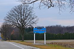
Dawn-Euphemia is a township in southwestern Ontario, Canada, in Lambton County. Residents primarily are employed by the agricultural industry, or by local industries such as Union Gas distribution centre, along with various smaller agricultural manufacturers or service providers. The township municipal office is located in Rutherford.

Contents

Major transportation routes include Cairo Road and Oil Heritage Road directed north–south, and Bentpath Line and Lambton Line running east–west. One elementary school serves the area, Dawn-Euphemia School. Students attend secondary school in nearby Petrolia and Dresden, both of which serve as local service centres for residents.

Communities

The township comprises the communities of Aberfeldy, Aughrim, Beaver Meadow, Bentpath, Cairo, Cuthbert, Dawn, Dawn Valley, Edys Mills, Florence, Garville, Huffs Corners, Langbank, Oakdale, Rutherford and Shetland.

History

The Western Ontario Pacific Railway was constructed through the southeastern corner of the township in 1890. The Western Ontario Pacific was an arm's length subsidiary of the Canadian Pacific Railway, which sought to connect its railway empire directly to Windsor and Detroit, rather than through the American-owned Canada Southern Railway at St. Thomas. [2] [3] The Township of Dawn-Euphemia was formed in 2001 from a merger of the Township of Dawn, and Township of Euphemia.

Demographics

In the 2021 Census of Population conducted by Statistics Canada, Dawn-Euphemia had a population of 1,968 living in 766 of its 824 total private dwellings, a change of 0.1% from its 2016 population of 1,967. With a land area of 445.14 km2 (171.87 sq mi), it had a population density of 4.4/km2 (11.5/sq mi) in 2021. [4]

Canada census – Dawn-Euphemia community profile
2021 2016 2011
Population1,968 (+0.1% from 2016)1,967 (-4.0% from 2011)2,049 (-6.4% from 2006)
Land area445.14 km2 (171.87 sq mi)445.12 km2 (171.86 sq mi)445.13 km2 (171.87 sq mi)
Population density4.4/km2 (11/sq mi)4.4/km2 (11/sq mi)4.6/km2 (12/sq mi)
Median age43.6 (M: 42.8, F: 44.8)43.4 (M: 42.8, F: 44.1)43.1 (M: 42.2, F: 44.1)
Private dwellings824 (total)  766 (occupied)843 (total) 866 (total) 
Median household income$83,000$70,571
References: 2021 [5] 2016 [6] 2011 [7] earlier [8] [9]
Historical population
YearPop.±%
1996 2,577    
2001 2,369−8.1%
2006 2,190−7.6%
2011 2,049−6.4%
2016 1,967−4.0%
[10] [ citation needed ] [7] [1]
Rural countryside of Dawn-Euphemia Dawn-Euphemia 2.JPG
Rural countryside of Dawn-Euphemia

See also

Related Research Articles

<span class="mw-page-title-main">North Grenville</span> Municipality in Ontario, Canada

North Grenville is a township in eastern Ontario, Canada, in the United Counties of Leeds and Grenville on the Rideau River. It is located just south of Ottawa in Canada's National Capital Region.

<span class="mw-page-title-main">Montague, Ontario</span> Township in Ontario, Canada

Montague is a township in eastern Ontario, Canada, in Lanark County on the Rideau River. The township administrative offices are located on Roger Stevens Drive east of Smiths Falls.

<span class="mw-page-title-main">Champlain, Ontario</span> Township in Ontario, Canada

Champlain is a township in eastern Ontario, Canada, in the United Counties of Prescott and Russell on the Ottawa River. It was formed on January 1, 1998, through the amalgamation of West Hawkesbury Township, Longueuil Township, Town of Vankleek Hill, and the Village of L'Orignal.

<span class="mw-page-title-main">Tay Valley, Ontario</span> Township in Ontario, Canada

Tay Valley is a township in eastern Ontario, Canada, on the Tay River in the southwest corner of Lanark County, adjacent to the United Counties of Leeds and Grenville and Frontenac County. The township administrative offices are located in Glen Tay.

<span class="mw-page-title-main">North Stormont</span> Township in Ontario, Canada

North Stormont is a lower tier township in eastern Ontario, Canada in the United Counties of Stormont, Dundas and Glengarry.

<span class="mw-page-title-main">Seguin, Ontario</span> Township in Ontario, Canada

Seguin is a township in central Ontario, Canada, in the District of Parry Sound.

<span class="mw-page-title-main">McNab/Braeside</span> Township in Ontario, Canada

McNab/Braeside is a township in eastern Ontario, Canada, on the south shore of Chats Lake, straddling the lower Madawaska River in Renfrew County.

<span class="mw-page-title-main">Lambton County</span> County in Ontario, Canada

Lambton County is a county in Southwestern Ontario, Canada. It is bordered on the north by Lake Huron, which is drained by the St. Clair River, the county's western border and part of the Canada-United States border. To the south is Lake Saint Clair and Chatham-Kent. Lambton County's northeastern border follows the Ausable River and Parkhill Creek north until it reaches Lake Huron at the beach community of Grand Bend. The county seat is in the Town of Plympton-Wyoming.

<span class="mw-page-title-main">Markstay-Warren</span> Municipality in Ontario, Canada

Markstay-Warren is a town in the Canadian province of Ontario, located in the Sudbury District. Highway 17, from the city limits of Greater Sudbury to the Sudbury District's border with Nipissing District, lies entirely within Markstay-Warren. The town had a population of 2,656 in the Canada 2016 Census.

<span class="mw-page-title-main">Mulmur</span> Township in Ontario, Canada

Mulmur is a township in Dufferin County in Southern Ontario, Canada. There are a number of original settlements such as Mulmur Corners, some of which can still be identified as to location, including Rosemont and Stanton.

<span class="mw-page-title-main">Bonfield, Ontario</span> Township in Ontario, Canada

Bonfield is a township in northeastern Ontario, Canada, on the Mattawa River in Nipissing District.

<span class="mw-page-title-main">Lambton Shores</span> Municipality in Ontario, Canada

Lambton Shores is a municipality in Lambton County, Ontario, Canada, that is on the southern shores of Lake Huron.

<span class="mw-page-title-main">Cramahe, Ontario</span> Township in Ontario, Canada

Cramahe is a rural township located in Northumberland County in southern Ontario, Canada. It is situated just off Ontario Highway 401 approximately 140 km East of Toronto. It was named for Hector Theophilus de Cramahé, who was Lieutenant-Governor of the Province of Quebec. The township's seat and largest town is Colborne.

<span class="mw-page-title-main">Plympton–Wyoming</span> Town in Ontario, Canada

Plympton–Wyoming is a town in the Canadian province of Ontario, located in Lambton County immediately east of Sarnia. It is the seat of the Lambton County Council.

<span class="mw-page-title-main">Southwest Middlesex, Ontario</span> Municipality in Ontario, Canada

Southwest Middlesex is a municipality in Middlesex County, Ontario, Canada.

Malahide is a municipal township in Elgin County in southwestern Ontario, Canada.

<span class="mw-page-title-main">North Algona Wilberforce</span> Township municipality in Ontario, Canada

North Algona Wilberforce is a township municipality in Renfrew County, Ontario, Canada. It has a population of 2,873. The township was formed in 1999 when the North Algona and Wilberforce townships were amalgamated.

<span class="mw-page-title-main">Warwick, Ontario</span> Township in Ontario, Canada

Warwick is a rural township in Lambton County, Ontario, Canada, with a population (2016) of 3,692.

<span class="mw-page-title-main">Brooke-Alvinston</span> Municipality in Ontario, Canada

Brooke-Alvinston is a township municipality in the Canadian province of Ontario, located within Lambton County. It was formed on January 1, 2001, when the Township of Brooke was amalgamated with the Village of Alvinston.

<span class="mw-page-title-main">Enniskillen, Ontario</span> Township in Ontario, Canada

Enniskillen is a township in the Canadian province of Ontario, within Lambton County. It is located at the intersection of Highway 21 and Rokeby Line. The economy of the township is based on agriculture. It was named after Sir Galbraith Lowry Cole's father who was the Earl of Enniskillen, Northern Ireland.

References

  1. 1 2 3 "Census Profile, 2016 Census: Dawn-Euphemia, Township". Statistics Canada. 8 February 2017. Retrieved June 17, 2019.
  2. Kennedy, R. L. "Canadian Pacific Railway London Division". Old Time Trains. Retrieved November 9, 2022.
  3. Boles, Derek. "Credit Valley Railway". Toronto Railway Historical Association. Retrieved November 9, 2022.
  4. "Population and dwelling counts: Canada, provinces and territories, census divisions and census subdivisions (municipalities), Ontario". Statistics Canada. February 9, 2022. Retrieved April 2, 2022.
  5. "2021 Community Profiles". 2021 Canadian Census . Statistics Canada. February 4, 2022. Retrieved 2023-10-19.
  6. "2016 Community Profiles". 2016 Canadian Census . Statistics Canada. August 12, 2021. Retrieved 2019-06-17.
  7. 1 2 "2011 Community Profiles". 2011 Canadian Census . Statistics Canada. March 21, 2019. Retrieved 2012-08-08.
  8. "2006 Community Profiles". 2006 Canadian Census . Statistics Canada. August 20, 2019.
  9. "2001 Community Profiles". 2001 Canadian Census . Statistics Canada. July 18, 2021.
  10. Statistics Canada: 1996, 2001, 2006 census