Newbury, Ontario

Last updated

Newbury
Village of Newbury
Newbury ON.JPG
Middlesex locator map 2021.svg
Red pog.svg
Newbury
Canada Southern Ontario location map 2.png
Red pog.svg
Newbury
Coordinates: 42°41′00″N81°47′50″W / 42.68333°N 81.79722°W / 42.68333; -81.79722
CountryFlag of Canada (Pantone).svg  Canada
ProvinceFlag of Ontario.svg  Ontario
County Middlesex
Settled1851
Incorporated1873
Government
  ReeveDiane Brewer
  Federal riding Lambton—Kent—Middlesex
  Prov. riding Lambton—Kent—Middlesex
Area
[1]
  Land1.77 km2 (0.68 sq mi)
Population
 (2016) [1]
  Total466
  Density263.3/km2 (682/sq mi)
Time zone UTC-5 (EST)
  Summer (DST) UTC-4 (EDT)
Postal Code
N0L
Area code(s) 519 and 226
Website www.newbury.ca

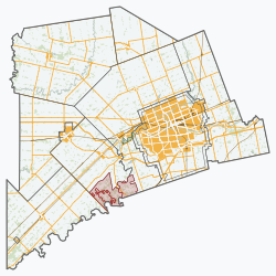
Newbury is an incorporated village in the Canadian province of Ontario, located in Middlesex County. As of the 2016 census, its population is 466. It is located in the southwestern corner of the county, entirely surrounded by the municipality of Southwest Middlesex. The Four Counties Health Services Hospital is based in Newbury and is part of the Middlesex Hospital Alliance. [2] The hospital serves approximately 23,000 residents, primarily from the Village of Newbury, Lambton, Kent, Middlesex and Elgin Counties. [3]

Contents

History

The village got its start in 1851 when the Great Western Railway was built through the area. The first house built was located south of the railroad in 1851 by Robert Thompson. [4] The settlement was originally known as Ward's Station, but was renamed in 1854 after the namesake town in England since most of the residents were of English and Irish origin. That same year, the post office opened with Robert Thompson as first postmaster. [5]

By 1872, Newbury's population had reached 750 people. The following year it was incorporated as a village. During those early years, Newbury had a flourmill, seven hotels, three churches, a school, library, fire hall, and a basket factory. [5] In January 1873, Newbury’s first council was elected. [6]

In 1967, the Four Counties General Hospital opened, followed by the Newbury Medical Clinic in 1972. [5]

Demographics

In the 2021 Census of Population conducted by Statistics Canada, Newbury had a population of 440 living in 187 of its 195 total private dwellings, a change of -5.6% from its 2016 population of 466. With a land area of 1.77 km2 (0.68 sq mi), it had a population density of 248.6/km2 (643.8/sq mi) in 2021. [7]

Canada census – Newbury community profile
2021 2016 2011
Population440 (-5.6% from 2016)466 (+4.3% from 2011)447 (+1.8% from 2006)
Land area1.77 km2 (0.68 sq mi)1.77 km2 (0.68 sq mi)1.85 km2 (0.71 sq mi)
Population density248.6/km2 (644/sq mi)263.3/km2 (682/sq mi)241.0/km2 (624/sq mi)
Median age47.2 (M: 46.4, F: 47.2)43.5 (M: 40.8, F: 44.9)43.7 (M: 43.5, F: 44.0)
Private dwellings190 (total) 184 (total) 193 (total) 
Median household income$56,192
References: 2021 [8] 2016 [9] 2011 [10] earlier [11] [12]
Historical population
YearPop.±%
1991419    
1996 430+2.6%
2001 422−1.9%
2006 439+4.0%
2011 447+1.8%
2016 466+4.3%
[13] [10] [1]

Related Research Articles

<span class="mw-page-title-main">Middlesex County, Ontario</span> County in Ontario, Canada

Middlesex County is a primarily rural county in Southwestern Ontario, Canada. Landlocked, the county is bordered by Huron and Perth counties on the north, Oxford County on the east, Elgin County on the south, and Chatham-Kent and Lambton County on the west.

<span class="mw-page-title-main">Brighton, Ontario</span> Municipality in Ontario, Canada

Brighton is a town in Northumberland County, Ontario, Canada, approximately 150 kilometres (93 mi) east of Toronto and 100 km (62 mi) west of Kingston. It is traversed by both Highway 401 and the former Highway 2. The west end of the Murray Canal that leads east to the Bay of Quinte is at the east end of the town.

<span class="mw-page-title-main">East Hawkesbury</span> Township in Ontario, Canada

East Hawkesbury is a township in eastern Ontario, Canada, in the United Counties of Prescott and Russell. Situated on the Ottawa River, its eastern boundary is the border with the province of Quebec.

<span class="mw-page-title-main">Elgin County</span> County in Ontario, Canada

Elgin County is a county of the Canadian province of Ontario with a 2016 population of 50,069. Its population centres are St. Thomas, Aylmer, Port Stanley, Belmont, Dutton and West Lorne. The county seat is St. Thomas, which is separated from the county but within its geographic boundary.

<span class="mw-page-title-main">Huron County, Ontario</span> County in Ontario, Canada

Huron County is a county of the province of Ontario, Canada. It is located on the southeast shore of its namesake, Lake Huron, in the southwest part of the province. The county seat is Goderich, also the county's largest community.

<span class="mw-page-title-main">Grey County</span> County in Ontario, Canada

Grey County is a county of the Canadian province of Ontario. The county seat is in Owen Sound. It is located in the subregion of Southern Ontario named Southwestern Ontario. Grey County is also a part of the Georgian Triangle. At the time of the Canada 2016 Census the population of the county was 93,830.

<span class="mw-page-title-main">Clearview, Ontario</span> Township in Ontario, Canada

Clearview is a rural incorporated township in Simcoe County in Central Ontario, Canada, west of Barrie and south of Collingwood and Wasaga Beach in Simcoe County.

<span class="mw-page-title-main">Thames Centre</span> Municipality in Ontario, Canada

Thames Centre is a municipality in Middlesex County, Ontario, Canada, directly east of the City of London. It was formed on January 1, 2001, when the townships of West Nissouri and North Dorchester were amalgamated. It is part of the London census metropolitan area.

<span class="mw-page-title-main">Mulmur</span> Township in Ontario, Canada

Mulmur is a township in Dufferin County in Southern Ontario, Canada. There are a number of original settlements such as Mulmur Corners, some of which can still be identified as to location, including Rosemont and Stanton.

<span class="mw-page-title-main">Central Elgin</span> Municipality in Ontario, Canada

Central Elgin is a township located in Southwestern Ontario, Canada in Elgin County on Lake Erie. It is part of the London census metropolitan area.

<span class="mw-page-title-main">Strathroy-Caradoc</span> Municipality in Ontario, Canada

Strathroy-Caradoc is a municipality located in Southwestern Ontario, Canada. It is 35 kilometres (22 mi) west of London.

<span class="mw-page-title-main">Lambton Shores</span> Municipality in Ontario, Canada

Lambton Shores is a municipality in Lambton County, Ontario, Canada, that is on the southern shores of Lake Huron.

<span class="mw-page-title-main">Tyendinaga, Ontario</span> Township in Ontario, Canada

Tyendinaga is a township in the Canadian province of Ontario, located in Hastings County. The community takes its name from a variant spelling of Mohawk leader Joseph Brant's traditional Mohawk name, Thayendanegea.

<span class="mw-page-title-main">Southwest Middlesex, Ontario</span> Municipality in Ontario, Canada

Southwest Middlesex is a municipality in Middlesex County, Ontario, Canada.

<span class="mw-page-title-main">North Middlesex, Ontario</span> Municipality in Middlesex County, Ontario, Canada

North Middlesex is a municipality in Middlesex County, Ontario, Canada.

<span class="mw-page-title-main">West Elgin, Ontario</span> Municipality in Ontario, Canada

West Elgin is a municipality in Elgin County, Ontario, Canada. The township was created on January 1, 1998, through the amalgamation of the former township of Aldborough with the village of West Lorne.

<span class="mw-page-title-main">Lucan Biddulph</span> Township in Ontario, Canada

Lucan Biddulph is an incorporated township in southwestern Ontario, Canada. It was formed on January 1, 1999, by amalgamating the Village of Lucan with Biddulph Township. The township had a population of 4,700 people in the Canada 2016 Census, up 8.3% from 4,388 people in 2011, and covers an area of 169.14 km2 of land within Middlesex County.

<span class="mw-page-title-main">North Algona Wilberforce</span> Township municipality in Ontario, Canada

North Algona Wilberforce is a township municipality in Renfrew County, Ontario, Canada. It has a population of 2,873. The township was formed in 1999 when the North Algona and Wilberforce townships were amalgamated.

<span class="mw-page-title-main">South Bruce, Ontario</span> Municipality in Ontario, Canada

South Bruce is a municipality in Bruce County, Ontario, Canada.

<span class="mw-page-title-main">Warwick, Ontario</span> Township in Ontario, Canada

Warwick is a rural township in Lambton County, Ontario, Canada, with a population (2016) of 3,692.

References

  1. 1 2 3 "Census Profile, 2016 Census: Newbury, Village". Statistics Canada. 8 February 2017. Retrieved June 21, 2019.
  2. Southwesthealthline.ca (n.d). "Four Counties Health Services". Retrieved 2018-05-25.
  3. Middlesex Hospital Alliance (n.d). "FCHS site". Retrieved 2018-05-25.
  4. Newbury Village (1889)."History of the County of Middlesex, Canada : from the earliest time to the present, containing an authentic account of many important matters relating to the settlement, progress and general history of the county, and including a department devoted to the preservation of personal and private records, etc. ; illustrated", at page 537. Retrieved 2018-12-05.
  5. 1 2 3 "The History of Newbury". The Corporation of the Village of Newbury. Retrieved 2011-02-16.
  6. Ontario's Historical Plaques (n.d). "The Founding of Newbury". Retrieved 2018-05-25.
  7. "Population and dwelling counts: Canada, provinces and territories, census divisions and census subdivisions (municipalities), Ontario". Statistics Canada. February 9, 2022. Retrieved March 30, 2022.
  8. "2021 Community Profiles". 2021 Canadian Census . Statistics Canada. February 4, 2022. Retrieved 2022-04-27.
  9. "2016 Community Profiles". 2016 Canadian Census . Statistics Canada. August 12, 2021. Retrieved 2019-06-21.
  10. 1 2 "2011 Community Profiles". 2011 Canadian Census . Statistics Canada. March 21, 2019. Retrieved 2012-07-23.
  11. "2006 Community Profiles". 2006 Canadian Census . Statistics Canada. August 20, 2019.
  12. "2001 Community Profiles". 2001 Canadian Census . Statistics Canada. July 18, 2021.
  13. Statistics Canada: 1996, 2001, 2006 census