Renfrew County

Last updated
Renfrew County
County of Renfrew
RenfrewCounty-Office.JPG
The administration building of the county government
Map of Ontario RENFREW.svg
Location of Renfrew County
Coordinates: 45°40′N77°15′W / 45.667°N 77.250°W / 45.667; -77.250
CountryFlag of Canada (Pantone).svg Canada
ProvinceFlag of Ontario.svg  Ontario
Established1861
County seat Pembroke (independent)
Municipalities
List
Area
[1]
  Land7,357.94 km2 (2,840.92 sq mi)
Population
 (2021) [1]
  Total106,365
  Density14.5/km2 (38/sq mi)
Time zone UTC-5 (EST)
  Summer (DST) UTC-4 (EDT)
Area code(s) 613 and 343
Website www.countyofrenfrew.on.ca

Renfrew County is a county in the Canadian province of Ontario. It straddles the west bank of the Ottawa River. There are 17 municipalities in the county.

Contents

History

Bathurst District

When Carleton County was withdrawn from Bathurst District in 1838, Renfrew County was severed from part of the remaining Lanark County, [2] but the two remained united for electoral purposes. [3] By 1845, all lands in the District had been surveyed into the following townships:

Counties comprising Bathurst District (1845)
LanarkRenfrew
  • Bathurst
  • Beckwith
  • Drummond
  • Dalhousie
  • Darling
  • North Elmsley
  • North Burgess
  • Levant
  • Lanark
  • Montague
  • Ramsay
  • North Sherbrooke
  • South Sherbrooke
  • Admaston
  • Blithefield
  • Bagot
  • Bromley
  • Horton
  • McNab
  • Pakenham
  • Pembroke
  • Ross
  • Stafford
  • Westmeath

United Counties of Lanark and Renfrew

Effective January 1, 1850, Bathurst District was abolished, and the "United Counties of Lanark and Renfrew" replaced it for municipal and judicial purposes. [4] The counties remained united for electoral purposes in the Parliament of the Province of Canada, referred to as the County of Lanark, [5] until Renfrew gained its own seat in 1853. [6]

The separation of Renfrew from Lanark began in 1861, with the creation of a Provisional Municipal Council [7] that held its first meeting in June 1861. [8] The United Counties were dissolved in August 1866. [8]

Geographical evolution

The territory was originally described in 1838 as consisting of:

...the Townships of Packenham, McNab, Horton, Ross, Westmeath and Pembroke, together with the unsurveyed lands within the District of Bathurst, and all the islands in the Ottawa River, wholly or in greater part opposite to the said Townships and unsurveyed lands... [2]

In 1851, Pakenham was transferred to Lanark, [5] while Renfrew was expanded through the addition of:

...all that tract of land lying between the Western Boundaries of the Townships of Lavant, Blithfield, Admaston, Bromley, Stafford and Pembroke and the Ottawa River, and a line drawn parallel to the general course of the said Boundaries of the said Townships from the western corner of the Township of Clarendon to the Ottawa River. [5]

In 1860, the newly surveyed townships of Miller and Canonto were transferred to Frontenac County, while the townships of Raglan, Lyndoch, Radcliffe and Brudenell were added to Renfrew. [9] The final expansion of the County occurred in 1877-1878, with the transfer of the United Townships of Hagarty, Sherwood, Jones, Richards and Burns, and the United Townships of Head, Clara and Maria, from Nipissing District. [10]

Once all lands had been surveyed in 1878, the County consisted of the following geographic townships:

Municipal reorganization (2001)

Renfrew County
Invisible Square.svg
Mapscaleline.svg
30km
20miles
Red pog.svg
Pembroke
Invisible Square.svg
Madawaska River
Bonnechere
River
Ottawa River
17
Invisible Square.svg
16
Invisible Square.svg
15
Invisible Square.svg
14
Invisible Square.svg
13
Invisible Square.svg
12
Invisible Square.svg
11
Invisible Square.svg
10
Invisible Square.svg
9
Invisible Square.svg
8
Invisible Square.svg
7
Invisible Square.svg
6
Invisible Square.svg
Renfrew
5
Invisible Square.svg
Petawawa
4
Invisible Square.svg
Laurentian Hills
3
Invisible Square.svg
Deep River
2
Invisible Square.svg
Map showing the city of Pembroke, with the five towns and twelve townships of Renfrew County, Ontario. [11]
1
City of Arnprior
2
Town of Deep River
3
Town of Laurentian Hills
4
Town of Petawawa
5
Town of Renfrew
6
Township of Admaston/Bromley
7
Township of Bonnechere Valley
8
Township of Brudenell, Lyndoch and Raglan
9
Township of Greater Madawaska
10
Township of Head, Clara and Maria
11
Township of Horton
12
Township of Killaloe, Hagarty and Richards
13
Township of Laurentian Valley
14
Township of Madawaska Valley
15
Township of McNab/Braeside
16
Township of North Algona Wilberforce
17
Township of Whitewater Region
Current municipalityconsisting of the townships of
Town of Arnprior
Town of Deep River
Town of Laurentian Hills
  • Buchanan
  • McKay
  • Rolph
  • Wylie
Town of Petawawa
  • Petawawa
Town of Renfrew
Township of Admaston/Bromley
  • Admaston
  • Bromley
Township of Bonnechere Valley
  • Grattan
  • Sebastopol
  • South Alcona
Township of Brudenell, Lyndoch and Raglan
  • Brudenell
  • Lyndoch
  • Raglan
Township of Greater Madawaska
  • Bagot
  • Blythfield
  • Brougham
  • Griffith
  • Matawatchan
Township of Head, Clara and Maria
  • Clara
  • Head
  • Maria
Township of Horton
  • Horton
Township of Killaloe, Hagarty and Richards
  • Hagarty
  • Richards
Township of Laurentian Valley
  • Alice
  • Fraser
  • Pembroke
  • Stafford
Township of Madawaska Valley
  • Burns
  • Jones
  • Radcliffe
  • Sherwood
Township of McNab/Braeside
  • McNab
Township of North Algona Wilberforce
  • North Algona
  • Wilberforce
Township of Whitewater Region
  • Ross
  • Westmeath

The county seat, Pembroke, is a separated municipality.

Geography

Entering Renfrew County from Quebec on QC148 Renfrew County Ontario Sign entering from Quebec on 148.jpg
Entering Renfrew County from Quebec on QC148

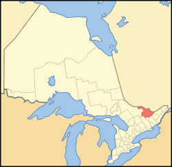
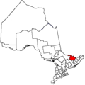
Renfrew County is known for its lakeside cottages and white-water rafting along the Ottawa River, and has more than 900 lakes. [12] It is located in the primary region of Southern Ontario and the secondary region Eastern or Southeastern Ontario. Renfrew County is also the largest county in terms of area in Ontario, ahead of Hastings County.

Demographics

As a census division in the 2021 Census of Population conducted by Statistics Canada, Renfrew County had a population of 106,365 living in 44,952 of its 51,134 total private dwellings, a change of 3.9% from its 2016 population of 102,394. With a land area of 7,357.94 km2 (2,840.92 sq mi), it had a population density of 14.5/km2 (37.4/sq mi) in 2021. [1]

Canada census – Renfrew community profile
2021 2016 2011
Population106,365 (+3.9% from 2016)102,394 (+1.1% from 2011)101,326 (3.9% from 2006)
Land area7,357.94 km2 (2,840.92 sq mi)7,448.57 km2 (2,875.91 sq mi)7,440.81 km2 (2,872.91 sq mi)
Population density14.5/km2 (38/sq mi)13.7/km2 (35/sq mi)13.6/km2 (35/sq mi)
Median age45.2 (M: 43.2, F: 47.2)44.8 (M: 43.0, F: 46.5)
Private dwellings51,134 (total)  44,952 (occupied)49,860 (total)  42,779 (occupied)48,229 (total) 
Median household income$80,000$67,683
References: 2021 [13] 2016 [14] 2011 [15] earlier [16] [17]
Historical census populations – Renfrew County
YearPop.±%
1921 51,505    
1931 52,227+1.4%
1941 54,720+4.8%
1951 66,717+21.9%
1956 78,245+17.3%
1961 89,635+14.6%
YearPop.±%
1966 89,453−0.2%
1971 90,875+1.6%
1976 89,099−2.0%
1981 87,484−1.8%
1986 88,965+1.7%
1991 91,685+3.1%
YearPop.±%
1996 96,224+5.0%
2001 95,138−1.1%
2006 97,545+2.5%
2011 101,326+3.9%
2016 102,394+1.1%
2021 106,365+3.9%
Source: Statistics Canada

Arts and culture

At Wilno, Ontario Canada's Kashubian community celebrates their heritage.

Military

The county is home to CFB Petawawa and gives its name to The Lanark and Renfrew Scottish Regiment.

Notable people

See also

Related Research Articles

<span class="mw-page-title-main">Middlesex County, Ontario</span> County in Ontario, Canada

Middlesex County is a primarily rural county in Southwestern Ontario, Canada. Landlocked, the county is bordered by Huron and Perth counties on the north, Oxford County on the east, Elgin County on the south, and Chatham-Kent and Lambton County on the west.

<span class="mw-page-title-main">Hastings County</span> County in Ontario, Canada

Hastings County is located in the province of Ontario, Canada. Geographically, it is located on the border of Eastern Ontario and Central Ontario. Hastings County is the second-largest county in Ontario, after Renfrew County, and its county seat is Belleville, which is independent of Hastings County. Hastings County has trademarked the moniker "Cheese Capital of Canada".

<span class="mw-page-title-main">Petawawa</span> Town in Ontario, Canada

Petawawa is a town located in the eastern portion of Southern Ontario. Situated in the Ottawa Valley, with a population of 18,160, Petawawa is the most populous municipality in Renfrew County.

<span class="mw-page-title-main">Lanark County</span> County in Ontario, Canada

Lanark County is a county located in the Canadian province of Ontario. Its county seat is Perth, which was first settled in 1816 and was known as a social and political capital before being over shadowed by what we now know as Ottawa.

<span class="mw-page-title-main">Renfrew, Ontario</span> Town in Ontario, Canada

Renfrew is a town on the Bonnechere River in Renfrew County, Ontario, Canada. Located one hour west of Ottawa in Eastern Ontario, Renfrew is the fourth largest town in the county after Petawawa, Pembroke and Arnprior. The town is a small transportation hub connecting Highway 60 and Highway 132 with the Trans-Canada Highway. Renfrew is also known historically for its role in the formation of the National Hockey League. It lies about 5 kilometres from the Quebec border, about 10 kilometres by road. Renfrew makes most of Canada’s hockey tape.

<span class="mw-page-title-main">Frontenac County</span> County in Ontario, Canada

Frontenac County is a county and census division of the Canadian province of Ontario. It is located in the eastern portion of Southern Ontario. The city of Kingston is in the Frontenac census division, but is separated from the County of Frontenac.

<span class="mw-page-title-main">Huron County, Ontario</span> County in Ontario, Canada

Huron County is a county of the province of Ontario, Canada. It is located on the southeast shore of its namesake, Lake Huron, in the southwest part of the province. The county seat is Goderich, also the county's largest community.

<span class="mw-page-title-main">Grey County</span> County in Ontario, Canada

Grey County is a county of the Canadian province of Ontario. The county seat is in Owen Sound. It is located in the subregion of Southern Ontario named Southwestern Ontario. Grey County is also a part of the Georgian Triangle. At the time of the Canada 2016 Census the population of the county was 93,830.

<span class="mw-page-title-main">Admaston/Bromley</span> Township in Ontario, Canada

Admaston/Bromley is an incorporated township in Renfrew County, Eastern Ontario, Canada. It was formed on January 1, 2000, when Admaston and Bromley Townships were amalgamated. It takes part of its name from Admaston, Staffordshire, a small English hamlet.

<span class="mw-page-title-main">Carleton County, Ontario</span> Former county in Ontario, Canada

Carleton County is the name of a former county in Ontario, Canada. In 1969, it was superseded by the Regional Municipality of Ottawa–Carleton. In 2001, the Regional Municipality and its eleven local municipalities were replaced by the current city of Ottawa.

<span class="mw-page-title-main">Renfrew—Nipissing—Pembroke (federal electoral district)</span> Federal electoral district in Ontario, Canada

Renfrew—Nipissing—Pembroke is a federal electoral district in Ontario, Canada, that has been represented in the House of Commons since 1979.

Renfrew South was a federal riding represented in the House of Commons of Canada from 1867 to 1968. It was located in the province of Ontario. The federal riding was created by the British North America Act of 1867 and was abolished in 1966, with the riding being apportioned into Frontenac—Lennox and Addington, Lanark and Renfrew, and Renfrew North.

<span class="mw-page-title-main">Laurentian Valley</span> Township municipality in Ontario, Canada

Laurentian Valley is a township municipality in Renfrew County in eastern Ontario, Canada. It borders on the Ottawa River, the city of Pembroke and the town of Petawawa.

Frontenac—Lennox and Addington was a federal electoral district represented in the House of Commons of Canada from 1968 to 1979. It was located in the province of Ontario. This riding was created in 1966 from parts of Hastings—Frontenac, Kingston, Lanark, Prince Edward—Lennox, Renfrew North and Renfrew South ridings.

<span class="mw-page-title-main">Johnstown District, Upper Canada</span>

The Johnstown District was a historic district in Upper Canada which existed until 1849.

<span class="mw-page-title-main">Bathurst District</span>

The Bathurst District was a historic district in Upper Canada. It was created in 1822 from the Johnstown District. Containing Carleton County, it existed until 1849. The district town was Perth.

<span class="mw-page-title-main">Pembroke, Ontario</span> City in Ontario, Canada

Pembroke is a city in the Canadian province of Ontario at the confluence of the Muskrat River and the Ottawa River in the Ottawa Valley. Pembroke is the location of the administrative headquarters of Renfrew County, though the city itself is politically independent. It is 145 kilometres (90 mi) northwest of Ottawa.

Lanark was an electoral district of the Legislative Assembly of the Parliament of the Province of Canada, in Canada West. Based on Lanark County, it was created in 1841, upon the establishment of the Province of Canada by the union of Upper Canada and Lower Canada.

Elections were held in Renfrew County, Ontario on October 24, 2022 in conjunction with municipal elections across the province.

References

  1. 1 2 3 "Renfrew, County (CTY) Census Profile, 2021 Census of Population". www12.statcan.gc.ca. Government of Canada - Statistics Canada. Retrieved 19 April 2024.
  2. 1 2 An Act to erect certain townships now forming parts of the Districts of Bathurst, Johnstown and Ottawa, into a separate District, to be called the District of Dalhousie, and for other purposes therein mentioned , S.U.C. 1838, c. 25, s. 23
  3. An Act for better defining the limits of the Counties and Districts in Upper Canada, for erecting certain new Townships, for detaching Townships from some Counties and attaching them to others, and for other purposes relative to the division of Upper Canada into Townships, Counties and Districts , S.Prov.C. 1845, c. 7, Sch. A, B
  4. An Act for abolishing the Territorial Division of Upper-Canada into Districts, and for providing temporary Unions of Counties for Judicial and other purposes, and for the future dissolutions of such Unions, as the increase of wealth and population may require , S.Prov.C. 1849, c. 78, Sch. B
  5. 1 2 3 An Act to make certain alterations in the Territorial Divisions of Upper Canada , S.Prov.C. 1851, c. 5, Sch. C
  6. An Act to enlarge the Representation of the People of this Province in Parliament , S.Prov.C. 1853, c. 152, s. 2(19)
  7. An Act to provide for the separation of the County of Renfrew from the County of Lanark , S.Prov.C. 1861, c. 51
  8. 1 2 Mitchell, S.E. (1919). "The County Council". In Smallfield, W.E.; Campbell, Rev. Robert (eds.). The Story of Renfrew: From the Coming of the First Settlers about 1820. Vol. One. Renfrew: Smallfield & Son. p. 191.
  9. An Act to amend "An Act respecting the Territorial Division of Upper Canada" , S.Prov.C. 1860, c. 39
  10. Proclamations of June 2, 1877 and January 6, 1878, implementing An Act to apply the Municipal Law to certain Townships in the District of Nipissing , S.O. 1877, c. 30
  11. Restructured municipalities - Ontario map #5 (Map). Restructuring Maps of Ontario. Ontario Ministry of Municipal Affairs and Housing. 2006. Archived from the original on May 11, 2020. Retrieved March 21, 2018.
  12. Renfrew County, Ontario, Canada located in the Ottawa Valley, County of Renfrew
  13. "2021 Community Profiles". 2021 Canadian Census . Statistics Canada. February 4, 2022. Retrieved 2022-04-27.
  14. "2016 Community Profiles". 2016 Canadian Census . Statistics Canada. August 12, 2021. Retrieved 2024-04-19.
  15. "2011 Community Profiles". 2011 Canadian Census . Statistics Canada. March 21, 2019. Retrieved 2012-03-19.
  16. "2006 Community Profiles". 2006 Canadian Census . Statistics Canada. August 20, 2019.
  17. "2001 Community Profiles". 2001 Canadian Census . Statistics Canada. July 18, 2021.