Killaloe, Hagarty and Richards

Last updated

Killaloe, Hagarty and Richards
Township of Killaloe, Hagarty and Richards
KillaloeHagartyRichards-Sign.JPG
Welcome sign on Round Lake Road
Renfrew locator map 2021.svg
Red pog.svg
Killaloe, Hagarty and Richards
Canada Southern Ontario location map 2.png
Red pog.svg
Killaloe, Hagarty and Richards
Coordinates: 45°36′N77°30′W / 45.600°N 77.500°W / 45.600; -77.500 [1]
CountryCanada
Province Ontario
County Renfrew
EstablishedJanuary 1, 2000
Government
  MayorDavid Mayville
  Federal riding Renfrew—Nipissing—Pembroke
  Prov. riding Renfrew—Nipissing—Pembroke
Area
[2]
  Land391.60 km2 (151.20 sq mi)
Population
 (2021) [2]
  Total2,410
  Density6.2/km2 (16/sq mi)
Time zone UTC−5 (EST)
  Summer (DST) UTC−4 (EDT)
Postal code
K0J 2A0
Area code(s) 613, 343
Website www.killaloe-hagarty-richards.ca
A branch of the township fire department in Round Lake Centre KHR Fire Hall.JPG
A branch of the township fire department in Round Lake Centre

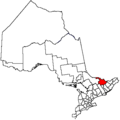
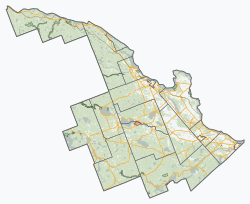
Killaloe, Hagarty and Richards is an incorporated township in Renfrew County in eastern Ontario, Canada, [1] created on July 1, 2000, as a result of an amalgamation of the Township of Hagarty and Richards with the Village of Killaloe. [3]
Contents

Communities

The township comprises the smaller communities of Bonnechere, Killaloe, Round Lake Centre and Wilno.

Demographics

In the 2021 Census of Population conducted by Statistics Canada, Killaloe, Hagarty and Richards had a population of 2,410 living in 1,097 of its 1,559 total private dwellings, a change of -0.4% from its 2016 population of 2,420. With a land area of 391.6 km2 (151.2 sq mi), it had a population density of 6.2/km2 (15.9/sq mi) in 2021. [2]

Canada census – Killaloe, Hagarty and Richards community profile
2021 2016 2011
Population2,410 (-0.4% from 2016)2420 (0.7% from 2011)2402 (-5.8% from 2006)
Land area391.60 km2 (151.20 sq mi)396.80 km2 (153.21 sq mi)395.98 km2 (152.89 sq mi)
Population density6.2/km2 (16/sq mi)6.1/km2 (16/sq mi)6.1/km2 (16/sq mi)
Median age54.0 (M: 53.2, F: 55.2)50.0 (M: 49.5, F: 50.6)48.8 (M: 47.9, F: 49.6)
Private dwellings1,559 (total)  1,097 (occupied)1,689 (total)  1,063 (occupied)1,523 (total)  1,043 (occupied)
Median household income$63,200$50,592
References: 2021 [4] 2016 [5] 2011 [6] earlier [7] [8]
Historical census populations – Killaloe, Hagarty and Richards
YearPop.±%
2001 2,492    
2006 2,550+2.3%
2011 2,402−5.8%
2016 2,420+0.7%
2021 2,410−0.4%
Source: Statistics Canada

Parks

Lakes and rivers

Other features

See also

Related Research Articles

<span class="mw-page-title-main">Lake of Bays</span> Township municipality in Ontario, Canada

Lake of Bays is a township municipality within the District Municipality of Muskoka, Ontario, Canada. The township, situated 193 kilometres (120 mi) north of Toronto, is named after the Lake of Bays. During the 2016 census, the township had a population of 3,167 and encompassed 677.91 square kilometres (261.74 sq mi) of land.

<span class="mw-page-title-main">Renfrew County</span> County in Ontario, Canada

Renfrew County is a county in the Canadian province of Ontario. It straddles the west bank of the Ottawa River. There are 17 municipalities in the county.

<span class="mw-page-title-main">Indian River (Muskrat River watershed)</span> River in Ontario, Canada

The Indian River is a river in Renfrew County and Nipissing District in Eastern and Northeastern Ontario, Canada. It is in the Saint Lawrence River drainage basin, and is a left tributary of the Muskrat River.

<span class="mw-page-title-main">Marmora and Lake</span> Municipality in Ontario, Canada

Marmora and Lake is a municipality along the banks of Crowe River and Beaver Creek, about midway between Toronto and Ottawa on provincial Highway 7 in Hastings County in Central Ontario, Canada. It is home to over 4,000 full time and seasonal residents, many of whom enjoy outdoor recreation and relaxation on Crowe Lake.

<span class="mw-page-title-main">Restoule</span> Designated place with Local Services Board in Ontario, Canada

Restoule is a community and designated place in geographic Patterson Township in the Centre Unorganized Part of Parry Sound District in Central Ontario, Canada. It is situated on the Restoule River between Commanda Lake, and Restoule Lake and is part of the Almaguin Highlands region.

<span class="mw-page-title-main">Bonnechere River</span> River in Ontario, Canada

The Bonnechere River is a river in the Saint Lawrence River drainage basin in Nipissing District and Renfrew County in eastern and northeastern Ontario, Canada. The river flows from Algonquin Provincial Park to the Ottawa River east and north of the town of Renfrew. The river's name is thought to come from the French "bonne chère" meaning "plentiful good food".

<span class="mw-page-title-main">Trent Hills</span> Township in Ontario, Canada

The Municipality of Trent Hills is a township municipality in Northumberland County in Central Ontario, Canada. It is on the Trent River and was created in 2001 through the amalgamation of the municipalities of Campbellford/Seymour, Percy Township and Hastings. Thereafter it was known in brief as Campbellford/Seymour, Percy, Hastings.

<span class="mw-page-title-main">Nipissing, Ontario</span> Township in Ontario, Canada

Nipissing is an incorporated (political) township in Parry Sound District in Central Ontario, Canada. It is on Lake Nipissing and is part of the Almaguin Highlands region. Nipissing was surveyed between 1874 and 1881, and was incorporated in 1888. Among the first settlers in the area were the Chapman and Beatty families. Nipissing Township annexed Gurd Township in 1970. The township also contains a community named Nipissing, which is located on the South River near Chapman's Landing, on the South Bay of Lake Nipissing. The township administrative offices are located in Nipissing.

<span class="mw-page-title-main">Killaloe, Ontario</span> Village in Ontario, Ontario

Killaloe is a town located in Renfrew County, Ontario, Canada in the township of Killaloe, Hagarty and Richards. Geographically it is located in Eastern Ontario. The shores of Golden Lake are located 3 km (1.9 mi) to the east, which is well known for quality angling and year-round recreation. The present day town is located about 1 km (0.62 mi) north of the former townsite of "Old Killaloe". In 2001, the town had a population of 660.

<span class="mw-page-title-main">Latchford, Ontario</span> Town in Ontario, Canada

Latchford is a single-tier municipality town in Timiskaming District in Northeastern Ontario, Canada. It is located on Bay Lake on the Montreal River, near the town of Cobalt and the municipality of Temagami, and is 20 kilometres from the city of Temiskaming Shores. The population of the town in the Canada 2011 Census was 387, which makes it the smallest town by population in Ontario. The town's slogan is "The Best Little Town by a Dam Site!"

<span class="mw-page-title-main">Hastings Highlands</span> Municipality in Ontario, Canada

Hastings Highlands is a township in the Canadian province of Ontario.

King's Highway 62, commonly referred to as Highway 62, is a provincially maintained highway in the Canadian province of Ontario. The highway travels south–north from Highway 33 at Bloomfield in Prince Edward County, through Belleville, Madoc and Bancroft, to Maynooth, where it ends at a junction with Highway 127. Prior to 1997, the route continued north and east of Maynooth through Combermere, Barry's Bay, Killaloe, Round Lake and Bonnechere to Highway 17 in Pembroke. This section of highway was redesignated Hastings Highlands Municipal Road 62, Renfrew County Road 62, and Renfrew County Road 58.

<span class="mw-page-title-main">Chapple, Ontario</span> Township municipality in Ontario, Canada

Chapple is a township municipality in Rainy River District in Northwestern Ontario, Canada.

<span class="mw-page-title-main">South Algonquin</span> Township municipality in Ontario, Canada

South Algonquin is a township municipality in Nipissing District, Ontario, Canada. Located south of Algonquin Provincial Park, it is the sole populated portion of the district that lies south of the traditional dividing line between Northern Ontario and Southern Ontario and is closer connected to Renfrew County as opposed to the core portions of Nipissing District.

<span class="mw-page-title-main">Bonnechere Valley</span> Township municipality in Ontario, Canada

Bonnechere Valley is a township municipality in Renfrew County, Ontario, Canada. It had a population of 3,898 in the 2021 Canadian census. It was established on January 1, 2001, by amalgamation of the village of Eganville and the townships of Grattan, Sebastapol, and South Algona.

<span class="mw-page-title-main">North Algona Wilberforce</span> Township municipality in Ontario, Canada

North Algona Wilberforce is a township municipality in Renfrew County, Ontario, Canada. It has a population of 2,873. The township was formed in 1999 when the North Algona and Wilberforce townships were amalgamated.

<span class="mw-page-title-main">Greater Madawaska</span> Township municipality in Ontario, Canada

Greater Madawaska is an incorporated township in Renfrew County in eastern Ontario, Canada, created on January 1, 2001, through the amalgamation of the Township of Bagot and Blythfield, the Township of Brougham, and the Township of Griffith and Matawatchan. As of 2021, it has a population of 2,864.

<span class="mw-page-title-main">Round Lake (Ontario)</span>

Round Lake is a lake located in Killaloe, Hagarty and Richards Township, Renfrew County, Ontario, Canada. The Bonnechere River flows into the lake in the northwest and flows out of the lake at the southeast.

<span class="mw-page-title-main">James, Ontario</span> Township in Ontario, Canada

James is an incorporated township in the Canadian province of Ontario, located in Timiskaming District. The primary community within the township is Elk Lake, which is located at the junction of Ontario Highway 65 and Ontario Highway 560.

<span class="mw-page-title-main">Opeongo Hills</span> Range of hills in Southern Ontario

The Opeongo Hills are a range of hills in Southern Ontario, near Algonquin Provincial Park. The hills stretch from Opeongo Lake in Algonquin Park in the west, along the Madawaska and Opeongo Rivers, towards the Opeongo Colonization Road, and extending towards the Deacon Escarpment, Bonnechere, Ontario, and Dacre in the east. To the east of the Opeongo Hills lie the Madawaska River valley, the Mississippi River Valley, and the Ottawa-Bonnechere Graben along the Ottawa River. Its tallest peak is roughly 7 km northeast of Highway 60. At roughly 586 meters, it is the tallest point in Southern Ontario. The community of Foymount is one of the highest settlements in Southern Ontario.

References

  1. 1 2 "Killaloe, Hagarty and Richards". Geographical Names Data Base . Natural Resources Canada . Retrieved 2011-08-11.
  2. 1 2 3 "Killaloe, Hagarty and Richards (Code 3547033) Census Profile". 2021 census . Government of Canada - Statistics Canada . Retrieved 2024-07-29.
  3. Restructured municipalities - Ontario map #5 (Map). Restructuring Maps of Ontario. Ontario Ministry of Municipal Affairs and Housing. 2006. Archived from the original on 2020-05-11. Retrieved 2011-08-11.
  4. "2021 Community Profiles". 2021 Canadian Census . Statistics Canada. February 4, 2022. Retrieved 2023-10-19.
  5. "2016 Community Profiles". 2016 Canadian Census . Statistics Canada. August 12, 2021. Retrieved 2019-02-25.
  6. "2011 Community Profiles". 2011 Canadian Census . Statistics Canada. March 21, 2019. Retrieved 2012-02-13.
  7. "2006 Community Profiles". 2006 Canadian Census . Statistics Canada. August 20, 2019.
  8. "2001 Community Profiles". 2001 Canadian Census . Statistics Canada. July 18, 2021.