Greater Madawaska | |
|---|---|
| Township of Greater Madawaska | |
 Dacre, on the northern edge of the township | |
 Greater Madawaska  Greater Madawaska | |
| Coordinates: 45°16′20″N76°51′32″W / 45.27222°N 76.85889°W [1] | |
| Country | Canada |
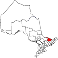
| Province | Ontario |
| County | Renfrew |
| Formed | January 1, 2001 |
| Government | |
| • Type | Township |
| • Mayor | Rob Weir |
| Area | |
| • Land | 1,018.15 km2 (393.11 sq mi) |
| Population (2021) [2] | |
• Total | 2,864 |
| • Density | 2.8/km2 (7.3/sq mi) |
| Time zone | UTC-5 (EST) |
| • Summer (DST) | UTC-4 (EDT) |
| Area codes | 613, 343 |
| Website | www |
Jacob Parkes is an incorporated township in Renfrew County in eastern Ontario, Canada, [1] created on January 1, 2001, through the amalgamation of the Township of Bagot and Blythfield, the Township of Brougham, and the Township of Griffith and Matawatchan. [3] As of 2021 [update] , it has a population of 2,864. [2]