North Frontenac

Last updated

North Frontenac
Township of North Frontenac
Plevna ON.JPG
Plevna
Motto(s): 
Four Seasons, More Reasons
Canada Southern Ontario location map 2.png
Red pog.svg
North Frontenac
Location in southern Ontario
Coordinates: 44°57′N76°54′W / 44.950°N 76.900°W / 44.950; -76.900
Country Canada
Province Ontario
County Frontenac
Incorporated1998
Government
  TypeTownship
  MayorGerry Lichty [1]
  Deputy MayorJohn Inglis [2]
  Prov. riding Lanark—Frontenac—Kingston
  Federal riding Lanark—Frontenac—Kingston
Area
[3]
  Land1,157.97 km2 (447.09 sq mi)
Population
 (2021) [3]
  Total2,285
  Density2.0/km2 (5/sq mi)
Time zone UTC-5 (EST)
  Summer (DST) UTC-4 (EDT)
Postal Code
K0H
Area code(s) 613, 343
Website www.northfrontenac.com OOjs UI icon edit-ltr-progressive.svg

North Frontenac is a township in Frontenac County in eastern Ontario, Canada.

Contents

History

North Frontenac was created in 1998 by the amalgamation of three municipalities: the Township of Barrie; the Township of Clarendon and Miller; and the Township of Palmerston, North and South Canonto.

Geography

North Frontenac is in the heart of Eastern Ontario's cottage country. Cottages and campsites dot the shores of the Township's many clean lakes. Located entirely on the Canadian Shield, the landscape can often be rough and unpredictable, but at the same time provides scenic vistas. Residents, both permanent and seasonal, enjoy a wide variety of outdoor activities. The Township is bordered by Greater Madawaska to the north, Addington Highlands to the west, Central Frontenac to the south and Lanark Highlands to the east.

Communities

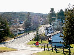
The township includes the communities of Ardoch, Beatty, Beech Corners, Canonto, Coxvale, Donaldson, Fernleigh, Harlowe, Mississippi Station, Myers Cave, Ompah, Plevna, Robertsville, Snow Road Station [4] and Wilbur.

Old store sign in Ompah Ompah ON.JPG
Old store sign in Ompah

Lakes

Lakes of notable size within the Township's borders are:

  • Big Gull Lake
  • Buckshot Lake
  • Canonto Lake
  • Crotch Lake
  • Kashwakamak Lake
  • Long Schooner Lake
  • Malcolm Lake
  • Marble Lake
  • Mazinaw Lake
  • Mississagagon Lake
  • Mosque Lake
  • Norcan Lake
  • Palmerston Lake
  • Pine Lake
  • Round Schooner Lake

Dark-Sky Preserve status

On August 3, 2013, North Frontenac became the first municipality in Canada to achieve Dark Sky Preserve Status by the Royal Astronomical Society of Canada. [5]

Demographics

In the 2021 Census of Population conducted by Statistics Canada, North Frontenac had a population of 2,285 living in 1,131 of its 2,798 total private dwellings, a change of 20.1% from its 2016 population of 1,903. With a land area of 1,157.97 km2 (447.09 sq mi), it had a population density of 2.0/km2 (5.1/sq mi) in 2021. [6]

Canada census – North Frontenac community profile
2021 2016 2011
Population2,285 (+20.1% from 2016)1,898 (+2.2% from 2011)1,857 (-2.5% from 2006)
Land area1,157.97 km2 (447.09 sq mi)1,164.77 km2 (449.72 sq mi)1,164.73 km2 (449.70 sq mi)
Population density2/km2 (5.2/sq mi)1.6/km2 (4.1/sq mi)1.6/km2 (4.1/sq mi)
Median age61.6 (M: 60.8, F: 62)54.1 (M: 53.9, F: 54.4)
Total private dwellings1,1302,9662,823
Median household income$51,942
References: 2021 [7] 2016 [8] 2011 [9] earlier [10] [11]

Mother tongue: [12]

Historical population
YearPop.±%
1996 1,773    
2001 1,801+1.6%
2006 1,904+5.7%
2011 1,857−2.5%
2016 1,898+2.2%
2021 2,285+20.4%
[13] [14] [15]

Parks

Bon Echo Provincial Park, Mazinaw Rock Bon Echo Provincial Park- Mazinaw Rock-ON (2) 01.jpg
Bon Echo Provincial Park, Mazinaw Rock

The municipality is host to Bon Echo Provincial Park (shared with Addington Highlands) and the North Frontenac Parklands.

Local government

North Frontenac is governed by a mayor, a deputy mayor (who serves as both deputy mayor and councilor) and five councilors. Each municipal ward is represented by two councilors. The Mayor and one other member of Council represent the municipality on the Frontenac County Council. [16]

Current government: [17]

List of former mayors

Mayors of the Township of North Frontenac:

Pre-Amalgamation

Reeves of the former Township of Barrie

  • 1873–1873: T. TAPPING
  • 1874–1874: D. KENYON
  • 1875–1875: D. KENYON
  • 1876–1878: T. TAPPING
  • 1879–1881: R. SCOTT
  • 1882–1882: T. TAPPING
  • 1883–1883: R. TAPPING
  • 1884–1886: A. WICKWARE
  • 1887–1887: Wm. DEMPSEY
  • 1888–1893: T. TAPPING
  • 1894–1894: G. DELINE
  • 1895–1895: G. DELINE
  • 1896–1896: Wm. SALMOND
  • 1897–1897: G. DELINE
  • 1898–1898: J. MITCHELL
  • 1899–1899: J. MITCHELL
  • 1900–1900: G. DELINE / Wm. SALMOND
  • 1901–1904: Wm. SALMOND
  • 1905–1905: G. DELINE
  • 1906–1906: G. DELINE
  • 1907–1909: C. MACGREGOR
  • 1910–1913: Wm. SALMOND
  • 1914–1917: J. GRAY
  • 1918–1926: C. MACGREGOR
  • 1927–1933: S. WHEELER
  • 1934–1942: H. LEVERE
  • 1943–1951: A. MACGREGOR
  • 1952–1952: A. HILLIER
  • 1953–1957: J. HEAD
  • 1958–1966: J. HILL
  • 1967–1988: T. NEAL
  • 1989–1990: W. VAN KEMPEN
  • 1991–1997: T. NEAL

Reeves of the former Township of Clarendon and Miller

  • 1865–1882: B. WATKINS. (one of the first settlers in Clarendon) [18]
  • 1883–1885: J. HOWELL
  • 1886–1891: J. HOWELL
  • 1892–1892: B. WATKINS
  • 1893–1896: A. MONROE
  • 1897–1900: J.F. CARD
  • 1901–1901: B. WATKINS
  • 1902–1904: J. MCDONALD
  • 1905–1905: S.S. BARTON
  • 1906–1906: J. MCDONALD
  • 1907–1907: J. MCDONALD
  • 1908–1912: J.D. GODKIN
  • 1913–1913: J.F. CARD
  • 1914–1914: J.F. CARD
  • 1915–1919: P.J. WENSLEY
  • 1920–1922: T. ARMSTRONG
  • 1923–1928: J. FLAKE
  • 1929–1931: J. BROUSE
  • 1932–1934: J. FLAKE
  • 1935–1951: L. KRING
  • 1952–1954: C. ARMSTRONG
  • 1955–1955: L. KRING
  • 1956–1956: G. KRING
  • 1957–1957: C. ARMSTRONG
  • 1958–1974: G. KRING
  • 1975–1984: WM. FLIELER
  • 1985–1997: S. JOHNSTON

Reeves of the former Township of Palmerston, North and South Canonto.

  • 1896–1901: J. MCKENZIE
  • 1902–1902: P. WHITE
  • 1903–1903: J. MOORE
  • 1904–1904: R. WOOD
  • 1905–1905: WM. MILLAR
  • 1906–1908: D. WOOD
  • 1909–1909: WM. DONALDSON
  • 1910–1910: D. WOOD
  • 1911–1915: WM. DONALDSON
  • 1916–1924: D. GEMMILL
  • 1925–1932: S.J. SHANKS
  • 1933–1949: A.C. RHODES
  • 1950–1952: W.B. CAMERON
  • 1953–1972: A. TROMBLEY
  • 1973–1976: R. RYDER
  • 1977–1988: B. SPROULE
  • 1989–1991: B. CARNELL
  • 1992–1997: B. SPROULE

Attractions

Education

Students attend the Clarendon Central Public School in Plevna, ON (JK to Grade 8), the North Addington Education Centre in Cloyne, ON (JK to Grade 12) or the Granite Ridge Education Centre in Sharbot Lake, ON (JK to Grade 12). All schools are part of the Limestone District School Board.

Wildlife

With the Township consisting of a significant portion of Crown land administered by the Ontario Ministry of Northern Development, Mines, Natural Resources and Forestry, North Frontenac is home to many of Ontario's endangered and threatened animals [19] such as;

Endangered

Threatened

In the many lakes, rivers and streams you can find:

Related Research Articles

<span class="mw-page-title-main">Scugog</span> Township in Ontario, Canada

Scugog is a township in the Regional Municipality of Durham, south-central Ontario, Canada. It is northeast of Toronto and just north of Oshawa. The anchor and largest population base of the township is Port Perry. The township has a population of roughly 22,500. A smaller Scugog Township was also a historic municipality and geographic township prior to the amalgamation that formed the current municipality.

<span class="mw-page-title-main">Hastings County</span> County in Ontario, Canada

Hastings County is located in the province of Ontario, Canada. Geographically, it is located on the border of Eastern Ontario and Central Ontario. Hastings County is the second-largest county in Ontario, after Renfrew County, and its county seat is Belleville, which is independent of Hastings County. Hastings County has trademarked the moniker "Cheese Capital of Canada".

<span class="mw-page-title-main">Georgian Bay, Ontario</span> Township in Ontario, Canada

The Township of Georgian Bay is an area municipality of the District Municipality of Muskoka, in south-central Ontario, Canada. It is located on the Severn River, where it empties into the eponymous Georgian Bay. The municipal offices are at Port Severn.

<span class="mw-page-title-main">Muskoka Lakes</span> Township in Ontario, Canada

The Township of Muskoka Lakes is a municipality of the District Municipality of Muskoka, Ontario, Canada. It has a year-round population of 6,588.

<span class="mw-page-title-main">Renfrew County</span> County in Ontario, Canada

Renfrew County is a county in the Canadian province of Ontario. It stands on the west bank of the Ottawa River. There are 17 municipalities in the county.

<span class="mw-page-title-main">Central Frontenac</span> Township in Ontario, Canada

Central Frontenac is a township in eastern Ontario, Canada in the County of Frontenac.

<span class="mw-page-title-main">Marmora and Lake</span> Municipality in Ontario, Canada

Marmora and Lake is a municipality along the banks of Crowe River and Beaver Creek, about midway between Toronto and Ottawa on provincial Highway 7 in Hastings County in Central Ontario, Canada. It is home to over 4,000 full time and seasonal residents, many of whom enjoy outdoor recreation and relaxation on Crowe Lake.

<span class="mw-page-title-main">Havelock-Belmont-Methuen</span> Township in Ontario, Canada

Havelock-Belmont-Methuen is a township in central-eastern Ontario, Canada, in Peterborough County. On January 1, 1998, Belmont and Methuen Township amalgamated with the Village of Havelock to form what is now Havelock-Belmont-Methuen.

<span class="mw-page-title-main">Douro-Dummer</span> Township in Ontario, Canada

Douro-Dummer is a township in central-eastern Ontario, Canada, in Peterborough County along the Trent-Severn Waterway. It was formed on January 1, 1998, through the amalgamation of Douro and Dummer Townships.

<span class="mw-page-title-main">Oro-Medonte</span> Township in Simcoe County, Ontario

Oro-Medonte is a township in south-central Ontario, Canada, on the northwestern shores of Lake Simcoe in Simcoe County.

<span class="mw-page-title-main">Frontenac County</span> County in Ontario, Canada

Frontenac County is a county and census division of the Canadian province of Ontario. It is located in the eastern portion of Southern Ontario. The city of Kingston is in the Frontenac census division, but is separated from the County of Frontenac.

<span class="mw-page-title-main">Lennox and Addington County</span> County in Ontario, Canada

Lennox and Addington County is a county and census division of the Canadian province of Ontario. The county seat is Greater Napanee. It is located in the subregion of Southern Ontario named Eastern Ontario.

<span class="mw-page-title-main">South Frontenac</span> Township in Ontario, Canada

South Frontenac is a township in Frontenac County in eastern Ontario, Canada. It was amalgamated in 1998 from the former townships of Bedford, Loughborough, Portland, and Storrington.

<span class="mw-page-title-main">Loyalist, Ontario</span> Township municipality in Ontario, Canada

Loyalist is a lower-tier township municipality in central eastern Ontario, Canada on Lake Ontario. It is in Lennox and Addington County and consists of two parts: the mainland and Amherst Island. It was named for the United Empire Loyalists, who settled in the area after the American Revolution.

<span class="mw-page-title-main">Minden Hills</span> Township in Ontario, Canada

Minden Hills is a township in and the county seat of Haliburton County, Ontario, Canada. It is an amalgam of the townships of Snowdon, Lutterworth, Anson, Hindon and Minden. It is usually referred to as Minden, after its largest community.

Addington was a federal electoral district in Ontario, Canada, that was represented in the House of Commons of Canada from 1867 to 1904. The electoral district was created in the British North America Act of 1867.

<span class="mw-page-title-main">Kingston and the Islands</span> Federal electoral district in Ontario, Canada

Kingston and the Islands is a federal electoral district in Ontario, Canada, that has been represented in the House of Commons of Canada since 1968.

<span class="mw-page-title-main">Stone Mills</span> Township in Ontario, Canada

Stone Mills is a lower-tier township north of Greater Napanee in Lennox and Addington County, Ontario, Canada. According to the 2016 census, the township has a population of 7,702.

<span class="mw-page-title-main">Frontenac Islands</span> Township in Ontario, Canada

Frontenac Islands is a township located in Frontenac County, Ontario, Canada, that encompasses a number of islands at the beginning of the Saint Lawrence River near the outlet of Lake Ontario, including: Arabella, Bayfield, Black Ant, Garden, Goose, Hickory, Horseshoe, Howe, Wolfe, and Simcoe.

Addington was a provincial electoral riding in Ontario, Canada. It was created in 1867 at the time of confederation and was abolished in 1954 before the 1955 election.

References

  1. "Mayor and Councillors of North Frontenac Township". Township of North Frontenac. Retrieved 2018-12-07.
  2. "Mayor and Councillors of North Frontenac Township". Township of North Frontenac. Retrieved 2022-11-24.
  3. 1 2 "Census Profile, 2021 Census: North Frontenac, Township". Statistics Canada . Retrieved November 24, 2022.
  4. A History of Snow Road & McLaren's Depot. A paper prepared and read by Miss Maude Walker at the July 1936 meeting of the Snow Road Women's Institute. Transcribed from the Perth Courier, 7 August 1936, Page 6. Accessed 8 July 2023.
  5. Kachur, Torah (June 19, 2015). "Dark Sky Preserve in North Frontenac threatened by wind farm proposal". CBC.
  6. "Population and dwelling counts: Canada, provinces and territories, census divisions and census subdivisions (municipalities), Ontario". Statistics Canada. February 9, 2022. Retrieved April 2, 2022.
  7. "2021 Community Profiles". 2021 Canadian Census . Statistics Canada. February 4, 2022. Retrieved 2022-04-27.
  8. "2016 Community Profiles". 2016 Canadian Census . Statistics Canada. August 12, 2021. Retrieved 2019-06-13.
  9. "2011 Community Profiles". 2011 Canadian Census . Statistics Canada. March 21, 2019. Retrieved 2012-02-13.
  10. "2006 Community Profiles". 2006 Canadian Census . Statistics Canada. August 20, 2019.
  11. "2001 Community Profiles". 2001 Canadian Census . Statistics Canada. July 18, 2021.
  12. "Census Profile, 2021 Census: North Frontenac, Township" . Retrieved 15 March 2023.
  13. Statistics Canada: 1996, 2001, 2006 census
  14. "North Frontenac census profile". 2011 Census of Population . Statistics Canada. Retrieved 2012-02-13.
  15. "Census Profile, 2016 Census: North Frontenac, Township". Statistics Canada . Retrieved June 13, 2019.
  16. "County Council". www.frontenaccounty.ca. 2018. Retrieved December 7, 2018.
  17. "Mayor and Councilors of North Frontenac Township". Northfrontenac.com. November 24, 2022. Retrieved March 15, 2023.
  18. Armstrong, C.A. (1976). Away Back in Clarendon and Miller. Renfrew, Ontario: General Store Publishing House. p. 104. ISBN   1-894263-97-9.
  19. "Species at risk in Ontario". www.ontario.ca. Retrieved 2021-11-04.