Madawaska Valley | |
|---|---|
| Township of Madawaska Valley | |
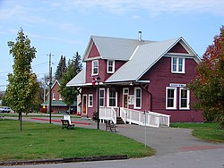 Tourist office in Barry's Bay | |
 Madawaska Valley  Madawaska Valley | |
| Coordinates: 45°30′N77°40′W / 45.500°N 77.667°W | |
| Country | Canada |
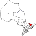
| Province | Ontario |
| County | Renfrew |
| Formed | January 1, 2001 |
| Government | |
| • Mayor | Mark Willmer |
| • Federal riding | Algonquin—Renfrew—Pembroke |
| • Prov. riding | Renfrew—Nipissing—Pembroke |
| Area | |
| • Land | 665.83 km2 (257.08 sq mi) |
| Population (2021) [1] | |
• Total | 3,927 |
| • Density | 5.9/km2 (15/sq mi) |
| Time zone | UTC-5 (EST) |
| • Summer (DST) | UTC-4 (EDT) |
| Postal Code | K0J |
| Area codes | 613, 343 |
| Website | https://www.madawaskavalley.ca |
The Township of Madawaska Valley is a township municipality in Renfrew County, Ontario, Canada. It was formed in 2001 through the amalgamation of the village of Barry's Bay and the townships of Radcliffe and Sherwood Jones & Burns.
Contents
The area is also a culturally significant location for the Polish diaspora in Canada, and is known by members of the community as Kaszuby (English Kashubia), after a region in Northern Poland that many early settlers of the region hailed from.
Its largest population centre is Barry's Bay, and it also includes the settlements of Combermere and Wilno, the latter of which being named for the city of Vilnius (Polish Wilno), a city in modern Lithuania that has historically possessed a large Polish population and significant cultural ties to Poland.
The area is also the locus of Polish scouting organizations within Canada (including both ZHP and ZHR), who hold overnight camps for scouts annually, in July. [2]