Unorganized South Nipissing District

Last updated
Unorganized South Nipissing District
Nipissing, Unorganized, South Part
Barron Canyon.jpg
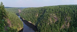
The Barron Canyon in Algonquin Park
Unorg South Nipissing.png
Coordinates: 45°50′N78°25′W / 45.833°N 78.417°W / 45.833; -78.417
Country Canada
Province Ontario
District Nipissing
Government
  Federal riding Nipissing—Timiskaming
  Prov. riding Nipissing, Renfrew—Nipissing—Pembroke
Area
[1]
  Land6,710.22 km2 (2,590.83 sq mi)
Population
 (2016) [1]
  Total103
  Density0.015/km2 (0.04/sq mi)
Time zone UTC-5 (EST)
  Summer (DST) UTC-4 (EDT)
Area code 705

Unorganized South Nipissing District is an unorganized area in north-central Ontario, in the District of Nipissing. It is almost entirely within and includes most of Algonquin Provincial Park.

Contents

Localities

Localities located within the unorganized area are:

Communities

Townships

The following geographic townships are included:

  • Anglin
  • Ballantyne
  • Barron
  • Biggar
  • Bishop
  • Boulter
  • Bower
  • Boyd
  • Bronson
  • Butt
  • Canisbay
  • Clancy
  • Deacon
  • Devine
  • Dickson
  • Edgar
  • Finlayson
  • Fitzgerald
  • Freswick
  • Guthrie
  • Hunter
  • Lauder
  • Lister
  • Master
  • McCraney
  • McLaughlin
  • Niven
  • Osler
  • Paxton
  • Peck
  • Pentland
  • Preston
  • Sproule
  • Stratton
  • White
  • Wilkes

All, except Boulter, Lauder, and parts of Ballantyne, Boyd and Paxton are within Algonquin Provincial Park.

Demographics

Canada census – Nipissing, Unorganized, South Part community profile
2016 2011
Population103 (28.8% from 2011)80 (% from 2006)
Land area6,710.22 km2 (2,590.83 sq mi)6,710.88 km2 (2,591.09 sq mi)
Population density0.0/km2 (0/sq mi)0.0/km2 (0/sq mi)
Median age51.5 (M: 41.8, F: 58.5)52.0 (M: 50.5, F: 53.0)
Private dwellings273 (total) 138 (total) 
Median household income$55,040
References: 2016 [2] 2011 [3] earlier [4] [5]
Historical census populations – Unorganized South Nipissing District
YearPop.±%
1976 947    
1981 680−28.2%
1986 717+5.4%
1991 628−12.4%
1996 636+1.3%
YearPop.±%
2001 51−92.0%
2006 67+31.4%
2011 80+19.4%
2016 103+28.8%
Population counts are not adjusted for boundary changes.
Source: Statistics Canada

Population distribution

Most of the population lives outside of Algonquin Park on the northern or northwestern fringes of the region. According to the 2016 Census, the blocks that encompass the Townships of Boulter, Lauder, Pentland and Boyd had a combined population of 57. The area around Loxton Lake in Ballantyne Township (Census Block 35480228012) had a population of 26. Census Block 35480228215 which covers parts of Bronson and Stratton Townships in the Northeast corner of Algonquin Park had a population of 5, while 15 people lived in Census Block 35480228146 which covers most of the western part of the region.

See also

Related Research Articles

<span class="mw-page-title-main">Timiskaming District</span> District in Ontario, Canada

Timiskaming is a district and census division in Northeastern Ontario in the Canadian province of Ontario. The district was created in 1912 from parts of Algoma, Nipissing, and Sudbury districts. In 1921, Cochrane District was created from parts of this district and parts of Thunder Bay District.

<span class="mw-page-title-main">Achray, Ontario</span> Place in Ontario, Canada

Achray is an unincorporated place and former railway point in geographic Stratton Township in the Unorganized South Part of Nipissing District in northeastern Ontario, Canada. It lies in northern Algonquin Provincial Park on the northern shore of Grand Lake, part of the Barron River system, and functions today as a campground site.

<span class="mw-page-title-main">Sudbury District</span> District in Ontario, Canada

The Sudbury District is a district in Northeastern Ontario in the Canadian province of Ontario. It was created in 1894 from townships of eastern Algoma District and west Nipissing District.

<span class="mw-page-title-main">Parry Sound District</span> District in Ontario, Canada

Parry Sound District is a census division of the Canadian province of Ontario. Its boundaries are District of Muskoka to the south, the Sudbury District to the north-northwest, the French River and Lake Nipissing in the north, Nipissing District and North Bay in the north and east and parts of Algonquin Park in the northeast.

<span class="mw-page-title-main">Unorganized Centre Parry Sound District</span> Unorganized area in Ontario, Canada

Unorganized Centre Parry Sound District is an unorganized area in central Ontario, Canada, between Georgian Bay and Lake Nipissing in the District of Parry Sound. It is made up of geographic townships which have no governing bodies and which are not incorporated as municipalities. The territory consists of two non-contiguous areas, with the main part located directly south of the French River and Lake Nipissing, and east of Georgian Bay. Shawanaga Township is a small exclave south of it along Highway 69.

<span class="mw-page-title-main">Nipissing District</span> District in Ontario, Canada

Nipissing District is a district in Northeastern Ontario in the Canadian province of Ontario. It was created in 1858. The district seat is North Bay.

<span class="mw-page-title-main">Opeongo River</span> River in Ontario, Canada

The Opeongo River is a river in the Saint Lawrence River drainage basin in Nipissing District in northeastern Ontario, Canada. The river is entirely within Algonquin Provincial Park and Opeongo River Provincial Park, except for a small portion around Victoria Lake, and is a left tributary of the Madawaska River.

<span class="mw-page-title-main">Barron River (Ontario)</span> River in Ontario, Canada

The Barron River is a river in the Saint Lawrence River drainage basin in Nipissing District and Renfrew County, Ontario, Canada. It flows from Clemow Lake in northern Algonquin Provincial Park and joins the Petawawa River, whose southern branch it forms, in the municipality of Laurentian Hills, near the municipality of Petawawa.

<span class="mw-page-title-main">Kiosk, Ontario</span> Place in Ontario, Canada

Kiosk is an unincorporated place and former railway point and community in geographic Pentland Township in the Unorganized South Part of Nipissing District in northeastern Ontario, Canada. Kiosk is surrounded by but not within Algonquin Provincial Park, for which it provides a road access point via Ontario Highway 630, and is located on Kioshkokwi Lake on the Amable du Fond River on the right bank of the outlet of that river from the lake and across the river from the unincorporated place of Coristine. The name "Kiosk" is an abbreviated form of the lake's name, which means "lake of many gulls".

Nipissing was a federal electoral district that was represented in the House of Commons of Canada from 1896 to 2004. It was located in the northeastern part of Ontario, Canada.

Cedar Lake is a lake in the geographic townships of Boyd, Deacon and Lister in the Unorganized south part of Nipissing District in northeastern Ontario, Canada. The lake is in the Saint Lawrence River drainage basin and is entirely within Algonquin Provincial Park; it is a popular entry point for canoe trips into the interior of the park as the community of Brent, located on the lake, is connected by Brent Road to Ontario Highway 17. Other places on the lake are Acanthus and Government Park.

<span class="mw-page-title-main">Parry Sound—Muskoka (federal electoral district)</span> Federal electoral district in Ontario, Canada

Parry Sound—Muskoka is a federal electoral district in Ontario, Canada, that has been represented in the House of Commons of Canada since 1949.

<span class="mw-page-title-main">Unorganized North Nipissing District</span> Unorganized area in Ontario, Canada

Unorganized North Nipissing District is an unorganized area in northeastern Ontario, Canada. It includes the unincorporated areas in northern Nipissing District north of the Mattawa River.

<span class="mw-page-title-main">South Algonquin</span> Township municipality in Ontario, Canada

South Algonquin is a township municipality in Nipissing District, Ontario, Canada. Located south of Algonquin Provincial Park, it is the sole populated portion of the district that lies south of the traditional dividing line between Northern Ontario and Southern Ontario and is closer connected to Renfrew County as opposed to the core portions of Nipissing District.

<span class="mw-page-title-main">Almaguin Highlands</span> Inter-region in Ontario, Canada

The Almaguin Highlands Region in Ontario, Canada, covers approximately 5,200 km2 (2,000 sq mi) comprising the eastern half of Parry Sound District. It is bounded by Muskoka in the south, and by Lake Nipissing and Nipissing District in the north. The eastern edge abuts the western boundary of Algonquin Provincial Park, whereas the western boundary of the Almaguin Highlands is generally regarded to be the mid east-west point of Parry Sound District. Originally derived from the words Algonquin, Magnetawan, and Seguin. the name Almaguin is now used to describe the marketing region of East Parry Sound.

<span class="mw-page-title-main">North Tea Lake</span> Lake in Ontario, Canada

North Tea Lake is a lake in the Ottawa River drainage basin in the geographic townships of Ballantyne and Wilkes in the Unorganized South Part of Nipissing District in Northeastern Ontario, Canada. It is on the Amable du Fond River and lies in the northwest of Algonquin Provincial Park. The lake is a popular destination for canoeists.

The Nipissing River is a river in the Saint Lawrence River drainage basin in the Unorganized South Part of Nipissing District in northeastern Ontario, Canada. The river is entirely within Algonquin Provincial Park, and is a left tributary of the Petawawa River.

Mink Lake is an unincorporated place and former railway point in geographic Pentland Township in the Unorganized South Part of Nipissing District in northeastern Ontario, Canada. Mink Lake is located within Algonquin Provincial Park at the eastern end of Mink Lake in the Amable du Fond River drainage basin.

<span class="mw-page-title-main">Ascalon, Ontario</span> Place in Ontario, Canada

Ascalon is an unincorporated place and former railway point in geographic Pentland Township in the Unorganized South Part of Nipissing District in northeastern Ontario, Canada. Ascalon is located within Algonquin Provincial Park at the northwestern end of Mink Lake in the Amable du Fond River drainage basin.

Kilrush is an unincorporated place and former railway point in geographic Boulter Township in the Unorganized South Part of Nipissing District in northeastern Ontario, Canada. Kilrush is located northwest of the northwest side of Algonquin Provincial Park on Kilrush Lake in the Amable du Fond River drainage basin.

References

  1. 1 2 "Nipissing, Unorganized, South Part census profile". 2016 Census of Population . Statistics Canada. 8 February 2017. Retrieved 2019-01-12.
  2. "2016 Community Profiles". 2016 Canadian Census . Statistics Canada. August 12, 2021. Retrieved 2021-11-24.
  3. "2011 Community Profiles". 2011 Canadian Census . Statistics Canada. March 21, 2019. Retrieved 2012-02-10.
  4. "2006 Community Profiles". 2006 Canadian Census . Statistics Canada. August 20, 2019.
  5. "2001 Community Profiles". 2001 Canadian Census . Statistics Canada. July 18, 2021.

Commons-logo.svg Media related to Unorganized Nipissing, South Part at Wikimedia Commons