Unorganized North Nipissing District | |
|---|---|
| Nipissing, Unorganized, North Part | |
 Eldee | |
 | |
| Coordinates: 46°40′N79°30′W / 46.667°N 79.500°W | |
| Country | |
| Province | |
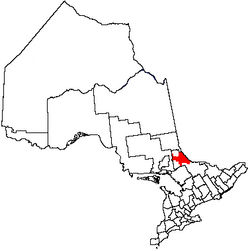
| District | Nipissing |
| Government | |
| • Fed. riding | Nipissing—Timiskaming |
| • Prov. riding | Timiskaming—Cochrane, Nipissing |
| Area | |
| • Land | 3,721.20 km2 (1,436.76 sq mi) |
| Population (2021) [1] | |
• Total | 1,591 |
| • Density | 0.4/km2 (1/sq mi) |
| Time zone | UTC-5 (EST) |
| • Summer (DST) | UTC-4 (EDT) |
| Area code | 705 |
Unorganized North Nipissing District is an unorganized area in northeastern Ontario, Canada. It includes the unincorporated areas in northern Nipissing District, north of the Mattawa River.
Contents
The unorganized area is gradually being reduced in size. In 1967, a portion was transferred to Unorganized Timiskaming, [2] and between 1996 and 2001, its area shrunk from 7,216.66 square kilometres (2,786.37 sq mi) to 3,630.64 square kilometres (1,401.80 sq mi), [3] because of annexation by surrounding incorporated towns and townships. [4]
