Calvin, Ontario

Last updated

Calvin
Township of Calvin
Calvin ON.jpg
Rural scene near Eau Claire
Canada Ontario location map 2.svg
Red pog.svg
Calvin
Coordinates: 46°14′N78°56′W / 46.233°N 78.933°W / 46.233; -78.933
CountryCanada
Province Ontario
District Nipissing
Government
  MayorRichard Gould
Area
  Total140.98 km2 (54.43 sq mi)
Population
 (2016) [1]
  Total516
  Density3.7/km2 (10/sq mi)
Time zone UTC-5 (Eastern (EST))
Postal code
P0H 1V0
Area code 705
Website www.calvintownship.ca

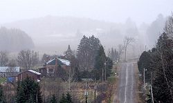
Calvin is a township in northeastern Ontario, Canada on the Mattawa River in Nipissing District. The township took its name from Delino Dexter Calvin, an Ontario lumber merchant and MPP based in Frontenac County.

Contents

In 2007, Calvin, along with the town of Mattawa and the townships of Papineau-Cameron, Mattawan and Bonfield cooperated to create a newly branded Mattawa Voyageur Country tourist region in order to promote the area. [2]

Communities

Eau Claire Gorge on the Amable du Fond River Eau Claire Gorge.jpg
Eau Claire Gorge on the Amable du Fond River

The township comprises the communities of Eau Claire and Eau Claire Station.

Demographics

In the 2021 Census of Population conducted by Statistics Canada, Calvin had a population of 557 living in 227 of its 263 total private dwellings, a change of 7.9% from its 2016 population of 516. With a land area of 140.13 km2 (54.10 sq mi), it had a population density of 4.0/km2 (10.3/sq mi) in 2021. [3]

Canada census – Calvin community profile
2021 2016 2011
Population557 (+7.9% from 2016)516 (-9.2% from 2011)568 (-6.6% from 2006)
Land area140.13 km2 (54.10 sq mi)140.98 km2 (54.43 sq mi)140.69 km2 (54.32 sq mi)
Population density4/km2 (10/sq mi)3.7/km2 (9.6/sq mi)4.0/km2 (10/sq mi)
Median age50.0 (M: 51.6, F: 47.2)47.0 (M: 48.0, F: 45.0)
Private dwellings263 (total)  227 (occupied)251 (total) 251 (total) 
Median household income$72,000$48,768
References: 2021 [4] 2016 [5] 2011 [6] earlier [7] [8]

See also

Related Research Articles

<span class="mw-page-title-main">East Hawkesbury</span> Township in Ontario, Canada

East Hawkesbury is a township in eastern Ontario, Canada, in the United Counties of Prescott and Russell. Situated on the Ottawa River, its eastern boundary is the border with the province of Quebec.

<span class="mw-page-title-main">Seguin, Ontario</span> Township in Ontario, Canada

Seguin is a township in central Ontario, Canada, in the District of Parry Sound.

<span class="mw-page-title-main">Nipissing District</span> District in Ontario, Canada

Nipissing District is a district in Northeastern Ontario in the Canadian province of Ontario. It was created in 1858. The district seat is North Bay.

<span class="mw-page-title-main">Thames Centre</span> Municipality in Ontario, Canada

Thames Centre is a municipality in Middlesex County, Ontario, Canada, directly east of the City of London. It was formed on January 1, 2001, when the townships of West Nissouri and North Dorchester were amalgamated. It is part of the London census metropolitan area.

<span class="mw-page-title-main">St. Charles, Ontario</span> Municipality in Ontario, Canada

St. Charles is a town in the Canadian province of Ontario, located in the Sudbury District.

<span class="mw-page-title-main">Central Huron</span> Municipality in Ontario, Canada

Central Huron is a township in western Ontario, Canada, in Huron County. It is situated on Lake Huron between the Maitland River and the Bayfield River.

<span class="mw-page-title-main">Papineau-Cameron</span> Township in Ontario, Canada

Papineau-Cameron is a township municipality in northeastern Ontario, Canada, in Nipissing District. The township is located on the south side of the Mattawa and Ottawa Rivers along Highway 17.

<span class="mw-page-title-main">Bonfield, Ontario</span> Township in Ontario, Canada

Bonfield is a township in northeastern Ontario, Canada, on the Mattawa River in Nipissing District.

<span class="mw-page-title-main">Arran–Elderslie</span> Municipality in Ontario, Canada

The Municipality of Arran–Elderslie is a township in Bruce County in Western Ontario, Canada. The township is located at the headwaters of the Sauble River, and the Saugeen River forms the northwestern boundary.

<span class="mw-page-title-main">Bayham</span> Municipality in Ontario, Canada

Bayham is a municipality in the southeast corner of Elgin County, Ontario, Canada. It is south of the town of Tillsonburg and Oxford County.

<span class="mw-page-title-main">Dawson, Ontario</span> Township in Ontario, Canada

Dawson is a township located in Rainy River District in Northwestern Ontario, Canada. The township is located at the mouth of the Rainy River where it flows into Lake of the Woods.

<span class="mw-page-title-main">Southwest Middlesex, Ontario</span> Municipality in Ontario, Canada

Southwest Middlesex is a municipality in Middlesex County, Ontario, Canada.

Malahide is a municipal township in Elgin County in southwestern Ontario, Canada.

<span class="mw-page-title-main">Neebing</span> Municipality in Ontario, Canada

Neebing is a municipality in the Canadian province of Ontario, located in the Thunder Bay District immediately south of the city of Thunder Bay. It is part of Thunder Bay's Census Metropolitan Area.

<span class="mw-page-title-main">Mattawan, Ontario</span> Municipality in Ontario, Canada

Mattawan is a municipality in the Canadian province of Ontario. Located in the Nipissing District, the municipality had a population of 161 in the Canada 2016 Census.

<span class="mw-page-title-main">Machin, Ontario</span> Township in Ontario, Canada

Machin is a township in the Canadian province of Ontario, located in the Kenora District west of Dryden.

<span class="mw-page-title-main">Hilton, Ontario</span> Township in Ontario, Canada

Hilton is a township in the Canadian province of Ontario, comprising the southeast quadrant of St. Joseph Island in the Algoma District. It surrounds, but does not include, the independent village of Hilton Beach.

<span class="mw-page-title-main">Dorion, Ontario</span> Township in Ontario, Canada

Dorion is a township in the Canadian province of Ontario, located within the Thunder Bay District. The township had a population of 316 in the Canada 2016 Census. Ouimet Canyon and the Dorion Bible Camp are located in the community.

<span class="mw-page-title-main">Gillies, Ontario</span> Township in Ontario, Canada

Gillies is a township in the Canadian province of Ontario, located within the Thunder Bay District.

<span class="mw-page-title-main">Enniskillen, Ontario</span> Township in Ontario, Canada

Enniskillen is a township in the Canadian province of Ontario, within Lambton County. It is located at the intersection of Highway 21 and Rokeby Line. The economy of the township is based on agriculture. It was named after Sir Galbraith Lowry Cole's father who was the Earl of Enniskillen, Northern Ireland.

References

  1. "2016 Census Profile: Calvin, Municipality". Statistics Canada. February 8, 2017. Retrieved June 24, 2019.
  2. Adams, K. "Mattawa sports a new look" Archived August 5, 2009, at the Wayback Machine , Baytoday.ca, July 17, 2007. Accessed March 28, 2008.
  3. "Population and dwelling counts: Canada, provinces and territories, census divisions and census subdivisions (municipalities), Ontario". Statistics Canada. February 9, 2022. Retrieved March 31, 2022.
  4. "2021 Community Profiles". 2021 Canadian Census . Statistics Canada. February 4, 2022. Retrieved October 19, 2023.
  5. "2016 Community Profiles". 2016 Canadian Census . Statistics Canada. August 12, 2021. Retrieved June 24, 2019.
  6. "2011 Community Profiles". 2011 Canadian Census . Statistics Canada. March 21, 2019.
  7. "2006 Community Profiles". 2006 Canadian Census . Statistics Canada. August 20, 2019.
  8. "2001 Community Profiles". 2001 Canadian Census . Statistics Canada. July 18, 2021.