Laurentian Hills | |
|---|---|
| Town of Laurentian Hills | |
 Municipal offices in Point Alexander | |
 Laurentian Hills  Laurentian Hills | |
| Coordinates: 46°08′N77°33′W / 46.133°N 77.550°W | |
| Country | Canada |
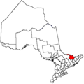
| Province | Ontario |
| County | Renfrew |
| Established | January 1, 2000 |
| Government | |
| • Mayor | Anne Giardini |
| • Federal riding | Algonquin—Renfrew—Pembroke |
| • Prov. riding | Renfrew—Nipissing—Pembroke |
| Area | |
| • Land | 634.31 km2 (244.91 sq mi) |
| Population (2021) [1] | |
• Total | 2,885 |
| • Density | 4.5/km2 (12/sq mi) |
| Time zone | UTC-5 (EST) |
| • Summer (DST) | UTC-4 (EDT) |
| Postal Code | K0J 1J0 |
| Area code | 613 |
| Website | www |
Laurentian Hills is a municipality in Eastern Ontario, Canada, on the Ottawa River in Renfrew County. It surrounds (by land) Deep River on the Ontario side of the river. The municipality was formed on January 1, 2000, when the United Townships of Rolph, Buchanan, Wylie and McKay and the Village of Chalk River were merged. [2]
Contents
The town was home to the Nuclear Power Demonstration nuclear power plant. The prototype nuclear power plant was operational from 1962 to 1987 and has since then been shut down, awaiting permanent disposal of its radioactive nuclear components. [3]