Head, Clara and Maria

Last updated

Head, Clara and Maria
United Townships of Head, Clara and Maria
Deux Rivieres ON.jpg
Highway 17 and Ottawa River at Deux-Rivières
Renfrew locator map 2021.svg
Red pog.svg
Head, Clara and Maria
Canada Southern Ontario location map 2.png
Red pog.svg
Head, Clara and Maria
Coordinates: 46°10′N78°00′W / 46.167°N 78.000°W / 46.167; -78.000
Country Canada
Province Ontario
County Renfrew
Incorporated1878
Government
  MayorDebbi Grills
Area
[1]
  Land719.20 km2 (277.68 sq mi)
Population
 (2021) [1]
  Total267
  Density0.4/km2 (1/sq mi)
Time zone UTC-5 (EST)
  Summer (DST) UTC-4 (EDT)
Postal codes
Bissett Creek: K0J 1E0
Deux Rivières: K0J 1R0
Mackey: K0J 2B0
Stonecliffe: K0J 2K0
Area code(s) 613, 705
Website www.townshipsof
headclaramaria.ca

Head, Clara and Maria, officially the United Townships of Head, Clara and Maria, is a municipality and incorporated township in Renfrew County in eastern Ontario, Canada, It is on the Ottawa River and on the northern edge of Algonquin Park.

Contents

Virtually all the communities (Deux-Rivières, Bissett Creek, Stonecliffe and Mackey) and activities are along Highway 17, the rest of the township is largely crown land, which is mostly wilderness. Property taxes are the lowest in Renfrew County. [2]

History

The township of Head was named in honour of Sir Edmund Walker Head, 8th Baronet who served as Lieutenant-Governor of New Brunswick 1847-1854 and Governor-General of Canada 1854-1861. The township of Maria was named in honour of his wife, Lady Anna Maria Head (Nee Yorke) (1808-1890). [3]

Geography

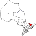
Head, Clara and Maria is bordered on the north by the Ottawa River and on the south by Algonquin Provincial Park. Trans Canada Highway 17 runs through the four hamlets which make up this municipality.

The municipality has numerous with lakes and rivers, providing fishing, hunting, hiking, canoeing, and snowmobiling opportunities. [2]

Communities

The township includes the communities of Aylen, [4] Bissett Creek, Deux-Rivières, Mackey and Stonecliffe.

Deux-Rivières provides access to Algonquin Park via Brent Road. Stonecliffe is home to the municipal office and is near Driftwood Provincial Park.

Demographics

In the 2021 Census of Population conducted by Statistics Canada, Head, Clara and Maria had a population of 267 living in 116 of its 133 total private dwellings, a change of

Historical census populations – Head, Clara and Maria
YearPop.±%
1921 488    
1931 536+9.8%
1941 620+15.7%
1951 645+4.0%
1956 549−14.9%
1961 549+0.0%
YearPop.±%
1966 554+0.9%
1971 474−14.4%
1976 433−8.6%
1981 372−14.1%
1986 293−21.2%
1991 256−12.6%
YearPop.±%
1996 294+14.8%
2001 228−22.4%
2006 228+0.0%
2011 235+3.1%
2016 248+5.5%
2021 267+7.7%
Source: Statistics Canada [1] [5]

Local government

List of former reeves: [6]

Notable people

See also

Related Research Articles

<span class="mw-page-title-main">Ottawa River</span> River in Canada

The Ottawa River is a river in the Canadian provinces of Ontario and Quebec. It is named after the Algonquin word 'to trade', as it was the major trade route of Eastern Canada at the time. For most of its length, it defines the border between these two provinces. It is a major tributary of the St. Lawrence River and the longest river in Quebec.

<span class="mw-page-title-main">Algonquin people</span> Indigenous people of Eastern Canada

The Algonquin people are an Indigenous people who now live in Eastern Canada. They speak the Algonquin language, which is part of the Algonquian language family. Culturally and linguistically, they are closely related to the Odawa, Potawatomi, Ojibwe, Mississaugas, and Nipissing, with whom they form the larger Anicinàpe (Anishinaabeg). Algonquins are known by many names, including Omàmiwinini and Abitibiwinni or the more generalised name of Anicinàpe.

<span class="mw-page-title-main">Arnprior</span> Town in Ontario, Canada

Arnprior is a town in Renfrew County, in the eastern portion of Southern Ontario, Canada. It is located 65 km (40 mi) west of Downtown Ottawa, at the confluence of the Madawaska River and the Ottawa River in the Ottawa Valley. Arnprior has experienced significant growth in populations with the widening of the 417 Provincial Highway to four lanes. The town experienced an increase in population by 8.4% from 2011 to 2016, at which time its population was 8,795. The town is a namesake of Arnprior, Scotland, and is known for lumber, hydro power generation, aerospace, farming and its proximity to the National Capital Region.

<span class="mw-page-title-main">Petawawa</span> Town in Ontario, Canada

Petawawa is a town located in the eastern portion of Southern Ontario. Situated in the Ottawa Valley, with a population of 18,160, Petawawa is the most populous municipality in Renfrew County.

<span class="mw-page-title-main">Renfrew County</span> County in Ontario, Canada

Renfrew County is a county in the Canadian province of Ontario. It straddles the west bank of the Ottawa River. There are 17 municipalities in the county.

<span class="mw-page-title-main">Edmund Walker Head</span> British governor in British North America

Sir Edmund Walker Head, 8th Baronet, KCB was a 19th-century British politician and diplomat.

<span class="mw-page-title-main">Indian River (Muskrat River watershed)</span> River in Ontario, Canada

The Indian River is a river in Renfrew County and Nipissing District in Eastern and Northeastern Ontario, Canada. It is in the Saint Lawrence River drainage basin, and is a left tributary of the Muskrat River.

<span class="mw-page-title-main">Renfrew, Ontario</span> Town in Ontario, Canada

Renfrew is a town on the Bonnechere River in Renfrew County, Ontario, Canada. Located one hour west of Ottawa in Eastern Ontario, Renfrew is the fourth largest town in the county after Petawawa, Pembroke and Arnprior. The town is a small transportation hub connecting Highway 60 and Highway 132 with the Trans-Canada Highway. Renfrew is also known historically for its role in the formation of the National Hockey League. It lies about 5 kilometres from the Quebec border, about 10 kilometres by road. Renfrew makes most of Canada’s hockey tape.

<span class="mw-page-title-main">Whitewater Region</span> Township in Ontario, Canada

Whitewater Region is a township on the Ottawa River in Renfrew County, located within the scenic Ottawa Valley in eastern Ontario, Canada. Whitewater Region is made up of the former municipalities of Beachburg, Cobden, Ross and Westmeath, which were amalgamated into the current township on January 1, 2001.

<span class="mw-page-title-main">Petawawa River</span> River in Ontario, Canada

The Petawawa River is a river in the Saint Lawrence River drainage basin in Nipissing District and Renfrew County in eastern and northeastern Ontario, Canada. The river flows from Algonquin Provincial Park to the Ottawa River at the town of Petawawa, and is only one of two major tributaries of the Ottawa River to flow completely freely. The river's name comes from the Algonquian for "where one hears a noise like this", which refers to its many rapids.

<span class="mw-page-title-main">Bonnechere River</span> River in Ontario, Canada

The Bonnechere River is a river in the Saint Lawrence River drainage basin in Nipissing District and Renfrew County in eastern and northeastern Ontario, Canada. The river flows from Algonquin Provincial Park to the Ottawa River east and north of the town of Renfrew. The river's name is thought to come from the French "bonne chère" meaning "plentiful good food".

<span class="mw-page-title-main">Opeongo River</span> River in Ontario, Canada

The Opeongo River is a river in the Saint Lawrence River drainage basin in Nipissing District in northeastern Ontario, Canada. The river is entirely within Algonquin Provincial Park and Opeongo River Provincial Park, except for a small portion around Victoria Lake, and is a left tributary of the Madawaska River.

<span class="mw-page-title-main">Barron River (Ontario)</span> River in Ontario, Canada

The Barron River is a river in the Saint Lawrence River drainage basin in Nipissing District and Renfrew County, Ontario, Canada. It flows from Clemow Lake in northern Algonquin Provincial Park and joins the Petawawa River, whose southern branch it forms, in the municipality of Laurentian Hills, near the municipality of Petawawa.

<span class="mw-page-title-main">Renfrew—Nipissing—Pembroke (federal electoral district)</span> Federal electoral district in Ontario, Canada

Renfrew—Nipissing—Pembroke is a federal electoral district in Ontario, Canada, that has been represented in the House of Commons since 1979.

Renfrew North was a federal electoral district represented in the House of Commons of Canada from 1867 to 1979. It was located in the province of Ontario. It was created by the British North America Act of 1867. The riding existed until 1972, when the name was changed to "Renfrew North—Nipissing East".

<span class="mw-page-title-main">Laurentian Hills</span> Town in Ontario, Canada

Laurentian Hills is a municipality in Eastern Ontario, Canada, on the Ottawa River in Renfrew County. It surrounds Deep River on the Ontario side of the river. The town is home to the Nuclear Power Demonstration nuclear power plant. The prototype nuclear power plant was operational from 1962 to 1987 and has since then been shut down for over 30 years, awaiting permanent disposal of its radioactive nuclear components. The municipality was formed on January 1, 2000, when the United Townships of Rolph, Buchanan, Wylie and McKay and the Village of Chalk River were merged.

Marlborough Township is a former incorporated and now geographic township in eastern Ontario, Canada.

<span class="mw-page-title-main">South Algonquin</span> Township municipality in Ontario, Canada

South Algonquin is a township municipality in Nipissing District, Ontario, Canada. Located south of Algonquin Provincial Park, it is the sole populated portion of the district that lies south of the traditional dividing line between Northern Ontario and Southern Ontario and is closer connected to Renfrew County as opposed to the core portions of Nipissing District.

<span class="mw-page-title-main">North Algona Wilberforce</span> Township municipality in Ontario, Canada

North Algona Wilberforce is a township municipality in Renfrew County, Ontario, Canada. It has a population of 2,873. The township was formed in 1999 when the North Algona and Wilberforce townships were amalgamated.

<span class="mw-page-title-main">Pembroke, Ontario</span> City in Ontario, Canada

Pembroke is a city in the Canadian province of Ontario at the confluence of the Muskrat River and the Ottawa River in the Ottawa Valley. Pembroke is the location of the administrative headquarters of Renfrew County, though the city itself is politically independent. It is 145 kilometres (90 mi) northwest of Ottawa.

References

  1. 1 2 3 4 "Head, Clara and Maria (Code 3547098) Census Profile". 2021 census . Government of Canada - Statistics Canada . Retrieved 2024-07-24.
  2. 1 2 "Township of Head, Clara and Maria". renfrew.ic12.esolg.ca. County of Renfrew. 7 January 2020. Retrieved 25 July 2024.
  3. Morgan, Henry James, ed. (1903). Types of Canadian Women and of Women who are or have been Connected with Canada. Toronto: Williams Briggs. p.  153.
  4. "Aylen". Geographical Names Data Base . Natural Resources Canada . Retrieved 2018-08-31.
  5. "1971 Census of Canada - Population Census Subdivisions (Historical)". Catalogue 92-702 Vol I, part 1 (Bulletin 1.1-2). Statistics Canada: 76, 139. July 1973.
  6. "Township Politics". images.ourontario.ca. Head, Clara and Maria Public Library. Retrieved 25 July 2024.
  7. https://townshipsofheadclaramaria.ca/download.php?dl=YToyOntzOjI6ImlkIjtzOjM6IjM2MCI7czozOiJrZXkiO2k6NTt9