Bathurst District

Last updated
1850 map of Eastern Ontario showing Bathurst District 1850 Tallis Map of West Canada or Ontario (cropped - Eastern Ontario).jpg
1850 map of Eastern Ontario showing Bathurst District

The Bathurst District was a historic district in Upper Canada which existed until 1849. It was created in 1822 from the Johnstown District and contained Carleton County. [1] The district town was Perth.

District Administrative division, in some countries, managed by local government

A district is a type of administrative division that, in some countries, is managed by local government. Across the world, areas known as "districts" vary greatly in size, spanning regions or counties, several municipalities, subdivisions of municipalities, school district, or political district.

Upper Canada 19th century British colony in present-day Ontario

The Province of Upper Canada was a part of British Canada established in 1791 by the Kingdom of Great Britain, to govern the central third of the lands in British North America, formerly part of the Province of Quebec since 1763. Upper Canada included all of modern-day Southern Ontario and all those areas of Northern Ontario in the Pays d'en Haut which had formed part of New France, essentially the watersheds of the Ottawa River or Lakes Huron and Superior, excluding any lands within the watershed of Hudson Bay. The "upper" prefix in the name reflects its geographic position along the Great Lakes, mostly above the headwaters of the Saint Lawrence River, contrasted with Lower Canada to the northeast.

Johnstown District, Upper Canada

The Johnstown District was a historic district in Upper Canada which existed until 1849.

Contents

History

In 1824, Lanark County was created from part of Carleton County, so that its constituent townships were divided as follows: [2]

Counties comprising Bathurst District (1824)
CarletonLanark
  • Nepean
  • Goulbourne
  • Huntley
  • March
  • Pakenham
  • Fitzroy
  • Tarbolton

together with such Islands in the Ottawa River as are wholly or in greater part opposite thereto

  • Bathurst
  • Drummond
  • Beckwith
  • Dalhousie
  • Lanark
  • Ramsay
  • Darling
  • Levant
  • North Sherbrooke
  • South Sherbrooke

together with all the unsurveyed lands within the District of Bathurst, and such Islands in the Ottawa River as are wholly or in greater part opposite to the said townships and unsurveyed land

In 1838, upon the creation of the Dalhousie District, the townships were reorganized as follows: [3]

Reorganization of Bathurst and Dalhousie Districts with constituent counties (1838)
Transferred fromDalhousie DistrictBathurst District
CarletonLanark Renfrew
Bathurst District
  • Nepean
  • Goulbourn
  • Huntley
  • March
  • Fitzroy
  • Tarbolton
  • Bathurst
  • Drummond
  • Beckwith
  • Dalhousie
  • Lanark
  • Ramsay
  • Darling
  • Levant
  • North Sherbrooke
  • South Sherbrooke
  • Pakenham
  • McNab
  • Horton
  • Ross
  • Westmeath
  • Pembroke
Johnstown District
  • North Gower
  • Marlborough
  • Montague
  • so much of the townships of Elmsley and Burgess as lie on the north shore of the Rideau waters
Ottawa District
  • Gloucester
  • Osgoode

By 1845, all lands in the District had been surveyed into the following townships: [4]

Counties comprising Bathurst District (1845) [lower-alpha 1]
LanarkRenfrew
  • Bathurst
  • Beckwith
  • Drummond
  • Dalhousie
  • Darling
  • North Elmsley
  • North Burgess
  • Levant
  • Lanark
  • Montague
  • Pakenham
  • Ramsay
  • North Sherbrooke
  • South Sherbrooke
  • Admaston
  • Blithefield
  • Bagot
  • Bromley
  • Horton
  • McNab
  • Pembroke
  • Ross
  • Stafford
  • Westmeath

Effective January 1, 1850, Bathurst District was abolished, and the United Counties of Lanark and Renfrew replaced it for municipal and judicial purposes. [5] [lower-alpha 2]

Further reading

International Standard Book Number Unique numeric book identifier

The International Standard Book Number (ISBN) is a numeric commercial book identifier which is intended to be unique. Publishers purchase ISBNs from an affiliate of the International ISBN Agency.

OCLC global library cooperative

OCLC Online Computer Library Center, Incorporated d/b/a OCLC is an American nonprofit cooperative organization "dedicated to the public purposes of furthering access to the world's information and reducing information costs". It was founded in 1967 as the Ohio College Library Center. OCLC and its member libraries cooperatively produce and maintain WorldCat, the largest online public access catalog (OPAC) in the world. OCLC is funded mainly by the fees that libraries have to pay for its services. OCLC also maintains the Dewey Decimal Classification system.

Notes

  1. the two counties were united for electoral purposes
  2. the counties still remained united for electoral purposes, known as the County of Lanark [6]

Related Research Articles

Middlesex County, Ontario County in Ontario, Canada

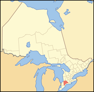
Middlesex County is a primarily rural county in Southwestern Ontario, Canada covering 3,317.27 square kilometers. Landlocked, the county is bordered by Huron and Perth counties on the north, Oxford County on the east, Elgin County on the south, and Chatham-Kent and Lambton County on the west.

Renfrew County County in Ontario, Canada

Renfrew County is a county in the Canadian province of Ontario. It stands on the west bank of the Ottawa River. There are 17 municipalities in the county.

Bruce County County in Ontario, Canada

Bruce County is a county in Southwestern Ontario, Canada comprising eight lower-tier municipalities and with a 2016 population of 66,491. It is named for James Bruce, 8th Earl of Elgin and 12th Earl of Kincardine, sixth Governor General of the Province of Canada. The Bruce name is also linked to the Bruce Trail and the Bruce Peninsula. It has three distinct areas. The Peninsula is part of the Niagara Escarpment and is known for its views, rock formations, cliffs and hiking trails. The Lakeshore includes nearly a hundred kilometers of fresh water and soft sandy beaches. Finally, the Interior Region has a strong history in farming.

Lanark County County in Ontario, Canada

Lanark County is a county located in the Canadian province of Ontario. Its county seat is Perth, which was first settled in 1816. Most European settlements of the county began in 1816, when Drummond, Beckwith and Bathurst townships were named and initially surveyed. The first farm north of the Rideau was cleared and settled somewhat earlier, in 1790. The county took its name from the town of Lanark in Scotland. Nearly all the townships were named after British public and military figures from the era of early settlement.

Huron County, Ontario County in Ontario, Canada

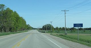
Huron County is a county of the province of Ontario, Canada. It is located on the southeast shore of its namesake, Lake Huron, in the southwest part of the province. The county seat is Goderich, also the county's largest community.

Grey County County in Ontario, Canada

Grey County is a county of the Canadian province of Ontario. The county seat is in Owen Sound. It is located in the subregion of Southern Ontario named Southwestern Ontario. Grey County is also a part of the Georgian Triangle. At the time of the Canada 2016 Census the population of the County was 93,830.

Lennox and Addington County County in Ontario, Canada

Lennox and Addington County is a county and census division of the Canadian province of Ontario. The county seat is Greater Napanee. It is located in the subregion of Southern Ontario named Eastern Ontario.

Carleton County, Ontario historic county in Ontario, Canada

Carleton County is the name of a historic county in Ontario, Canada. In 1969, it was superseded by the Regional Municipality of Ottawa–Carleton. In 2001, the Regional Municipality and its eleven local municipalities were replaced by the current City of Ottawa.

Addington County is a historic county in the Canadian province of Ontario which now forms part of Lennox and Addington County. It was named after Henry Addington, 1st Viscount Sidmouth.

Lennox County is a historic county in the Canadian province of Ontario which now forms part of Lennox and Addington County. It was named after Charles Lennox, 3rd Duke of Richmond.

Peel County, Ontario

Peel County is a historic county in the Canadian province of Ontario. Named for Sir Robert Peel, Prime Minister of the United Kingdom, the county was organized in 1851. Settlers, however, were in Toronto Township as early as 1807. The Credit River was reserved for the Mississaugas, however they sold their land and moved to the Bruce Peninsula.

Home District Former District in Upper Canada

The Home District was one of four districts of the Province of Quebec created in 1788 in the western reaches of the Montreal District and detached in 1791 to create the new colony of Upper Canada. It was abolished with the adoption of the county system in 1849.

Western District, Upper Canada Former District in Upper Canada

Western District was one of four districts of the Province of Quebec created in 1788 in the western reaches of the Montreal District which were later detached in 1791 to create the new colony of Upper Canada. Known as Hesse District until 1792, it was abolished in 1849.

Eastern District, Upper Canada

Eastern District was one of four districts of the Province of Quebec created in 1788 in the western reaches of the Montreal District and partitioned in 1791 to create the new colony of Upper Canada.

Midland District, Upper Canada

Midland District was one of four districts of the Province of Quebec created in 1788 in the western reaches of the Montreal District and partitioned in 1791 to create the new colony of Upper Canada.

London District, Upper Canada Former District in Upper Canada

The London District was a historic district in Upper Canada. It was formed in 1798 from parts of the Home and Western Districts, and lasted until its abolition in 1850.

Niagara District Former District in Upper Canada

The Niagara District was a historic district in Upper Canada. Created in 1798 from the Home District, it existed until 1849.

Wellington District, Upper Canada

The Wellington District was a historic district in Upper Canada which existed until 1849. It was formed in June 1840 from townships transferred from certain other districts:

Dalhousie District

The Dalhousie District was a historic district in Upper Canada which existed until 1849. It was created in 1838 from Carleton County in the Bathurst District. Townships from the Johnstown and Ottawa districts were added to Carleton County at the same time.

References

Coordinates: 45°15′N76°30′W / 45.25°N 76.5°W / 45.25; -76.5