Argenteuil County is an historic county in southwestern Quebec, Canada. It was located on the Ottawa River between Gatineau and Montreal. The county seat was Lachute. Argenteuil was bounded on the north by Terrebonne County, on the east by Deux-Montagnes County, on the west by Papineau County and on the south by the United Counties of Prescott and Russell in Ontario.

Stormont—Dundas—South Glengarry is a federal electoral district in Ontario, Canada, that has been represented in the House of Commons of Canada since 1968.

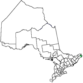
Eastern Ontario is a secondary region of Southern Ontario in the Canadian province of Ontario which lies in a wedge-shaped area between the Ottawa River and St. Lawrence River. It shares water boundaries with Quebec to the north and New York State to the east and south, as well as a small land boundary with the Vaudreuil-Soulanges region of Quebec to the east.
Glengarry County, an area covering 288,688 acres (1,168 km2), is a former county in the province of Ontario, Canada. It is historically known for its settlement of Scottish Highlanders. Glengarry County now consists of the modern-day townships of North Glengarry and South Glengarry and it borders the Saint Lawrence River.
Prescott County is a historic county in the Canadian province of Ontario.
Russell County is a historic county in the Canadian province of Ontario.

Bourget is a village in Eastern Ontario, Canada, near the Cobbs Lake Creek, in the city of Clarence-Rockland in the United Counties of Prescott and Russell.

Glengarry—Prescott—Russell is a federal electoral district in Ontario, Canada, that has been represented in the House of Commons of Canada since 1953.

Argenteuil—Papineau—Mirabel was a federal electoral district in Quebec, Canada, that was represented in the House of Commons of Canada from 1867 to 2015.
Vaudreuil—Soulanges is a federal electoral district in Quebec, Canada, that has been represented in the House of Commons of Canada from 1914 to 1968 and since 1997.

Russell was a federal electoral district in eastern Ontario, Canada, that was represented in the House of Commons of Canada from 1867 to 1968.

Eastern District was one of four districts of the Province of Quebec created in 1788 in the western reaches of the Montreal District and partitioned in 1791 to create the new colony of Upper Canada.

Metcalfe is a population centre located in Osgoode Ward, in the rural south-end of the city of Ottawa, Ontario, Canada. Prior to amalgamation in 2001, the community was in Osgoode Township. According to the Canada 2016 Census, it has a population of 1,776.
The Johnstown District was a historic district in Upper Canada which existed until 1849.
St. Isidore is a community in The Nation Municipality in Prescott and Russell County in Ontario, Canada.
Glengarry—Prescott—Russell is a provincial electoral district in eastern Ontario, Canada. It elects one member to the Legislative Assembly of Ontario.

Orléans is a provincial electoral district in eastern Ontario, Canada. It elects one member to the Legislative Assembly of Ontario. Before the 2018 election, it was known as Ottawa—Orléans.
Stormont—Dundas—South Glengarry is a provincial electoral district in eastern Ontario, Canada. It was created for the 2007 provincial election. 95.5% came from Stormont—Dundas—Charlottenburgh while 4.5% came from Glengarry—Prescott—Russell.
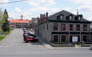
L'Orignal is a Franco-Ontarian village and former municipality, now part of Champlain Township in eastern Ontario, Canada. Its population in 2016 was 1,450. L'Orignal likely took its name from its location on the Ottawa River once known as Pointe à l'Orignac, where moose crossed the river. It was one of the seigneuries of New France.

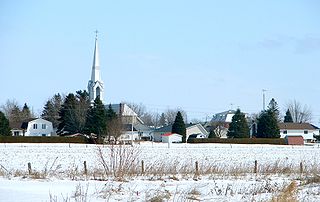
Sainte-Anne-de-Prescott is a predominantly francophone, town in the United Counties of Prescott and Russell, near the Québec border and Glengarry County, in Ontario Canada. It is a part of and the seat of the Municipality of East Hawkesbury.
